


Why visit Morbach
Townapedia lists 48 museums and landmarks, 20 parks and trails, 53 places to eat, 15 places to stay and 20 attractions in and around town.
Highlights include Idarkopfturm, Wildenburg Castle, Deutsches Telefonmuseum and Hunsrücker Holzmuseum.
Weather in Morbach
Forecast from MET Norway (CC BY 4.0). Full forecast
About Morbach
Morbach is a municipality that belongs to no Verbandsgemeinde – a kind of collective municipality – in the Bernkastel-Wittlich district in Rhineland-Palatinate, Germany. It is also a state-recognized climatic resort (Luftkurort).
From the Wikipedia article Morbach (this version), under CC BY-SA 4.0.
Things to do20

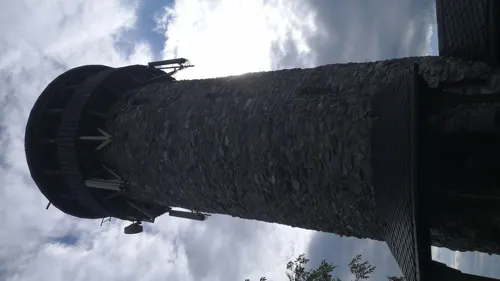
Idarkopfturm
Monument and historic site · 11.9 km
Observation tower on Idarkopf mountain



8 more on the map.
Museums and landmarks48
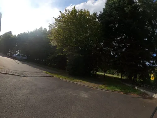
Deutsches Telefonmuseum
Museum · 0.8 km
25 Jugendherbergstraße, Morbach
Tu-Sa 14:00-17:00; Su,PH 10:30-17:00


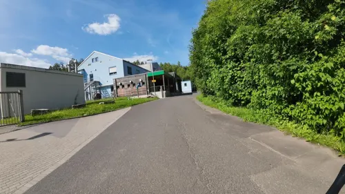
Besucher- und Informationszentrum "WasserWissensWerk"
Monument and historic site · 8.1 km
We-Su 10:00-17:00



Kaisergarten
Monument and historic site · 7.8 km
Zu Ehren von Kaiser Wilhelm und der Reichsgründung 1871 angelegt
Landgasthof Katzenloch
Monument and historic site · 8.2 km
12 Hauptstraße Katzenloch, Kempfeld
Soldatengrab
Monument and historic site · 8.3 km
Grab für den Soldaten Alfred Brodkorb aus Coswig in Sachsen. Gefallen am 17. März 1945. Er wurde von seinen Kameraden an Ort und Stelle begraben.

36 more on the map.
Parks, trails and playgrounds20


Freibad Morbach
Sports field and stadium · 1.0 km
Mo 11:00-20:00, Tu,Th 07:00-20:00; We,Fr-Su,PH 09:00-20:00

Hunsrück-Hochwald National Park
Park · 11.5 km
National park in Rhineland-Palatinate and Saarland, Germany


8 more on the map.
Restaurants and cafes53
Bauernhofcafe Hunolsteiner Hof
Restaurant · German · 6.1 km
Wirtsgarten. Küche bis 1 h vor Schliessung.
Apr-Oct We-Fr 12:00-18:00, Sa,Su 11:00-18:30; Nov-Mar Sa,Su 12:00-18:00
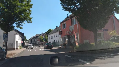
Bistro 4-Witz
Cafe · Pizza, Burger, Coffee Shop, Sandwich
2 Unterer Markt, Morbach
Mo 17:00-22:00; Tu-Fr 10:00-24:00; We off; PH,Sa,Su 17:00-24:00
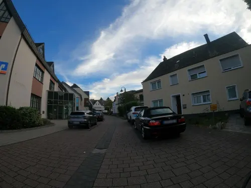

Gasthaus Schmitt
Restaurant · 5.0 km
3 In der Fahrt, Morbach
Mo,Tu 15:00-24:00; We off; Th-Sa 10:00-13:00,15:00-24:00; Su 10:00-24:00
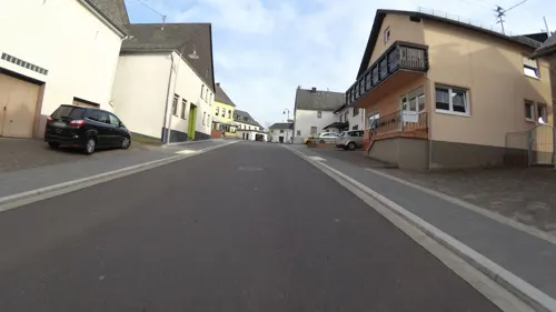
Gasthaus Zur Post
Bar and pub · 5.6 km
32 Hauptstraße, Morbach
Th-Mo 10:00-14:00,17:00+; Tu 10:00-14:00; We off
Rohr's
Restaurant · 2.2 km
10 Wendalinusgasse, Morbach
Tu-Th 17:00-21:00; Fr-Su 11:30-14:00,17:00-21:00; Mo off


Asia Wok
Restaurant · 0.6 km
7 Reitergasse, Morbach
Tu-Su 11:30-14:30,17:00-22:00
41 more on the map.
History
Until municipal administrative reform in Rhineland-Palatinate in 1969, the municipality belonged to the Bernkastel district, with its seat at Bernkastel-Kues. The municipality as it is today arose on 31 December 1974 when the new municipality of Morbach was formed out of Morbach itself and the 18 until then self-administering municipalities of Bischofsdhron, Elzerath, Gonzerath, Gutenthal, Haag, Heinzerath, Hinzerath, Hoxel, Hundheim, Hunolstein, Merscheid, Morscheid-Riedenburg, Odert, Rapperath, Wederath, Weiperath, Wenigerath and Wolzburg.
Within what is now the outlying centre of Wenigerath lay the US Air Force's Wenigerath Munitions Depot until 1995. Beginning in the 1950s, several hundred United States Air Force Munitions Systems personnel, otherwise known as “ammo troops”, worked at the so-called Wenigerath Non-Nuclear Munitions Storage Area and lived in Morbach and neighbouring villages in support of NATO operations launched from nearby Hahn Air base. The former “bomb dump”, which ceased operations after the collapse of the Soviet Union and the end of the Cold War, is now dotted with wind turbines, photovoltaic cells and various technologies which serve as an “Energy Farm”.
From the History section of Morbach on Wikipedia, under CC BY-SA 4.0.
Where to stay15
Best Western Hotel St. Michael
Motel and hotel · 0.6 km
3 Bernkasteler Straße, Morbach
Churches and places of worship26
Evangelische Kirche (Kempfeld)
Church · Protestant · 8.5 km
15 Hauptstraße, Kempfeld
Alte Kirche Sankt Johannes der Täufer
Church · Catholic · 5.8 km
1 Hochscheider Gasse, Morbach
Shopping8
Gas and EV charging5
Schools, colleges and libraries3
Healthcare2
Map of Morbach
200 places. The map loads OpenStreetMap tiles when you open it.
Getting there and nearby towns
Hahn Airport (HHN) is the nearest airport with scheduled flights listed in OpenStreetMap, 18 km away.
- Nohfelden 25 km south, about 25 min by car
- Wittlich 26 km northwest, about 26 min by car
- Wadern 34 km southwest, about 34 min by car
- Trier 35 km west, about 35 min by car
- Tholey 37 km south, about 37 min by car
- Ottweiler 45 km south, about 45 min by car
- Schmelz 46 km southwest, about 46 min by car
- Schiffweiler 49 km south, about 49 min by car
- Spiesen-Elversberg 55 km south, about 55 min by car
- Quierschied 55 km south, about 55 min by car
Drive times are estimates from straight-line distance, not routes.
Local news
Headlines from INDB.
Reviews, tips and questions
Loading what members have shared...
Sources and licences
- GeoNames (CC BY 4.0): population, coordinates, regions and time zone
- Mapillary (see each image): photos
- OpenStreetMap contributors (ODbL 1.0): places, airports, map data
- Wikidata (CC0 1.0): elevation, founding date, time zone, website, landmarks and historic places
- Wikimedia Commons (see each image): photos
- Wikipedia (CC BY-SA 4.0): overview and history text
Photo credits
- Morbach Denkmal, Norbert Schnitzler, CC BY-SA 3.0
- Morbach Bahnhofstraße 104, Mok1138, CC BY-SA 4.0
- Morbach Rapperath, St Wendalinus, Draufsicht, JakobPlayz29, CC0
- Morbach, das Rathaus, Dguendel, CC BY 4.0
- Morbach, Häuserzeile in der Bahnhofstraße, Dguendel, CC BY 4.0
- Morbach, Haus Hebegasse 9, Dguendel, CC BY 4.0
- Morbach, die Gaststätte "Zur Krone", Dguendel, CC BY 4.0
- Morbach, das Wirtshaus "Zum Dorfkrug", Dguendel, CC BY 4.0
- Morbach, Blick von der Hebegasse zur Kirche St.Anna, Dguendel, CC BY 4.0
- Morbach, die Kirche St.Anna, Bild 2, Dguendel, CC BY 4.0
- Morbach, der Untermarkt, Hotel Hochwald Lodge, Dguendel, CC BY 4.0
- Morbach, die Biergasse, Dguendel, CC BY 4.0
- Morbach, die Kirche St.Anna, Dguendel, CC BY 4.0
- Missionskreuz, St. Anna (Morbach)-101, Jwh, CC BY-SA 3.0 lu
- Morbach, Kirche St.Anna, die Taufkapelle, Dguendel, CC BY 4.0
- Morbach, Kirche St.Anna, Innenansicht, Blick zur Orgel, Dguendel, CC BY 4.0
- Morbach, Kirche St.Anna, der Altar, Dguendel, CC BY 4.0
- Morbach, Kirche St.Anna, Innenansicht, Dguendel, CC BY 4.0
- Morbach Krippe, Norbert Schnitzler, CC BY-SA 3.0
- Morbach Kirche, Norbert Schnitzler, CC BY-SA 3.0
- Morbach Kirche Georg, Norbert Schnitzler, CC BY-SA 3.0
- Morbach Kirche innen, Norbert Schnitzler, CC BY-SA 3.0
- Morbach, Kirche St.Anna, Relief Hl. Georg, Dguendel, CC BY 4.0
- Morbach Kriegerdenkmal, Norbert Schnitzler, CC BY-SA 3.0
- Kiergerdenkmal, Morbach-101, Jwh, CC BY-SA 3.0 lu
- Kiergerdenkmal, Morbach-102, Jwh, CC BY-SA 3.0 lu
- Kiergerdenkmal, Morbach-103, Jwh, CC BY-SA 3.0 lu
- Morbach, China-Restaurant und Hotel St.Michael, Dguendel, CC BY 4.0
- Morbach Denkmalsinschrift, Norbert Schnitzler, CC BY-SA 3.0
- Morbach, sculptuur in de Birkenfelder Strasse IMG 4796 2024-08-26 14.54, Michielverbeek, CC BY 4.0
- Morbach, katholische Pfarrkirche Sankt Anna Dm IMG 4810 2024-08-26 18.18, Michielverbeek, CC BY-SA 3.0 de
- Blick von der Moerschieder Burr-2, Jbndr, CC BY-SA 3.0
- Archaeologiepark Belginum, MSeses, CC BY-SA 3.0
- BaldenauInnen, Kolling at German Wikipedia, CC BY-SA 3.0
- Burg-Hunolstein02, Gete1, CC BY-SA 3.0
- Kahlheid, Mabol!, CC BY-SA 3.0
- Morbach Stumpfer Turm, Palauenc05, CC BY-SA 4.0
- Walholzkirche, CTHOE, CC BY-SA 3.0
- TrinitatiskircheDeuselbachAussen3, Dagmar Quiring, Evangelischer Kirchenkreis Trier, CC BY-SA 4.0
- Kempfeld, Evangelische Kirche P1070296c, Georg Schelbert, CC BY-SA 3.0
- EvangelischeKircheMorbachAussen3EKKT, Dagmar Quiring, Evangelischer Kirchenkreis Trier, CC BY-SA 4.0
- Katholische Filialkirche St. Peter, Marcus Leister, CC BY-SA 4.0
- Gutenthal Kirche 1210331, Flominator, CC BY-SA 4.0
- 2021 RP Hunsrück Gornhausen Barbelley 01, ManfRomeoWohlfahrt, CC BY 4.0
- Katholische Pfarrkirche St. Nicetius, Marcus Leister, CC BY-SA 4.0
- Kirche St. Wendelin Rapperath, Kinan98, CC BY-SA 3.0
- Stumpfer Turm bei Morbach 02, Simplicius, CC BY-SA 3.0
- Kirschweiler Festung im Herbst, Frank Garland, CC BY-SA 3.0
- In der Rosselhalde, Frank Garland, CC BY-SA 3.0
- Idarkopfturm-1, Muck, CC BY-SA 4.0
- Steingeruettelkopf 2021-01-11, Dietrich, CC BY-SA 4.0
- Kirschweiler, Naturschutzgebiet Silberich – Kirschweiler Festung - panoramio (2), Edgar El, CC BY 3.0
- Street-level photo, VIA_KK, CC BY-SA 4.0
- Street-level photo, rb61, CC BY-SA 4.0
- Street-level photo, VIA_KK, CC BY-SA 4.0
- Street-level photo, kreuzschnabel, CC BY-SA 4.0
- Street-level photo, ma_rt_in, CC BY-SA 4.0
- Street-level photo, teddy73, CC BY-SA 4.0
- Street-level photo, rb61, CC BY-SA 4.0
- Street-level photo, peewee32, CC BY-SA 4.0
- Street-level photo, VIA_CH, CC BY-SA 4.0
- Street-level photo, VIA_KK, CC BY-SA 4.0
- Street-level photo, VIA_KK, CC BY-SA 4.0
- Street-level photo, doing, CC BY-SA 4.0
- Street-level photo, VIA_KK, CC BY-SA 4.0
- Street-level photo, rb61, CC BY-SA 4.0
- Street-level photo, VIA_KK, CC BY-SA 4.0
- Street-level photo, VIA_KK, CC BY-SA 4.0
- Street-level photo, rb61, CC BY-SA 4.0
- Street-level photo, teddy73, CC BY-SA 4.0
- Street-level photo, teddy73, CC BY-SA 4.0
- Street-level photo, teddy73, CC BY-SA 4.0
- Street-level photo, rb61, CC BY-SA 4.0
- Street-level photo, VIA_CH, CC BY-SA 4.0
- Street-level photo, ramap, CC BY-SA 4.0
- Street-level photo, teddy73, CC BY-SA 4.0
- Street-level photo, ramap, CC BY-SA 4.0


Page built November 8, 2026. Spotted a mistake? Tell us or suggest a place.