


Why visit Velbert
Townapedia lists 72 museums and landmarks, 74 parks and trails, 186 places to eat, 18 places to stay and 15 attractions in and around town.
Highlights include Eulenbachbrücke, Schleppbahnbrücke Oberlangenhorstbeeke, Deutsches Schloß- und Beschlägemuseum and Feuerwehrmuseum Heiligenhaus.
Weather in Velbert
Forecast from MET Norway (CC BY 4.0). Full forecast
About Velbert
Velbert (German pronunciation: [ˈfɛlbɐt] , Low Rhenish: Vèlbed) is a town in the district of Mettmann, in the German state of North Rhine-Westphalia. The town is renowned worldwide for the production of locks and fittings.
From the Wikipedia article Velbert (this version), under CC BY-SA 4.0.
Photos of Velbert


Things to do15



Süßmosterei Dalbeck
Farm and orchard · 4.8 km
18 Mühlenweg, Heiligenhaus
We 09:00-18:00; Fr 09:00-18:00; Sa 09:00-13:00; Th,Su-Tu,PH off
Hofladen Nassenkamp
Farm and orchard · 4.3 km
145 Langenbügeler Straße, Heiligenhaus


3 more on the map.
Museums and landmarks72

Deutsches Schloß- und Beschlägemuseum
Museum · 0.8 km
1 Heinz Schemken Platz, Velbert
Mo off; Tu-Su,PH 10:00-18:00
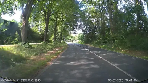
Feuerwehrmuseum Heiligenhaus
Museum · 3.7 km
24 Abtskücher Straße, Heiligenhaus
Mo-Sa off; Su 13:00-17:00 || "Besuchergruppen nach Vereinbarung"

Villa Petershall
Monument and historic site · 4.4 km
1 Lukasstraße, Velbert

Marienberg
Monument and historic site · 3.9 km
Bernsaustraße, Velbert

Schloß Hardenberg
Monument and historic site · 3.5 km
4 Zum Hardenberger Schloß, Velbert



Heimatmuseum
Museum · 3.9 km
37 Abtskücher Straße, Heiligenhaus
Mo-Fr off; Sa 14:00-17:00; Su 11:00-17:00 || "nach Vereinbarung"

An den Sträuchen
Monument and historic site · 2.9 km
Zweigeschossiges Fachwerkhaus, freistehend, Sichtfachwerk, Nordgiebel in Backsteinausfachung und Backsteinsockel, Westseite kleiner Anbau
108 Kuhlendahler Straße, Velbert
60 more on the map.
Parks, trails and playgrounds74


Schlupkothen
Hiking and trails · 5.0 km
Schild: Naturschutzgebiet betreten strengstens verboten. Geldbuße bis 50.000 Euro





Golfclub Essen-Heidhausen e.V.
Golf course · 3.7 km
36 Preutenborbeckstraße, Essen
62 more on the map.
Restaurants and cafes186
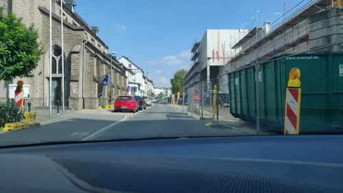
Bürgerstube
Restaurant · Croatian · 0.7 km
11 Kolpingstraße, Velbert
Mo off; Tu-Sa 11:00-14:30,17:00-22:30 open "Küche geöffnet"; Su...
Wechsel Bar
Restaurant · Regional · 3.7 km
132 Rodberger Straße, Essen
We-Sa 18:00-23:00; Su 17:00-22:00
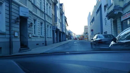
Habeez Velbert
Restaurant · Oriental · 0.6 km
123 Friedrichstraße, Velbert
Mo-Fr 11:30-21:00; Sa,Su 13:00-21:00
Karstens
Restaurant · Regional · 1.4 km
1 Am Sportzentrum, Velbert
Mo-Fr 16:00-23:00; Sa 11:30-23:00; Su,PH 11:30-22:00
Ristorante Centro Storico
Restaurant · Italian · 0.6 km
3 Kurze Straße, Velbert
Tu off; Mo,We-Th,Su 11:30-15:00,17:00-23:30; Fr-Sa 11:30-15:00,17:00-24:00

Eldorado-Weidenhof
Restaurant · Steak House
14 Mettmanner Straße, Velbert
We-Mo 11:30-15:00,17:30-23:00
La Baguette La Pizza
Restaurant · Pizza, Burger, Kebab, Pasta · 4.7 km
99a Hauptstraße, Heiligenhaus
We-Th 11:00-13:00, We-Su 17:00-21:00, Mo-Tu off
Berger Stübchen da Monticciolo
Restaurant · Italian · 4.1 km
2 Jacob-Lüneschloß-Straße
Tu-Sa 17:00-22:00; Su 16:30-21:30

Bäckerei Bolten
Bakery · 5.2 km
158 Hauptstraße, Heiligenhaus
Mo-Fr 06:00-17:00; Sa 06:00-14:00; Su 07:00-14:00

Café Herberge
Cafe · 4.5 km
28 Herberger Weg, Heiligenhaus
Mo-We 14:00-17:00, Sa 14:00-17:00, Su 11:00-17:00
174 more on the map.
History
Velbert was first mentioned in AD 875 as Feldbrahti and was ruled by the abbey at Werden.
From the History section of Velbert on Wikipedia, under CC BY-SA 4.0.
More about Velbert
Geography
Velbert is located on the hills of 'Niederberg' (meaning Lower Mountain), part of the Berg region, approx. 20 kilometres north-east of the capital of North Rhine-Westphalia, Düsseldorf, and 12 kilometers north-west of Wuppertal on the south side of the Ruhr river.
Velbert stands on the highest part of the Niederberg region and also in its centre. Its average elevation is around 230 metres above sea level; its highest point, at 303 metres, is the Hordt-Berg, and its lowest, at around 70.6 metres, is in Nierenhof am Deilbach. The highest point in Velbert itself is 263 metres above sea level, at the corner of Friedrichstraße and Langenberger Straße.
As part of the reform of local government districts in North Rhine-Westphalia that came into effect on 1 January 1975, the formerly independent cities of Velbert, Neviges and Langenberg were merged to form the present city of Velbert.
From the Wikipedia article Velbert, under CC BY-SA 4.0.
Notable people from Velbert
 Paul MeierGerman athletics competitor (born 1971)Photo: Superbass, CC BY-SA 4.0
 Axel BlockGerman cinematographerPhoto: Justus Nussbaum, CC BY-SA 3.0
- Günther WeisenbornGerman writer, dramaturge and playwright (1902–1969)
- Andreas LutheGerman footballer
- Otto Beisheimbusinessman (1924-2013)
- Sezer ÖztürkTurkish association football player (born 1985)
- Peter Nockeswimmer
- Lothar KochGerman oboist (1935–2003)
- Iwan DackoUkrainian priest, theologian, and professor
- Willy FleckhausGerman designer and journalist (1925–1983)
- Uğur IşılakTurkish composer and musician (born 1971)
- Klaus FußmannGerman artist (born 1938)
Born in Velbert, according to Wikidata (CC0). Each name links to its Wikipedia article.
Where to stay18
Churches and places of worship40
Shopping51
Gas and EV charging30
Schools, colleges and libraries35
Healthcare24
Map of Velbert
250 places. The map loads OpenStreetMap tiles when you open it.
Getting there and nearby towns
Flughafen Essen-Mülheim (ESS) is the nearest airport with scheduled flights listed in OpenStreetMap, 10 km away.
- Heiligenhaus 5 km west, about 5 min by car
- Wülfrath 6 km south, about 6 min by car
- Niederwenigern 10 km northeast, about 10 min by car
- Wuppertal 11 km southeast, about 11 min by car
- Mettmann 11 km southwest, about 11 min by car
- Essen 14 km north, about 14 min by car
- Hattingen 12 km northeast, about 12 min by car
- Gruiten 13 km south, about 13 min by car
- Ratingen 14 km west, about 14 min by car
- Sprockhövel 14 km east, about 14 min by car
Drive times are estimates from straight-line distance, not routes.
Towns near Velbert


Keep exploring
Local news
Headlines from INDB.
Reviews, tips and questions
Loading what members have shared...
Sources and licences
- GeoNames (CC BY 4.0): population, coordinates, regions and time zone
- Mapillary (see each image): photos
- OpenStreetMap contributors (ODbL 1.0): places, airports, map data
- Wikidata (CC0 1.0): elevation, founding date, time zone, website, landmarks and historic places
- Wikimedia Commons (see each image): photos
- Wikipedia (CC BY-SA 4.0): overview and history text
Photo credits
- Forum Niederberg Velbert 03, Ticketautomat ( talk ), CC BY 3.0
- Velbert Blumenstraße, Picmaen, CC BY 4.0
- Velbert, Offerstraße - panoramio, leeinad, CC BY-SA 3.0
- Velbert, Offerstraße - panoramio (2), leeinad, CC BY-SA 3.0
- Ortsbus Velbert 2, Metrophil44, CC BY-SA 4.0
- Ortsbus Velbert 1, Metrophil44, CC BY-SA 4.0
- Velbert-Friedrich-Karrenberg-Platz, Picmaen, CC BY 4.0
- Busbahnhof Velbert, Freddy2001, CC BY-SA 4.0
- Velbert, Offerstraße - panoramio (1), leeinad, CC BY-SA 3.0
- Velbert, Germany - panoramio, micovich, CC BY-SA 3.0
- Velbert, Christuskirche - panoramio, leeinad, CC BY-SA 3.0
- Velbert, Friedrichstraße, Fisch-Skulptur in der Fußgängerzone, SolingenFan95, CC BY-SA 4.0
- Velbert Am Offers, Picmaen, CC BY 4.0
- Velbert - panoramio, micovich, CC BY-SA 3.0
- Velbert, Oststraße - panoramio, micovich, CC BY-SA 3.0
- Schloss- und Beschlägemuseum Velbert 2015-08-22 (04), Freddy2001, CC BY-SA 4.0
- Schloss- und Beschlägemuseum Velbert 2015-08-22 (06), Freddy2001, CC BY-SA 4.0
- Schloss- und Beschlägemuseum Velbert 2015-08-22 (01), Freddy2001, CC BY-SA 4.0
- Schloss- und Beschlägemuseum Velbert 2015-08-22 (03), Freddy2001, CC BY-SA 4.0
- Schloss- und Beschlägemuseum Velbert 2015-08-22 (02), Freddy2001, CC BY-SA 4.0
- Schloss- und Beschlägemuseum Velbert 2015-08-22 (05), Freddy2001, CC BY-SA 4.0
- Velbert, Friedrichstraße, gegenüber Schulstraße, Telefonzelle vom Typ TelH90, SolingenFan95, CC BY-SA 4.0
- St. Paulus, Velbert-2545, Raimond Spekking, CC BY-SA 4.0
- St. Paulus, Velbert-2549, Raimond Spekking, CC BY-SA 4.0
- St. Paulus, Velbert-2547, Raimond Spekking, CC BY-SA 4.0
- St. Paulus, Velbert-2550, Raimond Spekking, CC BY-SA 4.0
- St. Paulus, Velbert-2548, Raimond Spekking, CC BY-SA 4.0
- St. Paulus, Velbert-2551, Raimond Spekking, CC BY-SA 4.0
- St. Paulus, Velbert-2558, Raimond Spekking, CC BY-SA 4.0
- St. Paulus, Velbert-2561, Raimond Spekking, CC BY-SA 4.0
- St. Paulus, Velbert-2562, Raimond Spekking, CC BY-SA 4.0
- Villa Hügel in Essen, Burkhard Mücke, CC BY-SA 4.0
- Essen Kloster Werden Innenhof 2 2005, Unknown author, CC BY-SA 3.0
- Velbert-Langenberg, Jüdischer Friedhof Oberer Eickeshagen, Bild 1, Im Fokus, CC BY-SA 4.0
- Kuhlendahl 11, Velopilger, CC BY-SA 4.0
- BurgHardenbergGrundriss, Gerhard August Fischer (1833-1906) (?), Public domain
- NSG E-012 Asbachtal 06, Thomas Schoch – www.retas.de, CC BY-SA 3.0
- Tönisheide, evangelische kerk foto3 2012-03-27 13.36, Michielverbeek, CC BY-SA 3.0
- VelbertSaubrücke, User:Erbsensuppe, CC BY-SA 3.0
- Geschwister Scholl Gymnasium Velbert 01, Ticketautomat ( talk ), CC BY 3.0
- Klinikum Niederberg Velbert 02, Ticketautomat ( talk ), CC BY 3.0
- Gottfried böhm, pilgrimage church, neviges 1963-1972 01, seier+seier, CC BY 2.0
- Stadion Sonnenblume Velbert 03, Ticketautomat ( talk ), CC BY 3.0
- Bibliothek Velbert, Stadtbücherei Velbert, CC BY-SA 4.0
- Villa Petershall Westseite, Lennox21, CC BY-SA 3.0
- NSG E-010 Oefter Tal (1), DiAuras, CC BY-SA 4.0
- Nikolaus-Ehlen-Gymnasium Velbert 1, Ticketautomat, CC BY-SA 3.0
- Oberlangenhorstbeeke 004, L-Ile-Rousse, CC BY-SA 4.0
- Forum Velbert 2025-1, Ticketautomat, CC BY 4.0
- Velbert, Herminghauspark, SolingenFan95, CC BY-SA 4.0
- Deutsches Schloss- und Beschlägemuseum, Elmarbirth, CC BY-SA 4.0
- Christuskirche Velbert Pano, Derwatz at de.wikipedia, CC BY-SA 3.0
- Alte Kirche Velbert, User:Erbsensuppe, CC BY-SA 3.0
- Katholische Pfarrkirche St. Marien 02, Ticketautomat ( talk ), CC BY 3.0
- Wülfrath-Zeittunnel-Rundweg Schlupkothen 03, Dat doris, CC BY-SA 4.0
- Evangelische Stadtkirche (Neviges) (03), Chris06, CC BY-SA 4.0
- St. Mariä Empfängnis (Neviges) (2), Chris06, CC BY-SA 4.0
- St. Paulus-Kirche Velbert 03, Ticketautomat ( talk ), CC BY 3.0
- Kirche Don Bosco Velbert-Birth, User:Erbsensuppe, CC BY-SA 3.0
- Schlosshardenberg1, O. Glasmacher ( Alterbergbau ), CC BY-SA 3.0
- NSG Oefter Bachtal mit Nebentälern (13), DiAuras, CC BY-SA 4.0
- St. Kamillus Essen-Heidhausen, wiki05, Public domain
- Kapelle des Marienbergs Neviges 2, Saintambroise (changes by Rabanus Flavus ), CC BY-SA 4.0
- Pfarrkirche von Neviges und Kloster, Saintambroise, CC BY-SA 4.0
- Street-level photo, cuspis, CC BY-SA 4.0
- Street-level photo, mighty_eighty, CC BY-SA 4.0
- Street-level photo, wladimir, CC BY-SA 4.0
- Street-level photo, mighty_eighty, CC BY-SA 4.0
- Street-level photo, mighty_eighty, CC BY-SA 4.0
- Street-level photo, mighty_eighty, CC BY-SA 4.0
- Street-level photo, mighty_eighty, CC BY-SA 4.0
- Street-level photo, heetENkoel, CC BY-SA 4.0
- Street-level photo, baldur80, CC BY-SA 4.0
- Street-level photo, roadrunnerno1, CC BY-SA 4.0
- Street-level photo, mighty_eighty, CC BY-SA 4.0
- Street-level photo, mighty_eighty, CC BY-SA 4.0
- Street-level photo, mighty_eighty, CC BY-SA 4.0
- Street-level photo, mighty_eighty, CC BY-SA 4.0
- Street-level photo, mighty_eighty, CC BY-SA 4.0
- Street-level photo, mighty_eighty, CC BY-SA 4.0
- Street-level photo, mighty_eighty, CC BY-SA 4.0
- Street-level photo, mighty_eighty, CC BY-SA 4.0
- Street-level photo, mighty_eighty, CC BY-SA 4.0
- Street-level photo, heetENkoel, CC BY-SA 4.0
- Street-level photo, heetENkoel, CC BY-SA 4.0
- Street-level photo, heetENkoel, CC BY-SA 4.0
- Street-level photo, cuspis, CC BY-SA 4.0
- Street-level photo, mighty_eighty, CC BY-SA 4.0
- Street-level photo, mighty_eighty, CC BY-SA 4.0
- Street-level photo, heetENkoel, CC BY-SA 4.0


Page built November 9, 2026. Spotted a mistake? Tell us or suggest a place.