


Versmold, Germany
Versmold is a town of 20,996 people in North Rhine-Westphalia, Germany.
Why visit Versmold
Townapedia lists 27 museums and landmarks, 29 parks and trails, 59 places to eat, 19 places to stay and 2 attractions in and around town.
Highlights include Bio-Bauernmarkt Hoffmeier, Heimatmuseum, Neues Gradierwerk and Am Sundern.
Weather in Versmold
Forecast from MET Norway (CC BY 4.0). Full forecast
About Versmold
Versmold (German: [ˈfɛʁsmɔlt] ; Westphalian: Vassem) is a town in Gütersloh District in the German state of North Rhine-Westphalia. It is located some 30 km west of Bielefeld.
From the Wikipedia article Versmold (this version), under CC BY-SA 4.0.
Things to do2

Bio-Bauernmarkt Hoffmeier
Farm and orchard · 6.1 km
52 Oesterweger Straße, Versmold
Mo-Fr 09:00-18:00; Sa 07:30-14:00
Museums and landmarks27
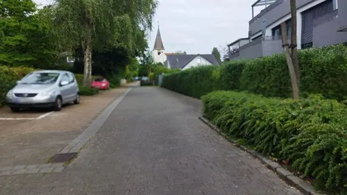
Heimatmuseum
Museum · 7.4 km
Hier wird seit 1944 das Wissen über Rothenfelde, Gradierwerke, Dornenstein und Salze vermittelt.
10 Wellengartenstraße, Bad Rothenfelde
Tu 16:00-18:00; Th 16:00-18:00

Neues Gradierwerk
Monument and historic site · 7.7 km
Gradierwerke wurden ursprünglich als Teil von Salzwerken zur Salzgewinnung eingesetzt. Heutzutage werden sie in Deutschland oft zu...
Kurpark, Bad Rothenfelde



Galerie et
Museum
7 Münsterstraße, Versmold
We 15:00-17:00; Sa 11:00-13:00; Su 11:00-13:00,15:00-17:00; PH off
15 more on the map.
Parks, trails and playgrounds29







Spielplatz Nr. 20
Playground · 0.7 km
Kletterparkour mit vielen Stationen
Mo-Su 08:00-20:00

Strandbad Sassenberg
Beach · 7.6 km
Jun-Aug: 10:00-20:00; May,Sep: Mo-Fr 14:00-18:00; Sa-Su,PH 10:00-18:00

Privatgarten Wagenhuber
Park · 4.5 km
Privatgarten mit Tierhaltung, geöffnet zum Tag der offenen Gartenpforte oder angekündigten Terminen
17 more on the map.
Restaurants and cafes59
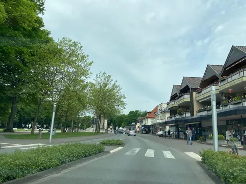
Cafe Coeurchen
Cafe · French · 7.7 km
15 Bahnhofstraße, Bad Rothenfelde
Mo,Th-Sa 09:00-22:00; Tu 09:00-18:00; Su 09:00-17:00

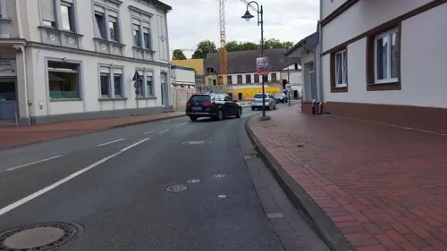

Alleecafé
Cafe · 7.5 km
4 Welfenallee, Bad Rothenfelde
Apr-Oct 08:30-18:00, Nov-Mar Sa-Su 14:30-18:00, Dec 16-31 off
Café Strathmann
Cafe · 7.5 km
14 Frankfurter Straße, Bad Rothenfelde
Mo-Sa 06:00-18:00; Su 08:00-18:00
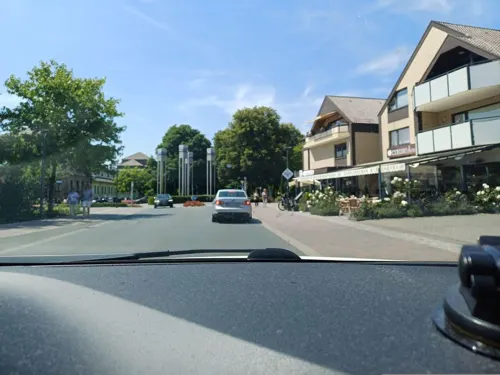
Divan 2
Restaurant · Turkish · 7.8 km
Divan bedeutet auf türkisch: lockere Atmosphäre und gemütliches Zusammensitzen.
17 Bahnhofstraße, Bad Rothenfelde
Mo-Su 11:00-24:00
Eiscafé Brino
Cafe · Ice Cream · 7.5 km
12 Frankfurter Straße, Bad Rothenfelde
Nov-Jan off


Enothek am Kurpark 7
Restaurant · 7.7 km
7 Am Kurpark, Bad Rothenfelde
We 11:00-23:00; Tu,Th-Sa 15:00-23:00
47 more on the map.
History
In 1096 Versmold was first mentioned in a document, and is thus one of the oldest known settlements in the region. The name "-mold" alludes to "melle", "mal" a location of a court.
Situated between the bishoprics Osnabrück and Münster, the possession of Versmold was disputed for a long time in the high Middle Ages. The population tried to protect themselves as well as they could. The St. Petri church was built as a "Wehrkirche" for defense.
From the History section of Versmold on Wikipedia, under CC BY-SA 4.0.
Where to stay19
Caritas Seniorenerholung Haus St. Elisabeth
Motel and hotel · 7.8 km
19 Bahnhofstraße, Bad Rothenfelde
Churches and places of worship14
St. Johannes Baptist
Church · Catholic · 7.0 km
1 Johannesplatz, Harsewinkel
Ev.-luth. Jesus-Chritus-Kirche
Church · Lutheran · 7.6 km
9 Münstersche Straße, Bad Rothenfelde
Mennoniten-Brüdergemeinde
Church · Mennonite · 4.5 km
24 Bockhorster Landweg, Versmold
Shopping26
Gas and EV charging10
Schools, colleges and libraries11
Healthcare9
Augentagesklinik Dr. Fell
Clinic and pharmacy · 7.7 km
8 Heidländer Weg, Bad Rothenfelde
Klinik im Kurpark
Clinic and pharmacy · 7.6 km
33 Hannoversche Straße, Bad Rothenfelde
Map of Versmold
206 places. The map loads OpenStreetMap tiles when you open it.
Getting there and nearby towns
Flugplatz Bielefeld (BFE) is the nearest airport with scheduled flights listed in OpenStreetMap, 28 km away.
- Hilter 11 km north, about 11 min by car
- Warendorf 15 km southwest, about 15 min by car
- Werther 19 km east, about 19 min by car
- Bielefeld 26 km east, about 26 min by car
- Hasbergen 26 km northwest, about 26 min by car
- Osnabrück 27 km north, about 27 min by car
- Wallenhorst 36 km north, about 36 min by car
- Westerkappeln 36 km northwest, about 36 min by car
- Münster 37 km west, about 37 min by car
- Hamm 46 km southwest, about 46 min by car
Drive times are estimates from straight-line distance, not routes.
Local news
Headlines from INDB.
Reviews, tips and questions
Loading what members have shared...
Sources and licences
- GeoNames (CC BY 4.0): population, coordinates, regions and time zone
- Mapillary (see each image): photos
- OpenStreetMap contributors (ODbL 1.0): places, airports, map data
- Wikidata (CC0 1.0): elevation, founding date, time zone, website
- Wikimedia Commons (see each image): photos
- Wikipedia (CC BY-SA 4.0): overview and history text
Photo credits
- Versmold Kirche 2005-07-12, Unknown author, CC BY-SA 3.0
- Versmold-Kantorhaus, Hagar66, CC BY-SA 3.0
- Versmold St. Petri Kirche, Daniel Brockpähler, CC BY-SA 3.0
- Versmold-Erinnerungszeichen, Hagar66, CC BY-SA 3.0
- Versmold-Rathaus, Hagar66, CC BY-SA 3.0
- ChiesaVersmold, Airin, CC BY-SA 3.0
- Versmold-Muensterstrasse 7, Hagar66, CC BY-SA 3.0
- Versmold-Mairie, Hagar66, CC BY-SA 3.0
- Versmold-Schweinebrunnen, Hagar66, CC BY-SA 3.0
- Versmold-Ravensberger Strasse 7+9, Hagar66, CC BY-SA 3.0
- Versmold - kath. Kirche St. Michael, Hagar66, CC BY-SA 3.0
- Morgenhimmel in Versmold, Abrissgebiet, CC0
- Versmold-Stadtpark-Verhaltensregeln, Hagar66, CC BY-SA 3.0
- Versmold-Stadtpark-Wilhelm I Bueste, Hagar66, CC BY-SA 3.0
- Sparkassen-Arena Versmold, Hullu poro, CC BY-SA 4.0
- Kurt-Nagel-Parkstadion Versmold, Hullu poro, CC BY-SA 4.0
- Versmold - Loxten-ev.Kirche, Hagar66, CC BY-SA 3.0
- Halle (Westfalen) - NSG Barrelpäule im Winter, Hagar66, CC BY-SA 3.0
- Bockhorst Dorfkirche, Reiner Lippold, Versmold-Bockhorst, CC BY-SA 3.0 de
- Greffen St. Johannes osten, Daniel Brockpähler, CC BY-SA 3.0
- Harsewinkel - NSG Am Sundern, Hagar66, CC BY-SA 3.0
- Greffen Baggersee Greffener Mark, Daniel Brockpähler, CC BY-SA 3.0
- Borgholzhausen-Salzenteichs Heide, Hagar66, CC BY-SA 3.0
- Versmold-Versmolder Bruch, Hagar66, CC BY-SA 3.0
- Bad-Kösen-Gradierwerk, CTHOE, CC BY-SA 3.0
- St. Johannes der Täufer Greffen außen, Daniel Brockpähler, CC BY-SA 3.0
- Bad Laer - DC6, Hagar66, CC BY-SA 3.0
- Borgholzhausen-Johannisegge Schornstein, Hagar66, CC BY-SA 3.0
- 2020-08-22 Stieleiche in Loxten, NRW 01, Yvonne Bentele, CC BY-SA 4.0
- 2020-08-22 Stieleiche in Loxten, NRW 02, Yvonne Bentele, CC BY-SA 4.0
- Street-level photo, changchun1, CC BY-SA 4.0
- Street-level photo, changchun1, CC BY-SA 4.0
- Street-level photo, sattelschwein, CC BY-SA 4.0
- Street-level photo, sattelschwein, CC BY-SA 4.0
- Street-level photo, thorstenh, CC BY-SA 4.0
- Street-level photo, ThorstenHPunkt, CC BY-SA 4.0
- Street-level photo, thorstenh, CC BY-SA 4.0
- Street-level photo, thorstenh, CC BY-SA 4.0
- Street-level photo, thorstenh, CC BY-SA 4.0
- Street-level photo, thorstenh, CC BY-SA 4.0
- Street-level photo, zuse, CC BY-SA 4.0
- Street-level photo, flohoff, CC BY-SA 4.0
- Street-level photo, changchun1, CC BY-SA 4.0
- Street-level photo, thetornado76, CC BY-SA 4.0
- Street-level photo, changchun1, CC BY-SA 4.0
- Street-level photo, changchun1, CC BY-SA 4.0
- Street-level photo, changchun1, CC BY-SA 4.0
- Street-level photo, changchun1, CC BY-SA 4.0
- Street-level photo, ThorstenHPunkt, CC BY-SA 4.0


Page built November 8, 2026. Spotted a mistake? Tell us or suggest a place.