


Warendorf, Germany
Warendorf is a town of 38,707 people in North Rhine-Westphalia, Germany.
Why visit Warendorf
Townapedia lists 97 museums and landmarks, 74 parks and trails, 122 places to eat, 23 places to stay and 7 attractions in and around town.
Highlights include Biohof Schulze Schleppinghoff, Hofladen auf dem Spargelhof Hengemann, Westpreußisches Landesmuseum and Motorcycle Museum Heiner Beckmann.
Weather in Warendorf
Forecast from MET Norway (CC BY 4.0). Full forecast
About Warendorf
Warendorf (German pronunciation: [ˈvaːʁəndɔʁf] , Westphalian: Warnduorp) is a town in North Rhine-Westphalia, Germany, and capital of Warendorf District.
From the Wikipedia article Warendorf (this version), under CC BY-SA 4.0.
Photos of Warendorf


Things to do7

Biohof Schulze Schleppinghoff
Farm and orchard · 5.8 km
6 Gronhorst, Warendorf
Mo-Fr 08:00-18:00; Sa 08:00-14:00


Museums and landmarks97


Motorcycle Museum Heiner Beckmann
Museum · 10.5 km
32 Beelener Straße, Harsewinkel
easter-Oct: Su 11:00-17:00 || "nach Vereinbarung"



Bischofshäuschen
Monument and historic site · 10.2 km
Geburtshaus des Bischofs Johann Bernhard Brinkmann
4 Kirchplatz, Everswinkel

85 more on the map.
Parks, trails and playgrounds74



Vitus-Bad
Sports field and stadium · 10.7 km
Abweichende Öffnungszeiten in den Ferien, siehe https://www.gemeindewerke-everswinkel.de/de/vitus-bad/oeffnungszeiten.php
29 Alverskirchener Straße, Everswinkel
Mo,We,Fr 14:30-21:00; Tu 06:00-08:00,14:30-21:00; Th 06:00-21:00;...

Golfclub Gut Hahues zu Telgte
Golf course · 10.7 km
5 Harkampsheide, Telgte
Apr-Oct: Tu-Fr 10:00-17:00; Apr-Oct: Sa-Su 11:00-14:00; Nov-Apr:...

62 more on the map.
Restaurants and cafes122
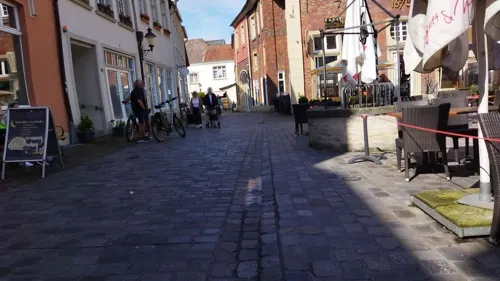
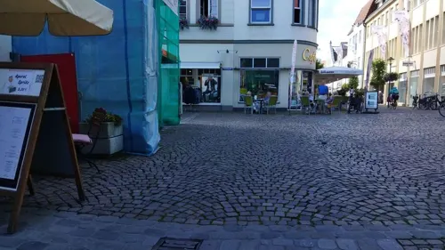
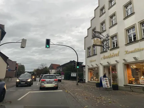
Bäckerei Arenhövel
Bakery · 5.6 km
Auch Café und Konditorei
Sa 05:00-13:00; Su 07:00-17:00; Mo,We-Fr 05:00-18:00; Tu 05:00-13:00
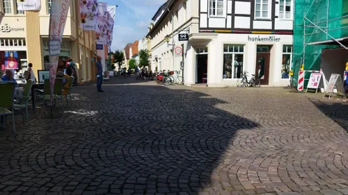

Eichenhof Schlüter
Restaurant · Regional · 8.9 km
Restaurant und Café
9 Wieningen, Everswinkel
Th 14:00+; We,Fr-Su,PH 09:30+; Mo,Tu off; Jan-Feb off
Fischrestaurant Jungmann
Restaurant · Seafood · 8.3 km
25 Lentrup, Warendorf
Mo,Tu off; We-Sa 17:00+; Su,PH 11:45-14:00,17:00+
Il Mulino
Restaurant · Italian, Pizza · 5.5 km
4 Lappenbrink, Sassenberg
Tu-Sa 17:00-22:00; Su 11:30-22:00

Kosterei
Cafe · Regional, Coffee Shop
38 Oststraße, Warendorf
Tu,We,Fr 07:30-13:30; Th 07:30-13:30,15:00-18:00; Sa 07:30-14:00
Zum Fensterberg
Restaurant · International · 6.2 km
32 Heideweg, Warendorf
We-Sa 16:00-23:00; Su 11:00-22:00; Mo,Tu off
Am Nienkamp
Restaurant · 8.4 km
1 Nienkamp, Ennigerloh
Mo-Fr 17:00-24:00, Sa 14:00-02:00, Su 10:30-24:00; Tu off
110 more on the map.
History
The origin and name Warendorf date back to the ancient Saxon royal court of Warintharpa (“the village on the embankment”), which was most likely already formed in 700 BC. Between the years of 1197 and 1201 Warendorf became a town. During this time, among the already established parish, which belonged to the “old church” (St. Laurentius), a new, second parish with the “new church” (Marienkirche) was formed just west of the town centre. The medieval records of the founding of Warendorf are missing, along with several records and documents in Münster. These were all destroyed during the rule under the Anabaptists. Bishop Hermann II von Katzenelnbogen (Bishop 1173–1202) also contributed to the founding of the town.
Read more of the history
In 1224 the first recorded mention of Warendorf as a civitas, which is a civil and municipal community, was made. The wealth of Warendorf grew increasingly and developed more and more into an important trading town, since it is situated favourably between Münster and Oelde. Apart from that Warendorf profited from the production and selling of linen. The wealthy citizens settled on the market square and in the streets, Emsstrasse and Oststrasse. Still today these areas of the town are most prominent in the townscape of Warendorf. In contrast, the poorer part of population lived in simple houses with dirt floors. These bad living conditions lead to the epidemics and illnesses.
In 1404 there was a great fire in Warendorf, during which along with 600 houses also the “old church” (St. Laurentius) and the town hall with all its inventory were destroyed.
In 1533 the Anabaptist movement spread in Warendorf and also in Münster. This movement took over rule in the town for one week in October 1534, until it was ended by a short occupation by Bishop Franz von Waldeck. Four Anabaptist apostles and the Warendorf Anabaptist movement leaders were sentenced to death and were executed by a sword on the market square. As a deterrent the bodies of the “apostles” were laid on the four gates into the town. As a result of this, Warendorf lost its town rights and regained them again in 1542. Free elections of the local council were first held in 1556 under Bishop Franz von Waldeck's successor. The Anabaptist movement continued up into the 17th century in the background without any serious danger for the town or church.
Between 1627 and 1632 loss of the town rights occurred during religious battles of the Thirty Years' War. The first mention of the “Fettmarkt” dates back to 1657. This event remained an important funfair with a flea market and livestock market still today. In 1741 another great fire broke out, which resulted in the destruction of the “new church” (Marienkirche) and 332 houses. Because many tradesmen had to move further, and so Warendorf suffered economic loss.
In 1802 Warendorf came under the Prussian sovereignty. The once blossoming town impoverished. In 1826 the establishment of the Westphalian state stud farm in Warendorf was succeeded by the Prussian stud administration. In 1887 the railroad line Münster – Warendorf – Rheda-Wiedenbrück was opened. In 1937 barracks were built just north of Warendorf. Today, the sport school of the German army is also located in these barracks.
On 1 January 1975, a reformation of the municipalities was carried out. This reformation integrated the communities of Einen and Milte, and the town of Freckenhorst into the town of Warendorf. Also during this reformation, the larger district of Warendorf (district) was formed by combining the districts of Warendorf and Beckum. Warendorf became seat of the district government.
From the History section of Warendorf on Wikipedia, under CC BY-SA 4.0.
More about Warendorf
Geography
Warendorf is situated on the Ems river in the eastern part of the Münsterland area. This area of the Westphalian Lowland is characterized by agriculture. Because of its varying landscape of fields, pastures, small forests and hedgerows, people compare this area to a park.
The closest large city is Münster, which is located 30 kilometres (19 miles) west of Warendorf. Other large cities in the area are Osnabrück, approx. 40 kilometres (25 miles) to the north, Bielefeld, approx. 45 kilometres (28 miles) to the east, and Hamm, approx. 35 kilometres (22 miles) to the south.
Arts and culture
Warendorf has hosted several international events, such as the world skydiving championships, riding events, and the national swimming championships. A notable annual event in Warendorf is the celebration on 15 August of the Feast of the Assumption of the Blessed Virgin Mary (Mariä Himmelfahrt).
From the Wikipedia article Warendorf, under CC BY-SA 4.0.
Notable people from Warendorf
 Christian KukukGerman show jumperPhoto: File:Maimarkt Mannheim 2015 - 52...., CC BY-SA 4.0
 Henrique JohannpötterBrazilian bishop (1933-2011)Photo: Carlosveras201001, CC BY-SA 4.0
 Reinhold SendkerGerman politicianPhoto: Foto-AG Gymnasium Melle, CC BY 3.0
- Frank OstholtGerman equestrian
- Paul SpiegelGerman politician (1937-2006)
- Andreas RidderGerman footballer
- Beatrix NobisGerman art historian (1950-2024)
- Maximilian Schulze NiehuesGerman footballer
Born in Warendorf, according to Wikidata (CC0). Each name links to its Wikipedia article.
Where to stay23
Churches and places of worship38
Marienkapelle
Church · Roman Catholic · 10.2 km
7 Kirchplatz, Everswinkel
St. Johannes Evangelist
Church · Catholic · 5.5 km
1 Lappenbrink, Sassenberg
Shopping50
Gas and EV charging25
Schools, colleges and libraries32
Healthcare12
Map of Warendorf
250 places. The map loads OpenStreetMap tiles when you open it.
Getting there and nearby towns
Münster Osnabrück Airport (FMO) is the nearest airport with scheduled flights listed in OpenStreetMap, 29 km away.
- Sassenberg 6 km northeast, about 6 min by car
- Beelen 9 km east, about 9 min by car
- Everswinkel 10 km west, about 10 min by car
- Ennigerloh 13 km south, about 13 min by car
- Telgte 14 km west, about 14 min by car
- Ostbevern 14 km northwest, about 14 min by car
- Versmold 15 km northeast, about 15 min by car
- Glandorf 15 km north, about 15 min by car
- Harsewinkel 16 km east, about 16 min by car
- Sendenhorst 16 km southwest, about 16 min by car
Drive times are estimates from straight-line distance, not routes.
Towns near Warendorf


Keep exploring
Local news
Headlines from INDB.
Reviews, tips and questions
Loading what members have shared...
Sources and licences
- GeoNames (CC BY 4.0): population, coordinates, regions and time zone
- Mapillary (see each image): photos
- OpenStreetMap contributors (ODbL 1.0): places, airports, map data
- Wikidata (CC0 1.0): elevation, founding date, time zone, website
- Wikimedia Commons (see each image): photos
- Wikipedia (CC BY-SA 4.0): overview and history text
Photo credits
- Warendorf-marktplatz, Benutzer:Michael Sch., CC BY-SA 3.0
- Stadtbücherei und Kulturbüro Warendorf, Gerd Fahrenhorst, CC BY 4.0
- Warendorf Lilienstraße 22 DNr117 DSC04633, Cosmic42, CC BY-SA 4.0
- Warendorf Lilienstraße 23-25 r, Alex B. Sammy, CC BY-SA 4.0
- Warendorf Lilienstraße 26 DNr116 DSC04632, Cosmic42, CC BY-SA 4.0
- Warendorf Lilienstraße 24 r, Alex B. Sammy, CC BY-SA 4.0
- Warendorf Lilienstraße 29 l, Alex B. Sammy, CC BY-SA 4.0
- Warendorf Lilienstraße 20 l, Alex B. Sammy, CC BY-SA 4.0
- Warendorf Lilienstraße 22 r, Alex B. Sammy, CC BY-SA 4.0
- Warendorf Lilienstraße 22 f, Alex B. Sammy, CC BY-SA 4.0
- Warendorf Lilienstraße 20 r, Alex B. Sammy, CC BY-SA 4.0
- Warendorf Lilienstraße 24 l, Alex B. Sammy, CC BY-SA 4.0
- Warendorf Lilienstraße 23-25 l, Alex B. Sammy, CC BY-SA 4.0
- Warendorf Lilienstraße 23-25 f, Alex B. Sammy, CC BY-SA 4.0
- Warendorf Lilienstraße 29, Alex B. Sammy, CC BY-SA 4.0
- Warendorf Kurze Kesselstraße 14, Alex B. Sammy, CC BY-SA 4.0
- Warendorf Kurze Kesselstraße 16, Alex B. Sammy, CC BY-SA 4.0
- Warendorf Kurze Kesselstraße 10, Alex B. Sammy, CC BY-SA 4.0
- Warendorf Kurze Kesselstraße 12, Alex B. Sammy, CC BY-SA 4.0
- Stolperstein Warendorf Lange Kesselstraße 23 Rudolf Anspacher, Gmbo 2013, CC0
- Stolperstein Warendorf Lange Kesselstraße 23 Joseph Nathan Anspacher, Gmbo 2013, CC0
- Stolperstein Warendorf Lange Kesselstraße 23 Johanna Hertz, Gmbo 2013, CC0
- Stolperstein Warendorf Lange Kesselstraße 23 Julius Anspacher, Gmbo 2013, CC0
- Stolperstein Warendorf Lange Kesselstraße 23 Erna Anspacher, Gmbo 2013, CC0
- Stolpersteine Warendorf Lange Kesselstraße 23, Gmbo 2013, CC0
- Stolpersteinlage Warendorf Lange Kesselstraße 23, Gmbo 2013, CC0
- Warendorf Kurze Kesselstraße 9, Alex B. Sammy, CC BY-SA 4.0
- Warendorf Kurze Kesselstraße 13-15, Alex B. Sammy, CC BY-SA 4.0
- Warendorf Lange Kesselstraße 14, Alex B. Sammy, CC BY-SA 4.0
- Warendorf Lange Kesselstraße 16 l, Alex B. Sammy, CC BY-SA 4.0
- Warendorf Lange Kesselstraße 23, Alex B. Sammy, CC BY-SA 4.0
- Warendorf Lange Kesselstraße 15, Alex B. Sammy, CC BY-SA 4.0
- Warendorf Lange Kesselstraße 16 r, Alex B. Sammy, CC BY-SA 4.0
- Warendorf Lange Kesselstraße 19, Alex B. Sammy, CC BY-SA 4.0
- Warendorf Kurze Kesselstraße 4, Alex B. Sammy, CC BY-SA 4.0
- 48231 Warendorf, Germany - panoramio (5), Foto Fitti, CC BY-SA 3.0
- Wallfahrtskapelle buddenbaum exterior, Matthäus Wander, CC BY 3.0
- Stiftskirche-st-bonifatius-freckenhorst, Poggenpower95, CC BY-SA 3.0
- Motorradmuseum Heiner Beckmann Außenansicht, Unknown author, CC BY-SA 3.0
- KircheJohannesEvangelistSassenberg, A. Göke, Public domain
- GLW WAF Luftaufnahme, Jan Wohlgemuth ( Janwo 18:50, 16. Mai 2008 (CEST)), CC BY-SA 2.0 de
- Warendorf - Vohren, Affhüppen Kapelle, Klix, CC BY-SA 3.0
- EverswinkelStMagnus0222, Rüdiger Wölk, CC BY-SA 2.0 de
- Warendorf - Franziskanerkloster, Michael Schmalenstroer, CC BY 2.5
- Müssingen - NSG Emsaue und Mussenbachaue - 03, Ath, CC0
- Warendorf - Christuskirche, Michael Schmalenstroer, CC BY-SA 4.0
- Marienkapelle in Everswinkel, Wikiwinkel, CC BY-SA 4.0
- Hotel Im Engel, Warendorf, Gerd Fahrenhorst, CC BY 4.0
- Everswinkel Johanneskirche, Daniel Brockpähler, CC BY-SA 3.0
- Stolperstein Warendorf Brünebrede 17 Jakob Meyer, Gmbo 2013, CC0
- Stolperstein Warendorf Brünebrede 54 Johanna Lehmann, Gmbo 2013, CC0
- Stolperstein Warendorf Brünebrede 17 Anita Meyer, Gmbo 2013, CC0
- Ostbevern, Schirlheide -- 2014 -- 8474, Dietmar Rabich, CC BY-SA 4.0
- Beelen - NSG Axtbach - 01, Ath, CC0
- Greffen Baggersee Greffener Mark, Daniel Brockpähler, CC BY-SA 3.0
- 20151012 mk emsaue einen 021, Kaiserm123, CC BY-SA 4.0
- Street-level photo, changchun1, CC BY-SA 4.0
- Street-level photo, changchun1, CC BY-SA 4.0
- Street-level photo, descilla, CC BY-SA 4.0
- Street-level photo, alucardo, CC BY-SA 4.0
- Street-level photo, sunufatarungo, CC BY-SA 4.0
- Street-level photo, poxonline, CC BY-SA 4.0
- Street-level photo, changchun1, CC BY-SA 4.0
- Street-level photo, changchun1, CC BY-SA 4.0
- Street-level photo, changchun1, CC BY-SA 4.0
- Street-level photo, sunufatarungo, CC BY-SA 4.0
- Street-level photo, sunufatarungo, CC BY-SA 4.0
- Street-level photo, sunufatarungo, CC BY-SA 4.0
- Street-level photo, baldur80, CC BY-SA 4.0


Page built November 9, 2026. Spotted a mistake? Tell us or suggest a place.