


Why visit Viernheim
Townapedia lists 46 museums and landmarks, 52 parks and trails, 244 places to eat, 18 places to stay and 21 attractions in and around town.
Highlights include Kinopolis, Fernmeldeturm Mannheim, Heimatmuseum and House of Maemories.
Weather in Viernheim
Forecast from MET Norway (CC BY 4.0). Full forecast
About Viernheim
Viernheim (German pronunciation: [ˈfɪʁnhaɪm] ) is a midsize industrial town on Mannheim's outskirts and is found in the Rhine Neckar agglomeration and economic area. It is the second biggest town in Bergstraße district in Hesse, Germany. Since 1994 it has also borne the title Brundtlandstadt, as it has been taking part in an energy conservation pilot project. In 1968, the town hosted the eighth Hessentag state festival.
From the Wikipedia article Viernheim (this version), under CC BY-SA 4.0.
Photos of Viernheim


Things to do21

Kinopolis
Cinema and theater · 1.6 km
8 Robert-Schuman-Straße, Viernheim
Mo-Sa 13:00-01:00; Su 12:00-01:00

Fernmeldeturm Mannheim
Monument and historic site · 8.6 km
Building in Mannheim, Electorate of Baden, Germany

Herrmanns Hofladen
Farm and orchard · 5.3 km
8 Ladenburger Straße
Mo,Tu 09:00-13:00,15:00-18:30; Th,Fr 09:00-18:30; We,Sa 09:00-14:00




Vogelpark
Zoo and aquarium · 4.7 km
Vogelpark am Karlstern, Mannheim-Gartenstadt
Mar Su[-1]-Oct Su[-1] -1 day 08:00-19:00; Oct Su[-1]-Mar Su[-1] -1...
Hofladen Wolk
Farm and orchard · 2.2 km
7 Am Straßenheimer Weg, Viernheim
Mo,We,Th,Fr 09:30-12:00; Sa 09:30-13:00; PH off

9 more on the map.
Museums and landmarks46


House of Maemories
Museum · 4.0 km
Amerikanische Geschichte(n) in Mannheim - Führung am 1. Sontag im Monat um 11:00
Sa 13:00-17:00; Su 11:00-17:00

Historischer Brunnen
Monument and historic site · 4.4 km
Brunnenschacht, Sandstein, ca. 4m freiliegend
34 more on the map.
Parks, trails and playgrounds52

Miramar
Sports field and stadium · 4.6 km
The thermal baths are still closed and will be under reconstruction until spring 2026.
100 Waidallee, Weinheim
Mo-Th 09:30-22:00, Fr 09:30-24:00, Sa 09:00-24:00, Su 09:00-22:00;...




Strandbad Waidsee
Sports field and stadium · 4.7 km
May 09:00-19:30; Jun-Aug 09:00-20:30; Sep 09:00-19:30
40 more on the map.
Restaurants and cafes244
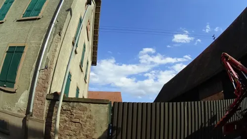
Hotel Landgasthof Bühlerhof
Restaurant · 3.1 km
*** Bis auf weiteres nur Hotel geöffnet, Restaurant geschlossen.
13, Heddesheim
Mo-Su off; Su,PH off
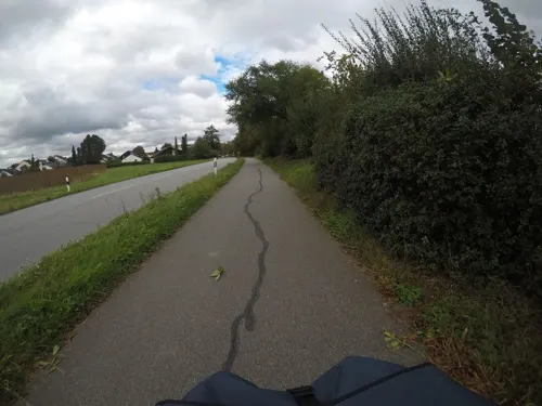
ATB Vereinshaus
Restaurant · Greek · 4.1 km
66 Ahornstraße, Heddesheim
Mo,We-Sa 17:00-24:00; Su 10:30-14:30,17:00-24:00
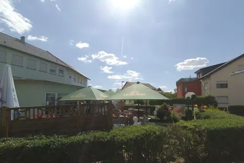
Akropolis
Restaurant · Greek · 3.7 km
15 Lessingstraße, Heddesheim
Mo-Sa 17:00-24:00;Tu off; Su,PH 11:30-14:30, 17:00-24:00
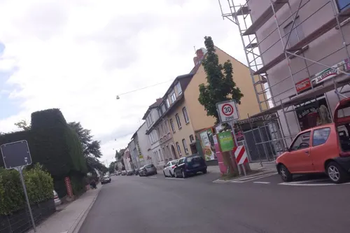
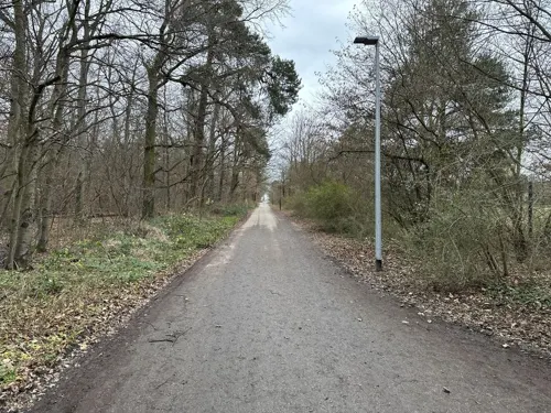
Bei Gitta
Restaurant · 1.7 km
Vereinsgaststätte der Hundefreunde Viernheim
8 Am Kirschenweg, Viernheim
Tu-Su 11:00-23:00; Dec 24-26 off
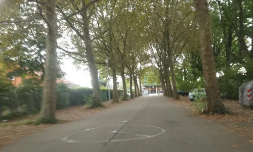
Beim Alex
Restaurant · Greek · 4.8 km
40/2 Breslauer Straße, Weinheim
Mo-Fr 11:30-14:00, 17:00+;We off
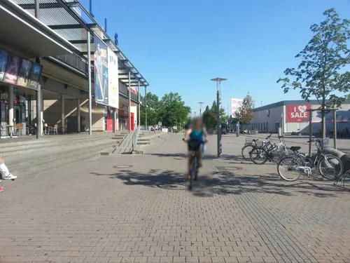
Cozy & Tasty
Restaurant · Burger, American · 1.6 km
8 Robert-Schuman-Straße, Viernheim
Mo off; Tu-Th 15:00-22:00; Fr 15:00-22:30; Sa 13:00-22:30; Su 13:00-22:00
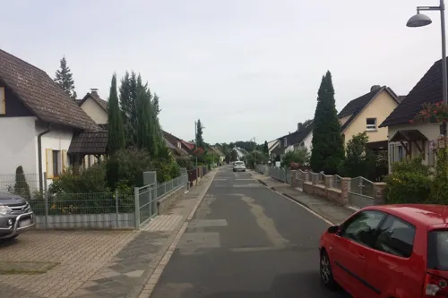
Drei Eichen
Restaurant · Greek · 5.4 km
1 Rottannenweg, Mannheim
Mo-Sa 12:00-14:00, Su 12:00-20:00, Sa 17:00-20:00
Dynasty
Restaurant · Chinese · 4.5 km
4 Schlehdornweg, Weinheim
Mo-Fr 11:30-15:00,17:30-23:00; Sa,Su 11:30-23:00

Bäcker Görtz
Bakery · 5.3 km
2 Keltenstraße, Mannheim
Mo-Fr 05:30-18:00; Sa 06:00-17:00; Su,PH 07:30-17:00

Bäckerei Theurer
Cafe · Coffee Shop, Ice Cream, Juice, Cake, Pasta · 3.4 km
2a Odenwaldstraße, Heddesheim
Mo-Su 06:00-19:00

Döner im Rott
Restaurant · Kebab · 5.4 km
12 Marie-Bernays-Platz, Mannheim
Mo-Fr 11:00-20:30; Sa 12:00-20:30
232 more on the map.
History
Viernheim grew out of a Carolingian king's court. Viernheim had its first documentary mention in 777 in the Lorsch codex, the Lorsch Abbey's book of documents. Through donations, it ended up in the Abbey’s ownership. In 1232, the Abbey’s holdings were given to the Archbishops of Mainz, but only in 1308 did Viernheim pass to Mainz. In 1439, however, the town was pledged to the Schönau Abbey, who in turn sold it to the Electorate of the Palatinate. After the Thirty Years' War, it passed back to Mainz, and thence under the Reichsdeputationshauptschluss in 1803 to the Grand Duchy of Hesse, out of which came the People's State of Hesse in 1918. Once in the People's State, the town was assigned first to the Amtsvogtei of Lorsch. When Landratsbezirke – another kind of administrative division – were created in 1821, Viernheim was assigned to Heppenheim. From 1832 to 1839 came a spell under Bensheim's jurisdiction. From 1848, the town then belonged to Heppenheim district, which in 1938 was merged with Bensheim district to form today’s Bergstraße district. In 1948, Viernheim was granted town rights by the newly founded Land of Hesse.
During the 19th century the tobacco industry gained some importance, since several small tobacco manufacturers were founded. Rolling cigars provided additional income for farmers or peasants and their families during the winter.
Read more of the history
Until the end of the 19th century, Viernheim was a farming village. Bad harvests and widespread hunger in 1852 led to 458 inhabitants emigrating in this year to North America. With industrialization and the opening of the Oberrheinische Eisenbahn (a regional narrow-gauge railway still serving a roughly triangular route among Weinheim, Mannheim and Heidelberg) in 1887, the town began to become more of a workers’ residential community as many inhabitants found work in the factories in nearby Mannheim and Weinheim. Many workers, however, kept farming as a sideline. The location of industry in Viernheim itself began with the opening of the Weinheim-Worms railway (now mostly derelict) in 1905, and further strengthened after the Second World War, bringing along with it a sharp rise in population. Given the town's favourable road links to three Autobahnen, it grew into a midsize industrial town. In 1994 came its designation as a “Brundtland Town”, and its attendant participation in an energy conservation pilot project.
During World War II, Viernheim did not suffer severe damage, since the town had no strategic or industrial importance. So the Viernheim railway station served for a while as Mannheim station, after the Mannheim Central Station was destroyed in an air-raid in 1942.
On 23 June 2016, a hostage incident occurred within a cinema in the town. No hostages were injured and the gunman was shot and killed by the Spezialeinsatzkommando.
From the History section of Viernheim on Wikipedia, under CC BY-SA 4.0.
More about Viernheim
Geography
Viernheim lies in the Rhine rift, and although it also lies in Hesse, it is bounded on the west, south and east by Baden-Württemberg. North of the Viernheim woods, in Lampertheim, begins the Hessisches Ried. East of Viernheim lies the town of Weinheim, which is where the district’s namesake Bergstraße begins, and which also marks the beginning of the Odenwald. The town lies roughly 10 kilometres (6 miles) northeast of Mannheim, 10 km (6 mi) east of the Rhine and 10 km (6 mi) west of the Bergstrasse.
Viernheim borders in the north on the town of Lampertheim (in Hessen), in the northeast on the towns of Hemsbach and Weinheim, in the south on the community of Heddesheim (all three in the Rhein-Neckar-Kreis), and in the west on the district-free city of Mannheim (all in Baden-Württemberg).
Economy
Viernheim lies on the A 659, which leads directly to Mannheim and Weinheim, and also affords a direct link to three further Autobahnen, the A 5, the A 6 and the A 67. Because of the two Autobahn junctions, the Viernheimer Kreuz and the Viernheimer Dreieck, Viernheim is also well known to many drivers.
Viernheim is linked to the surrounding cities by a narrow-gauge railway and a busline. The electric narrow-gauge railway (Oberrheinische Eisenbahn, OEG), nowadays designated line 5R, is usually regarded as an interurban. Since 1887 it has run to Mannheim, Weinheim and Heidelberg, and is run by the Rhein-Neckar-Verkehr GmbH (RNV). A regional busline of Busverkehr Rhein-Neckar runs to Weinheim as well as Lampertheim and Worms. There are also two town buslines run by the RNV daughter company V-Bus. All public transport is integrated into the Rhine-Neckar Transport Association.
Arts and culture
Evangelische Auferstehungskirche, Berliner Ring (Church of the Resurrection)
Kapelle St. Josef, Bürgermeister Neff-Straße 15 (Tridentine Mass)
Neuapostolische Kirche, Maria-Mandel-Straße* St. Apostel Kirche
Waldsee (popularly "Anglersee"), a large artificial pond and recreation area.
Various other churches of Germany's two predominant denominations:
February: Carnival parade or Street Carnival (alternating each year)
May: 1 May Labour Day: German Confederation of Trade Unions celebration
May: Tanz in den Mai; Traditionelles May Day at the fire station, Brundtlandfest
July: first weekend, traditional community festival of community association, Viernheim
July: CdG-Sommerfest in Bavarian style* August: MGV- Gartenfest (first weekend in August)
From the Wikipedia article Viernheim, under CC BY-SA 4.0.
Notable people from Viernheim
 Ulrich TukurGerman actor and musician (born 1957)Photo: Krd, CC BY-SA 3.0
 Claudia ReinhardtGerman photographerPhoto: Clahart, CC BY-SA 4.0
 Kaya KinkelGerman politicianPhoto: Martin Kraft, CC BY-SA 4.0
- Claudia TonnGerman heptathlete
- Fritz NieblerGerman amateur wrestler
- Walter BaureisGerman association football player (1930-2014)
Born in Viernheim, according to Wikidata (CC0). Each name links to its Wikipedia article.
Where to stay18
Churches and places of worship38
Rumänisch-orthodoxe Kirchengemeinde "Auferstehung Christi"
Church · Orthodox · 5.0 km
12-14 Alter Postweg, Mannheim
Shopping77
Gas and EV charging22
Viernheim - Rhein-Neckar-Zentrum Supercharger
EV charging · 1.6 km
8 Robert-Schuman-Straße, Viernheim
Schools, colleges and libraries33
Healthcare26
Map of Viernheim
250 places. The map loads OpenStreetMap tiles when you open it.
Getting there and nearby towns
City-Airport Mannheim (MHG) is the nearest airport with scheduled flights listed in OpenStreetMap, 9 km away.
- Heddesheim 4 km southeast, about 4 min by car
- Weinheim 6 km east, about 6 min by car
- Hirschberg an der Bergstraße 7 km southeast, about 7 min by car
- Hemsbach 8 km northeast, about 8 min by car
- Ilvesheim 7 km south, about 7 min by car
- Ladenburg 8 km south, about 8 min by car
- Mannheim 10 km southwest, about 10 min by car
- Edingen-Neckarhausen 9 km south, about 9 min by car
- Lampertheim 10 km northwest, about 10 min by car
- Schriesheim 10 km southeast, about 10 min by car
Drive times are estimates from straight-line distance, not routes.
Towns near Viernheim


Keep exploring
Local news
Headlines from INDB.
Reviews, tips and questions
Loading what members have shared...
Sources and licences
- GeoNames (CC BY 4.0): population, coordinates, regions and time zone
- Mapillary (see each image): photos
- OpenStreetMap contributors (ODbL 1.0): places, airports, map data
- Wikidata (CC0 1.0): elevation, founding date, time zone, website, landmarks and historic places
- Wikimedia Commons (see each image): photos
- Wikipedia (CC BY-SA 4.0): overview and history text
Photo credits
- Stolperstein Viernheim Luisenstraße 36 Frieda Oppenheimer, Uwe Walch, CC BY-SA 4.0
- Stolperstein Viernheim Luisenstraße 36 Hugo Oppenheimer, Uwe Walch, CC BY-SA 4.0
- Stolperstein Viernheim Luisenstraße 36 Doris Oppenheimer, Uwe Walch, CC BY-SA 4.0
- Stolperstein Viernheim Luisenstraße 36 Julius Oppenheimer, Uwe Walch, CC BY-SA 4.0
- Stolperstein Viernheim Luisenstraße 36 Max Liebster, Uwe Walch, CC BY-SA 4.0
- Stolperstein Viernheim Luisenstraße 36 Irma Oppenheimer, Uwe Walch, CC BY-SA 4.0
- Margrit Malachowski (Badischer Schachkongress Viernheim 1984), Krtschil, CC BY-SA 4.0
- Viernheim, Denkmal Lorscher Straße, Muck, CC BY-SA 4.0
- Viernheim Rathaus 20100711, Rudolf Stricker, Attribution
- Stolperstein Viernheim Rathausstraße 23 Lore Oppenheimer, Uwe Walch, CC BY-SA 4.0
- Stolperstein Viernheim Rathausstraße 23 Abraham Herzberger, Uwe Walch, CC BY-SA 4.0
- Stolperstein Viernheim Rathausstraße 23 Helene Herzberger, Uwe Walch, CC BY-SA 4.0
- Stolperstein Viernheim Rathausstraße 23 Elisabeth Weissmann, Uwe Walch, CC BY-SA 4.0
- Stolperstein Viernheim Rathausstraße 23 Gertrud Herzberger, Uwe Walch, CC BY-SA 4.0
- Twelve Apostles church in Viernheim (6), Krzysztof Golik, CC BY-SA 4.0
- Twelve Apostles church in Viernheim (9), Krzysztof Golik, CC BY-SA 4.0
- Twelve Apostles church in Viernheim (8), Krzysztof Golik, CC BY-SA 4.0
- Twelve Apostles church in Viernheim (7), Krzysztof Golik, CC BY-SA 4.0
- 75VIRathausViernheim kl, UlAlpixel, CC BY-SA 4.0
- Viernheim, Rathausstraße 28, Muck, CC BY-SA 4.0
- Twelve Apostles church in Viernheim (5), Krzysztof Golik, CC BY-SA 4.0
- Viernheim, Luisenstraße 27, Muck, CC BY-SA 4.0
- Twelve Apostles church in Viernheim (3), Krzysztof Golik, CC BY-SA 4.0
- Twelve Apostles church in Viernheim (4), Krzysztof Golik, CC BY-SA 4.0
- Twelve Apostles church in Viernheim (10), Krzysztof Golik, CC BY-SA 4.0
- 2026-06-06 D500-97565M Achim-Lammerts Mannheim-Neckarufer-Fernmeldeturm, Achim Lammerts (Syntaxys), CC BY-SA 4.0
- Luisenpark Mannheim Gondolettas, Andromeda Altair, Public domain
- Viernheimer Kirchec, Wisohr, CC BY-SA 3.0
- Weinheim Dietrich-Bonhoeffer-Schule 20120909, Rudolf Stricker, Attribution
- Heddesheim evangelische Kirche 20110315, Rudolf Stricker, Attribution
- Heddesheim St. Remigius-Kirche 20110315, Rudolf Stricker, Attribution
- Naturschutzgebiet "Viehwäldchen, Apfelkammer, Neuwäldchen", MWFenkner, CC BY-SA 3.0
- Kinopolis, Graf Foto, CC BY-SA 3.0
- Auferstehungskirche Viernheim 100 3385, No machine-readable author provided. LosHawlos assumed (based on copyright claims)., CC BY-SA 3.0
- Miramar Erlebnisbad Sauna und Therme (Weinheim), Sciencia58, CC0
- Wiki DSC00833 Neuzenlache 1431020, René Schröder, CC BY-SA 4.0
- NSG Teiche am Landgraben, Michael Linnenbach, CC BY-SA 4.0
- Kirche Sankt Michael Viernheim 100 3376, No machine-readable author provided. LosHawlos assumed (based on copyright claims)., CC BY-SA 3.0
- Weinheim - St.-Marien-Kirche, Radosław Drożdżewski (Zwiadowca21), CC BY-SA 3.0
- Kirche Sankt Hildegard Viernheim 100 3391, No machine-readable author provided. LosHawlos assumed (based on copyright claims)., CC BY-SA 3.0
- Herrmanns Hofladen Mannheim-Käfertal, Wegavision, CC0
- Römerbrücke bei Weinheim, Cryptorebel, CC BY-SA 4.0
- Kriegerdenkmal 1870-71 Viernheim, Wegavision, CC0
- Eingangsbereich Vogelpark Viernheim 2012, 4028mdk09, CC BY-SA 3.0
- Street-level photo, wegavision, CC BY-SA 4.0
- Street-level photo, ramap, CC BY-SA 4.0
- Street-level photo, wegavision, CC BY-SA 4.0
- Street-level photo, wegavision, CC BY-SA 4.0
- Street-level photo, wegavision, CC BY-SA 4.0
- Street-level photo, wegavision, CC BY-SA 4.0
- Street-level photo, ramap, CC BY-SA 4.0
- Street-level photo, Blablaeffekt, CC BY-SA 4.0
- Street-level photo, ramap, CC BY-SA 4.0
- Street-level photo, wegavision, CC BY-SA 4.0
- Street-level photo, wegavision, CC BY-SA 4.0
- Street-level photo, mfa, CC BY-SA 4.0
- Street-level photo, mfa, CC BY-SA 4.0
- Street-level photo, ramap, CC BY-SA 4.0
- Street-level photo, ramap, CC BY-SA 4.0
- Street-level photo, wegavision, CC BY-SA 4.0
- Street-level photo, ramap, CC BY-SA 4.0
- Street-level photo, wegavision, CC BY-SA 4.0
- Street-level photo, Eraoniel, CC BY-SA 4.0
- Street-level photo, wegavision, CC BY-SA 4.0
- Street-level photo, wegavision, CC BY-SA 4.0
- Street-level photo, wegavision, CC BY-SA 4.0
- Street-level photo, b166er, CC BY-SA 4.0
- Street-level photo, wegavision, CC BY-SA 4.0
- Street-level photo, wegavision, CC BY-SA 4.0


Page built November 9, 2026. Spotted a mistake? Tell us or suggest a place.