


Wilhelmshaven, Germany
Wilhelmshaven is a town of 84,393 people in Lower Saxony, Germany, founded in 1869.
Why visit Wilhelmshaven
Townapedia lists 92 museums and landmarks, 36 parks and trails, 234 places to eat, 35 places to stay and 17 attractions in and around town.
Highlights include Aquarium Wilhelmshaven, Stadttheater, Deutsches Marinemuseum and Kunsthalle Wilhelmshaven.
Weather in Wilhelmshaven
Forecast from MET Norway (CC BY 4.0). Full forecast
About Wilhelmshaven
Wilhelmshaven (German pronunciation: [ˌvɪlhɛlmsˈhaːfn̩] , lit. 'William's Harbour'; Northern Low Saxon: Willemshaven) is a coastal town in Lower Saxony, Germany. It is situated on the western side of the Jade Bight, a bay of the North Sea, and has a population of 76,089. Wilhelmshaven is the centre of the "Jade Buse" business region (which has around 330,000 inhabitants) and is Germany's main military port.
From the Wikipedia article Wilhelmshaven (this version), under CC BY-SA 4.0.
Travel tips from other travellers: Wilhelmshaven on Wikivoyage (CC BY-SA 4.0).
Photos of Wilhelmshaven


Things to do17


Voslapp Range Rear Light
Lighthouse · 4.2 km
Lighthouse in Wilhelmshaven, Germany, part of Voslapp range lights
Voslapp Oberfeuer
Lighthouse · 4.2 km
Jadefahrwasser, Richtfeuerlinie 164,5°


UCI Kinowelt
Cinema and theater · 3.2 km
22 Bahnhofstraße, Wilhelmshaven
"30 Minuten vor Beginn der 1. Vorstellung"

Kaiser Wilhelm Bridge
Bridge · 4.3 km
Swing bridge in Wilhelmshaven, Germany


5 more on the map.
Museums and landmarks92

Deutsches Marinemuseum
Museum · 4.5 km
125 Südstrand, Wilhelmshaven
Apr-Oct Mo-Su,PH 10:00-18:00; Nov-Mar Mo-Su,PH 10:00-17:00

Kunsthalle Wilhelmshaven
Museum · 3.1 km
28 Adalbertstraße, Wilhelmshaven
Tu 14:00-20:00; We-Su 11:00-17:00; PH off


Wattenmeerhaus, UNESCO-Weltnaturerbe Wattenmeer Besucherzentrum Wilhelmshaven
Museum · 4.5 km
110b Südstrand, Wilhelmshaven
Apr-Oct Mo-Su 10:00-17:00; Nov-Mar Tu-Su 10:00-17:00

Accumer Mühle
Monument and historic site · 5.6 km
Reetgedeckter Galerieholländer mit je zwei sich gegenüberliegenden Jalousie- und Segelflügeln, Kappe, Windrose und zwei voll...
Apr-Oct: Su[3] 14:00-17:00



Ruscherei
Museum · 1.2 km
Verschiedene gastronomische Bereiche für Treffen und Festlichkeiten aller Art bis zu einer Gesamtkapazität von 100 Plätzen im Haus und...
1 Ubbostraße, Wilhelmshaven
|| "Nach Absprache"
Bunker-Museum Wilhelmshaven
Museum · 3.0 km
1a Minsener Oog, Wilhelmshaven
Su 15:00-17:00+ || "Führung / Besichtigung nach Terminabsprache"
80 more on the map.
Parks, trails and playgrounds36

Nautimo
Sports field and stadium · 1.3 km
99 Friedenstraße, Wilhelmshaven
Mo-Fr 10:00-21:00; Sa,Su,PH 09:00-21:00


Nordfrost-Arena
Sports field and stadium · 1.6 km
103 Friedenstraße, Wilhelmshaven


Störtebeker Park
Sports field and stadium · 1.7 km
Oct-Mar Mo-Th 09:00-15:00; Fr 09:00-13:00; Sa-Su,PH off; Apr-Sep...

Kanu- und Segelsportverein Wilhelmshaven e. V. von 1966
Marina and boat launch · 5.0 km
8 Benzstraße, Wilhelmshaven
24 more on the map.
Restaurants and cafes234

Banter Ruine
Restaurant · German · 4.1 km
61 Jadeallee, Wilhelmshaven
Mo-Fr 17:00-21:00; Sa,Su,PH 12:00-14:00,17:00-21:00; Tu off
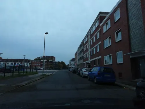
Ishikawa
Restaurant · Japanese · 2.8 km
Parken ist auf dem Mittelstreifen der Gökerstraße möglich.
2 Knorrstraße, Wilhelmshaven
Mo-Fr 11:30-15:00,16:30-22:00; Sa,Su 12:00-22:00
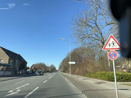
Zum Knurrhahn
Restaurant · German · 4.4 km
215 Flutstraße, Wilhelmshaven
Tu-Sa 11:00-14:00, Tu-Sa 17:00-22:00, Su 11:00-14:00
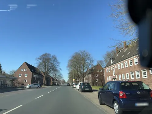

ATHOS
Restaurant · Burger, Greek, International, Mediterranean, Steak House · 2.1 km
116 Gökerstraße, Wilhelmshaven
Tu-Su 17:00-23:00
Akdeniz Steakhaus & Mittelmeer-Restaurant
Restaurant · Turkish · 2.3 km
149 Bismarckstraße, Wilhelmshaven
Tu-Sa 17:00-24:00, PH,Su 12:00-15:00,17:00-24:00; Mo off
Bambuspalast
Restaurant · Chinese · 2.9 km
54 Virchowstraße, Wilhelmshaven
Mo-Sa 11:30-15:00,17:00-23:00; PH Su 11:30-23:00
Da Sergio
Restaurant · Italian · 3.2 km
3 Parkstraße, Wilhelmshaven
Tu-Su,PH 12:00-14:30,17:30-22:00; Mo off
Guido's 2.0
Restaurant · Steak House · 3.1 km
21 Virchowstraße, Wilhelmshaven
Mo-Th 12:00-14:30,18:00-22:30; Fr,Sa 17:30-23:00; Su off
Oase im Gorch-Fock-Haus
Restaurant · Regional · 2.9 km
15 Viktoriastraße, Wilhelmshaven
Tu-Sa 17:00-23:00; PH 11:30-16:00
222 more on the map.
History
The Siebethsburg castle, built before 1383, operated as a pirate stronghold; the Hanseatic League destroyed it in 1433. Four centuries later, the Kingdom of Prussia planned a fleet and a harbour on the North Sea. In 1853, Prince Adalbert of Prussia, a cousin of the Prussian King Frederick William IV, arranged the Jade Treaty (Jade-Vertrag) with the Grand Duchy of Oldenburg, in which Prussia and the Grand Duchy entered into a contract whereby Oldenburg ceded 3.13 km2 (1.21 sq mi) of its territory at the Jade Bight to Prussia. In 1869 King William I of Prussia (later also German Emperor) founded the town as an exclave of the Province of Hanover and a naval base for Prussia's developing fleet. All the hinterland of the city remained a part of Oldenburg.
Trams started running in 1913, and continued until 1945 when they were bombed. A shipbuilding yard developed at Wilhelmshaven, the Kaiserliche Werft Wilhelmshaven (Wilhelmshaven Imperial Shipyard). On 30 June 1934 the "pocket battleship" Admiral Graf Spee was launched at Wilhelmshaven. The battleship Scharnhorst was subsequently laid down a year afterward, before her commissioning in 1939. The biggest European warship of the second world war, the battleship "Tirpitz", was built at the same naval yard 1936-1941.
Read more of the history
In 1937 Wilhelmshaven and the adjacent town of Rüstringen merged and the united city, named Wilhelmshaven, became a part of the Free State of Oldenburg.
During World War II (1939–1945), Wilhelmshaven served as the main base of the Kriegsmarine. Allied bombing destroyed two thirds of the town's buildings while the main target, the Naval Shipyard Wilhelmshaven, remained operational despite serious damage. A major attack on residential areas of Wilhelmshaven was carried out on 15 October 1944. Various churches, hospitals, schools and many residential buildings were destroyed or severely damaged. During the war, Alter Banter Weg (No. 1582 Wilhelmshaven), functioned as a subcamp of the Neuengamme concentration camp.
On 28 April 1945 the Polish First Armored Division captured Wilhelmshaven, and took the surrender of the entire garrison, including over 200 ships of the Kriegsmarine. The Poles remained as part of the Allied occupation forces until 1947.
In 1947 the city council decided to seek a new emblem for the city. After the Control Commission for Germany – British Element (CCG/BE) had rejected several designs, Wilhelmshaven selected the image of a Frisian warrior (Rüstringer Friese), designed after a nail man erected in the city during the First World War to collect war donations.
A trolley bus service was in operation from 1942-1960, taking over from the tram that was destroyed in the WW2 bombing.
Between 1947 and 1972 Wilhelmshaven was the home of Prince Rupert School, a comprehensive boarding school for children of British Army of the Rhine and Royal Air Force Germany personnel serving in West Germany. The school relocated to Rinteln in Lower Saxony in 1972, and closed in 2014. There is an active association of former Wilhelmshaven pupils called The Wilhelmshaven Association. After World War II the shipyard was totally disarmed under the British Commander in Chief, and of course many military buildings were damaged or vacant. While it was prohibited to establish any kind of military-linked businesses, Wilhelmshaven took the opportunity to provide a convenient location for Olympia Werke, which became one of the most popular quality typewriter factories in the world. A workforce of 7,000 worker was employed there in 1953.
From the History section of Wilhelmshaven on Wikipedia, under CC BY-SA 4.0.
More about Wilhelmshaven
Geography
Wilhelmshaven has an oceanic climate (Köppen: Cfb; Trewartha: Dolk). Wilhelmshaven is located on the coast of the North Sea and is influenced by a distinct maritime climate. The average temperature ranges from 1 °C (34 °F) in winter to 16 °C (61 °F) in summer, with warm winters and cool summers throughout the year.
The Wilhelmshaven weather station has recorded the following extreme values:
Highest Daily Precipitation: 75.2 mm (2.96 in) on 29 June 1981.
From the Wikipedia article Wilhelmshaven, under CC BY-SA 4.0.
Notable people from Wilhelmshaven
 Erhard MilchGerman officer, NSDAP, most recently field marshal in the Third Reich, war criminal (1892–1972)Photo: Fischer, Public domain
 Thomas HengelbrockGerman conductorPhoto: Axel Hindemith, CC BY 3.0
 Klaus RiedelGerman rocket scientist (1907-1944)Photo: SchmiAlf, CC BY 4.0
 Kurt DoerryGerman sprinter (1874-1947)Photo: Unknown author Unknown author, Public domain
 Maren FrommGerman volleyball playerPhoto: Zorro2212, CC BY-SA 3.0
 Timo TjahjantoIndonesian film director, screenwriter and producerPhoto: John Sears, CC BY-SA 4.0
 Hans HellmannGerman scientist (1903–1938)Photo: Unknown author Unknown author, Public domain
- Heinz PrüferGerman mathematician (1896–1934)
- Sebastian PolterGerman association football player
- Hans ClarinGerman actor (1929–2005)
- Helmut HeißenbüttelGerman writer (1921–1996)
- Olaf LiesGerman politician (SPD), Minister President of Lower Saxony
Born in Wilhelmshaven, according to Wikidata (CC0). Each name links to its Wikipedia article.
Where to stay35
Fliegerdeich Hotel & Restaurant
Motel and hotel · 4.5 km
3 Fliegerdeich, Wilhelmshaven
Churches and places of worship29
Christus- und Garnisonkirche
Church · Lutheran · 3.5 km
2 Am Kirchplatz, Wilhelmshaven
Apostel-Johannes-Kirche
Church · Protestant · 1.1 km
97 Werdumer Straße, Wilhelmshaven
Ev.-Freikirchliche Gemeinde (Baptisten)
Church · Baptist · 2.5 km
13 Schulstraße, Wilhelmshaven
Heppenser Kirche (St. Nikolai-Kirche)
Church · Lutheran · 2.9 km
31 Heppenser Straße, Wilhelmshaven
St.-Jakobi-Kirche
Church · Lutheran · 2.0 km
104 Kirchreihe, Wilhelmshaven
Shopping64
Gas and EV charging17
Schools, colleges and libraries36
Gymnasium Cäcilienschule
School · Catholic · 2.7 km
69 Peterstraße, Wilhelmshaven
Healthcare21
Map of Wilhelmshaven
250 places. The map loads OpenStreetMap tiles when you open it.
Getting there and nearby towns
JadeWeserAirport (WVN) is the nearest airport with scheduled flights listed in OpenStreetMap, 6 km away.
- Sande 8 km southwest, about 8 min by car
- Schortens 10 km west, about 10 min by car
- Jever 14 km west, about 14 min by car
- Butjadingen 15 km east, about 15 min by car
- Varel 17 km south, about 17 min by car
- Zetel 17 km southwest, about 17 min by car
- Bockhorn 18 km south, about 18 min by car
- Schillig 18 km north, about 18 min by car
- Friedeburg 21 km southwest, about 21 min by car
- Wittmund 22 km west, about 22 min by car
Drive times are estimates from straight-line distance, not routes.
Towns near Wilhelmshaven


Keep exploring
Local news
Headlines from INDB.
Reviews, tips and questions
Loading what members have shared...
Sources and licences
- GeoNames (CC BY 4.0): population, coordinates, regions and time zone
- Mapillary (see each image): photos
- OpenStreetMap contributors (ODbL 1.0): places, airports, map data
- Wikidata (CC0 1.0): elevation, founding date, time zone, website, landmarks and historic places
- Wikimedia Commons (see each image): photos
- Wikipedia (CC BY-SA 4.0): overview and history text
Photo credits
- Luftaufnahmen Nordseekueste 2012 05 D90 by-RaBoe 123, © Ra Boe / Wikipedia, CC BY-SA 3.0 de
- 8517 Rosarium Wilhelmshaven 8517, Gerd Fahrenhorst, CC BY 4.0
- 2012-05-28 Fotoflug Cuxhaven Wilhelmshaven DSCF9567, Martina Nolte, CC BY-SA 3.0 de
- Heete in Wilhelmshaven, Gerd Fahrenhorst, CC BY 4.0
- Wilhelmshaven, ehem. St. Michael 2017 Foto 6951, Gerd Fahrenhorst, CC BY 4.0
- 2012-05-28 Fotoflug Cuxhaven Wilhelmshaven DSC 3885, Martina Nolte, CC BY-SA 3.0 de
- Allee und See im Stadtpark Wilhelmshaven, Gerd Fahrenhorst, CC BY 4.0
- Stadtpark Wilhelmshaven 8543, Gerd Fahrenhorst, CC BY 4.0
- Stadtpark Wilhelmshaven 8544, Gerd Fahrenhorst, CC BY 4.0
- Am Neuender Busch 62, Wilhelmshaven, Gerd Fahrenhorst, CC BY 4.0
- Anna im Stadtpark Wilhelmshaven 2024-07, Gerd Fahrenhorst, CC BY 4.0
- 8509 Rosarium Wilhelmshaven 8509, Gerd Fahrenhorst, CC BY 4.0
- 8508 Rosarium Wilhelmshaven 8508, Gerd Fahrenhorst, CC BY 4.0
- Heidelinde im Rosarium Wilhelmshaven, Freddy2001 ( talk ), CC BY-SA 4.0
- 8510 Rosarium Wilhelmshaven 8510, Gerd Fahrenhorst, CC BY 4.0
- Stadtpark Wilhelmshaven 8545, Gerd Fahrenhorst, CC BY 4.0
- Sitzgruppe im Rosarium Wilhelmshaven, Gerd Fahrenhorst, CC BY 4.0
- Stadtpark Wilhelmshaven 8546, Gerd Fahrenhorst, CC BY 4.0
- 8507 Rosarium Wilhelmshaven 8507, Gerd Fahrenhorst, CC BY 4.0
- 8541 Rosarium Wilhelmshaven 8541, Gerd Fahrenhorst, CC BY 4.0
- 8515 Rosarium Wilhelmshaven 8515, Gerd Fahrenhorst, CC BY 4.0
- Anna im Stadtpark Wilhelmshaven 2017 Foto 1, Gerd Fahrenhorst, CC BY 4.0
- Anna im Stadtpark Wilhelmshaven 2017 Foto 2, Gerd Fahrenhorst, CC BY 4.0
- 8511 Rosarium Wilhelmshaven 8511, Gerd Fahrenhorst, CC BY 4.0
- 8518 Rosarium Wilhelmshaven 8518, Gerd Fahrenhorst, CC BY 4.0
- 8540 Rosarium Wilhelmshaven 8540, Gerd Fahrenhorst, CC BY 4.0
- 8534 Rosarium Wilhelmshaven 8534, Gerd Fahrenhorst, CC BY 4.0
- Botanischer Garten Wilhelmshaven 8504, Gerd Fahrenhorst, CC BY 4.0
- Voslapp Range Rear 6883, Ein Dahmer, CC BY-SA 3.0
- Jade-Hochschule, Wilhelmshaven, Gerd Fahrenhorst, CC BY-SA 3.0
- Accumer Mühle, Unknown author, CC BY-SA 3.0
- Banter Ruine (Wilhelmshaven), Freddy2001, CC BY-SA 4.0
- Christus- und Garnisonkirche, Wilhelmshaven, Unknown author, CC BY-SA 3.0
- Christkönig-Wilhelmshaven, Philipp Jakob, CC BY-SA 3.0
- Cäcilienschule Wilhelmshaven, Christallkeks, CC BY-SA 3.0
- Luftaufnahmen Nordseekueste 2012 05 D90 by-RaBoe 212, © Ra Boe / Wikipedia, CC BY-SA 3.0 de
- Käthe-Kollwitz-Schule, Wilhelmshaven, Gerd Fahrenhorst, CC BY-SA 3.0
- NORDERNEY 3490, Ein Dahmer, CC BY-SA 4.0
- Nordfrost-Arena, Wilhelmshaven, Gerd Fahrenhorst, CC BY-SA 3.0
- Neuende Kirche, Unknown author, CC BY-SA 3.0
- Kunsthalle Wilhelmshaven 02, K. Siereveld, Public domain
- Kopperhoerner Muehle 0098, Ein Dahmer, CC BY-SA 4.0
- Küstenmuseum Wilhelmshaven, Gerd Fahrenhorst, CC BY 3.0
- Pumpwerk 1, Hector250001, CC BY-SA 3.0
- 5370 St. Willehad Kirche-2, 5370_St._Willehad_Kirche.JPG : Gerd Fahrenhorst derivative work: Rabanus Flavus, CC BY-SA 3.0
- Wilhelmshaven Stadttheater, Uwe Karwath, Wilhelmshaven, CC BY-SA 3.0
- Theater am Meer Wilhelmshaven, Theater am Meer, Wilhelmshaven, CC0
- Freikirchebaptisten, Laup F, CC BY 3.0
- Botanischer Garten Wilhelmshaven 8490, Gerd Fahrenhorst, CC BY 4.0
- Aquarium Wilhelmshaven 2017-02, Gerd Fahrenhorst, CC BY 4.0
- St. Marienkirche Whv 8839, Gerd Fahrenhorst, CC BY 4.0
- Barghauser See, Klinkenborg, CC BY-SA 4.0
- 8011 Wattenmeerhaus Wilhelmshaven, Gerd Fahrenhorst, CC BY 3.0
- Bronzeplastik Marabu 6956, Gerd Fahrenhorst, CC BY 4.0
- Reinhard-Nieter-Krankenhaus, Wilhelmshaven, Gerd Fahrenhorst, CC BY-SA 3.0
- Banter Kirche 1, Hector250001, CC BY-SA 3.0
- ATLANTIC Hotel 7761, Ein Dahmer, CC BY-SA 4.0
- WHV Fliegerdeich 8259, Ein Dahmer, CC BY-SA 4.0
- Lutherkirche Heppens, Gerd Fahrenhorst, CC BY-SA 3.0
- Apostelkirche Altengroden 2017, Gerd Fahrenhorst, CC BY 4.0
- Wilhelmshaven, St. Peter 1, Gerd Fahrenhorst, CC BY 3.0
- Heppenser Kirche DSCN8441, Gerd Fahrenhorst, CC BY 4.0
- City Hotel Valois, Wilhelmshaven, Gerd Fahrenhorst, CC BY 4.0
- Südstrand 120, Hotel Seenelke, Wilhelmshaven, Gerd Fahrenhorst, CC BY 4.0
- Hotel am Stadtpark (Tide Hotel), Wilhelmshaven, Gerd Fahrenhorst, CC BY 4.0
- ARCONA 0930, Ein Dahmer, CC BY-SA 4.0
- Nautimo, Außenansicht, MedienhausJW, CC BY-SA 4.0
- Hotel Schöne Aussicht, Rüstersiel, Gerd Fahrenhorst, CC BY 4.0
- Kapelle Friedenstraße, Wilhelmshaven 2, Gerd Fahrenhorst, CC BY 4.0
- J POI 048 WHV Kaiser-Wilhelm-Bruecke 2022-04-24, Pathumthani, CC BY-SA 4.0
- Panorama KW-Brücke - panoramio, Rolf Tiegs, CC BY-SA 3.0
- Street-level photo, hotzi57, CC BY-SA 4.0
- Street-level photo, Isilcalgan, CC BY-SA 4.0
- Street-level photo, VIA_KK, CC BY-SA 4.0
- Street-level photo, klaas130, CC BY-SA 4.0
- Street-level photo, mfa, CC BY-SA 4.0
- Street-level photo, Isilcalgan, CC BY-SA 4.0
- Street-level photo, Isilcalgan, CC BY-SA 4.0
- Street-level photo, Isilcalgan, CC BY-SA 4.0
- Street-level photo, hotzi57, CC BY-SA 4.0
- Street-level photo, hotzi57, CC BY-SA 4.0
- Street-level photo, VIA_KK, CC BY-SA 4.0
- Street-level photo, klaas130, CC BY-SA 4.0
- Street-level photo, VIA_KK, CC BY-SA 4.0


Page built November 9, 2026. Spotted a mistake? Tell us or suggest a place.