


Wipperfürth, Germany
Wipperfürth is a town of 23,723 people in North Rhine-Westphalia, Germany.
Why visit Wipperfürth
Townapedia lists 76 museums and landmarks, 47 parks and trails, 90 places to eat, 28 places to stay and 78 attractions in and around town.
Highlights include Hofladen Hedfeld, Toffi's Milchbar, Rote Fabrik and Schwarzpulvermuseum Villa Ohl.
Weather in Wipperfürth
Forecast from MET Norway (CC BY 4.0). Full forecast
About Wipperfürth
Wipperfürth (German pronunciation: [ˈvɪpɐˌfʏʁt] ) or the Hanseatic City of Wipperfürth is a municipality in the Oberbergischer Kreis of North Rhine-Westphalia, Germany, about 40 km north-east of Cologne, and the oldest town in the Bergischen Land. In the local dialect, a Bergish dialect of the Limburgish language the town is still being called Weperevorthe.
From the Wikipedia article Wipperfürth (this version), under CC BY-SA 4.0.
Things to do78

Hofladen Hedfeld
Farm and orchard · 6.5 km
1, Halver
Tu 15:00-18:00; We 10:00-18:00; Th-Fr 15:00-18:00; Sa 08:00-16:00


66 more on the map.
Museums and landmarks76


Basisstation Wasserquintett
Museum · 0.7 km
Die Ausstellung ist in einem Gebäude auf dem Vereinshaus und nur zu Fuß oder mit dem Fahrrad zugänglich.
47b Lüdenscheider Straße, Wipperfürth
Mo-Fr 09:00-18:00; Sa,Su 10:00-17:00


Schloss Hückeswagen
Monument and historic site · 5.6 km
1 Auf'm Schloß, Hückeswagen

Villa Schnabel
Monument and historic site · 5.7 km
2a Bachstraße, Hückeswagen


64 more on the map.
Parks, trails and playgrounds47

Bürgerbad Hückeswagen
Sports field and stadium · 6.0 km
Dauerhaft geschlossen, Bad und Sauna, siehe Webseite
13 Zum Sportzentrum, Hückeswagen
closed


Harthbachtal mit Nebenbächen und Hangwäldern
Hiking and trails · 5.2 km


35 more on the map.
Restaurants and cafes90
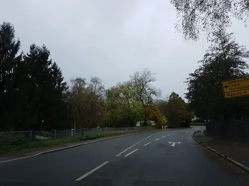

Beim Rösi
Restaurant · German · 4.6 km
32 Johann-Wilhelm-Roth-Straße, Wipperfürth
May-Sep: Mo-Tu off; We-Fr 16:00-23:00; Sa,Su 14:00-23:00; Oct-Apr:...
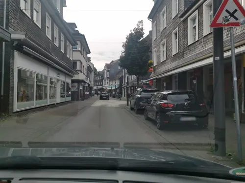
Da Luca
Restaurant · Italian
8 Marktstraße, Wipperfürth
We-Fr 11:30-14:30,17:00-22:30; Sa 17:00-22:30; Su,PH 11:30-21:00; Mo,Tu off
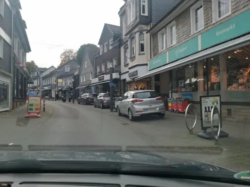
Esito Burger And More
Restaurant · Fast Food
12 Untere Straße, Wipperfürth
Mo-Fr 11:00-21:00; Sa,Su,PH off
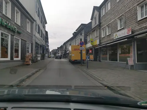
Gaia Café & Deli
Restaurant · Turkish, Breakfast
51 Untere Straße, Wipperfürth
Tu-Sa 09:00-22:00; Su 10:00-21:00; Mo off
Gasthaus zur Neyetalsperre
Restaurant · Regional · 2.0 km
3 Großblumberg, Wipperfürth
Fr-Su,PH 09:00-22:00
Haus Kleineichen
Restaurant · Regional, Bavarian · 3.8 km
44 Bevertalstraße, Hückeswagen
We-Sa 11:30-14:00,17:30-21:45; Su,PH 11:30-14:00,17:30-21:15
Istanbul Citygrill
Restaurant · Kebab, Pizza
32 Hochstraße, Wipperfürth
Mo-Fr 11:00-22:00; Sa 12:00-22:00; Su 14:00-22:00; Tu off


KLÖN CAFÉ
Cafe · Coffee Shop, Breakfast, Cake · 7.3 km
9 Hauptstraße, Rönsahl
Mo-Th 10:00-17:00; Sa-Su 14:00-17:00
La Nave
Restaurant · Italian · 2.0 km
24 Hansestraße, Wipperfürth
Mo 11:00-13:30, 17:00-20:30; Th-Fr 11:00-13:30, 17:00-20:30; Sa...
La Piazza
Restaurant · Italian, Pizza, Salat · 1.0 km
3 Leiersmühle, Wipperfürth
Tu-Fr 11:30-14:00, 17:00-21:30; Sa,Su 17:00-21:30
78 more on the map.
History
The eldest documentary mention dates from 1131. In the Siegburger Mirakelbuch the place is already designated Oppidum(=town). Manner of writing of the first naming: "Weperevorthe". Wipperfürth received town rights between 1217 and 1222. Since 1283 the administration of the town was governed by count Adolf V. von Berg. Already in 1275 king Rudolf von Habsburg allowed the count to move his mint from Wildberg to Wipperfürth. Here, Pfennige were stamped according to Cologne model. In 1328, with the privilege of king Louis the Bavarian the first coinage of Groschen in Germany began in Wipperfürth. Since the 14th century the town was a member of the Hanse. Businesspeople of the town traveled to Stockholm, Dorpat, Malmö, Novgorod, Reval and Lübeck. The town coat of arms of 1267 shows a church in merlons-reinforced wall. Leftovers of this town wall can still be found on the Klosterberg. The oldest building are located at the market, together with the market well. The development of the town was hindered by numerous town fires: 1333, 1352, 1368, 1383, 1404, 1412 and 1465. From 1815–1932 Wipperfürth was capital town of the district with the same name.
From the History section of Wipperfürth on Wikipedia, under CC BY-SA 4.0.
Where to stay28
DJH Jugendherberge Wipperfürth - Sport-Jugendherberge
Motel and hotel · 0.9 km
34 Ostlandstraße, Wipperfürth
Churches and places of worship42
St. Agatha
Church · Roman Catholic · 2.6 km
24 Agathaberg, Wipperfürth
Sankt Johann Baptist
Church · Roman Catholic · 8.1 km
Pastoratsstraße, Marienheide
Shopping31
Gas and EV charging11
Schools, colleges and libraries23
Europäische Akademie für psychosoziale Gesundheit - Fritz Perls Institut
School · 4.4 km
5 Wefelsen, Hückeswagen
Healthcare10
Map of Wipperfürth
250 places. The map loads OpenStreetMap tiles when you open it.
Getting there and nearby towns
Cologne Bonn Airport (CGN) is the nearest airport with scheduled flights listed in OpenStreetMap, 33 km away.
- Remscheid 16 km northwest, about 16 min by car
- Solingen 23 km west, about 23 min by car
- Wuppertal 23 km northwest, about 23 min by car
- Bergisch Gladbach 24 km southwest, about 24 min by car
- Hagen 28 km north, about 28 min by car
- Leverkusen 30 km west, about 30 min by car
- Wülfrath 31 km northwest, about 31 min by car
- Köln 37 km southwest, about 37 min by car
- Bochum 43 km north, about 43 min by car
- Dortmund 45 km north, about 45 min by car
Drive times are estimates from straight-line distance, not routes.
Local news
Headlines from INDB.
Reviews, tips and questions
Loading what members have shared...
Sources and licences
- GeoNames (CC BY 4.0): population, coordinates, regions and time zone
- Mapillary (see each image): photos
- OpenStreetMap contributors (ODbL 1.0): places, airports, map data
- Wikidata (CC0 1.0): elevation, founding date, time zone, website
- Wikimedia Commons (see each image): photos
- Wikipedia (CC BY-SA 4.0): overview and history text
Photo credits
- Wipperfürth Marktplatz, No machine-readable author provided. Trexer assumed (based on copyright claims)., CC BY-SA 3.0
- St. Antonius, Wipperfürth-9144, Raimond Spekking, CC BY-SA 4.0
- Evangelische Kirche Wipperfürth-9170, Raimond Spekking, CC BY-SA 4.0
- Wipperfürth, Velopilger, CC0
- Blick vom Klosterberg, Wipperfürth-9148, Raimond Spekking, CC BY-SA 4.0
- Blick vom Klosterberg (Wipperfürth), DiAuras, CC BY-SA 4.0
- Katholischer Kindergarten, Ringstraße, Wipperfürth-9174, Raimond Spekking, CC BY-SA 4.0
- Wipperfürther Marktplatz - panoramio, Marco Nassenstein, CC BY 3.0
- Blick vom Klosterberg, Wipperfürth-9146, Raimond Spekking, CC BY-SA 4.0
- Marktplatz Wipperfürth-9149, Raimond Spekking, CC BY-SA 4.0
- Marktplatz Graf Engelbert II von Berg Denkmal (Wipperfürth) (1), DiAuras, CC BY-SA 4.0
- Marktplatz Graf Engelbert II von Berg Denkmal (Wipperfürth) (2), DiAuras, CC BY-SA 4.0
- Marktplatz Graf Engelbert II von Berg Denkmal (Wipperfürth) (3), DiAuras, CC BY-SA 4.0
- St. Antonius mit ehemaligem Klostergebäude, Klosterplatz, Wipperfürth-9175, Raimond Spekking, CC BY-SA 4.0
- Rathaus Marktplatz 1 (Wipperfürth), DiAuras, CC BY-SA 4.0
- Marktplatz 12 (Wipperfürth), DiAuras, CC BY-SA 4.0
- Marktplatz 11, 12 (Wipperfürth), DiAuras, CC BY-SA 4.0
- Evangelische Kirche (Wipperfürth), DiAuras, CC BY-SA 4.0
- Brunnen Marktplatz (Wipperfürth), DiAuras, CC BY-SA 4.0
- Marktplatz 11 (Wipperfürth) (2), DiAuras, CC BY-SA 4.0
- St. Antonius mit ehemaligem Klostergebäude, Klosterplatz, Wipperfürth-9145, Raimond Spekking, CC BY-SA 4.0
- Takko Wipperfürth - Lust auf Shopping-9169, Raimond Spekking, CC BY-SA 4.0
- St. Antonius mit ehemaligem Klostergebäude, Klosterplatz, Wipperfürth-9176, Raimond Spekking, CC BY-SA 4.0
- St. Nikolaus, Wipperfürth-9156, Raimond Spekking, CC BY-SA 4.0
- St. Nikolaus, Wipperfürth-9151, Raimond Spekking, CC BY-SA 4.0
- St. Nikolaus, Wipperfürth-9157, Raimond Spekking, CC BY-SA 4.0
- St. Nikolaus, Wipperfürth-9161, Raimond Spekking, CC BY-SA 4.0
- St. Nikolaus, Wipperfürth-9162, Raimond Spekking, CC BY-SA 4.0
- Missionskreuz Kirchplatz (BD 141) (Wipperfürth) (1), DiAuras, CC BY-SA 4.0
- St. Nikolaus, Wipperfürth-9163, Raimond Spekking, CC BY-SA 4.0
- St. Nikolaus (Wipperfürth) (12), DiAuras, CC BY-SA 4.0
- St. Nikolaus, Wipperfürth-9165, Raimond Spekking, CC BY-SA 4.0
- St. Nikolaus, Wipperfürth-9159, Raimond Spekking, CC BY-SA 4.0
- Pfarrzentrum St. Nikolaus, Wipperfürth-9155, Raimond Spekking, CC BY-SA 4.0
- Pfarrzentrum St. Nikolaus, Wipperfürth-9153, Raimond Spekking, CC BY-SA 4.0
- Bildstock Kirchplatz (BD 143) (Wipperfürth), DiAuras, CC BY-SA 4.0
- Missionskreuz Kirchplatz (BD 141) (Wipperfürth) (2), DiAuras, CC BY-SA 4.0
- St. Nikolaus (Wipperfürth), Velopilger, CC0
- Alter ev. Friedhof Hindenburgstraße (Wipperfürth) (4), DiAuras, CC BY-SA 4.0
- Ruine Eibach HDR, SerWal, CC BY-SA 3.0
- Neuenberg-1, Carsten Becher, CC BY-SA 3.0
- Wipperfürth - Daiseion-ji Tempel 01 ies, Frank Vincentz, CC BY-SA 3.0
- Hückeswagen - Marktstraße - Pauluskirche ex 08 ies, Frank Vincentz, CC BY-SA 3.0
- Schloss Gimborn 09, Dickelbers, CC BY-SA 4.0
- Marienheide Gimborn - Sankt Johann Baptist 02 ies, Frank Vincentz, CC BY-SA 3.0
- Engelbert von Berg Gymnasium Wipperfürth2, No machine-readable author provided. Trexer assumed (based on copyright claims)., CC BY-SA 3.0
- Kierspe Rönsahl - Kirchstraße - Servatiuskirche 03 ies, Frank Vincentz, CC BY-SA 3.0
- Haus Hammerstein, Trohleder, CC BY-SA 4.0
- Hueckeswagen-schlosskapelle, Unknown author, CC BY 2.0
- Hueckeswagen-johanniskirche, Unknown author, CC BY 2.0
- Hückeswagen - Auf'm Schloss - Schloss 23 ies, Frank Vincentz, CC BY-SA 3.0
- Wipperfürth Pfarrkirche St. Nikolaus vom Hausmannsplatz, Dr. Andreas Laschet, CC BY-SA 3.0
- Agathaberg Kirche, The original uploader was Trexer at German Wikipedia ., CC BY-SA 3.0
- Kirche Unbefleckte Empfängnis (Egen), Chris06, CC BY-SA 4.0
- Raderstraße 1-Februar 2011, BangertNo, CC BY-SA 3.0
- Hückeswagen - Friedrichstraße18 Stadtbibliothek 04 ies, Frank Vincentz, CC BY-SA 3.0
- NSG Sürthtal, Pingsjong, GFDL
- Kapellenweg 4 -Kempershöhe (Marienheide) Drehorgelmuseum, DiAuras, CC BY-SA 4.0
- Hückeswagen - Fuhr12-Tuchfabrik 03 ies, Frank Vincentz, CC BY-SA 3.0
- St. Michael (Wipperfürth) (1), DiAuras, CC BY-SA 4.0
- Naturschutzgebiet Berrenbecke (GM-097) (3), DiAuras, CC BY-SA 4.0
- Hückeswagen Kleineichen - Bevertalstraße - Beverteich 04 ies, Frank Vincentz, CC BY-SA 3.0
- GM-093 Hänge der Neyetalsperre (17), DiAuras, CC BY-SA 4.0
- NSG Hangquellmoor Kupferberg (7), DiAuras, CC BY-SA 4.0
- NSG GM-089 Harthbachtal (23), DiAuras, CC BY-SA 4.0
- Ibachtal und Tal des Wieger Siepens, DiAuras, CC BY-SA 4.0
- NSG MK-004 In der Bommert-2, Ökologix, CC BY-SA 3.0
- NSG Leiverbachtal und Talhänge (19) Talaue nordöstl. Pixberger Mühle, DiAuras, CC BY-SA 4.0
- NSG GM-103 Mausbachtal (43) Mausbachtal, DiAuras, CC BY-SA 4.0
- Fischteich an der Neye Unternien (Wipperfürth), DiAuras, CC BY-SA 4.0
- St Anna Kirche Haemmern, Marco Nassenstein, Public domain
- Street-level photo, simonikes, CC BY-SA 4.0
- Street-level photo, ASRvw, CC BY-SA 4.0
- Street-level photo, ASRvw, CC BY-SA 4.0
- Street-level photo, ASRvw, CC BY-SA 4.0
- Street-level photo, ASRvw, CC BY-SA 4.0
- Street-level photo, ASRvw, CC BY-SA 4.0
- Street-level photo, raymond, CC BY-SA 4.0
- Street-level photo, ASRvw, CC BY-SA 4.0
- Street-level photo, travelagentprofi, CC BY-SA 4.0
- Street-level photo, uwekoch, CC BY-SA 4.0
- Street-level photo, wladimir, CC BY-SA 4.0
- Street-level photo, ASRvw, CC BY-SA 4.0
- Street-level photo, ASRvw, CC BY-SA 4.0
- Street-level photo, wladimir, CC BY-SA 4.0
- Street-level photo, travelagentprofi, CC BY-SA 4.0
- Street-level photo, travelagentprofi, CC BY-SA 4.0
- Street-level photo, ASRvw, CC BY-SA 4.0
- Street-level photo, simonikes, CC BY-SA 4.0


Page built November 8, 2026. Spotted a mistake? Tell us or suggest a place.