




Why visit Zeitlarn
Townapedia lists 7 museums and landmarks, 3 parks and trails, 28 places to eat, 4 places to stay and 8 attractions in and around town.
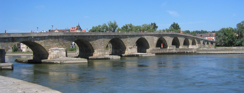
Highlights include Nibelungen Bridge, Staatstheater Regensburg, Castra Regina and Museum der Bayerischen Geschichte.
Weather in Zeitlarn
Forecast from MET Norway (CC BY 4.0). Full forecast
About Zeitlarn
Zeitlarn is a municipality in the district of Regensburg in Bavaria in Germany.
From the Wikipedia article Zeitlarn (this version), under CC BY-SA 4.0.
Things to do8

Nibelungen Bridge
Bridge · 6.3 km
Road structure in Regensburg, Germany

Staatstheater Regensburg
Cinema and theater · 6.8 km
Theatre building and opera house in Regensburg, Germany
Stone Bridge
Bridge · 6.4 km
12th-century bridge across the Danube in Regensburg, Germany

Velodrom
Cinema and theater · 6.7 km
Former velodrome, then cinema, now theatre in Regensburg, Bavaria, Germany


Museums and landmarks7

Castra Regina
Monument and historic site · 6.6 km
Roman legionary fortress at the site of modern Regensburg, Germany

Museum der Bayerischen Geschichte
Museum · 6.5 km
History museum in Regensburg, Germany

Regensburg Museum of History
Museum · 6.8 km
Museum of the history, art and culture of Regensburg and eastern Bavaria



Parks, trails and playgrounds3


Restaurants and cafes28

Pizzeria Pielmühle
Restaurant · Italian · 2.5 km
24 Regendorfer Straße, Lappersdorf
Mo 17:00-23:00;We-Sa 17:00-23:00; Su 11:30-14:00,17:00-23:00
Hotel-Restaurant Götzfried
Restaurant · Regional · 3.4 km
1 Wutzlhofen, Regensburg
Mo-Sa 18:00-23:00; Su 12:00-21:00
Korfu
Restaurant · Greek · 3.7 km
31 Regensburger Straße, Lappersdorf
Tu-Sa 19:00-22:00; Su 11:30-14:00,19:00-22:00
La Pineta
Restaurant · Italian · 3.5 km
1 Regensburger Straße, Lappersdorf
Tu-Sa 17:00-23:00; Su 11:00-14:00,17:00-22:00


Bäckerei Schifferl
Bakery · 3.7 km
29 Regensburger Straße, Lappersdorf
Mo-Fr 06:00-18:00; Sa 06:00-13:00; Su 07:30-10:30
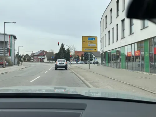
Teruo Restaurant
Restaurant · Sushi · 3.7 km
136 Amberger Straße, Regensburg
PH,Tu-Fr,Su 11:00-15:00,17:00-22:30; Sa 17:00-22:00

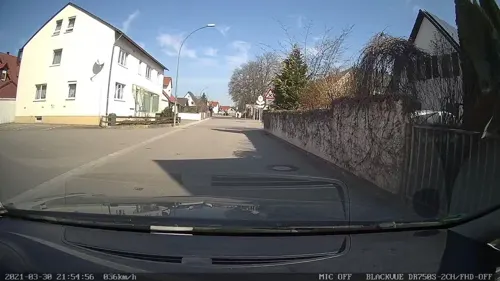
Altmann
Restaurant · Bavarian · 3.6 km
17 Regensburger Straße, Lappersdorf
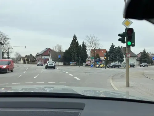


Bäckerei Krois
Cafe · 3.7 km
136 Amberger Straße, Regensburg
Mo-Fr 06:30-17:00; Sa 06:30-13:00
16 more on the map.
Where to stay4
Churches and places of worship11
Mariä Himmelfahrt
Church · Roman Catholic · 3.6 km
2 Kirchberg, Lappersdorf
St. Laurentius
Church · Roman Catholic · 2.0 km
3 Kirchplatz, Lappersdorf
Friedenskirche
Church · Protestant · 3.4 km
3 D.-Martin-Luther-Straße, Lappersdorf
Shopping10
Gas and EV charging3
Schools, colleges and libraries5
Staatliche Feuerwehrschule Regensburg
School · 2.9 km
30 Michael-Bauer-Straße, Lappersdorf
Healthcare3
Map of Zeitlarn
82 places. The map loads OpenStreetMap tiles when you open it.
Getting there and nearby towns
Flugplatz Straubing-Wallmühle (RBM) is the nearest airport with scheduled flights listed in OpenStreetMap, 36 km away.
- Lappersdorf 4 km southwest, about 4 min by car
- Regenstauf 5 km north, about 5 min by car
- Regensburg 7 km south, about 7 min by car
- Neutraubling 12 km southeast, about 12 min by car
- Maxhütte-Haidhof 14 km north, about 14 min by car
- Burglengenfeld 15 km north, about 15 min by car
- Bad Abbach 16 km south, about 16 min by car
- Kelheim 24 km southwest, about 24 min by car
- Roding 32 km northeast, about 32 min by car
- Abensberg 35 km southwest, about 35 min by car
Drive times are estimates from straight-line distance, not routes.
Local news
Headlines from INDB.
Reviews, tips and questions
Loading what members have shared...
Sources and licences
- GeoNames (CC BY 4.0): population, coordinates, regions and time zone
- Mapillary (see each image): photos
- OpenStreetMap contributors (ODbL 1.0): places, airports, map data
- Wikidata (CC0 1.0): elevation, founding date, time zone, website, landmarks and historic places
- Wikimedia Commons (see each image): photos
- Wikipedia (CC BY-SA 4.0): overview and history text
Photo credits
- Regensburg - panoramio (73), Hans100, CC BY 3.0
- Bismarckplatz Theater Regensburg 20160928 (1), photographer and uploader was Hajotthu at de.wikipedia, CC BY-SA 3.0
- Regensburg - Steinerne Bruecke ohne Dom, Hytrion at German Wikipedia, CC BY-SA 3.0
- Velodrom (Regensburg), Johanning, CC BY-SA 3.0
- Legionslager Castra Regina, Burkhard Mücke, CC BY-SA 4.0
- Museum der Bayerischen Geschichte Regensburg, Burkhard Mücke, CC BY-SA 4.0
- Eingang Historisches Museum Regensburg, Burkhard Mücke, CC BY-SA 4.0
- Zu Unserer Lieben Frau zur Alten Kapelle von Norden, The original uploader was DALIBRI at German Wikipedia ., CC BY-SA 2.0 de
- 00 2273 Regensburger Dom, W. Bulach, CC BY-SA 4.0
- Schottenportal RB, Richard Bartz, CC BY-SA 3.0
- 14.03.29 Zeitlarn St.Bartholomäus, Gehsport-sepp ( Diskussion ), CC BY-SA 4.0
- Heilige Dreifaltigkeit Regendorf 2014, Johanning, CC BY-SA 4.0
- Schloss Regendorf 2014, Johanning, CC BY-SA 4.0
- 13.06.18 Lorenzen St.Laurentius, Gehsport-sepp ( Diskussion ), CC BY-SA 4.0
- Lappersdorf - panoramio (2), Hans100, CC BY 3.0
- Zeitlberg Sky - panoramio, M a ✗, CC BY 3.0
- Mapillary (osmplus org) 2025-04-28 12H07M39S416 (726895576427621 at QywlzXDepxZtF9s7T2fihU), osmplus_org, CC BY-SA 4.0
- Mapillary (osmplus org) 2025-04-28 12H07M40S333 (1072706371338376 at QywlzXDepxZtF9s7T2fihU), osmplus_org, CC BY-SA 4.0
- Zeitlberg Panorama - panoramio, M a ✗, CC BY 3.0
- Mapillary (osmplus org) 2025-04-28 12H07M39S333 (988750616769138 at QywlzXDepxZtF9s7T2fihU), osmplus_org, CC BY-SA 4.0
- Mapillary (osmplus org) 2025-04-28 12H07M38S416 (1044262137860384 at QywlzXDepxZtF9s7T2fihU), osmplus_org, CC BY-SA 4.0
- Mapillary (osmplus org) 2025-04-28 12H07M40S416 (4173786142856274 at QywlzXDepxZtF9s7T2fihU), osmplus_org, CC BY-SA 4.0
- Mapillary (osmplus org) 2025-04-28 12H07M41S125 (560765060069924 at QywlzXDepxZtF9s7T2fihU), osmplus_org, CC BY-SA 4.0
- Mapillary (osmplus org) 2025-04-28 12H07M38S375 (2570306566633817 at QywlzXDepxZtF9s7T2fihU), osmplus_org, CC BY-SA 4.0
- Mapillary (osmplus org) 2025-04-28 12H07M37S416 (1501383847897532 at QywlzXDepxZtF9s7T2fihU), osmplus_org, CC BY-SA 4.0
- Mapillary (osmplus org) 2025-04-28 12H07M41S416 (1259962845314797 at QywlzXDepxZtF9s7T2fihU), osmplus_org, CC BY-SA 4.0
- Mapillary (osmplus org) 2025-04-28 12H07M42S375 (556646097495406 at QywlzXDepxZtF9s7T2fihU), osmplus_org, CC BY-SA 4.0
- Mapillary (osmplus org) 2025-04-28 12H07M37S375 (3241424822689411 at QywlzXDepxZtF9s7T2fihU), osmplus_org, CC BY-SA 4.0
- Mapillary (osmplus org) 2025-04-28 12H07M36S416 (1023158676549715 at QywlzXDepxZtF9s7T2fihU), osmplus_org, CC BY-SA 4.0
- Mapillary (osmplus org) 2025-04-28 12H07M42S416 (1035822618045474 at QywlzXDepxZtF9s7T2fihU), osmplus_org, CC BY-SA 4.0
- Mapillary (osmplus org) 2025-04-28 12H07M43S333 (1641126359876763 at QywlzXDepxZtF9s7T2fihU), osmplus_org, CC BY-SA 4.0
- Mapillary (osmplus org) 2025-04-28 12H07M36S333 (1199628411619715 at QywlzXDepxZtF9s7T2fihU), osmplus_org, CC BY-SA 4.0
- Mapillary (osmplus org) 2025-04-28 12H07M35S416 (1371906457372246 at QywlzXDepxZtF9s7T2fihU), osmplus_org, CC BY-SA 4.0
- Mapillary (osmplus org) 2025-04-28 12H07M43S416 (1224863982531121 at QywlzXDepxZtF9s7T2fihU), osmplus_org, CC BY-SA 4.0
- Mapillary (osmplus org) 2025-04-28 12H07M44S333 (1402836090908954 at QywlzXDepxZtF9s7T2fihU), osmplus_org, CC BY-SA 4.0
- Mapillary (osmplus org) 2025-04-28 12H07M35S375 (994494796174680 at QywlzXDepxZtF9s7T2fihU), osmplus_org, CC BY-SA 4.0
- Mapillary (osmplus org) 2025-04-28 12H07M34S416 (1025166075911040 at QywlzXDepxZtF9s7T2fihU), osmplus_org, CC BY-SA 4.0
- Mapillary (osmplus org) 2025-04-28 12H07M44S416 (2199681077130376 at QywlzXDepxZtF9s7T2fihU), osmplus_org, CC BY-SA 4.0
- Mapillary (osmplus org) 2025-04-28 12H07M45S333 (1616056449058314 at QywlzXDepxZtF9s7T2fihU), osmplus_org, CC BY-SA 4.0
- Mapillary (osmplus org) 2025-04-28 12H07M34S375 (1364518984796283 at QywlzXDepxZtF9s7T2fihU), osmplus_org, CC BY-SA 4.0
- Zeitlberg Sunset - panoramio, M a ✗, CC BY 3.0
- Kriegerdenkmal Lappersdorf Namen links, Wikitarisch, CC BY-SA 4.0
- Street-level photo, toaskoas, CC BY-SA 4.0
- Street-level photo, rnissl, CC BY-SA 4.0
- Street-level photo, SuedOstLink, CC BY-SA 4.0
- Street-level photo, rnissl, CC BY-SA 4.0
- Street-level photo, rnissl, CC BY-SA 4.0
- Street-level photo, ledermann, CC BY-SA 4.0
- Street-level photo, ledermann, CC BY-SA 4.0
- Street-level photo, rnissl, CC BY-SA 4.0
- Street-level photo, rnissl, CC BY-SA 4.0
- Street-level photo, rnissl, CC BY-SA 4.0
- Street-level photo, toaskoas, CC BY-SA 4.0
- Street-level photo, rnissl, CC BY-SA 4.0
- Street-level photo, SuedOstLink, CC BY-SA 4.0
- Street-level photo, ledermann, CC BY-SA 4.0
- Street-level photo, rnissl, CC BY-SA 4.0


Page built November 9, 2026. Spotted a mistake? Tell us or suggest a place.