


Abbotskerswell, United Kingdom
Abbotskerswell is a town of 1,267 people in England, United Kingdom.
Why visit Abbotskerswell
Townapedia lists 9 museums and landmarks, 8 parks and trails, 27 places to eat, 8 places to stay and 4 attractions in and around town.
Highlights include Teign Bridge, Alexandra Theatre, Newton Abbot Museum and Bradley.
Weather in Abbotskerswell
Forecast from MET Norway (CC BY 4.0). Full forecast
About Abbotskerswell
Abbotskerswell is a village and civil parish in the English county of Devon. The village is in the north part of the parish and is located two miles (3 km) south of the town of Newton Abbot, 7 miles (11 km) from the seaside resort of Torquay and 32 miles (51 km) from the city of Plymouth. The A381 road between Newton Abbot and Totnes runs down the western side of the parish and the main railway line between these two towns forms part of its eastern boundary.
From the Wikipedia article Abbotskerswell (this version), under CC BY-SA 4.0.
Things to do4
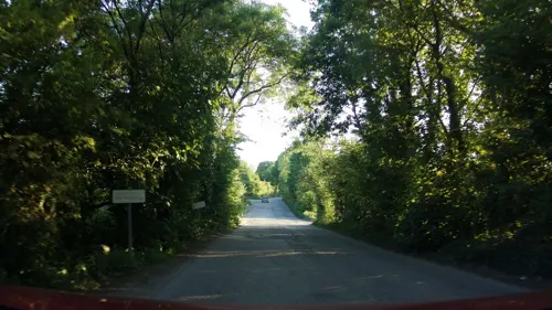
Teign Bridge
Bridge · 2.9 mi
Bridge in Teigngrace, Teignbridge, Devon, England, UK

Alexandra Theatre
Cinema and theater · 1.6 mi
Cinema in Newton Abbot, Devon, England, UK


Museums and landmarks9


Bradley
Museum · 1.4 mi
National Trust medieval manor house near Newton Abbot, Devon, England, UK

Compton Castle
Museum · 2.5 mi
Grade I listed historic house museum in South Hams, Devon, England, UK


Berry's Wood
Monument and historic site · 1.5 mi
Iron Age hill fort in south Devon, England, UK
Parks, trails and playgrounds8


Hackney Marshes
Park · 2.5 mi
Local nature reserve in Devon, England, UK



Restaurants and cafes27
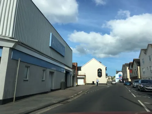
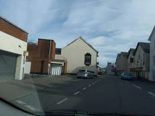


The Barn Owl
Bar and pub · 1.2 mi
Aller Road, Kingskerswell
Tu-Th 12:00-22:00; Fr,Sa 12:00-23:00; Su 12:00-21:00; Mo off


15 more on the map.
History
The settlement that is now Abbotskerswell was called Cærswylle in 956, Carsvelle in 1086 and Kareswill in 1242, meaning 'cress spring' from the Old English cærse + wylle. The name 'Abbotskerswell' itself is derived from 'Kerswell belonging to the abbot' [of Horton] and was recorded as Karswill Abbatts in 1285, Abbotescharswelle in 1314 and Abbots Keswell in 1675.
In the Domesday Book Abbotskerswell was listed as Carsuella in the ancient hundred of Kerswell, and was held by the abbot of Horton Abbey, Dorset. The name kerswell means cress spring. In 1086 it had a population of less than one hundred. The parish later became part of Haytor Hundred when it was derived from Kerswell Hundred. By 1901 the population had risen to 451 and to 1,515 by 2001.
The village church, dedicated to St Mary, was affected by the Dissolution of the Monasteries in the reign of Henry VIII. Old treasures, particularly a large badly damaged medieval statue assumed to be of the Virgin and Child, have been found within the church, and work has been undertaken to restore them. The north aisle is of the Perpendicular period and the western tower has diagonal buttresses and a stair turret in the centre of one side.
Read more of the history
Abbotskerswell developed around the growing of apples and oranges for cider making. Henley's Devonshire Cider was made by a company based in nearby Newton Abbot from apples grown in the extensive orchards around the village, and their presses were here too.
ABBOTSKERSWELL, or Abbot's Carswell, is a pleasant village, two miles S. of Newton Abbot, and has in its parish 433 souls and 1600 acres of land, including several scattered houses and the hamlet of Aller, where there is a paper mill, on a rivulet 1 ½ mile from the church. The soil is all freehold, and belongs to Sir W.P. Carew, Bart., the Hon. Mrs. Hare, W. Hole, Esq., Wm. and John Creed, and a few smaller owners. The Church (St. Mary,) is an ancient fabric in the perpendicular style, with a tower and three bells. It is about to be thoroughly repaired and beautified. The old pews are to give way to open benches, and the finely carved oak screen is to be restored and opened. . . . A cottage has been converted into a Baptist Chapel; and in the parish is a Quaker's Burial Ground, which was reserved for that purpose by a Mr. Tucket, when he sold Court Barton estate. Here is a small National School.
From the History section of Abbotskerswell on Wikipedia, under CC BY-SA 4.0.
Where to stay8
Churches and places of worship14
The Church of Jesus Christ of Latter-day Saints
Church · Latter Day Saints · 1.4 mi
Shopping5
Gas and EV charging4
Schools, colleges and libraries6
Wolborough Church of England Nursery and Primary School
School · Anglican · 1.5 mi
Union Street, Newton Abbot
Healthcare3
Map of Abbotskerswell
88 places. The map loads OpenStreetMap tiles when you open it.
Getting there and nearby towns
Exeter Airport (EXT) is the nearest airport with scheduled flights listed in OpenStreetMap, 18 miles away.
- Newton Abbot 1 mi north, about 2 min by car
- Kingsteignton 3 mi northeast, about 5 min by car
- Cockington 4 mi southeast, about 6 min by car
- Marldon 4 mi south, about 6 min by car
- Torquay 5 mi southeast, about 8 min by car
- Paignton 5 mi south, about 9 min by car
- Teignmouth 6 mi northeast, about 9 min by car
- Stoke Gabriel 7 mi south, about 12 min by car
- Dawlish 8 mi northeast, about 13 min by car
- Brixham 9 mi southeast, about 14 min by car
Drive times are estimates from straight-line distance, not routes.
Towns near Abbotskerswell


Keep exploring
Local news
Headlines from INDB.
Reviews, tips and questions
Loading what members have shared...
Sources and licences
- GeoNames (CC BY 4.0): population, coordinates, regions and time zone
- Mapillary (see each image): photos
- OpenStreetMap contributors (ODbL 1.0): places, airports, map data
- Wikidata (CC0 1.0): elevation, founding date, time zone, website, landmarks and historic places
- Wikimedia Commons (see each image): photos
- Wikipedia (CC BY-SA 4.0): overview and history text
Photo credits
- Stile in Abbotskerswell Churchyard, Partonez, CC BY-SA 4.0
- Abbotskerswell St Mary from ENE GeoUK 7076055, Derek Harper, CC BY-SA 2.0
- Chest Tomb at the Church of St. Mary, Abbotskerswell, Partonez, CC BY-SA 4.0
- West Ogwell Church, Guy Wareham, CC BY-SA 2.0
- Bradley Manor, Newton Abbot, Devon, Smalljim, CC BY-SA 3.0
- Newton Abbot (2026-01-04) 042, Simon Cobb, CC0
- Courtenay Park (2021-08-22) 18, Simon Cobb, CC0
- Newton Abbot (2026-01-04) 061, Simon Cobb, CC0
- Compton Castle 2, Roger Cornfoot, CC BY-SA 2.0
- St Leonard's Tower (30165546562), Phil Gayton from Totnes, UK, CC BY 2.0
- Street-level photo, southglos, CC BY-SA 4.0
- Street-level photo, southglos, CC BY-SA 4.0
- Street-level photo, WaggyDog, CC BY-SA 4.0
- Street-level photo, southglos, CC BY-SA 4.0
- Street-level photo, southglos, CC BY-SA 4.0
- Street-level photo, RyanBush, CC BY-SA 4.0
- Street-level photo, WaggyDog, CC BY-SA 4.0
Page built November 10, 2026. Spotted a mistake? Tell us or suggest a place.