


Why visit Brixham
Townapedia lists 18 museums and landmarks, 18 parks and trails, 75 places to eat, 14 places to stay and 9 attractions in and around town.
Highlights include Berry Head Lighthouse, Brixham Theatre, Brixham Heritage Museum and Golden Hind.
Weather in Brixham
Forecast from MET Norway (CC BY 4.0). Full forecast
About Brixham
Brixham is a coastal town and civil parish in the borough of Torbay in the county of Devon, in the south-west of England. As of the 2021 census, Brixham had a population of 16,825. It is one of the main three centres of the borough, along with Paignton and Torquay.
From the Wikipedia article Brixham (this version), under CC BY-SA 4.0.
Travel tips from other travellers: Brixham on Wikivoyage (CC BY-SA 4.0).
Photos of Brixham


Things to do9

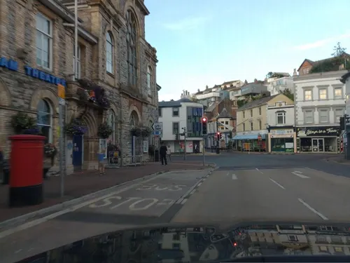

Broadsands
Beach · 1.9 mi
Beach on the coast of Torbay in South Devon, England


Museums and landmarks18
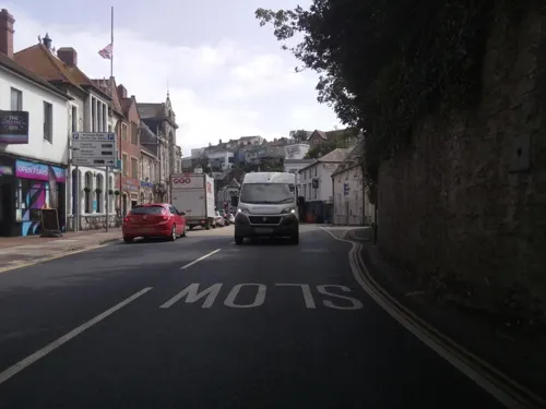
Brixham Heritage Museum
Museum
Museum in Devon, England, United Kingdom
New Road, Brixham


Greenway
Museum · 3.3 mi
Former house of Agatha Christie in Kingswear, Devon, England, UK



6 more on the map.
Parks, trails and playgrounds18






6 more on the map.
Restaurants and cafes75

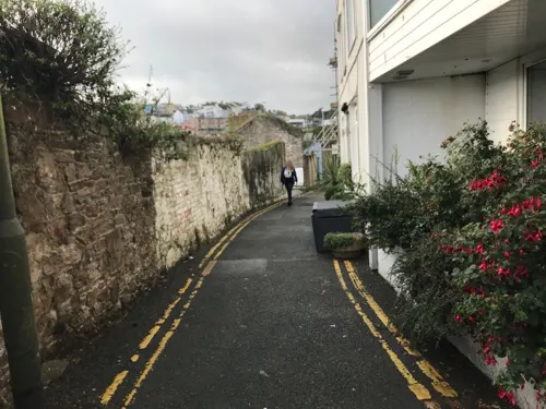
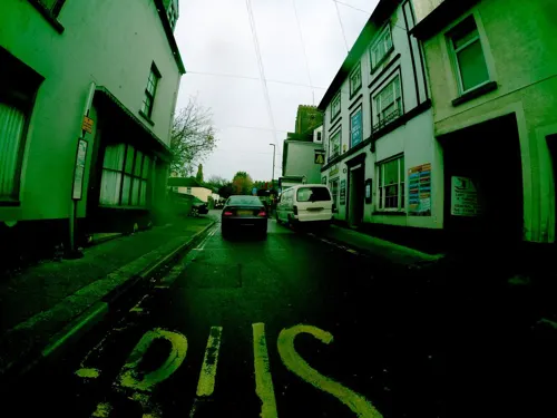

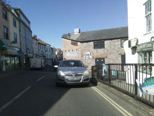


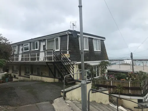



Costa Coffee
Cafe · Coffee Shop
24-26 Fore Street
Mo-Fr 08:00-18:00; Sa 08:00-17:30; Su 09:00-17:00
63 more on the map.
History
The first evidence of settlement dates from the Saxon period, it being possible that settlers arrived by sea from Hampshire in the 6th century or overland in about the year 800.
Brixham was recorded in the Domesday Book of 1086 as Briseham with a population of 39.
Brixham was part of the former Haytor Hundred. In 1334, the town's value was assessed as being one pound, twelve shillings and eightpence. William de Whithurst, a distinguished Crown official and judge in Ireland, became parish priest of Brixham in 1350. By 1524 Brixham's value had risen to £24 and sixteen shillings. In 1536 the town was recorded as being a borough, but the status was later lost. The presence of a market is recorded from 1822.
The oldest and largest of Brixham's two Anglican churches is St. Mary's, approximately one mile (1.6 km) inland from the sea in the area of the town once known as Cowtown. The present church, dating from approximately 1360, is the third to occupy the site (an ancient Celtic burial place), the first and second having been a Saxon building of wooden construction and a Norman one of stone respectively.
Read more of the history
On 5 November 1688, the invasion force of the Dutch prince, William of Orange landed in Brixham, with more than 30,000 soldiers, sailors and volunteers, prior to marching on London to be crowned King William III as part of the Glorious Revolution. There is a statue and commemorative plaque marking the event close to the Golden Hind replica in the Inner Harbour, while a road at the other end of the harbour, which leads up a steep hill to where the Dutch made their camp, is still called Overgang, Dutch for passage or crossing.
Built in around 1736, Brixham boasts what is believed to be the world's only coffin-shaped house, the story going that its unusual design results from an argument between a father and his prospective son-in-law. Upon being asked for his daughter's hand in marriage, the father answered that, "I would rather see my daughter in a coffin than married to you." Not to be so easily discouraged, the prospective husband promised that the father's wishes would be met and built the coffin-shaped house, his action so impressing the bride's father that the latter gave his blessings to the marriage.
Built in 1815, the tower of All Saints' Church is a prominent landmark overlooking the centre of Brixham. Vicar of this church from 1824 to his death in 1847, though much absent because of ill health, was the Rev. Francis Lyte, who is well known for the writing, in the last weeks of his life, of the famous hymn Abide With Me at his home, Berry Head House, (now Brixham's largest hotel) on the north-eastern edge of the town.
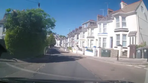
Most of the small picturesque terraced cottages built during the nineteenth century and earlier, along the narrow streets overlooking Brixham Harbour were occupied by fishermen and their families and others involved in related trades such as boatbuilding and sailmaking, while housing further away from the harbour in Cowtown and Higher Brixham tends to date from between the 1930s and the 1970s.
Opened in 1863, the British Seaman's Boys' Home was established in Brixham by William Gibbs of Tyntesfield for the bringing up and education of orphaned sons of deceased British seamen. It was closed in 1988 and the building it once occupied, Grenville House in Berry Head Road, is now an outdoor education centre.
On the night of 10/11 January 1866, Brixham was subjected to a storm of unusual severity, which, after the wind had veered to the east around midnight, a direction from which Torbay is not well sheltered, sank at least eleven local trawlers and a visiting French boat. Four Brixham fishermen were drowned. Much greater damage was done to the large number of vessels, at least 62 in number, some by the standards of the time quite large ships, en route to other ports which had sought shelter in Torbay from the storm. Forty of these ships were driven from their anchors and for the most part wrecked along three miles (4.8 km) of the local coastline. It is not known how many of their crew members and passengers were killed; the committee set up to help the victims of the disaster estimated that at least 70 had died, while other sources, in particular contemporary newspaper accounts, made claims of more than 150 fatalities. A memorial marking a mass grave in St Mary's Churchyard memorializes 25 unidentified victims and four named ones. The estimated financial cost of vessel and cargo losses ranges between £150,000 (equivalent to £20 million in 2022) and £200,000 (£26.5 million in 2022).
A direct result of this disaster was that, thanks to money raised by the citizens of Exeter, Brixham acquired its first Royal National Lifeboat Institution (RNLI) lifeboat, and has maintained a lifeboat station ever since. To date Brixham lifeboat crews (all volunteers) have been awarded 26 awards for bravery.
Brixham was joined to the railway network in February 1868 by the short Torbay and Brixham Railway which carried both passengers and goods (particularly fish), but the line, rendered progressively less and less commercially viable by the expansion of the road transport network in the course of the twentieth century, finally fell victim in 1963 to the Beeching cuts and the course of the old line, though still recognisable in places, has largely been built over, as has the site of Brixham railway station.
Due to Brixham's increasing popularity as a tourist destination following the Second World War, a number of holiday camps were built, for example Pontin's Wall Park and Dolphin camps, the latter being one of the company's biggest. It closed in 1991 after its main entertainment complex was destroyed by fire and the site has now been redeveloped with residential housing.
From the History section of Brixham on Wikipedia, under CC BY-SA 4.0.
More about Brixham
Education
Brixham has a number of schools, mostly located in the centre of residential areas.
Other schools and academies in Brixham and the surrounding area include
From the Wikipedia article Brixham, under CC BY-SA 4.0.
Notable people from Brixham
 Dan GoslingEnglish association football playerPhoto: Timmy96, CC0
 Keith JohnstoneBritish drama teacher (1933–2023)Photo: Erik van der Liet, CC BY-SA 4.0
- Nicholas PennellBritish actor (1938-1995)
- Corinne MolesworthBritish tennis player
- Adam HartEnglish scientist, author and broadcaster
- Gus Huxfordassociation football player (1889-1961)
- Gorley PuttBritish academic and author
Born in Brixham, according to Wikidata (CC0). Each name links to its Wikipedia article.
Where to stay14
Churches and places of worship8
Shopping20
Gas and EV charging1
Schools, colleges and libraries8
St Margaret Clitherow Catholic Primary School
School · Roman Catholic · 0.7 mi
Polhearne Way, Brixham
Healthcare3
Map of Brixham
174 places. The map loads OpenStreetMap tiles when you open it.
Getting there and nearby towns
Exeter Airport (EXT) is the nearest airport with scheduled flights listed in OpenStreetMap, 24 miles away.
- Teignmouth 11 mi north, about 17 min by car
- Kingsteignton 11 mi north, about 18 min by car
- Dawlish 13 mi north, about 21 min by car
- Ivybridge 18 mi west, about 29 min by car
- Exeter 23 mi north, about 37 min by car
- Sidmouth 24 mi northeast, about 38 min by car
- Plymstock 25 mi west, about 41 min by car
- Plymouth 28 mi west, about 45 min by car
- Tavistock 30 mi west, about 48 min by car
- Saltash 31 mi west, about 50 min by car
Drive times are estimates from straight-line distance, not routes.
Towns near Brixham


Keep exploring
Local news
Headlines from INDB.
Reviews, tips and questions
Loading what members have shared...
Sources and licences
- GeoNames (CC BY 4.0): population, coordinates, regions and time zone
- Mapillary (see each image): photos
- OpenStreetMap contributors (ODbL 1.0): places, airports, map data
- Wikidata (CC0 1.0): elevation, founding date, time zone, website, landmarks and historic places
- Wikimedia Commons (see each image): photos
- Wikipedia (CC BY-SA 4.0): overview and history text
Photo credits
- Brixham from the sea, Kicior99, CC BY 3.0
- Brixham (2022-04-18) 82, Simon Cobb, CC0
- Brixham (2022-04-18) 75, Simon Cobb, CC0
- Brixham (2021-07-28) 73, Simon Cobb, CC0
- Brixham (2021-07-28) 74, Simon Cobb, CC0
- Brixham (2022-04-18) 86, Simon Cobb, CC0
- Brixham (2021-07-28) 72, Simon Cobb, CC0
- Brixham (2021-07-28) 75, Simon Cobb, CC0
- Brixham (2022-04-18) 88, Simon Cobb, CC0
- Brixham (2022-04-18) 87, Simon Cobb, CC0
- 01 Coleton Fishacre, Waterborough, CC BY-SA 3.0
- Man and Boy, Brixham Harbour, JLParton, CC BY-SA 4.0
- Churston Court Inn, Churston, Brixham, Torbay, Devon, South Devon Players, CC BY 3.0
- Berry Head Hotel (from water), MhdBrixham, CC BY-SA 3.0
- Brixham (2021-07-28) 56, Simon Cobb, CC0
- Ashhole Cavern Brixham, Jamieparton, CC0
- Brixham (2021-07-28) 18, Simon Cobb, CC0
- Brixham (2022-04-18) 20, Simon Cobb, CC0
- Brixham (2022-04-18) 51, Simon Cobb, CC0
- Brixham (2021-07-28) 57, Simon Cobb, CC0
- Brixham (2021-07-28) 31, Simon Cobb, CC0
- Brixham (2021-07-28) 39, Simon Cobb, CC0
- -2019-04-25 Golden Hind Museum Ship, Brixham Harbour (2), Kolforn ( Kolforn ) I'd appreciate if you could mail me ([email protected]) if you want to use this picture out of the Wikimedia project scope. This file is licensed under the Creative Commons..., CC BY-SA 4.0
- Golden Hind, Brassknocker, CC BY-SA 4.0
- Berry Head lighthouse, Nilfanion, CC BY-SA 3.0
- Lugworm Casts at Broadsands, Partonez, CC BY-SA 4.0
- Greenway House in the 1970s, Richard Symonds, CC BY-SA 3.0
- Street-level photo, laye, CC BY-SA 4.0
- Street-level photo, davebarter, CC BY-SA 4.0
- Street-level photo, southglos, CC BY-SA 4.0
- Street-level photo, davebarter, CC BY-SA 4.0
- Street-level photo, davebarter, CC BY-SA 4.0
- Street-level photo, davebarter, CC BY-SA 4.0
- Street-level photo, davebarter, CC BY-SA 4.0
- Street-level photo, davebarter, CC BY-SA 4.0
- Street-level photo, southglos, CC BY-SA 4.0
- Street-level photo, davebarter, CC BY-SA 4.0
- Street-level photo, trigpoint, CC BY-SA 4.0
- Street-level photo, southglos, CC BY-SA 4.0
- Street-level photo, southglos, CC BY-SA 4.0
- Street-level photo, davebarter, CC BY-SA 4.0
- Street-level photo, davebarter, CC BY-SA 4.0
- Street-level photo, trigpoint, CC BY-SA 4.0
- Street-level photo, davebarter, CC BY-SA 4.0
- Street-level photo, davebarter, CC BY-SA 4.0
- Street-level photo, laye, CC BY-SA 4.0
- Street-level photo, WaggyDog, CC BY-SA 4.0


Page built November 10, 2026. Spotted a mistake? Tell us or suggest a place.