


Why visit Dawlish
Townapedia lists 4 museums and landmarks, 12 parks and trails, 47 places to eat, 8 places to stay and 3 attractions in and around town.
Highlights include Teignmouth lighthouse, Dawlish Museum, Church Rocks Wreck and Shaldon Zoo.
Weather in Dawlish
Forecast from MET Norway (CC BY 4.0). Full forecast
About Dawlish
Dawlish is a seaside resort town and civil parish in the Teignbridge district of Devon, England. It is located on the south coast, 12 miles (19 km) south of the city of Exeter and a similar distance from the town of Torquay. At the 2021 census, it had a population of 15,257, which was 16% more than the 13,161 recorded in 2011. Dawlish had grown in the 18th century from a small fishing port into a seaside resort, as had its near neighbour, Teignmouth, in the 19th century.
From the Wikipedia article Dawlish (this version), under CC BY-SA 4.0.
Travel tips from other travellers: Dawlish on Wikivoyage (CC BY-SA 4.0).
Photos of Dawlish


Things to do3

Teignmouth lighthouse
Lighthouse · 3.0 mi
Lighthouse in Devon, England, UK


Museums and landmarks4
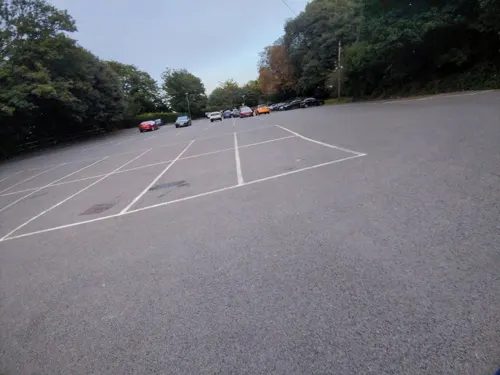

Church Rocks Wreck
Monument and historic site · 2.4 mi
Shipwreck near Teignmouth, Devon, England, UK
Parks, trails and playgrounds12





Restaurants and cafes47
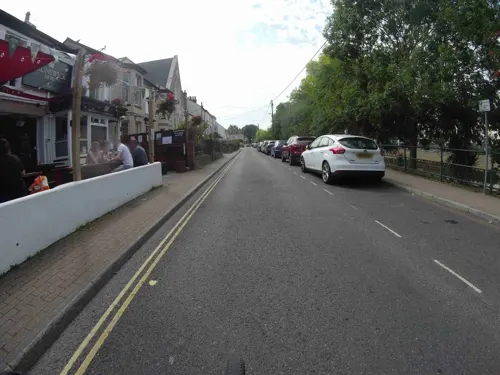



The Castle Inn
Bar and pub · 1.2 mi
Mo-Sa 12:00-15:00,18:00-23:00; Su 12:00-19:00
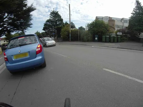


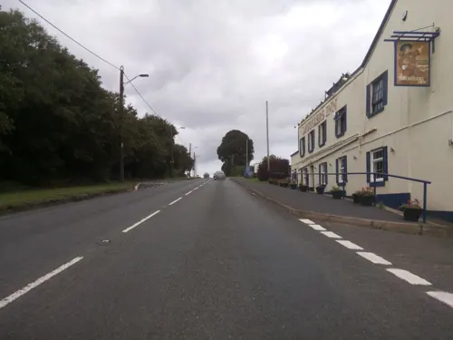


35 more on the map.
History
Before Dawlish itself was settled, fishermen and salt makers came down from the higher ground where they lived, to take advantage of the natural resources available on the coast hereabouts. They built salterns to produce salt and stored it in sheds nearby. The unpredictable nature of the stream, Dawlish Water, during floods is likely to have led to nearby Teignmouth being the preferred site for salt-making, and the practice stopped at Dawlish during the Anglo-Saxon period (400–1000 CE).
The earliest settlement at Dawlish grew up almost a mile away from the coast, around the area where the parish church is today. There is evidence of early settlements at Aller Farm, Smallacombe, Lidwell and at Higher and Lower Southwood, where the ground would have been fertile and not subject to flooding.
The land that includes present-day Dawlish was granted by Edward the Confessor to Leofric, later the first Bishop of Exeter, in 1044. After the Norman Conquest, Leofric gave the land to the Diocese of Exeter, which held it until it was sold, in 1802.
Read more of the history
Little of note happened at Dawlish until the end of the 18th century, when seaside locations on the south coast started to become popular with the wealthy, mainly caused by George III making Weymouth in Dorset his summer holiday residence from 1789. In May 1795, the antiquarian and topographer John Swete spent some time in Dawlish and reported that, although not long ago it had been no more than a fishing village and the best lodging house would not cost more than half a guinea per week, it was now so fashionable that "in the height of the season, not a house of the least consequence is to be hired for less than two guineas a week, and many of them rise to so high a sum as four or five."
In the first decade of the 19th century, the land between the original settlement and the sea was "landscaped"; the stream was straightened, small waterfalls were built into it, and it was flanked by a broad lawn and rows of new houses: The Strand on the north side and Brunswick Place on the south. The layout survives remarkably unchanged today, despite severe damage from a torrent of water coming down Dawlish Water from the Haldon Hills on the night of 10 November 1810.
Also worth noting are Manor House and Brook House (both about 1800) and some of the cottages in Old Town Street surviving from the old village. Dawlish's transformation from a fishing settlement to a watering hole for Victorian celebrities is documented at the Dawlish Museum.
In 1830, Isambard Kingdom Brunel designed an atmospheric railway, which operated on a pneumatic principle, using a 15-inch iron tube. One of the pumping stations was in this town. The line ran right along the seafront, but Brunel ensured that the line was carried across the mouth of the stream on a small granite viaduct, leaving access to the beach.
The railway opened on 30 May 1846 between Exeter St Davids and Newton Abbot. The first passenger train ran in September 1847, but the project was besieged with problems mainly with the leather sealing valve; after 12 months of use, it needed replacing at a cost of £25,000. South Devon Railway directors abandoned the project in favour of conventional trains.
From the History section of Dawlish on Wikipedia, under CC BY-SA 4.0.
More about Dawlish
Education
Dawlish College, formerly Dawlish Community College, in Elm Grove Road, is the main secondary school.
Oakwood Court College is a specialist residential college based in Dawlish, with a satellite college in Torpoint.
From the Wikipedia article Dawlish, under CC BY-SA 4.0.
Notable people from Dawlish
 Adrian SmithBritish statisticianPhoto: Unknown author, CC0
- Frederick HolmanBritish swimmer, Olympic gold medallist, former world record-holder
- Robert James ShuttleworthEnglish botanist and malacologist (1810-1874)
- Herman MerivaleEnglish civil servant and historian (1806–1874)
- Aylward M. BlackmanBritish egyptologist (1883-1956)
- Thomas Vowler ShortChurch of England bishop (1790-1872)
- Igerna SollasBritish naturalist
- Derek ColeEnglish cricketer (1925-2006)
- Paul Britten AustinBritish translator from Swedish
- Steven WillisEnglish cricketer (born 1969)
- Robert John Dickson Burniepolitician (1842–1908)
- Henry Singleton PennellEnglish military officer (1874–1907); recipient of the Victoria Cross
Born in Dawlish, according to Wikidata (CC0). Each name links to its Wikipedia article.
Where to stay8
Churches and places of worship14
Church of St Michael The Archangel (Parish Church of East Teignmouth)
Church · 2.6 mi
Shopping5
Schools, colleges and libraries6
Education and Care (Devon) Ltd At 7-9 Oak Park Villas
School
Oak Park Road, Dawlish
Healthcare6
Dawlish Warren Pharmacy
Clinic and pharmacy · 1.5 mi
1 Dawlish Warren Road, Dawlish Warren
Map of Dawlish
105 places. The map loads OpenStreetMap tiles when you open it.
Getting there and nearby towns
Exeter Airport (EXT) is the nearest airport with scheduled flights listed in OpenStreetMap, 11 miles away.
- Teignmouth 3 mi southwest, about 4 min by car
- Kingsteignton 6 mi southwest, about 9 min by car
- Exeter 10 mi north, about 16 min by car
- Sidmouth 12 mi northeast, about 20 min by car
- Honiton 19 mi northeast, about 31 min by car
- Tiverton 22 mi north, about 36 min by car
- Ivybridge 24 mi southwest, about 38 min by car
- Tavistock 30 mi west, about 48 min by car
- Plymstock 31 mi southwest, about 51 min by car
- Plymouth 33 mi southwest, about 53 min by car
Drive times are estimates from straight-line distance, not routes.
Towns near Dawlish


Keep exploring
Local news
Headlines from INDB.
Reviews, tips and questions
Loading what members have shared...
Sources and licences
- GeoNames (CC BY 4.0): population, coordinates, regions and time zone
- Mapillary (see each image): photos
- OpenStreetMap contributors (ODbL 1.0): places, airports, map data
- Wikidata (CC0 1.0): elevation, founding date, time zone, website, landmarks and historic places
- Wikimedia Commons (see each image): photos
- Wikipedia (CC BY-SA 4.0): overview and history text
Photo credits
- Dawlish View, Farzeymedic, CC BY 4.0
- Co-operative store in Dawlish (16567319874), Alex Liivet from Chester, United Kingdom, CC BY 2.0
- Dawlish (2022-04-30) 02, Simon Cobb, CC0
- Dawlish (2022-04-30) 01, Simon Cobb, CC0
- Dawlish (2022-04-30) 03, Simon Cobb, CC0
- Lloyds Bank Dawlish, Zcobes, CC BY-SA 4.0
- Teignmouth lighthouse (0044), Nilfanion, CC BY-SA 4.0
- Dawlish MethodistChurch, Motacilla, CC BY-SA 4.0
- Church of St Michael The Archangel (Parish Church of East Teignmouth), Simon Cobb, CC0
- Dawlish (2021-07-31) 19, Simon Cobb, CC0
- Railway Inn, Simon Cobb, CC0
- Dawlish (2022-04-30) 04, Simon Cobb, CC0
- Dawlish (2021-10-16) 42, Simon Cobb, CC0
- Westcliff Primary Academy, Simon Cobb, CC0
- Holcombe (2021-07-31) 27, Simon Cobb, CC0
- Dog House Inn, Simon Cobb, CC0
- Marine Tavern (1), Simon Cobb, CC0
- South Devon Inn, Simon Cobb, CC0
- Dawlish (2021-07-31) 14, Simon Cobb, CC0
- Holcombe (2021-07-31) 22, Simon Cobb, CC0
- St Mary's church hall, Dawlish Warren, Cinnamonsweets, CC BY-SA 4.0
- Gay's Creamery bakery, Rathfelder, CC0
- 26 And 27, Brunswick Place, Simon Cobb, CC0
- Reed Cottage, Simon Cobb, CC0
- Citroen Coffee Maker (9585236252), Barry Lewis, CC BY 2.0
- Memorial bench at Lea Mount in Dawlish, sea view, Andrej Shadura, CC BY-SA 4.0
- Street-level photo, jasskurn, CC BY-SA 4.0
- Street-level photo, southglos, CC BY-SA 4.0
- Street-level photo, jasskurn, CC BY-SA 4.0
- Street-level photo, jasskurn, CC BY-SA 4.0
- Street-level photo, southglos, CC BY-SA 4.0
- Street-level photo, jasskurn, CC BY-SA 4.0
- Street-level photo, southglos, CC BY-SA 4.0
- Street-level photo, jasskurn, CC BY-SA 4.0
- Street-level photo, southglos, CC BY-SA 4.0
- Street-level photo, jasskurn, CC BY-SA 4.0
- Street-level photo, southglos, CC BY-SA 4.0
- Street-level photo, southglos, CC BY-SA 4.0
- Street-level photo, southglos, CC BY-SA 4.0
- Street-level photo, jasskurn, CC BY-SA 4.0
- Street-level photo, WaggyDog, CC BY-SA 4.0
- Street-level photo, miguel_andrade, CC BY-SA 4.0
- Street-level photo, southglos, CC BY-SA 4.0
- Street-level photo, jasskurn, CC BY-SA 4.0
- Street-level photo, jasskurn, CC BY-SA 4.0
- Street-level photo, jasskurn, CC BY-SA 4.0
- Street-level photo, southglos, CC BY-SA 4.0
- Street-level photo, tallguy, CC BY-SA 4.0
- Street-level photo, jasskurn, CC BY-SA 4.0


Page built November 10, 2026. Spotted a mistake? Tell us or suggest a place.