


Alderbury, United Kingdom
Alderbury is a town of 2,223 people in England, United Kingdom.
Why visit Alderbury
Townapedia lists 12 museums and landmarks, 2 places to eat, 1 place to stay and 2 attractions in and around town.
Highlights include Salisbury Playhouse, Arundells and Mompesson House.
Weather in Alderbury
Forecast from MET Norway (CC BY 4.0). Full forecast
About Alderbury
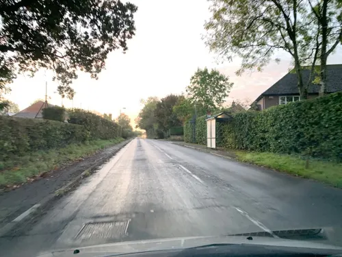
Alderbury is a village and civil parish in Wiltshire, England, in the south of the county around 3 miles (5 km) southeast of Salisbury.
From the Wikipedia article Alderbury (this version), under CC BY-SA 4.0.
Photos of Alderbury

Things to do2

Salisbury Playhouse
Cinema and theater · 3.4 mi
Theatre in Salisbury, England

Museums and landmarks12

Arundells
Museum · 3.3 mi
Historic house museum in Salisbury, Wiltshire, England, UK

Mompesson House
Museum · 3.2 mi
18th century house in Cathedral Close, Salisbury, Wiltshire, England, UK

Salisbury Museum
Museum · 3.2 mi
Museum in Salisbury, England, United Kingdom

The Rifles (Berkshire and Wiltshire) Museum
Museum · 3.3 mi
Military museum in Salisbury, England, United Kingdom

Young Gallery
Museum · 3.3 mi
Historic building and museum in Salisbury, Wiltshire, England, UK


Alderbury House
Monument and historic site · 0.4 mi
Grade II Listed Manor House. Built around 1789
Restaurants and cafes2

Where to stay1

History
The name Alderbury derives from the Old English Aethelwaruburh meaning 'Aethelwaru's fortification'.
The Domesday survey in 1086 recorded a settlement with 13 households at Alwarberie or Alwaresberie. Between 1110 and 1122, Alderbury church and its dependent chapels at Ivychurch (just north of the present Alderbury village), Whaddon and Farley were granted by Henry I to the Bishop of Salisbury.
Ivychurch Priory was founded in the late 12th century by King Stephen, on the site of the Ivychurch chapel. After the dissolution, lessees of the bishop included the Earls of Pembroke (1551–1647) and the Earls of Radnor (1757–1801). Longford Castle, on the opposite bank of the Avon, has been the Radnor seat since 1717.
The ancient Alderbury parish had two detached areas at Farley and Pitton, adjacent to each other but around 3 miles (5 km) to the northeast of Alderbury and separated from it by Clarendon Park. At some point before the 1881 census they were made a separate civil parish, Pitton and Farley.
The population of the parish reached a peak of around 700 in the middle of the 19th century, and was little changed until after the Second World War. The 1951 census recorded 1,029 and by 2001 numbers had more than doubled to 2,143.
Read more of the history
Between 1961 and 1991, the village was the location of a Royal Observer Corps monitoring bunker, to be used in the event of a nuclear attack. It remains mostly intact and in June 2000, it was re-equipped for three days to film a documentary on the ROC.
From the History section of Alderbury on Wikipedia, under CC BY-SA 4.0.
Notable people from Alderbury
- Sydney JacobsNew Zealand cricketer
Born in Alderbury, according to Wikidata (CC0). Each name links to its Wikipedia article.
Churches and places of worship6
Schools, colleges and libraries1
Alderbury and West Grimstead Church of England Primary School
School · Anglican · 0.4 mi
Firs Road, Salisbury
Healthcare1
Map of Alderbury
25 places. The map loads OpenStreetMap tiles when you open it.
Getting there and nearby towns
Upavon Airfield (UPV) is the nearest airport with scheduled flights listed in OpenStreetMap, 17 miles away.
- Salisbury 3 mi northwest, about 5 min by car
- Whiteparish 4 mi southeast, about 7 min by car
- Amesbury 9 mi north, about 15 min by car
- Romsey 11 mi east, about 17 min by car
- Cadnam 11 mi southeast, about 17 min by car
- Lark Hill 11 mi north, about 18 min by car
- Verwood 13 mi southwest, about 21 min by car
- Tidworth 13 mi north, about 21 min by car
- Totton 14 mi southeast, about 22 min by car
- Ringwood 14 mi south, about 22 min by car
Drive times are estimates from straight-line distance, not routes.
Towns near Alderbury


Keep exploring
Local news
Headlines from INDB.
Reviews, tips and questions
Loading what members have shared...
Sources and licences
- GeoNames (CC BY 4.0): population, coordinates, regions and time zone
- Mapillary (see each image): photos
- OpenStreetMap contributors (ODbL 1.0): places, airports, map data
- Wikidata (CC0 1.0): elevation, founding date, time zone, website, landmarks and historic places
- Wikimedia Commons (see each image): photos
- Wikipedia (CC BY-SA 4.0): overview and history text
Photo credits
- Church of St Mary, Alderbury. 20, Richard Avery, CC BY-SA 4.0
- Church of St Mary, Alderbury. 17, Richard Avery, CC BY-SA 4.0
- Church of St Mary, Alderbury. 16, Richard Avery, CC BY-SA 4.0
- Church of St Mary, Alderbury. 19, Richard Avery, CC BY-SA 4.0
- Church of St Mary, Alderbury. 18, Richard Avery, CC BY-SA 4.0
- Church of St Mary, Alderbury. 14, Richard Avery, CC BY-SA 4.0
- Church of St Mary, Alderbury. 15, Richard Avery, CC BY-SA 4.0
- Salisbury Playhouse, Neil Owen, CC BY-SA 2.0
- Mompesson House 2, Seb Ballard, CC BY-SA 2.0
- Kings House Salisbury Museum, SalisburyMuseum1, CC BY-SA 3.0
- The Wardrobe, Salisbury, Unknown author, CC BY-SA 2.0
- Church of St Osmund (1) Salisbury, UK, Richard Avery, CC BY-SA 4.0
- St Mark's Church, Salisbury, Wiltshire, Roger Templeman, CC BY-SA 2.0
- Longford Castle front, Peter, CC BY 2.0
- The Young Gallery, TheYoungGallery, CC BY-SA 4.0
- Sir Edward Heath - Arundells 59 Cathedral Close Salisbury SP1 2EN, Spudgun67, CC BY-SA 4.0
- Hatchment in St Thomas's church, Salisbury 05, Richard Avery, CC BY-SA 4.0
- Ye tree at Alderbury Church 2, Richard Avery, CC BY-SA 4.0
- Street-level photo, iced, CC BY-SA 4.0
- Street-level photo, iced, CC BY-SA 4.0


Page built November 10, 2026. Spotted a mistake? Tell us or suggest a place.