


Salisbury, United Kingdom
Salisbury is a town of 44,748 people in England, United Kingdom.
Why visit Salisbury
Townapedia lists 44 museums and landmarks, 19 parks and trails, 151 places to eat, 20 places to stay and 9 attractions in and around town.
Highlights include Odeon, Salisbury Playhouse, Mompesson House and Salisbury Museum.
Weather in Salisbury
Forecast from MET Norway (CC BY 4.0). Full forecast
About Salisbury
Salisbury is a cathedral city and civil parish in Wiltshire, England with a population of 41,820, at the confluence of the rivers Avon, Nadder and Bourne. The city is approximately 20 miles (30 kilometres) from Southampton and 30 miles (50 kilometres) from Bath.
From the Wikipedia article Salisbury (this version), under CC BY-SA 4.0.
Travel tips from other travellers: Salisbury on Wikivoyage (CC BY-SA 4.0).
Photos of Salisbury


Things to do9





Museums and landmarks44

Mompesson House
Monument and historic site
18th century house in Cathedral Close, Salisbury, Wiltshire, England, UK
The Close, Salisbury

Salisbury Museum
Museum · 0.4 mi
Museum in Salisbury, England, United Kingdom
65, Salisbury
Mo-Su 10:00-17:00

Arundells
Monument and historic site
Historic house museum in Salisbury, Wiltshire, England, UK
59 West Walk, Salisbury

The Rifles Berkshire and Wiltshire Museum
Museum · Military Museum
Military museum in Salisbury, England, United Kingdom
58, Salisbury
Mo-Su 10:00-16:15


Young Gallery
Museum
Historic building and museum in Salisbury, Wiltshire, England, UK



Cathedral Campanile
Monument and historic site
Parch marks revealing the location of the 13th century bell tower that was demolished in 1790.
32 more on the map.
Parks, trails and playgrounds19


Salisbury Golf Centre
Golf course · 1.7 mi
Wilton Road, Salisbury


7 more on the map.
Restaurants and cafes151
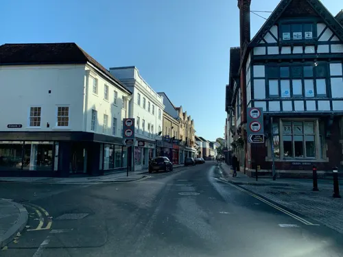
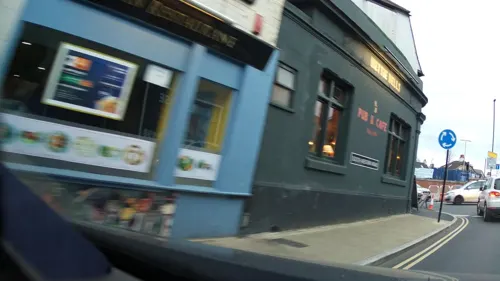
Gurkha Kitchen
Restaurant · Indian · 0.4 mi
129-133 South Western Road, Salisbury
Mo-Th 16:30-22:30; Fr-Sa 16:30-23:00; Su 16:30-22:00
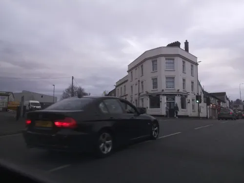

The Royal George
Bar and pub
17 Bedwin Street, Salisbury
Mo-Th 12:00-23:00; Fr-Sa 12:00-24:00; Su 12:00-20:00

Boston Tea Party
Cafe · Coffee Shop
13 High Street, Salisbury
Mo-Fr 08:30-16:00; Sa 08:30-17:00; Su 09:00-16:00

Qudos
Bar and pub
"Music Bar, Grill, Guest Rooms"
Castle Street, Salisbury
Mo-Th 07:30-22:30; Fr 07:30-23:30; Sa 08:00-23:30; Su 08:00-19:00

139 more on the map.
History
The hilltop at Old Sarum lies near the Neolithic sites of Stonehenge and Avebury and shows some signs of early settlement. It commanded a salient between the River Bourne and the Hampshire Avon, near a crossroads of several early trade routes. During the Iron Age, sometime between 600 and 300 BC, a hillfort (oppidum) was constructed around it. The Romans may have occupied the site or left it in the hands of an allied tribe. At the time of the Saxon invasions, Old Sarum fell to King Cynric of Wessex in 552. Preferring settlements in bottomland, such as nearby Wilton, the Saxons largely ignored Old Sarum until the Viking invasions led King Alfred (King of Wessex from 871 to 899) to restore its fortifications. Along with Wilton, however, it was abandoned by its residents to be sacked and burned by the Dano-Norwegian king Sweyn Forkbeard in 1003. It subsequently became the site of Wilton's mint. Following the Norman invasion of 1066, a motte-and-bailey castle was constructed by 1070. The castle was held directly by the Norman kings; its castellan was generally also the sheriff of Wiltshire.
Read more of the history
In 1075 the Council of London established Herman as the first bishop of Salisbury, uniting his former sees of Sherborne and Ramsbury into a single diocese which covered the counties of Dorset, Wiltshire, and Berkshire. In 1055, Herman had planned to move his seat to Malmesbury, but its monks and Earl Godwin objected. Herman and his successor, Saint Osmund, began the construction of the first Salisbury cathedral, though neither lived to see its completion in 1092. Osmund served as Lord Chancellor of England (in office c. 1070–1078); he was responsible for the codification of the Sarum Rite, the compilation of the Domesday Book, which was probably presented to William at Old Sarum, and, after centuries of advocacy from Salisbury's bishops, was finally canonised by Pope Callixtus III in 1457. The cathedral was consecrated on 5 April 1092 but suffered extensive damage in a storm, traditionally said to have occurred only five days later. Bishop Roger was a close ally of Henry I (reigned 1100–1135): he served as viceroy during the king's absence in Normandy and directed, along with his extended family, the royal administration and exchequer. He refurbished and expanded Old Sarum's cathedral in the 1110s and began work on a royal palace during the 1130s, prior to his arrest by Henry's successor, Stephen. After this arrest, the castle at Old Sarum was allowed to fall into disrepair, but the sheriff and castellan continued to administer the area under the king's authority.
Bishop of Salisbury Hubert Walter was instrumental in the negotiations with Saladin during the Third Crusade, but he spent little time in his diocese prior to his elevation to archbishop of Canterbury. The brothers Herbert and Richard Poore succeeded him and began planning the relocation of the cathedral into the valley almost immediately. Their plans were approved by King Richard I but repeatedly delayed: Herbert was first forced into exile in Normandy in the 1190s by the hostility of his archbishop Walter and then again to Scotland in the 1210s owing to royal hostility following the papal interdiction against King John. The secular authorities were particularly incensed, according to tradition, owing to some of the clerics debauching the castellan's female relations. In the end, the clerics were refused permission to reenter the city walls following their rogations and processions. This caused Peter of Blois to describe the church as "a captive within the walls of the citadel like the ark of God in the profane house of Baal". He advocated:
Let us descend into the plain! There are rich fields and fertile valleys abounding in the fruits of the earth and watered by the living stream. There is a seat for the Virgin Patroness of our church to which the world cannot produce a parallel.
Herbert Poore's successor and brother, Richard Poore, eventually moved the cathedral to a new town on his estate at Veteres Sarisberias ("Old Salisburies") in 1220. The site was at "Myrifield" ("Merryfield"), a meadow near the confluence of the River Nadder and the Hampshire Avon. It was first known as "New Sarum" or New Saresbyri. The town was laid out on a grid.
Work on the new cathedral building, the present Salisbury Cathedral, began in 1221. The site was supposedly established by shooting an arrow from Old Sarum, although this is certainly a legend: the distance is over three kilometres (2 mi). The legend is sometimes amended to claim that the arrow struck a white deer, which continued to run and died on the spot where the cathedral now rests. The structure was built upon wooden faggots on a gravel bed with unusually shallow foundations of 18 in (45 cm) and the main body was completed in only 38 years. The 123 m or 404 ft tall spire, the tallest in the UK, was built later. With royal approval, many of the stones for the new cathedral were taken from the old one; others came from Chilmark. They were probably transported by ox-cart, owing to the obstruction to boats on the River Nadder caused by its many weirs and watermills. The cathedral is considered a masterpiece of Early English architecture. The spire's large clock was installed in 1386, and is one of the oldest surviving mechanical clocks in the world. The cathedral also contains the best-preserved of the four surviving copies of Magna Carta.
From the History section of Salisbury on Wikipedia, under CC BY-SA 4.0.
More about Salisbury
Geography
Salisbury is approximately halfway between Exeter and London being 80 miles (128 km) east-northeast of Exeter, 78 miles (126 km) west-southwest of London and also 34 miles (55 km) south of Swindon, 20 miles (32 km) northwest of Southampton and 32 miles (51 km) southeast of Bath.
The geology of the area, as with much of South Wiltshire and Hampshire, is largely chalk. The rivers which flow through the city have been redirected, and along with landscaping, have been used to feed into public gardens. They are popular in the summer, particularly in Queen Elizabeth Gardens, as the water there is shallow and slow-flowing enough to enter safely. Because of the low-lying land, the rivers are prone to flooding, particularly during the winter months. The Town Path, a walkway that links Harnham with the rest of the city, is at times impassable.
Water-meadows at Harnham, fed by two branches of the River Nadder, are first documented in the 17th century. East Harnham Meadows, in the floodplain of the Avon, is a Site of Special Scientific Interest.
There are civil airfields at Old Sarum (where the experimental aircraft the Edgley Optica was developed and tested) and at Thruxton near Andover.
Economy
Salisbury holds a charter market on Tuesdays and Saturdays and has held markets regularly since 1227. In the 15th century the Market Place had four crosses: the Poultry Cross, whose name describes its market; the 'cheese and milk cross', which indicated that market and was in the triangle between the HSBC bank and the Salisbury Library; a third cross near the site of the present war memorial, which marked a woollen and yarn market; and a fourth, called Barnwell or Barnard's Cross, in the Culver Street and Barnard Street area, which marked a cattle and livestock market. Today, only the Poultry Cross remains, to which flying buttresses were added in the 19th century. The Market Hall, later known as the Corn Exchange, was completed in 1859.
In 1226, Henry III granted the Bishop of Salisbury a charter to hold a fair lasting eight days from the Feast of the Assumption of Mary (15 August). Over the centuries the dates of the fair have moved around, but in its modern guise, a funfair is now held in the Market Place for three days from the third Monday in October.
Arts and culture
Salisbury was an important centre for music in the 18th century. The grammarian James Harris, a friend of Handel, directed concerts at the Assembly Rooms for almost 50 years up to his death in 1780. Many of the most famous musicians and singers of the day performed there.
Salisbury holds an annual St George's Day pageant, the origins of which are claimed to go back to the 13th century.
Salisbury has a strong artistic community, with galleries situated in the city centre, including the Young Gallery (incorporating the John Creasey Museum), located in Salisbury Library. In the 18th century, John Constable made a number of celebrated landscape paintings featuring the cathedral's spire and the surrounding countryside. Salisbury's annual International Arts Festival, started in 1973, and held in late May to early June, provides a programme of theatre, live music, dance, public sculpture, street performance and art exhibitions. Salisbury also houses a producing theatre, Salisbury Playhouse, which produces between eight and ten plays a year, as well as welcoming touring productions.
The Salisbury Museum is housed in the King's House, a Grade I listed building whose history dates back to the 13th century, opposite the west front of the cathedral.
Education
In the 13th and 14th centuries, Salisbury was a seat of learning, with students of theology and the liberal arts taught at the College of the Valley Scholars, founded by Bishop Giles of Bridport in 1262. This has some claim to be seen as the first university college in England, as it was founded three years before Merton College, Oxford. Most of the scholars transferred to Salisbury Hall, Oxford, in 1325.
There are several schools in and around Salisbury. The city has the only grammar schools in Wiltshire, South Wilts Grammar School for girls and Bishop Wordsworth's School for boys; since September 2020, both have mixed sixth forms. Other schools in or near the city include Salisbury Cathedral School, Chafyn Grove School, Leehurst Swan School, the Godolphin senior and prep schools, Sarum Academy, St Joseph's Catholic School, and Wyvern St Edmund's.
Sixth-form education is offered by Salisbury Sixth Form College, while the Salisbury campus of Wiltshire College offers a range of further education courses, as well as some higher education courses in association with Bournemouth University. Sarum College is a Christian theological college, within the Cathedral close.
From the Wikipedia article Salisbury, under CC BY-SA 4.0.
Notable people from Salisbury
 Joseph FiennesEnglish film and stage actor (born 1970)Photo: Greg2600, CC BY-SA 2.0
 Anthony DanielsEnglish actor and mime artist (born 1946)Photo: Major Nelson, CC BY 2.0
 John of SalisburyEnglish philosopher and theologian (ca 1115-1180)Photo: Étienne Colaud, Public domain
 Charlotte HopeBritish actress (born 1988)Photo: Allie Holloway/Studio D, CC BY 4.0
 William LawesEnglish composer and musicianPhoto: Unknown artist Unknown artist, Public domain
 Jeffrey TateBritish conductor (1943–2017)Photo: Gotfryd, Bernard, photographer, Public domain
 Herbert PontingEnglish photographer and explorer (1870–1935)Photo: Ponting, Herbert George, copyright claimant, Public domain
 Isabelle AllenEnglish actressPhoto: Sassy, CC BY 3.0
- Duncan JamesEnglish singer
- Philip MassingerEnglish playwright (1583–1640)
- David Mitchell (comedian)British actor, comedian and writer
- Michael CrawfordBritish actor and singer
Born in Salisbury, according to Wikidata (CC0). Each name links to its Wikipedia article.
Where to stay20
Churches and places of worship39
Shopping47
Gas and EV charging8
Schools, colleges and libraries34
St Osmund's Catholic Primary School, Salisbury
School · Roman Catholic · 0.5 mi
Exeter Street, Salisbury
Stratford-sub-Castle Church of England Voluntary Controlled Primary School
School · Anglican · 1.7 mi
Stratford Road, Salisbury
Healthcare10
Map of Salisbury
250 places. The map loads OpenStreetMap tiles when you open it.
Getting there and nearby towns
Upavon Airfield (UPV) is the nearest airport with scheduled flights listed in OpenStreetMap, 15 miles away.
- Amesbury 7 mi north, about 12 min by car
- Tidworth 13 mi northeast, about 20 min by car
- Verwood 14 mi south, about 22 min by car
- Romsey 14 mi southeast, about 23 min by car
- Ringwood 15 mi south, about 25 min by car
- Totton 17 mi southeast, about 27 min by car
- Ferndown 19 mi south, about 30 min by car
- Warminster 19 mi northwest, about 31 min by car
- Southampton 21 mi southeast, about 33 min by car
- Winchester 21 mi east, about 33 min by car
Drive times are estimates from straight-line distance, not routes.
Towns near Salisbury


Keep exploring
Local news
Headlines from INDB.
Reviews, tips and questions
Loading what members have shared...
Sources and licences
- GeoNames (CC BY 4.0): population, coordinates, regions and time zone
- Mapillary (see each image): photos
- OpenStreetMap contributors (ODbL 1.0): places, airports, map data
- Wikidata (CC0 1.0): elevation, founding date, time zone, website, landmarks and historic places
- Wikimedia Commons (see each image): photos
- Wikipedia (CC BY-SA 4.0): overview and history text
Photo credits
- Choristers' Square, Salisbury, Nessy-Pic, CC BY-SA 3.0
- Salisbury at Christmas, 2023 04, Richard Avery, CC BY 4.0
- Salisbury at Christmas, 2023 05, Richard Avery, CC BY 4.0
- Market Square, Salisbury. 03, Richard Avery, CC BY-SA 4.0
- Salisbury Market from Oatmeal Row, Richard Avery, CC BY-SA 4.0
- Salisbury Market Square Christmas Tree 2023, Richard Avery, CC0
- Market Square, Salisbury 04, Richard Avery, CC BY-SA 4.0
- Salisbury Playhouse, Neil Owen, CC BY-SA 2.0
- Mompesson House 2, Seb Ballard, CC BY-SA 2.0
- Kings House Salisbury Museum, SalisburyMuseum1, CC BY-SA 3.0
- Old Sarum Cathedral 1978, hugh llewelyn, CC BY-SA 2.0
- The Wardrobe, Salisbury, Unknown author, CC BY-SA 2.0
- Church of St Osmund (1) Salisbury, UK, Richard Avery, CC BY-SA 4.0
- Salisbury Cathedral, Andrew Dunn (Website: http://www.andrewdunnphoto.com/ ), CC BY-SA 2.0
- Salisbury District Hospital, main entrance, Richard Avery, CC BY-SA 3.0
- North Gate Salisbury 2 (5690859348), Tony Hisgett from Birmingham, UK, CC BY 2.0
- Audley House 20130408 196, Elisa.rolle, CC BY-SA 3.0
- SalisburyCathedral-wyrdlight-EastExt, Antony McCallum: Who is the uploader, photographer, full copyright owner and proprietor of WyrdLight.com, CC BY-SA 4.0
- St Martin's Church, St Martin's Church Street, Salisbury (NHLE Code 1259041) (July 2022) (3), User:Hassocks5489, CC0
- The Young Gallery, TheYoungGallery, CC BY-SA 4.0
- Nordtor in Salisbury 02, Olaf Meister, CC BY-SA 4.0
- Castle Hill Country Park, Salisbury. 3, Richard Avery, CC BY-SA 4.0
- Sir Edward Heath - Arundells 59 Cathedral Close Salisbury SP1 2EN, Spudgun67, CC BY-SA 4.0
- Street-level photo, filipc, CC BY-SA 4.0
- Street-level photo, iced, CC BY-SA 4.0
- Street-level photo, iced, CC BY-SA 4.0
- Street-level photo, iced, CC BY-SA 4.0
- Street-level photo, pestrickland, CC BY-SA 4.0
- Street-level photo, southglos, CC BY-SA 4.0
- Street-level photo, southglos, CC BY-SA 4.0
- Street-level photo, southglos, CC BY-SA 4.0
- Street-level photo, southglos, CC BY-SA 4.0
- Street-level photo, pestrickland, CC BY-SA 4.0
- Street-level photo, filipc, CC BY-SA 4.0
- Street-level photo, iced, CC BY-SA 4.0
- Street-level photo, pestrickland, CC BY-SA 4.0
- Street-level photo, pestrickland, CC BY-SA 4.0
- Street-level photo, pestrickland, CC BY-SA 4.0
- Street-level photo, iced, CC BY-SA 4.0
- Street-level photo, pestrickland, CC BY-SA 4.0
- Street-level photo, iced, CC BY-SA 4.0
- Street-level photo, iced, CC BY-SA 4.0
- Street-level photo, southglos, CC BY-SA 4.0
- Street-level photo, southglos, CC BY-SA 4.0
- Street-level photo, pestrickland, CC BY-SA 4.0
- Street-level photo, southglos, CC BY-SA 4.0
- Street-level photo, pestrickland, CC BY-SA 4.0
- Street-level photo, pestrickland, CC BY-SA 4.0
- Street-level photo, noid, CC BY-SA 4.0
- Street-level photo, pestrickland, CC BY-SA 4.0
- Street-level photo, pestrickland, CC BY-SA 4.0


Page built November 10, 2026. Spotted a mistake? Tell us or suggest a place.