

Why visit Verwood
Townapedia lists 3 museums and landmarks, 11 parks and trails, 7 places to eat, 1 place to stay and 3 attractions in and around town.
Highlights include Verwood Hub, Edmondsham House, Moors Valley Country Park and Moors Valley Golf Course.
Weather in Verwood
Forecast from MET Norway (CC BY 4.0). Full forecast
About Verwood
Verwood is a town and civil parish in eastern Dorset, England. The town lies 10 miles (16 km) north of Bournemouth and 13 miles (21 km) north east of Poole as the crow flies. The civil parish comprises the town of Verwood together with the extended village of Three Legged Cross, and in 2014 had a population of 15,170 (according to Dorset County Council). Verwood is the largest town in Dorset without an upper school.
From the Wikipedia article Verwood (this version), under CC BY-SA 4.0.
Things to do3


Museums and landmarks3

Edmondsham House
Museum · 2.7 mi
Country house in Dorset, England, UK

Parks, trails and playgrounds11

Moors Valley Country Park
Park · 1.9 mi
Country park in Dorset, England
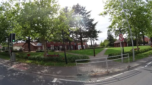

Crane Valley - Valley Course
Golf course · 1.3 mi
18 hole Par 72 Valley Course & 9 hole Par 33 Woodland Course
The Clubhouse, Verwood, Dorset



Restaurants and cafes7
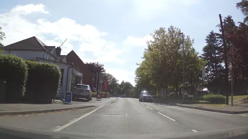
Forzza
Restaurant · Italian Pizza · 0.6 mi
9A Ringwood Road
Mo-Th 17:00-22:00; Fr-Sa 17:00-23:00; Su 16:30-21:30
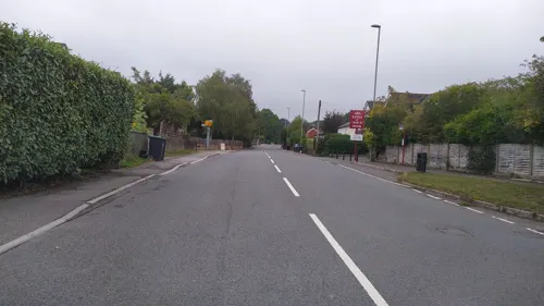

Champagne Chinese Takeaway
Restaurant · Chinese · 0.5 mi
9 Manor Road, Verwood
Su, Tu-Th 17:00-22:30; Fr-Sa 17:00-23:00

History
Verwood was originally recorded as Beau Bois (Norman French: "beautiful wood") in 1288, and it was not until 1329 that it got the name Verwood, which developed from Fairwood or The Fayrewood. Verwood is recorded as "Fairwod" (1329) and as "Fayrwod" (1436); this name has the meaning "fair wood" and the modern form shows the change of initial "f" to "v" characteristic of many Southwestern English dialects.
The East Dorset pottery industry, known collectively as Verwood Pottery, thrived from early times on the clay soils of the neighbourhood which had ample firing material close at hand. The major production was of domestic earthenware although finer and more unusual pieces have been found from earlier times. In the latter days ornamental and novelty items were produced.
Until the end of their useful life, the methods of production had not varied from Roman times, all the processes being carried out with no mechanisation or electrification. For example, the clay was always trodden by foot and not mixed in a pug mill. The wheel was turned by an assistant with a pole or handle, and the kilns were wood-fired. For these reasons the Crossroads Pottery, then the last remaining in the area, attracted national and local newspaper attention in the early to mid-20th century.
Read more of the history
The industry was not confined to a local sales base. Hawkers, or "higglers", took the wares for sale over a wide area of southern England. They were also exported abroad, especially to Newfoundland which had a thriving trade with the nearby port of Poole. Examples of Verwood pots can be seen at the Verwood Heathland Heritage Centre.
The Verwood Memorial Recreation Ground is dedicated to those who fell in the World War I, and is owned by the Verwood Memorial Recreation Ground Trust. Members of the Verwood Town Council automatically become trustees. The recreation ground land was purchased by public subscription in 1920 and the parish council was to hold the land to the benefit of the inhabitants of the parish of Verwood for use as a public recreation ground. The recreation ground comprises an area big enough for a football pitch and several children's play areas. It is across the road from the Memorial Stone, and as of 2013 had a set of wrought iron gates with a plaque on them saying "Verwood Recreation Ground / In memory of those that fell in the Great War 1914-1918".
It is widely believed that the oak trees around the recreation ground were planted in remembrance of each local person who fell in the First World War (one tree per person). These trees each have tree preservation orders to protect them.
In 1955 a formal committee of trustees was set up with the intention of building a new village hall, to be called the "Memorial Hall" in remembrance of those locals who valiantly gave their lives in World War II and it was agreed that the new hall should be constructed at the recreation ground. The official opening of Verwood Memorial Hall took place on 9 May 1959. The Memorial Hall was extended during the Queen's Silver Jubilee year (1977). The hall has come under threat on a number of occasions, each time public pressure resisting its demolition.
The Memorial Stone is across the road from the Memorial Hall and the Memorial Recreation Ground. Two plaques on the front of the stone are dedicated to the gallant souls who died in both world wars.
Verwood's first supermarket opened in the 1980s. In 1987 the population of Verwood reached 9,856. In 2001 the town's population reached 12,069. Verwood Heritage Centre was opened by Robert Gascoyne-Cecil, 7th Marquess of Salisbury. The centre is used as a museum of local history and a coffee shop. In 2007 the Verwood Hub, a multi-purpose cinema and theatre, opened to the public.
By 2014 the town had a population of over 15,000 and the Verwood Town Plan, published that year, identified a number of priorities including providing residents with new facilities, such as a swimming pool and an upper school.
From the History section of Verwood on Wikipedia, under CC BY-SA 4.0.
More about Verwood
Education
Schooling in Verwood is based on the 3-tier system, although after first school and middle school pupils usually transfer to either Queen Elizabeth's School, Wimborne Minster or Ferndown Upper School.
There are 3 first schools, accommodating children aged from 4–9: Verwood CofE First, Hillside First and Trinity CofE First.
Emmanuel CofE Middle School takes children from the three First schools, at ages 9–13. The school is on the same campus as Verwood First School.
Plans to open an upper school in Verwood were discussed as part of the 2014 Verwood Town Plan.
From the Wikipedia article Verwood, under CC BY-SA 4.0.
Notable people from Verwood
 Ben ReevesBritish footballer (born 1991)Photo: Timmy96, CC0
Born in Verwood, according to Wikidata (CC0). Each name links to its Wikipedia article.
Where to stay1
Churches and places of worship2
Verwood Road Evangelical Chapel
Church · Evangelical · 1.4 mi
Verwood Road, Wimborne
Shopping4
Gas and EV charging2
Schools, colleges and libraries5
Map of Verwood
38 places. The map loads OpenStreetMap tiles when you open it.
Getting there and nearby towns
Bournemouth Airport (BOH) is the nearest airport with scheduled flights listed in OpenStreetMap, 7 miles away.
- Wimborne Minster 8 mi southwest, about 13 min by car
- Bournemouth 11 mi south, about 17 min by car
- Poole 12 mi southwest, about 20 min by car
- Southampton 20 mi east, about 33 min by car
- Warminster 26 mi northwest, about 42 min by car
- Westbury 30 mi northwest, about 48 min by car
- Portsmouth 34 mi east, about 55 min by car
- Bath 41 mi northwest, about 1 h by car
- Basingstoke 43 mi northeast, about 1 h 15 min by car
- Swindon 47 mi north, about 1 h 15 min by car
Drive times are estimates from straight-line distance, not routes.
Towns near Verwood


Keep exploring
Local news
Headlines from INDB.
Reviews, tips and questions
Loading what members have shared...
Sources and licences
- GeoNames (CC BY 4.0): population, coordinates, regions and time zone
- Mapillary (see each image): photos
- OpenStreetMap contributors (ODbL 1.0): places, airports, map data
- Wikidata (CC0 1.0): elevation, founding date, time zone, website, landmarks and historic places
- Wikimedia Commons (see each image): photos
- Wikipedia (CC BY-SA 4.0): overview and history text
Photo credits
- Moors Valley Country Park Centre, Bermicourt, CC BY-SA 3.0
- Street-level photo, southglos, CC BY-SA 4.0
- Street-level photo, southglos, CC BY-SA 4.0
- Street-level photo, jrallnutt, CC BY-SA 4.0
- Street-level photo, noid, CC BY-SA 4.0
- Street-level photo, southglos, CC BY-SA 4.0
- Street-level photo, southglos, CC BY-SA 4.0
- Street-level photo, jrallnutt, CC BY-SA 4.0
- Street-level photo, southglos, CC BY-SA 4.0
- Street-level photo, noid, CC BY-SA 4.0
- Street-level photo, southglos, CC BY-SA 4.0
- Street-level photo, noid, CC BY-SA 4.0
Page built November 10, 2026. Spotted a mistake? Tell us or suggest a place.