


Why visit Totton
Townapedia lists 6 museums and landmarks, 21 parks and trails, 62 places to eat, 2 places to stay and 2 attractions in and around town.
Highlights include Eling Tide Mill, Eling Tide Mill Experience Visitor Centre, St James' Park and Copythorne Common.
Weather in Totton
Forecast from MET Norway (CC BY 4.0). Full forecast
About Totton
Totton is a town in the civil parish of Totton and Eling, in the New Forest district of Hampshire, England. In 2021 it had a population of 28,094.
From the Wikipedia article Totton (this version), under CC BY-SA 4.0.
Things to do2

Museums and landmarks6



Parks, trails and playgrounds21

St James' Park
Park · 2.7 mi
Recreational area in Shirley, Southampton, Hampshire, England



9 more on the map.
Restaurants and cafes62
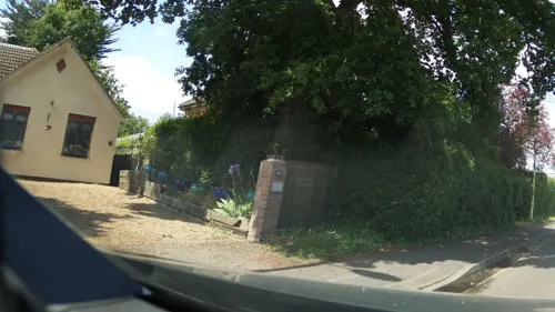


Cartland Truck Stop Cafe
Cafe · Burger, English, Breakfast · 1.1 mi
First Avenue, Southampton

50 more on the map.
History
The name "Totton" means 'Tot(r)ingtun' farm of 'Tot(t)a', "Totton was "Totinctone" in 985 and "Totyngton" in 1174-1199. Totton was recorded in the Domesday Book as Dodintune.
Totton claimed to be the largest village in England until it was made a town in 1974. The town is often considered to be made up of several smaller villages, such as Testwood, Calmore and Hammonds Green (as well as the original village of Totton) which have been connected by new clusters of housing to form the town as it is today. This is backed up by the presence of several areas of local shops, which served their respective villages in the past, and to an extent still do today. Until the 1967 forest perambulation fencing, New Forest ponies were free to roam its streets. The town's built up area has swollen significantly since the later half of the 20th century and now forms a near continuous web of development with surrounding villages, with Ower, Netley Marsh and Ashurst in particular having little or no discernible distinction in built up area.
Totton's town centre has changed little since the 1970s. Commercial Road and the A35 causeway are the main exit routes from the town.
Read more of the history
The Iron Age Hillfort at Tatchbury Mount is evidence of early settlement in the Totton area and Netley Marsh on the edge of Totton was the site of an early battle between Anglo Saxon invaders under Cerdic and Romano-Celtic peoples under Natanleod. The construction of Testwood Lakes revealed a treasure-trove of ancient artefacts including one of the oldest known bridges in England, believed to date to around c.1,500BC.
Totton Appears on the "Hantoniae sive Sovthantonensis Comitatvs" map in Joan Blaeu's Atlas Major Vol. 5 Published in 1665
The area's history is inevitably closely connected with ship and boat building but more with its timber trade. It was the site of much illegal dealing in the timber unlawfully obtained from the New Forest.
From the History section of Totton on Wikipedia, under CC BY-SA 4.0.
Where to stay2
Churches and places of worship16
Totton Evangelical Free Church
Church · Evangelical
124 Ringwood Road, Southampton
Shopping16
Gas and EV charging3
Schools, colleges and libraries21
Healthcare6
Map of Totton
155 places. The map loads OpenStreetMap tiles when you open it.
Getting there and nearby towns
Southampton Airport (SOU) is the nearest airport with scheduled flights listed in OpenStreetMap, 6 miles away.
- Southampton 4 mi east, about 6 min by car
- Portswood 4 mi east, about 7 min by car
- Romsey 5 mi north, about 8 min by car
- Hythe 6 mi southeast, about 9 min by car
- Bishopstoke 8 mi northeast, about 13 min by car
- Hedge End 8 mi east, about 13 min by car
- Fair Oak 9 mi east, about 14 min by car
- Lymington 11 mi south, about 18 min by car
- Winchester 13 mi northeast, about 20 min by car
- New Milton 14 mi southwest, about 22 min by car
Drive times are estimates from straight-line distance, not routes.
Towns near Totton


Keep exploring
Local news
Headlines from INDB.
Reviews, tips and questions
Loading what members have shared...
Sources and licences
- GeoNames (CC BY 4.0): population, coordinates, regions and time zone
- Mapillary (see each image): photos
- OpenStreetMap contributors (ODbL 1.0): places, airports, map data
- Wikidata (CC0 1.0): elevation, founding date, time zone, website, landmarks and historic places
- Wikimedia Commons (see each image): photos
- Wikipedia (CC BY-SA 4.0): overview and history text
Photo credits
- St james church shirley southampton, JimChampion, CC BY-SA 3.0
- Eling Tide Mill frm beside the mill pond, User:Timtrent, CC BY-SA 2.5
- St james park southampton april 2021, Geni, CC BY-SA 4.0
- Street-level photo, iced, CC BY-SA 4.0
- Street-level photo, southglos, CC BY-SA 4.0
- Street-level photo, southglos, CC BY-SA 4.0
- Street-level photo, southglos, CC BY-SA 4.0
- Street-level photo, iced, CC BY-SA 4.0
- Street-level photo, noid, CC BY-SA 4.0
- Street-level photo, noid, CC BY-SA 4.0
- Street-level photo, southglos, CC BY-SA 4.0
- Street-level photo, ebel, CC BY-SA 4.0
- Street-level photo, ebel, CC BY-SA 4.0
- Street-level photo, southglos, CC BY-SA 4.0
- Street-level photo, southglos, CC BY-SA 4.0
- Street-level photo, southglos, CC BY-SA 4.0
- Street-level photo, southglos, CC BY-SA 4.0
- Street-level photo, noid, CC BY-SA 4.0
- Street-level photo, southglos, CC BY-SA 4.0
- Street-level photo, southglos, CC BY-SA 4.0
- Street-level photo, southglos, CC BY-SA 4.0
- Street-level photo, iced, CC BY-SA 4.0
Page built November 10, 2026. Spotted a mistake? Tell us or suggest a place.