


Why visit Ashurst
Townapedia lists 4 museums and landmarks, 5 parks and trails, 7 places to eat, 2 places to stay and 1 attraction in and around town.
Highlights include Betley Bridge, Bramber Castle, Knepp Castle and Knepp Wildland.
Weather in Ashurst
Forecast from MET Norway (CC BY 4.0). Full forecast
About Ashurst
Ashurst is a village and civil parish in the Horsham District of West Sussex, England, about 2 miles (3.2 km) west of Henfield and 11 miles (18 km) south of Horsham, on the B2135 road. The village is about 0.6 miles (0.97 km) west of the River Adur. It has a 12th-century parish church dedicated to St James, where local resident Laurence Olivier's funeral was held, as well as a Church of England primary school and a pub, the Fountain Inn.
From the Wikipedia article Ashurst, West Sussex (this version), under CC BY-SA 4.0.
Things to do1

Betley Bridge
Bridge · 1.6 mi
Disused railway bridge in West Sussex, England, United Kingdom
Museums and landmarks4

Bramber Castle
Monument and historic site · 3.4 mi
Norman castle in Bamber, West Sussex, England, UK

Knepp Castle
Monument and historic site · 3.1 mi
Castle ruin and scheduled monument in Shipley, Horsham, West Sussex, RH13

Parks, trails and playgrounds5




Restaurants and cafes7
Potters Fish and Chips
Fast food · Fish And Chips · 2.0 mi
5 Wilton Close, Horsham

The Old Railway
Bar and pub · 1.7 mi
Upper Station Road, Henfield
Mo-Th 12:00-23:00; Fr-Sa 12:00-24:00; Su 12:00-22:30

The Cabin at Berretts Farm
Cafe · Coffee Shop · 1.8 mi
Nov-Mar Mo,Th-Su 09:00-16:00; Apr-Oct 09:00-16:00
Cadence Club Cafe
Cafe · 1.6 mi
Bines Road, Horsham
Sa 09:00-16:00 Su 10:00-16:00


The Bakery
Bakery · 2.0 mi
3 Wilton Close, Horsham
Mo-Fr 07:00-14:00; Sa 07:00-12:00
Where to stay2
Churches and places of worship14
Shrine Church of Our Lady of Consolation and St Francis
Church · 3.1 mi
Shopping1
Gas and EV charging1
Schools, colleges and libraries2
Map of Ashurst
37 places. The map loads OpenStreetMap tiles when you open it.
Getting there and nearby towns
Brighton City Airport (ESH) is the nearest airport with scheduled flights listed in OpenStreetMap, 7 miles away.
- Partridge Green 2 mi north, about 3 min by car
- Ashington 3 mi west, about 5 min by car
- Washington 4 mi southwest, about 7 min by car
- Cowfold 5 mi northeast, about 7 min by car
- Hurstpierpoint 6 mi east, about 10 min by car
- Findon 6 mi southwest, about 9 min by car
- Shoreham-by-Sea 7 mi south, about 11 min by car
- Lancing 7 mi south, about 12 min by car
- Worthing 8 mi south, about 13 min by car
- Portslade 8 mi southeast, about 12 min by car
Drive times are estimates from straight-line distance, not routes.
Towns near Ashurst


Keep exploring
Local news
Headlines from INDB.
Reviews, tips and questions
Loading what members have shared...
Sources and licences
- GeoNames (CC BY 4.0): population, coordinates, regions and time zone
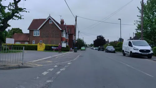
- Mapillary (see each image): photos
- OpenStreetMap contributors (ODbL 1.0): places, airports, map data
- Wikidata (CC0 1.0): elevation, founding date, time zone, website, landmarks and historic places
- Wikimedia Commons (see each image): photos
- Wikipedia (CC BY-SA 4.0): overview and history text
Photo credits
- St James' church and war memorial, Antiquary, CC BY-SA 4.0
- Ashurst Church, West Sussex, Simon Carey, CC BY-SA 2.0
- Margaret Barber grave Ashurst 2014, Deeday-UK, CC BY-SA 4.0
- Bramber - Bramber Castle - 20220724153836, Michael Coppins, CC BY-SA 4.0
- Knepp Castle, July 2021 (1), Richard Nevell, CC BY-SA 4.0
- Tamworth sow at Knepp Wildland, tomline43, CC BY 2.0
- Tottington Wood (2), Dudley Miles, CC BY-SA 4.0
- Jarvis Hall, Jarvis Lane, Steyning (IoE Code 298766), The Voice of Hassocks, CC0
- St. George's, West Grinstead, Antiquary, CC BY-SA 4.0
- West Grinstead RC church, Antiquary, CC BY-SA 4.0
- St Michael and All Angels Church Partridge Green - the Tower, Kinnerton, CC BY-SA 3.0
- Henfield C of E parish church, Antiquary, CC BY-SA 4.0
- Steyning Methodist Church, Steyning, The Voice of Hassocks, CC0
- Steyning St Andrews Church, from the SW, Michael Coppins, CC BY-SA 4.0
- Shermanbury church, Charlesdrakew, Public domain
- St Nicholas, Bramber, June 2021 02, Poliphilo, CC0
- Woods Mill, Sussex Wildlife Trust, England - footpath bridge, Acabashi, CC BY-SA 4.0
- Street-level photo, matt_ellery, CC BY-SA 4.0


Page built November 10, 2026. Spotted a mistake? Tell us or suggest a place.