


Bath, United Kingdom
Bath is a city of 101,557 people in England, United Kingdom, founded in 43.
Why visit Bath
Townapedia lists 79 museums and landmarks, 74 parks and trails, 159 places to eat, 39 places to stay and 29 attractions in and around town.
Highlights include Old Orchard Street Theatre, Theatre Royal, The Assembly Rooms and Victoria Art Gallery.
Weather in Bath
Forecast from MET Norway (CC BY 4.0). Full forecast
About Bath
Bath (RP: , locally [ba(ː)θ]) is a city in Somerset, England, known for and named after its Roman-built baths. The city became a UNESCO World Heritage Site in 1987, and was later listed as one of the "Great Spa Towns of Europe". Bath is situated in the valley of the River Avon, 97 miles (156 km) west of London and 11 miles (18 km) southeast of Bristol, and is the largest city and urban settlement in Somerset. At the 2021 census, the population of the city was 94,080.
From the Wikipedia article Bath, Somerset (this version), under CC BY-SA 4.0.
Travel tips from other travellers: Bath on Wikivoyage (CC BY-SA 4.0).
Photos of Bath

Things to do29

Old Orchard Street Theatre
Cinema and theater · 0.4 mi
Former theatre in Bath, England, now Freemasons Hall and Masonic Museum
12 Old Orchard Street, Bath


Pulteney Bridge
Bridge · 0.6 mi
Grade I listed bridge in Bath, Somerset, England


Bathampton Toll Bridge
Bridge · 2.4 mi
Grade II listed bridge in Bathampton, Bath and North East Somerset, Somerset, England, UK

Cleveland Bridge
Bridge · 1.0 mi
Bridge in Bath and North East Somerset, Somerset, England, UK
Mission Theatre
Cinema and theater
Theatre in Bath, England, in a former congregational hall


Beckford's Tower and Museum
Monument and historic site · 2.3 mi
Architectural folly and museum on Lansdown Hill, just outside Bath, Somerset, England, United Kingdom

17 more on the map.
Museums and landmarks79

The Assembly Rooms
Monument and historic site · 0.8 mi
Elegant public rooms at the heart of fashionable 18th-century Bath life. Opened with a grand ball in 1771 and now open to the public.
Bennett Street, Bath
Mo-Su 10:30-18:00

Victoria Art Gallery
Museum · 0.5 mi
Art museum in Bath, Somerset, England, United Kingdom
Bridge Street, Bath
PH,Tu-Su 10:00-17:00; Mo off

Holburne Museum
Museum · 0.9 mi
Art museum with about 9,000 objects
Great Pulteney Street
Mo-Sa 10:00-17:00; Su 11:00-17:00; PH 11:00-17:00; Dec 24-26 off; Jan 1 off
Assembly Rooms and Fashion Museum
Museum · 0.8 mi
Fashionable dress for men, women and children from the late 16th century to the present day
Bennett Street
10:30-17:00

Herschel Museum of Astronomy
Museum · 0.6 mi
Museum in Bath, England, United Kingdom
19 New King Street, Bath
Feb-Dec Tu-Su 10:00-17:00


Museum of Bath Architecture
Museum · 0.8 mi
Museum in Bath, England, United Kingdom
The Paragon, Bath
Tu-Fr 14:00-17:00; Sa,Su 10:30-17:00
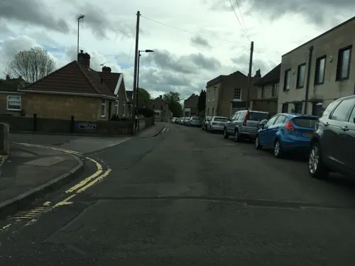

Prior Park
Monument and historic site · 0.9 mi
18th-century landscape garden designed with advice from famous garden designer Capabilility Brown.
Ralph Allen Drive, Bath

The Roman Baths
Monument and historic site · 0.4 mi
Major attraction. Well-preserved Roman site for public bathing: Sacred Spring, Roman Temnple, Roman Bath House and museum.
Abbey Church Yard, Bath


Museum of East Asian Art
Museum · 0.8 mi
Last admission to the museum is at 16:30. Closed on Mondays and Bank Holiday Mondays.
12 Bennett Street, Bath
Tu-Sa 10:00-17:00; Su 12:00-17:00
67 more on the map.
Parks, trails and playgrounds74

Parade Gardens
Park · 0.5 mi
Grade II listed park in Bath, Somerset, England, UK
Apr-Oct Mo-Su 10:00-18:00; Nov-Mar Mo-Su 10:00-15:00

Sydney Gardens
Park · 0.9 mi
Public open space in Bath, Somerset, England, UK




62 more on the map.
Restaurants and cafes159
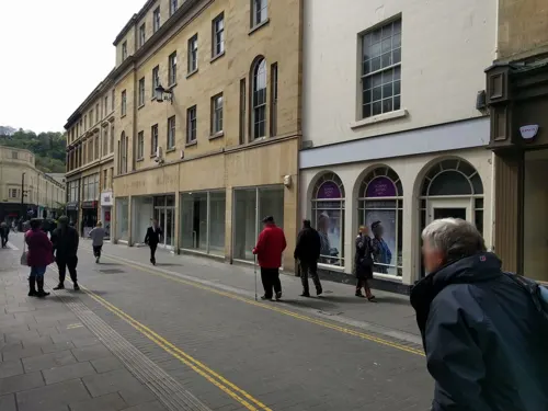
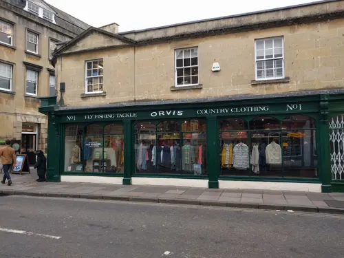
Flapjackery
Bakery · Flapjack · 0.6 mi
8 Pulteney Bridge
Mo-Th 09:30-17:00; Fr 09:30-17:30; Sa 09:00-18:00; Su 10:00-16:00
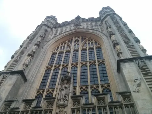
Indian Temptation
Restaurant · Indian · 0.5 mi
9-10 Cheap Street, Bath
Mo-Th, Su 12:00-22:00; Fr, Sa 12:00-22:30

Las Iguanas
Restaurant · Mexican · 0.5 mi
12 Seven Dials
Mo-Th 11:00-21:00; Fr 11:00-22:00; Sa 11:00-23:00; Su 11:00-21:00


The Raven
Bar and pub · Pie · 0.6 mi
6-7 Queen Street, Bath
Mo-Th 08:00-23:00; Fr-Sa 08:00-00:00; Su 08:00-22:30

The Pig & Fiddle
Bar and pub · British · 0.6 mi
2 Saracen Street, Bath
Mo-Tu 08:00-22:00; We-Sa 08:00-23:00; Su 08:00-21:00

The Griffin Inn
Bar and pub · 0.5 mi
Monmouth Street
Mo-Tu off; We-Th 15:00-23:00; Fr 15:00-24:00; Sa 11:00-24:00; Su...
147 more on the map.
History
The hills in the locality such as Bathampton Down saw human activity from the Mesolithic period. Several Bronze Age round barrows were opened by John Skinner in the 18th century. A long barrow site, believed to be from the Beaker people of the Early Bronze Age, was flattened to make way for RAF Charmy Down. Solsbury Hill, which overlooks the current city, was an Iron Age hill fort, as well as possibly the adjacent Bathampton Camp.
Archaeological evidence shows that the site of the main spring for the Roman Baths may have been treated as a shrine by the Britons, and was dedicated to the water deity Sulis, equivalent to the Roman goddess Minerva; the name Sulis continued to be used after the Roman invasion, appearing in the town's Roman name, Aquae Sulis (literally, "the waters of Sulis"). Messages to her scratched onto metal, known as curse tablets, have been recovered from the sacred spring by archaeologists. The tablets were written in Latin, and laid curses on personal enemies.
Read more of the history
A temple was constructed in 60–70 AD, and a bathing complex was built up over the next 300 years. Engineers drove oak piles into the mud to provide a stable foundation, and surrounded the spring with an irregular stone chamber lined with lead. In the second century, the spring was enclosed within a wooden barrel-vaulted structure that housed the caldarium (hot bath), tepidarium (warm bath), and frigidarium (cold bath). The town was later given defensive walls, probably in the third century. After the end of Roman rule in Britain, the baths fell into disrepair and were eventually lost as a result of rising water levels and silting. In March 2012, archaeologists unearthed a hoard of 30,000 silver Roman coins about 150 metres (490 ft) from the Roman Baths. The hoard is believed to date from the third century is one of the largest discovered in Britain.
It was suggested by Geoffrey of Monmouth that a hillfort on the outskirts of Bath was the site of the 6th century Battle of Badon, in which King Arthur defeated the Anglo-Saxons, though that is not accepted by the majority of modern historians. The town was captured by the West Saxons in 577 after the Battle of Deorham; the Anglo-Saxon poem The Ruin may describe the appearance of the Roman site about this time. A monastery was founded at an early date, reputedly by Saint David although more probably in 675 by Osric, King of the Hwicce, perhaps using the walled area as its precinct. Other sources refer to the order founded by Osric as a nunnery, with a date of 676.
Nennius, a 9th-century historian, mentions a "hot lake" in the land of the Hwicce along the River Severn, and adds that "it is surrounded by a wall, made of brick and stone, and men may go there to bathe at any time, and every man can have the kind of bath he likes. If he wants, it will be a cold bath; and if he wants a hot bath, it will be hot". Bede described hot baths in the geographical introduction to the Ecclesiastical History in terms very similar to those of Nennius. King Offa of Mercia gained control of the monastery in 781 and rebuilt the church, which was dedicated to Saint Peter. By the 9th century, the old Roman street pattern had been lost and Bath was a royal possession. King Alfred laid out the town afresh, leaving its south-eastern quadrant as the abbey precinct. In the Burghal Hidage, Bath is recorded as a burh (borough), described as having walls of 1,375 yards (1,257 m), allocated 1000 men for defence. King Edgar of England was crowned in Bath Abbey in 973, in a ceremony that formed the basis of all future English coronations.
William Rufus granted the town, abbey and mint to a royal physician, John of Tours, who, following the sacking of the town during the Rebellion of 1088, became Bishop of Wells and Abbot of Bath. It was papal policy for bishops to move to more urban seats, and John of Tours translated his own from Wells to Bath. The bishop planned and began a much larger church as his cathedral, to which was attached a priory, with the bishop's palace beside it. New baths were built around the three springs. Later bishops returned the episcopal seat to Wells while retaining the name Bath in the title, thus becoming the Bishop of Bath and Wells. St John's Hospital was founded around 1180 by Bishop Reginald Fitz Jocelin and is among the oldest almshouses in England. The 'hospital of the baths' was built beside the hot springs of the Cross Bath, for their health-giving properties and to provide shelter for the poor infirm. Administrative systems fell within the hundreds. The Bath Hundred had various names including the Hundred of Le Buri. The Bath Foreign Hundred or Forinsecum covered the area outside the city and was later combined into the Bath Forum Hundred. Wealthy merchants had no status within the hundred courts and formed guilds to gain influence. Around 1200, the first mayor was appointed, and the first guildhall was probably built in the same century
From the History section of Bath, Somerset on Wikipedia, under CC BY-SA 4.0.
More about Bath
Geography
Bath is in the Avon Valley and is surrounded by limestone hills as it is near the southern edge of the Cotswolds, a designated Area of Outstanding Natural Beauty, and the Mendip Hills rise around 7 miles (11 km) south of the city. The hills that surround and make up the city have a maximum altitude of 781 feet (238 metres) on the Lansdown plateau. Bath has an area of 11 square miles (28 square kilometres).
The floodplain of the Avon has an altitude of about 59 ft (18 m) above sea level, although the city centre is at an elevation of around 25 metres (82 ft) above sea level. The river, once an unnavigable series of braided streams broken up by swamps and ponds, has been controlled by weirs into a single channel. Periodic flooding, which shortened the life of many buildings in the lowest part of the city, was normal until major flood control works were completed in the 1970s. Kensington Meadows is an area of mixed woodland and open meadow next to the river which has been designated as a local nature reserve.
Economy
Bath once had an important manufacturing sector, particularly in crane manufacture, furniture manufacture, printing, brass foundries, quarries, dye works and Plasticine manufacture, as well as many mills. In the modern day, industry is in decline, and the economy has pivoted towards advanced electronics, software, and service-oriented industries. This has included the Bath-based company Future Publishing moving from print to gaming and digital formats.
During and after World War II, Bath was home to Ministry of Defence offices, with three large sites on the outskirts (Ensleigh, Foxhill and Warminster Road) and a number of smaller central offices, including the Empire Hotel. After the end of the Cold War, staff numbers declined, and from 2010 to 2013 about 2,600 remaining staff were moved to MoD Abbey Wood in Bristol. In 2013 the three large sites were sold for the development of over 1,000 new houses.
Arts and culture
Bath became the centre of fashionable life in England during the 18th century when its Old Orchard Street Theatre and architectural developments such as Lansdown Crescent, the Royal Crescent, The Circus, and Pulteney Bridge were built.
Bath's five theatres – Theatre Royal, Ustinov Studio, the Egg, the Rondo Theatre, and the Mission Theatre – attract internationally renowned companies and directors and an annual season by Sir Peter Hall. The city has a long-standing musical tradition; Bath Abbey, home to the Klais Organ and the largest concert venue in the city, stages about 20 concerts and 26 organ recitals each year. Another concert venue, the art deco-style 1,600-seat The Forum, originated as a cinema. The city holds the annual Bath International Music Festival and Mozartfest, the annual Bath Literature Festival (and its counterpart for children), the Bath Film Festival, the Bath Digital Festival, the Bath Fringe Festival, the Bath Beer Festival and the Bath Chilli Festival. The Bach Festivals occur at two and a half-year intervals. An annual Bard of Bath competition aims to find the best poet, singer or storyteller.
Education
Bath has two universities, the University of Bath and Bath Spa University. Bath College offers further education, and Norland College provides education and training in childcare.
Established in 1966, the University of Bath was named University of the Year by The Sunday Times in 2011. It offers programs in politics, languages, the physical sciences, engineering, mathematics, architecture, management and technology. The University of Bath has a single umbrella name for its sports teams: TeamBath. Sports for which TeamBath is noted are football, athletics, badminton, basketball, bob skeleton, bobsleigh, hockey, judo, modern pentathlon, netball, rugby union, swimming, tennis, triathlon and volleyball. The City of Bath Triathlon takes place annually at the university.
Bath Spa University grew from a post-World War II teacher training college to being granted university status in 2005. It offers courses leading to a Postgraduate Certificate in Education. It has schools in the following subject areas: Art and Design, Education, English and Creative Studies, Historical and Cultural Studies, Music and the Performing Arts, Science and the Environment and Social Sciences.
From the Wikipedia article Bath, Somerset, under CC BY-SA 4.0.
Notable people from Bath
 Jacqueline WilsonEnglish novelistPhoto: Edwardx, CC BY-SA 4.0
 Indira VarmaEnglish actressPhoto: Raboe001, CC BY-SA 3.0
 Adelard of Bath12th-century English natural philosopherPhoto: Unknown author, Public domain
 PinkPantheressBritish singer-songwriterPhoto: CamilaAlves.raf, CC BY-SA 4.0
 William Edward ParryEnglish naval officer and Arctic explorer (1790–1855)Photo: Charles Skottowe, Public domain
 Bill BaileyBritish comedian, musician and actorPhoto: Birgit Fostervold, CC BY-SA 4.0
 Margaret Pole, Countess of SalisburyEnglish peeress, daughter of George, Duke of Clarence (1473-1541)Photo: anonymous, Public domain
 William Amherst, 1st Earl AmherstBritish diplomat (1773-1857)Photo: Thomas Lawrence, Public domain
 Kris MarshallEnglish actorPhoto: DavidPMaynard, CC BY-SA 4.0
 Henry ColeEnglish civil servant and inventor (1808–1882)Photo: Lock & Whitfield, Public domain
 Princess Claire of BelgiumBelgian princess (born 1974)Photo: Werktuigendagen Oudenaarde, CC BY-SA 2.0
- Ann WiddecombeBritish politician and media personality (1947–2026)
Born in Bath, according to Wikidata (CC0). Each name links to its Wikipedia article.
Where to stay39
Churches and places of worship73
Shopping79
Gas and EV charging23
Schools, colleges and libraries42
Healthcare31
Map of Bath
250 places. The map loads OpenStreetMap tiles when you open it.
Getting there and nearby towns
Bristol Airport (BRS) is the nearest airport with scheduled flights listed in OpenStreetMap, 16 miles away.
- Limpley Stoke 3 mi southeast, about 5 min by car
- Corston 3 mi west, about 6 min by car
- Bristol 12 mi northwest, about 19 min by car
- Swindon 28 mi northeast, about 45 min by car
- Gloucester 34 mi north, about 55 min by car
- Cheltenham 38 mi north, about 1 h by car
- Poole 49 mi south, about 1 h 15 min by car
- Bournemouth 50 mi southeast, about 1 h 15 min by car
- Southampton 53 mi southeast, about 1 h 30 min by car
- Oxford 54 mi northeast, about 1 h 30 min by car
Drive times are estimates from straight-line distance, not routes.
Towns near Bath


Keep exploring
Local news
Headlines from INDB.
Reviews, tips and questions
Loading what members have shared...
Sources and licences
- GeoNames (CC BY 4.0): population, coordinates, regions and time zone
- Mapillary (see each image): photos
- OpenStreetMap contributors (ODbL 1.0): places, airports, map data
- Wikidata (CC0 1.0): elevation, founding date, time zone, website, landmarks and historic places
- Wikimedia Commons (see each image): photos
- Wikipedia (CC BY-SA 4.0): overview and history text
Photo credits
- Bath Somerset 2023 -City- by-RaBoe 055, Raboe001, CC BY-SA 3.0
- Bath from alexandra park, Wjh31, Public domain
- View from the northwest viewpoint at Alexandra Park, Bath 2025-07-22, Andy Li, CC0
- SouthGate and Bath from Beechen Cliff, Rwendland, CC BY-SA 4.0
- Approaching Bath Spa - panoramio, Matt Prosser, CC BY-SA 3.0
- Bath, Somerset Panorama - April 2011, Diliff, CC BY-SA 3.0
- Bath Spa railway station, from Beechen Cliff, Rwendland, CC BY-SA 3.0
- Old Orchard Street Theatre, Rodw, CC0
- Theatre Royal, Bath, MichaelMaggs, CC BY-SA 2.5
- Pulteney bridge in Bath view from south before noon, Jürgen Matern, CC BY-SA 3.0
- The Holburne Museum, July 2016, David A. Russo, CC BY-SA 4.0
- Herschel Museum Bath 2005, Nveitch at English Wikipedia, Public domain
- Bath 2014 12, Photograph by Mike Peel ( www.mikepeel.net )., CC BY-SA 4.0
- Museum of Bath at Work, Rodw, Public domain
- Bath parade gardens, Ad Meskens, CC BY-SA 3.0
- Bath cathedrale ext, Velvet, CC BY-SA 3.0
- Church of our Lady and St Alphege, Oldfield Park, Bath, Jaggery, CC BY-SA 2.0
- Mission Theatre, Rodw, Public domain
- Roman Baths in Bath Spa, England - July 2006, Diliff, CC BY 2.5
- Fashion Museum and Assembly Rooms Bath, Mark Anderson, CC BY-SA 2.0
- Twerton Park, Nick from Bristol, UK, CC BY 2.0
- Allsaintsweston, Phil Williams, CC BY-SA 2.0
- ENG Bath Julian Road 01, -wuppertaler, CC BY-SA 4.0
- Queensquaresouthside (Francis Hotel), Rodw, Public domain
- Jane Austen Centre, Fahdshariff at English Wikipedia, Public domain
- Kingswood School, Bath, Virginia Knight, CC BY-SA 2.0
- Prior Park Bath Palladian Bridge, No machine-readable author provided. Infilms assumed (based on copyright claims)., Public domain
- Royal United Hospital Bath, J Tucker, CC BY-SA 2.0
- Bath victoria memorial 1, Ad Meskens, CC BY-SA 3.0
- Saint Gregory's Catholic College, Bath, toward pupil entrance, Rwendland, CC BY-SA 3.0
- St Mark's CofE School, Rodw, CC BY-SA 3.0
- St Mary the Virgin's Church, Bath July 2007, Original uploader was Erebus555 at en.wikipedia, CC BY-SA 3.0
- St. Michael's Church. Bath, UK, Becca923, CC BY-SA 2.0
- Bath, Somerset 41, XeresNelro, CC BY-SA 4.0
- Eggtheatre, Rodw, Public domain
- Mr B's Emporium 1, Mx. Granger, CC0
- The Hunstman, Bath (48180119386), Rachelle Haun, CC BY 2.0
- Sally Lunns house, Fahdshariff at English Wikipedia, Public domain
- North colonnade 20130408 322, Elisa.rolle, CC BY-SA 3.0
- 3, Abbey Green, Chris debian, CC BY-SA 4.0
- The Gainsborough Bath Spa, Rwendland, CC BY-SA 4.0
- Walcot Methodist Church, Bath - Flickr - BazzaDaRambler, BazzaDaRambler, CC BY 2.0
- Bath (2023-06-18) 071, Simon Cobb, CC0
- Bath (2023-06-18) 001, Simon Cobb, CC0
- Bath, UK - panoramio (59), Tabraiz Feham, CC BY 3.0
- ENG Bath Manvers Street 01, -wuppertaler, CC BY-SA 4.0
- Las Iguanas, Break6700, CC BY-SA 4.0
- Emmanuel Church, Newbridge, Bath, Rwendland, CC BY-SA 3.0
- Maze, Pulteney Bridge, Bath, Rodhullandemu, CC BY-SA 3.0
- Hampton by Hilton Bath City, Chris debian, CC BY-SA 4.0
- PriorParkCollege, Agadant, CC BY-SA 3.0
- Queen Square Bath north side, NotFromUtrecht, CC BY-SA 3.0
- Komedia Bath 131108, Pretzels, Public domain
- Bathampton Toll Bridge - panoramio, Heikki Immonen, CC BY 3.0
- Cleveland Bridge, Bath, Neiljforsyth, CC BY-SA 4.0
- Victoria Art Gallery 2008, Rodw, Public domain
- Cast Iron Public Toilets, Sydney Gardens, Bath. - panoramio, Robert Powell, CC BY-SA 3.0
- Bench at the northeast viewpoint at Alexandra Park, Bath 2025-07-22, Andy Li, CC0
- Street-level photo, ldodds, CC BY-SA 4.0
- Street-level photo, elopio, CC BY-SA 4.0
- Street-level photo, chris_debian, CC BY-SA 4.0
- Street-level photo, ldodds, CC BY-SA 4.0
- Street-level photo, ldodds, CC BY-SA 4.0
- Street-level photo, ldodds, CC BY-SA 4.0
- Street-level photo, southglos, CC BY-SA 4.0
- Street-level photo, southglos, CC BY-SA 4.0
- Street-level photo, southglos, CC BY-SA 4.0
- Street-level photo, southglos, CC BY-SA 4.0
- Street-level photo, ldodds, CC BY-SA 4.0
- Street-level photo, southglos, CC BY-SA 4.0
- Street-level photo, popple, CC BY-SA 4.0
- Street-level photo, ldodds, CC BY-SA 4.0
- Street-level photo, ldodds, CC BY-SA 4.0
- Street-level photo, chris_debian, CC BY-SA 4.0
- Street-level photo, ldodds, CC BY-SA 4.0
- Street-level photo, ldodds, CC BY-SA 4.0
- Street-level photo, elopio, CC BY-SA 4.0
- Street-level photo, ldodds, CC BY-SA 4.0
- Street-level photo, elopio, CC BY-SA 4.0
- Street-level photo, southglos, CC BY-SA 4.0
- Street-level photo, ldodds, CC BY-SA 4.0
- Street-level photo, noid, CC BY-SA 4.0
- Street-level photo, southglos, CC BY-SA 4.0
- Street-level photo, noid, CC BY-SA 4.0
- Street-level photo, 4004, CC BY-SA 4.0
- Street-level photo, southglos, CC BY-SA 4.0


Page built November 10, 2026. Spotted a mistake? Tell us or suggest a place.