


Cheltenham, United Kingdom
Cheltenham is a city of 118,836 people in England, United Kingdom, founded in 1226.
Why visit Cheltenham
Townapedia lists 88 museums and landmarks, 77 parks and trails, 153 places to eat, 39 places to stay and 16 attractions in and around town.
Highlights include Everyman, Playhouse, The Wilson and Belas Knap.
Weather in Cheltenham
Forecast from MET Norway (CC BY 4.0). Full forecast
About Cheltenham
Cheltenham is a historic spa town and borough adjacent to the Cotswolds in Gloucestershire, England. Cheltenham became known as a health and holiday spa town resort following the discovery of mineral springs in 1716, and claims to be the most complete Regency town in Britain. It is directly northeast of Gloucester.
From the Wikipedia article Cheltenham (this version), under CC BY-SA 4.0.
Travel tips from other travellers: Cheltenham on Wikivoyage (CC BY-SA 4.0).
Photos of Cheltenham


Things to do16



Bacon Theatre
Cinema and theater · 1.2 mi
Theatre on the site of Dean Close School, Cheltenham, England
Cineworld
Cinema and theater
Henrietta Street, Cheltenham
"30mins before first film and 15mins after last."


4 more on the map.
Museums and landmarks88

The Wilson
Museum
Museum in Cheltenham, United Kingdom
Clarence Street, Cheltenham
Mo-Sa 09:30-17:15; Th 09:30-19:45; Su 11:00-16:00

Belas Knap
Monument and historic site · 5.0 mi
Archaeological site in Sudeley, Tewkesbury, England, UK

Jet Age Museum
Museum · 4.1 mi
Aviation museum in Staverton, Gloucestershire, United Kingdom

Masonic Hall
Monument and historic site
2 Portland Street, Cheltenham


British Steeplechasing Hall of Fame
Museum · 1.4 mi
Museum in Gloucestershire
CJ Hole
Monument and historic site
1 Bath Street, Cheltenham
Mo-Fr 09:00-18:00; Sa 09:00-17:00; Su off
Hewlett's Camp
Monument and historic site · 1.5 mi
Reputedly Iron Age camp, without archaeological evidence
Lavender Lodge
Monument and historic site · 3.2 mi
Part of The Greenway Hotel and Spa. It is guest accommodation.
76 more on the map.
Parks, trails and playgrounds77


The Park, University of Gloucestershire
Park · 0.9 mi
Park in United Kingdom

Completely-Suzuki Stadium
Sports field and stadium · 0.9 mi
Whaddon Road, Cheltenham




65 more on the map.
Restaurants and cafes153

Prezzo
Restaurant · Italian
99 Promenade, Cheltenham
Mo-Th 11:30-23:00; Fr-Sa 11:30-23:30; Su 11:30-22:30

The Ivy
Restaurant · British · 0.4 mi
Montpellier Walk, Cheltenham
Mo-Th 08:00-23:30; Fr,Sa 08:00-00:30; Su 09:00-23:30


Bangkok Kitchen
Restaurant · Thai · 0.4 mi
44-48 St James Street, Cheltenham
Mo off; Tu-Th 12:00-14:30,18:00-22:00; Fr,Sa...
Bar & Wok
Restaurant · Noodle
288 High Street, Cheltenham
Tu,We 17:30-21:15; Th,Su 12:00-14:00,17:30-21:15; Fr...
Bhoomi Kitchen
Restaurant · Indian · 0.6 mi
52 Suffolk Road, Cheltenham
Mo off; Fr-Su 12:00-13:45,18:00-21:30; Tu-Th 18:00-21:30
Bombay & Co
Restaurant · Indian
5 Portland Street, Cheltenham
Tu-Fr 12:00-14:30,17:00-21:30; Sa 12:00-22:30; Su 12:00-21:30
141 more on the map.
History
Cheltenham is located at River Chelt, which rises nearby at Dowdeswell and runs through the town on its way to the Severn. It was first recorded in 803, as Celtan hom; the meaning has not been resolved with certainty, but latest scholarship concludes that the first element preserves a Celtic noun cilta, 'steep hill', here referring to the Cotswold scarp; the second element may mean 'settlement' or 'water-meadow'. As a royal manor, it features in the earliest pages of the Gloucestershire section of Domesday Book where it is named Chintenha[m]. The town was awarded a market charter in 1226.
Read more of the history
Though little remains of its pre-spa history, Cheltenham has always been a health and holiday spa town resort since the discovery of mineral springs there in 1716. Captain Henry Skillicorne (1678–1763), is credited with being the first entrepreneur to recognise the opportunity to exploit the mineral springs. The retired "master mariner" became co-owner of the property containing Cheltenham's first mineral spring upon his 1732 marriage to Elizabeth Mason. Her father, William Mason, had done little in his lifetime to promote the healing properties of the mineral water apart from limited advertising and building a small enclosure over the spring. Skillicorne's wide travels as a merchant had prepared him to see the dormant potential on this inherited property. After moving to Cheltenham in 1738, he immediately began improvements intended to attract visitors to his spa. He built a pump to regulate water flow and erected an elaborate well-house complete with a ballroom and upstairs billiard room to entertain his customers. The beginnings of Cheltenham's tree-lined promenades and the gardens surrounding its spas were first designed by Captain Skillicorne with the help of "wealthy and travelled" friends who understood the value of relaxing avenues. The area's walks and gardens had views of the countryside, and soon the gentry and nobility from across the county were enticed to come and investigate the beneficial waters of Cheltenham's market town spa.
In 1795, Captain Powell Snell raised the First Troop of Gloucestershire Gentleman and Yeomanry (Royal Gloucestershire Hussars) at the Plough Inn (now Regent Arcade) in Cheltenham.
The visit of George III with the queen and royal princesses in 1788 set a stamp of fashion on the spa. The spa waters can still be sampled at the Pittville Pump Room, built for this purpose and completed in 1830; it is a centrepiece of Pittville, a planned extension of Cheltenham to the north, undertaken by Joseph Pitt, who laid the first stone on 4 May 1825.
Cheltenham's success as a spa town is reflected in the railway station, still called Cheltenham Spa, and spa facilities in other towns inspired by or named after it.
Alice Liddell and Lewis Carroll were regular visitors to a house in Cudnall Street, Charlton Kings – a suburb of Cheltenham. Alice Liddell's grandparents owned this house, and it still contains the mirror, or looking glass, that was purportedly the inspiration for Lewis Carroll's novel Through the Looking-Glass, published in 1871.
Horse racing began in Cheltenham in 1815 and became a major national attraction after the establishment of the Festival in 1902. The racecourse attracts tens of thousands of visitors to each day of the festival each year, with such large numbers of visitors having a significant impact on the town.
In the Second World War, the United States Army Services of Supply, European Theatre of Operations established its primary headquarters at Cheltenham under the direction of Lt. Gen. John C. H. Lee, with the flats of the Cheltenham Racecourse becoming a giant storage depot for countless trucks, jeeps, tanks and artillery pieces. Most of this material was reshipped to the continent for and after the D-Day invasion. Lee and his primary staff had offices and took residence at Thirlestaine Hall in Cheltenham.
The first British jet aircraft prototype, the Gloster E.28/39, was manufactured in Cheltenham. Manufacturing started in Hucclecote near Gloucester, but was later moved to Regent Motors in Cheltenham High Street (now the Regent Arcade), considered a location safer from bombing during the Second World War.
From the History section of Cheltenham on Wikipedia, under CC BY-SA 4.0.
More about Cheltenham
Geography
Cheltenham is situated just inside the edge of the Cotswolds, an Area of Outstanding Natural Beauty in the South-West region of England. The small River Chelt flows under and through the town.
Cleeve Hill, overlooks the town and is the highest point in the county of Gloucestershire and the Cotswold Hills range, at 1,083 feet (330 m).
The town is near the northeastern edge of the South West of England region being 88 miles (142 km) west-northwest of London, 38 miles (61 km) northeast of Bristol and 42 miles (67.5 km) south of Birmingham.
The districts of Cheltenham include: Arle, Benhall, Charlton Kings, Fairview, Fiddler's Green, Hesters Way, Lansdown, Leckhampton, Lynworth, Montpellier, Oakley, Pittville, Prestbury, the Reddings, Rowanfield, St Luke's, St Mark's, St Paul's, St Peter's, Springbank, Swindon Village, Tivoli, Up Hatherley, Whaddon and Wyman's Brook.
The borough contains 5 civil parishes within its boundaries. These are Charlton Kings, Leckhampton with Warden Hill, Prestbury, Swindon and Up Hatherley. These all have their own parish councils who handle local services and planning with elected councillors.
Economy
As a Regency spa town, tourism is an important sector in Cheltenham's economy, but it also has some light industry, including food processing, aerospace and electronics businesses. The Government's electronic surveillance operation Government Communications Headquarters (GCHQ), known for its "doughnut-shaped" building, is in Cheltenham. Vertex Data Science, GE-Aviation, Chelsea Building Society, Endsleigh Insurance, Archant, Nelson Thornes, UCAS (Universities & Colleges Admissions Service), Kohler Mira, Zürich Financial Services, Douglas Equipment, Volo and Spirax-Sarco Engineering all have sites in and around Cheltenham.
A number of design agencies and businesses are located in the town. Weird Fish and Superdry were both founded in Cheltenham, and Superdry plc is still based there. The multinational design house Meri Meri has its European headquarters in Cheltenham.
Cheltenham is a regional shopping centre, home to department stores, the oldest being Cavendish House, from 1823, and the Regent Arcade. Since 2006, Cheltenham is the headquarters of "The Movie Booth", a company that owns and operates DVD rental kiosks.
The Beechwood Shopping Centre in the town centre was demolished in 2017 to make way for a £30million, 115,000 square foot John Lewis store.
Among Cheltenham's many restaurants, two are currently Michelin one-star restaurants, Le Champignon Sauvage and Lumière.
Arts and culture
The town is known for its Regency architecture and is said to be "the most complete regency town in England". Many of the buildings are listed, including the Cheltenham Synagogue, judged by Nikolaus Pevsner to be one of the architecturally best non-Anglican places of worship in Britain.
Built in 1902 within the Imperial Square, Cheltenham Town Hall is a Grade II-listed building and features a plaque commemorating the coronation of King Edward VII and Queen Alexandra.
The Cheltenham Art Gallery & Museum, also called The Wilson, hosts a programme of art exhibitions running throughout the year. The Wilson was named after polar explorer Edward Wilson, who was born in Cheltenham.
In 2014, many of the town's historic cultural and leisure buildings were put under the control of The Cheltenham Trust, a charity set up to manage and develop the buildings on behalf of the town. Along with The Wilson, the Trust now manages the Town Hall, the Pittville Pump Room, the Prince of Wales Stadium and Leisure @, a large fitness and swimming complex. A volunteer board of Trustees controls the Trust.
Education
The oldest school in Cheltenham is Pate's Grammar School (founded in 1574). Cheltenham College (founded in 1841) was the first of the public schools of the Victorian period. The school was the setting in 1968 for the classic Lindsay Anderson film if..... It also hosts the annual Cheltenham Cricket Festival, first staged in 1872, and the oldest cricket festival in the world.
The most famous school in the town, according to The Good Schools Guide, is Cheltenham Ladies' College (founded in 1853). Dean Close School was founded in 1886 as the 79th public school in the Victorian period, founded in memory of the Reverend Francis Close (1797–1882), a former rector of Cheltenham. Cheltenham Bournside School moved to its current location in 1972. The town also includes several campuses of the University of Gloucestershire, two other independent and six other state secondary schools, plus institutions of further education.
From the Wikipedia article Cheltenham, under CC BY-SA 4.0.
Notable people from Cheltenham
 Eric DierEnglish association football playerPhoto: Steffen Prößdorf, CC BY-SA 4.0
 FKA twigsEnglish singer and dancer (born 1988)Photo: AddisonByAddisonRaeFan, CC BY-SA 4.0
 Sir Arthur Harris, 1st BaronetRoyal Air Force air marshal and writer (1892-1984)Photo: Fg Off Stannus, Royal Air Force..., Public domain
 Eddie the EagleBritish ski jumperPhoto: Orville Barlow, CC BY-SA 4.0
 Edward Adrian WilsonEnglish polar explorer, ornithologist, natural historian, physician and artist (1872–1912)Photo: Edward Thomas Wilson (1832–1918), Public domain
 Randy BreckerAmerican flugelhorn and trumpet player (1945-)Photo: Tore Sætre, CC BY-SA 4.0
 Alex GregoryBritish rowerPhoto: Ben Sutherland, CC BY 2.0
 Henry John ElwesEnglish botanist, entomologist, author, lepidopterist, collector and traveller (1846-1922)Photo: Unknown author Unknown author, Public domain
- Gustav HolstBritish composer (1874–1934)
- Brian JonesBritish musician (1942–1969)
- Ralph RichardsonBritish actor (1902–1983)
- Robert HardyBritish actor (1925–2017)
Born in Cheltenham, according to Wikidata (CC0). Each name links to its Wikipedia article.
Where to stay39
Churches and places of worship49
Shopping76
Gas and EV charging14
Schools, colleges and libraries39
Healthcare35
Map of Cheltenham
250 places. The map loads OpenStreetMap tiles when you open it.
Getting there and nearby towns
Gloucestershire Airport (GLO) is the nearest airport with scheduled flights listed in OpenStreetMap, 4 miles away.
- Gloucester 7 mi west, about 12 min by car
- Worcester 21 mi north, about 34 min by car
- Swindon 27 mi southeast, about 43 min by car
- Oxford 37 mi east, about 59 min by car
- Solihull 38 mi north, about 1 h by car
- Birmingham 41 mi north, about 1 h by car
- Dudley 41 mi north, about 1 h by car
- West Bromwich 43 mi north, about 1 h 15 min by car
- Wolverhampton 47 mi north, about 1 h 15 min by car
- Walsall 48 mi north, about 1 h 15 min by car
Drive times are estimates from straight-line distance, not routes.
Towns near Cheltenham


Keep exploring
Local news
Headlines from INDB.
Reviews, tips and questions
Loading what members have shared...
Sources and licences
- GeoNames (CC BY 4.0): population, coordinates, regions and time zone
- Mapillary (see each image): photos
- OpenStreetMap contributors (ODbL 1.0): places, airports, map data
- Wikidata (CC0 1.0): elevation, founding date, time zone, website, landmarks and historic places
- Wikimedia Commons (see each image): photos
- Wikipedia (CC BY-SA 4.0): overview and history text
Photo credits
- Cheltenham.from.leckhampton.arp, Arpingstone, Public domain
- Cheltenham Synagogue, Elliott Brown from Birmingham, United Kingdom, CC BY 2.0
- Royal Crescent, Cheltenham (3831664880), Elliott Brown from Birmingham, United Kingdom, CC BY 2.0
- Synagogue Lane, Cheltenham (3830872867), Elliott Brown from Birmingham, United Kingdom, CC BY 2.0
- Cheltenham Art Gallery & Museum on 21 March 2009, Elliott Brown from Birmingham, United Kingdom, CC BY 2.0
- Bellas Knap chamber 1, Pahazzard, CC BY-SA 3.0
- Gloster E28 39 (48648599192), Hugh Llewelyn from Keynsham, UK, CC BY-SA 2.0
- Orobanche hederae1, No machine-readable author provided. Aroche assumed (based on copyright claims)., CC BY 2.5
- Cheltenham - panoramio (4), Tanya Dedyukhina, CC BY 3.0
- Cheltenhamtown, Tom-cf at English Wikipedia, Public domain
- The Cheltenham Ladies College, Jongleur100, CC BY-SA 3.0
- Cleeve Hill, Tim Fennell, Public domain
- Cheltenham General Hospital, David Hawgood, CC BY-SA 2.0
- The Masonic Hall, Cheltenham, Jim Linwood, CC BY 2.0
- Cheltenham Minster 04, Simon Burchell, CC BY-SA 4.0
- Montpellier Rotunda and Pump Room, Cheltenham, Reading Tom from Reading, UK, CC BY 2.0
- St. Edward's School, Janpakula, CC BY-SA 3.0
- Southam House, Southam, Glos., Griffp, CC BY-SA 4.0
- All Saints Church, Cheltenham, P L Chadwick, CC BY-SA 2.0
- St Paul's Church, Cheltenham, Gloucestershire, griffp, CC BY-SA 3.0
- The Old Restoration, Cheltenham, Reading Tom from Reading, UK, CC BY 2.0
- Cambray Baptist Church, Cheltenham, Jim Linwood, CC BY 2.0
- Cheltenham College Chapel and library, Prioryman, CC BY-SA 3.0
- Cheltenham Minster 06, Simon Burchell, CC BY-SA 4.0
- Theatre exterior July 2016, Everyman Theatre, CC BY-SA 4.0
- Cruikshank Morning Promenade Montpellier Rotunda, George Cruikshank (1792-1878), Public domain
- The Crescent Bakery (43003390004), Reading Tom from Reading, UK, CC BY 2.0
- The Bayshill (43003389024), Reading Tom from Reading, UK, CC BY 2.0
- Former Fire Station (43719428091), Reading Tom from Reading, UK, CC BY 2.0
- Cheltenham Playhouse (43671951182), Reading Tom from Reading, UK, CC BY 2.0
- Everyman Theatre, Cheltenham - panoramio, N19±, CC BY-SA 3.0
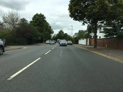
- Street-level photo, southglos, CC BY-SA 4.0
- Street-level photo, swinetown, CC BY-SA 4.0
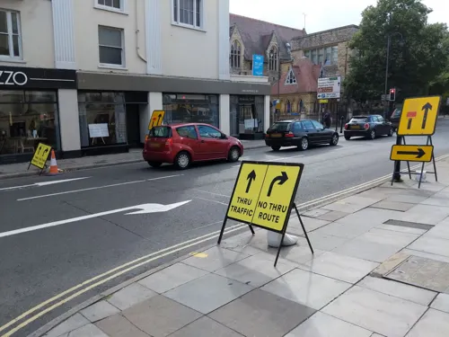
- Street-level photo, dllewellyn, CC BY-SA 4.0
- Street-level photo, dllewellyn, CC BY-SA 4.0
- Street-level photo, dllewellyn, CC BY-SA 4.0
- Street-level photo, southglos, CC BY-SA 4.0
- Street-level photo, southglos, CC BY-SA 4.0
- Street-level photo, southglos, CC BY-SA 4.0
- Street-level photo, themadcabbie, CC BY-SA 4.0
- Street-level photo, themadcabbie, CC BY-SA 4.0
- Street-level photo, themadcabbie, CC BY-SA 4.0
- Street-level photo, themadcabbie, CC BY-SA 4.0


Page built November 10, 2026. Spotted a mistake? Tell us or suggest a place.