


Blaydon-on-Tyne, United Kingdom
Blaydon-on-Tyne is a town of 15,155 people in England, United Kingdom.
Why visit Blaydon-on-Tyne
Townapedia lists 13 museums and landmarks, 12 parks and trails, 80 places to eat, 6 places to stay and 4 attractions in and around town.
Highlights include Blaydon Bridge, Newburn Bridge, Path Head Watermill and Washing Wells Roman Fort.
Weather in Blaydon-on-Tyne
Forecast from MET Norway (CC BY 4.0). Full forecast
About Blaydon-on-Tyne
Blaydon is a town in the Metropolitan Borough of Gateshead, Tyne and Wear, England, and historically in County Durham. Blaydon, and neighbouring Winlaton, which Blaydon is now contiguous with, form the town of Blaydon-on-Tyne. The Blaydon/Winlaton ward had a population in 2011 of 13,896.
From the Wikipedia article Blaydon (this version), under CC BY-SA 4.0.
Photos of Blaydon-on-Tyne


Things to do4
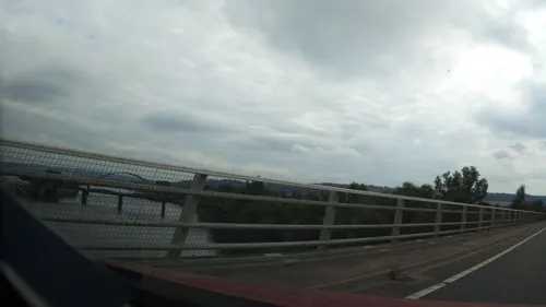


Scotswood Bridge
Bridge · 1.0 mi
Road bridge across the River Tyne in north east England

Museums and landmarks13


Washing Wells Roman Fort
Monument and historic site · 2.9 mi
Human settlement in Gateshead, Tyne and Wear, England, UK
1 more on the map.
Parks, trails and playgrounds12


Benwell Nature Park
Park · 1.9 mi
Park in Newcastle upon Tyne, United Kingdom

Restaurants and cafes80
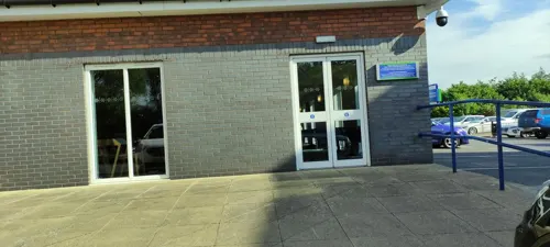



Little Connies Kitchen
Cafe · 0.8 mi
1 Rokeby Street, Newcastle upon Tyne
Mo-Fr 09:00-15:00; Sa 09:00-14:00
@ The Castle
Cafe · 1.3 mi
Stella Road, Blaydon-on-Tyne
Mo-Sa 09:00-18:00; Su 10:00-18:00

Firebrick Brewers
Brewery and winery · 0.4 mi
9-13 Cowen Road, Blaydon-on-Tyne
Mo-Fr 09:00-17:00; Sa 10:00-16:00
Miji Chinese Restaurant
Restaurant · Chinese · 0.8 mi
Widdrington Terrace, Blaydon-on-Tyne
68 more on the map.
History
The town of Blaydon is essentially an industrial area and is not more than two centuries old. Indeed, in the 1760s there was little here but a few farms and cottages. In the latter part of the same century a smelting works was set up from which sprang the industrial growth of the area.
Though the town itself has a relatively short history there has been activity in the area for many centuries.
The earliest recorded evidence of human activity at Blaydon is a Neolithic polished stone axe found in the early 20th century. Finds and structures from later prehistoric periods include a bronze spearhead and log-boat, both recovered from the River Tyne in the 19th century. A number of Bronze Age cists are recorded from Summerhill and several others from Bewes Hill.
Little is recorded of medieval Blaydon, which appears to have been based upon the modern farm sites of High and Low Shibdon. The Blaydon Burn Belts Corn Mill, part of a row of 5 or 6 water corn mills stretching from Brockwell Wood to the River Tyne is known to have been present by the early 17th century, suggesting a healthy population at that time. It is likely that, as well as farming, many industrial activities such as mining and quarrying had begun in the medieval and post-medieval periods, well before the industrial period of the 18th to 20th centuries when Blaydon became an important industrial centre.
Read more of the history
Also known as the Battle of Newburn or Newburn Ford, this relatively unknown battle has recently been elevated in importance by English Heritage. On 28 August 1640, 20,000 Scots defeated 5,500 English soldiers who were defending the ford over the Tyne four miles (6.4 km) west of Newcastle. The Scots had been provoked by Charles I, who had imposed bishops and a foreign prayer book on their church. The Scots army, led by Alexander Leslie, fought its way to Newcastle and occupied the city for almost a year before Charles I paid it £200,000 to depart. The battle brought to an end the so-called 'Eleven Years of Tyranny' by forcing Charles to recall Parliament.
The stimulus for industry at Blaydon and Blaydon Burn, as elsewhere in the region, was the growth in coal mining and the coal trade, particularly from the early 18th century, when the Hazard and Speculation pits were established at Low Shibdon linked to the Tyne by wagonways. The 18th century Blaydon Main Colliery was reopened in the mid-19th century and worked until 1921. Other pits and associated features included Blaydon Burn Colliery, Freehold pit and the Blaydon Burn Wagonway. Industries supported by the coal trade included chemical works, bottle works, sanitary pipe works, lampblack works, an ironworks, a smithy and brickworks - Cowen's Upper and Lower Brickworks were established in 1730 and were associated with a variety of features including a clay drift mine and coal/clay drops. The Lower works remains in operation. Blaydon Burn Coke Ovens, also of 19th-century origin, were replaced in the 1930s by Priestman Ottovale Coke and Tar Works which was the first in the world to produce petrol from coal known as Blaydon Benzole.
In addition to the workers' housing developments associated with industrialisation, a number of grand residences were constructed for industrialists in the area, such as Blaydon Burn House, home of Joseph Cowen, owner of the brickworks. Ironically, the remains of Old Dockendale Hall, an earlier grand residence (or perhaps a superior farmhouse) of 17th century or earlier construction, was destroyed when the coke and tar works was built at Blaydon Burn.
In the 1930s, pupils at the now demolished Blaydon Intermediate School, under the leadership of English teacher Mr Elliott and art teacher Mr Boyce, gradually developed a technique for producing hardback books. Their productions were highly respected and favourably compared to other successful private printing presses of the time. In one volume produced by the school in 1935, entitled "Songs of Enchantment", the pupils were successful in convincing the famous poet Walter de la Mare to write a foreword in which he praised their enterprise and efforts.
The post war era of the late 40s and 50s saw a rapid rise in demand for electricity and, in the North East, the extension of existing and construction of a number of new power stations was seen as a key part of the solution. For the Blaydon area, this meant the arrival of a new power station at Stella Haugh, known as the South Stella Power Station, which helped to meet the energy demands of the North East until its closure in 1991. It was demolished in 1992.
From the History section of Blaydon on Wikipedia, under CC BY-SA 4.0.
More about Blaydon-on-Tyne
Geography
Modern Blaydon stands close to the Tyne with the A695, a key road from Gateshead to Hexham, passing through the town centre. Between this main road and the river is the railway and beyond it, on a bend of the Tyne, is the industrial district of Blaydon Haughs. The main part of the town lies south of the railway.
Despite being a largely urban and industrial area, there are various rural aspects to Blaydon and the surrounding area. The area has many acres of open countryside, mostly at 500 feet (150 m) or more above sea level, and numerous farms and similar holdings. Between High Spen and Chopwell are large Forestry Commission woods, and these and other forested areas extend westward down the hillside to the River Derwent, which forms most of the metropolitan district boundary.
Shibdon Pond, on the eastern edge of the town at the former site of Blaydon Main colliery, is a nature reserve with many species of waterfowl. English Nature has designated Shibdon Pond as one of Tyne and Wear's Sites of Special Scientific Interest (SSSIs). The subject of a regeneration campaign, Shibdon Dene (sometimes inaccurately called 'Blaydon Dene') is another recreational area consisting of a pathway between a great number of fine trees.
Economy
Once the powerhouse of the Industrial Revolution in Gateshead, Blaydon's traditional industry was coal mining. However, since the decline of mining in the 1950s and 1960s, the economy has diversified. As well as a small number of commuting professionals, residents of Blaydon are often involved in engineering and manufacturing with many businesses operating from premises in Blaydon Haughs (or 'The Spike'), on the banks of the River Tyne.
Blaydon was for a time the head office of Associated Cooperative Creameries (later renamed ACC then ACC Milk). ACC Milk was sold to Dairy Farmers of Britain in 2004. On 3 June 2009, Dairy Farmers of Britain went into receivership and the dairy in Chainbridge Road closed shortly afterwards with the loss of 300 jobs. In 2010 the dairy was acquired by Medina Dairies and reopened, but closed again just a year later.
Blaydon has a shopping centre, known locally as the precinct. A brutalist 1970s creation, it contains the town's major shops. Blaydon Car Boot Sale takes place every Wednesday between March and October at Blaydon RFC. The area underwent a significant programme of housing regeneration between 2009 and 2014 with new developments in progress at High View on the Winlaton-Blaydon border, by the riverside on the site of the former Stella South power station and at Axwell Gardens, near to the existing Axwell Park estate.
Education
Blaydon is part of the Gateshead Local Education Authority. It is home to a number of primary schools (both faith and secular schools) including Blaydon West primary and St Joseph's, a Roman Catholic primary school. It also has St Thomas More Catholic School, a high achieving Roman Catholic secondary school which serves the Roman Catholic population of the western part of Gateshead borough.
From the Wikipedia article Blaydon, under CC BY-SA 4.0.
Notable people from Blaydon-on-Tyne
- James ArmstrongEnglish footballer (1892-1966)
- Joseph CowenBritish politician (1829–1900)
- Ray BilcliffEnglish football player (1931-2009)
- Bert TullochEnglish footballer (1889-1953)
- Alan HeppleCanadian ice hockey player
- Gavin Webstercomedian
- Ray Robinsonassociation football player (1895-1964)
- William WallaceEnglish footballer (1893-1917)
- Billy SherringtonEnglish football manager (1890–1977)
Born in Blaydon-on-Tyne, according to Wikidata (CC0). Each name links to its Wikipedia article.
Where to stay6
Churches and places of worship21
St Margaret's Church and Parish Centre
Church · Anglican · 1.0 mi
14 Heighley Street, Newcastle upon Tyne
Shopping15
Gas and EV charging5
Schools, colleges and libraries15
St Bede's Catholic Primary School
School · Roman Catholic · 1.4 mi
Whickham View, Newcastle upon Tyne
St Mary & St Thomas Aquinas Catholic Primary School
School · Roman Catholic · 0.8 mi
Stella Lane, Blaydon-on-Tyne
Healthcare6
Map of Blaydon-on-Tyne
177 places. The map loads OpenStreetMap tiles when you open it.
Getting there and nearby towns
Newcastle International Airport (NCL) is the nearest airport with scheduled flights listed in OpenStreetMap, 5 miles away.
- Whickham 2 mi southeast, about 3 min by car
- Newcastle upon Tyne 4 mi east, about 6 min by car
- Gosforth 5 mi northeast, about 7 min by car
- Prudhoe 5 mi west, about 9 min by car
- Ponteland 6 mi north, about 10 min by car
- Hebburn 8 mi east, about 13 min by car
- Consett 9 mi southwest, about 14 min by car
- Jarrow 9 mi east, about 15 min by car
- The Boldons 10 mi east, about 17 min by car
- Sunderland 14 mi east, about 22 min by car
Drive times are estimates from straight-line distance, not routes.
Towns near Blaydon-on-Tyne


Keep exploring
Local news
Headlines from INDB.
Reviews, tips and questions
Loading what members have shared...
Sources and licences
- GeoNames (CC BY 4.0): population, coordinates, regions and time zone
- Mapillary (see each image): photos
- OpenStreetMap contributors (ODbL 1.0): places, airports, map data
- Wikidata (CC0 1.0): elevation, founding date, time zone, website, landmarks and historic places
- Wikimedia Commons (see each image): photos
- Wikipedia (CC BY-SA 4.0): overview and history text
Photo credits
- Blaydon - Scotswood Railway Bridge, Chris Bell, CC BY-SA 2.0
- Newburn bridge, Chris Bell, CC BY-SA 2.0
- ScotswoodBridge Side 2008, D.Garnys, Public domain
- Derwent1, Burnopfielder1 ( talk ) burnopfielder1, Public domain
- Blaydon railway station 1831314 5aaa541e, Ben Brooksbank, CC BY-SA 2.0
- Blaydon Railway Station - 4, AlecCoates, CC BY 4.0
- Blaydon Railway Station - 3, AlecCoates, CC BY 4.0
- Blaydon Railway Station - 2, AlecCoates, CC BY 4.0
- 156 at Blaydon Railway Station - 1, AlecCoates, CC BY 4.0
- 156 at Blaydon Railway Station - 2, AlecCoates, CC BY 4.0
- Blaydon Railway Station - 1, AlecCoates, CC BY 4.0
- Street-level photo, jethro10, CC BY-SA 4.0
- Street-level photo, southglos, CC BY-SA 4.0
- Street-level photo, floatingboater, CC BY-SA 4.0
- Street-level photo, livingwithdragons, CC BY-SA 4.0
- Street-level photo, southglos, CC BY-SA 4.0
- Street-level photo, jethro10, CC BY-SA 4.0


Page built November 10, 2026. Spotted a mistake? Tell us or suggest a place.