


Gosforth, United Kingdom
Gosforth is a town of 23,975 people in England, United Kingdom.
Why visit Gosforth
Townapedia lists 29 museums and landmarks, 28 parks and trails, 193 places to eat, 17 places to stay and 20 attractions in and around town.
Highlights include Northern Stage, People's Theatre, Great North Museum: Hancock and Hatton Gallery.
Weather in Gosforth
Forecast from MET Norway (CC BY 4.0). Full forecast
About Gosforth
Gosforth is an area of Newcastle upon Tyne, in Tyne and Wear, England, situated north of the city centre. It constituted a separate urban district of Northumberland from 1895 until 1974 before officially merging with the city of Newcastle upon Tyne. In 2001, it had a population of 23,620.
From the Wikipedia article Gosforth (this version), under CC BY-SA 4.0.
Things to do20


People's Theatre
Cinema and theater · 1.4 mi
Theatre and former cinema in Newcastle upon Tyne, England

Jubilee Theatre
Cinema and theater · 0.8 mi
Theatre in St Nicholas Hospital, Gosforth, Newcastle, England

Balmbra's Music Hall
Cinema and theater · 2.0 mi
Music hall theatre in Newcastle upon Tyne, United Kingdom

Bambuco Bridge
Bridge · 2.2 mi
Former sculpture in Newcastle upon Tyne, England

Gateshead Millennium Bridge
Bridge · 2.2 mi
Pedestrian and cyclist tilt bridge spanning the River Tyne in England between Gateshead and Newcastle upon Tyne

King Edward VII Bridge
Bridge · 2.5 mi
Railway bridge over the River Tyne in Newcastle upon Tyne and Gateshead, UK

Live Theatre
Cinema and theater · 2.1 mi
Theatre in Newcastle upon Tyne, England
Northern Stage, Newcastle upon Tyne
Cinema and theater · 1.4 mi
Theatre and producing theatre company in Newcastle upon Tyne, England

Queen Elizabeth II Metro Bridge
Bridge · 2.5 mi
Railway bridge in Newcastle, England

Redheugh Bridge
Bridge · 2.6 mi
Bridge across the River Tyne in North East England, UK; opened in 1983

Byker Bridge
Bridge · 1.9 mi
Road bridge in Newcastle upon Tyne, Tyne and Wear, England
8 more on the map.
Museums and landmarks29

Great North Museum: Hancock
Museum · 1.4 mi
Natural history museum in Newcastle upon Tyne, United Kingdom
Barras Bridge, Newcastle upon Tyne
Mo-Fr 10:00-17:00; Sa 10:00-16:00; Su 11:00-16:00

Hatton Gallery
Museum · 1.4 mi
Art museum in Newcastle upon Tyne, United Kingdom
King's Road, Newcastle upon Tyne
Mo-Sa 10:00-17:00

Baltic Centre for Contemporary Art
Museum · 2.3 mi
Art gallery in Gateshead, Tyne and Wear.

Bessie Surtees House
Museum · 2.2 mi
Grade I listed historic house museum in Newcastle upon Tyne, United Kingdom

Centre for Life
Museum · 2.3 mi
Science museum in Newcastle upon Tyne, England

Discovery Museum
Museum · 2.2 mi
Science museum in Newcastle upon Tyne, United Kingdom

Grey's Monument
Monument and historic site · 1.8 mi
Monument in Newcastle, UK

Laing Art Gallery
Museum · 1.8 mi
Art gallery in Newcastle, United Kingdom

Museum of Antiquities
Museum · 1.4 mi
Archaeology museum in Newcastle upon Tyne, England

Newcastle upon Tyne Castle
Museum · 2.2 mi
11th-century castle in Newcastle upon Tyne, England, UK


Seven Stories
Museum · 2.0 mi
Museum and visitor centre in Newcastle, United Kingdom
17 more on the map.
Parks, trails and playgrounds28


Regent Centre
Park · 0.9 mi
Business park in Gosforth, Newcastle upon Tyne, England

Town Moor
Park · 0.7 mi
Grass pasture in Newcastle upon Tyne, United Kingdom

Gosforth Central Park
Park · 0.4 mi
Park near to Gosforth High Street in Gosforth, Newcastle upon Tyne, England
Benwell Nature Park
Park · 2.7 mi
Park in Newcastle upon Tyne, United Kingdom
Castle Leazes
Park · 1.2 mi
Park in Newcastle upon Tyne, United Kingdom
Gosforth Park
Park · 2.2 mi
Park in North Gosforth, Tyne and Wear, England, UK

16 more on the map.
Restaurants and cafes193
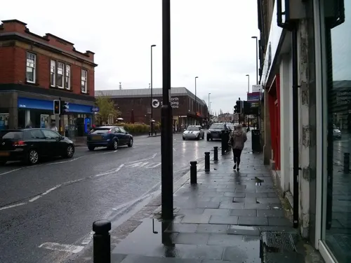
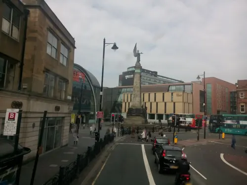
Caffè Nero
Cafe · Coffee Shop · 1.5 mi
3-4 Saint Marys Place, Newcastle upon Tyne
Mo-Fr 07:30-17:30; Sa 08:30-17:30; Su 09:00-17:30
Dosa Kitchen
Restaurant · Indian · 0.9 mi
7A Osborne Road, Newcastle upon Tyne
Tu-Th 17:00-21:30; Fr 17:00-22:30; Sa 12:00-15:00; Sa 17:00-22:30;...
Lemon Grass Deli & Kitchen
Cafe · Thai · 0.6 mi
12 Brentwood Avenue, Newcastle upon Tyne
Mo-Tu 10:30-20:30; We-Th 10:30-21:30; Fr-Sa 09:30-21:30; Su 09:30-20:00
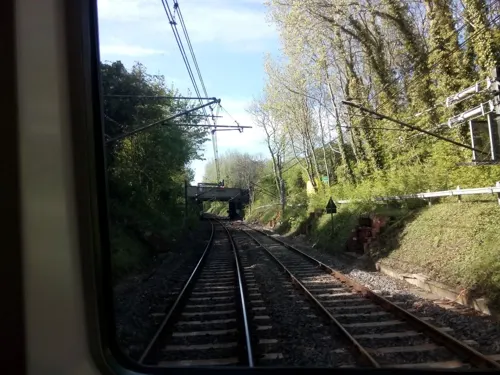
Little Aidan's
Cafe · Breakfast
2 Newlands Road, Newcastle upon Tyne
Mo-Sa 09:00-16:00; Su 09:00-15:00

Asda Café
Cafe · Coffee Shop · 0.9 mi
Hollywood Avenue, Newcastle upon Tyne
Mo-Sa 08:30-18:00; Su 10:00-16:00

Barluga
Restaurant · British · 0.4 mi
West Avenue, Newcastle upon Tyne
Mo-Th 12:00-23:00; Fr-Sa 09:00-24:00; Su 10:00-22:30
Casa Neri
Cafe · Pizza, Italian · 0.7 mi
A family run, Italian cafe offering a wide range of fresh, homemade lunch dishes and desserts. Available to sit in or take away.
41 Station Road, Newcastle upon Tyne
Tu-Th 09:00-15:00; Su,Mo off; Fr 09:00-14:30,18:00-21:00; Sa 11:00-16:00
Gosforth Palace
Restaurant · Chinese · 0.5 mi
6A Salters Road, Newcastle upon Tyne
Mo-Sa 12:00-14:00,17:30-23:00; Tu off; Su 12:00-23:00
181 more on the map.
History
The origin of the area's name is thought to have come from 'Gese Ford', meaning 'the ford over the Ouse', referring to a crossing over the local River Ouse or Ouseburn. However, as it is first recorded as 'Goseford' in 1166, others think that the name originates from the Old English 'Gosaford', meaning 'a ford where the geese dwell'. Richard Welford notes that the names of North and South Gosforth come from the north and south of the River Ouse. South Gosforth was first mentioned in 1319, when it was noted that the English Army retreated there from a siege on Berwick. According to the 19th-century publication, A Topographical Dictionary of England, the township of Gosforth was held of the crown by the Surtees family from 1100 to 1509, when it passed by marriage to Robert Brandling.
In 1777, Gosforth contained seven townships of North Gosforth, South Gosforth, Coxlodge, Kenton, Fawdon, East Brunton and West Brunton. By order of the Local Government Board on 20 September 1872, the parishes of South Gosforth and Coxlodge were constituted into a district, governed by the South Gosforth Local Board. In 1894, the Local Government Board was succeeded by Gosforth Urban District Council, based at Gosforth Council Offices.
Read more of the history
In the 19th century, Gosforth was the location of a number of collieries, including the Gosforth and Coxlodge Collieries. Gosforth Colliery was located in South Gosforth, while Coxlodge Colliery was west of the Great North Road. Coxlodge Colliery comprised three pits; the Bower Pit, the Regent or Engine Pit, where the Regent Centre now stands, and the Jubilee or North Pit further west on Jubilee Road.
The modern-day centre of Gosforth, straddling the Great North Road (here called Gosforth High Street), originated in 1826 as a settlement known for several decades as Bulman Village. It originally consisted of a number of properties large enough to qualify occupiers for the franchise (so-called 'forty shilling freeholders' (£2)), built by the Bulman family in an attempt to provide voters for their cause in the 1826 elections. A stone bearing the name 'Bulman Village' survives and was incorporated in the façade of a later building, the Halifax Bank building north of the Brandling Arms public house.
The Blacksmith's Arms public house on Gosforth High Street stands on the site of the original blacksmith's forge.
At the 2001 census there were 23,620 people living in Gosforth. In the 19th century Gosforth's population was largely deemed by the coal trade. In 1801 there were 1,385 inhabitants, most of whom lived in Kenton, and were employed in the colliery there. In 1831 the population had risen to 3,546, partly due to the opening of the Fawdon and Coxlodge collieries. Between 1831 and 1871 the population only grew by a very small amount to 3,723, due to the pits at Fawdon and Kenton having ceased to function.
There have been a number of archaeological finds in Gosforth, with the earliest piece being a prehistoric flint flake that was found in 1959. In 1863 a 2nd-century Greek Colonial coin was found in a garden in Bulman Village. A Roman altar was found in North Gosforth.
From the History section of Gosforth on Wikipedia, under CC BY-SA 4.0.
More about Gosforth
Economy
Many businesses have offices in the Regent Centre complex, near the High Street, as well as other business parks including Gosforth Industrial Estate, located near the Metro train sheds, and Gosforth Business Park, located between Gosforth Park and nearby Longbenton.
Gosforth houses Jubilee House, the headquarters of the savings and mortgages business of Virgin Money. The building was previously known as Northern Rock House, however in 2008 Northern Rock faced huge difficulties in the subprime mortgage crisis and was nationalised. Virgin Money bought Northern Rock from the British Government in 2012 and promised not to make any of the former Northern Rock employees redundant.
Northern Rock had a landmark tower building, built in the 1960s, which in the 2000s was replaced with a 10-storey office building; Partnership House, as it is now known since being sold by the bank, now houses companies including law firm Clifford Chance and video games developer Ubisoft Reflections. Other resident companies of Regent Centre include the National Health Service (NHS).
From the Wikipedia article Gosforth, under CC BY-SA 4.0.
Notable people from Gosforth
 Jim MageeanBritish singerPhoto: Jobymageean, CC BY-SA 4.0
- Joyce RedmanAnglo-Irish actress (1915-2012)
- Angela MilnerBritish paleontologist (1947-2021)
- Robbie ElliottEnglish footballer (born 1973)
- Peter Hunter BlairBritish academic and historian (1912–1982)
- Joan LeeBritish actress
- John AshBritish ornithologist (1925-2014)
- Roger Humancricketer (1909-1942)
- Ernest Arthur BellBritish biochemist and Director of the Royal Botanic Gardens, Kew (1926-2006)
- Margaret GreigBritish mathematician
- Sue CarrollBritish writer and columnist (1953-2011)
- Robert HaileyEnglish cricketer (born 1952)
Born in Gosforth, according to Wikidata (CC0). Each name links to its Wikipedia article.
Where to stay17
Avenue Guest House
Motel and hotel · 1.1 mi
2 Manor House Road, Newcastle upon Tyne
Caledonian Hotel
Motel and hotel · 0.8 mi
64-78 Osborne Road, Newcastle upon Tyne
Jesmond Park Guest House
Motel and hotel · 1.0 mi
74-76 Queens Road, Newcastle upon Tyne
Churches and places of worship47
Shopping26
Gas and EV charging5
Tesco Petrol Filling Station
Gas station · 1.0 mi
Kenton Lane, Newcastle upon Tyne
Schools, colleges and libraries41
St Catherine's Catholic Primary School
School · Roman Catholic · 1.4 mi
Greystoke Gardens, Newcastle upon Tyne
St Oswald's Catholic Primary School
School · Roman Catholic · 1.2 mi
Hartford Road, Newcastle upon Tyne
Healthcare17
Douglas Pharmacy
Clinic and pharmacy · 0.7 mi
17 Ashburton Road, Newcastle upon Tyne
Gosforth Podiarty Ltd
Clinic and pharmacy · 0.4 mi
West Avenue, Newcastle upon Tyne
J & J Whittaker
Clinic and pharmacy · 1.2 mi
32 Wansbeck Road, Newcastle upon Tyne
Map of Gosforth
250 places. The map loads OpenStreetMap tiles when you open it.
Getting there and nearby towns
Newcastle International Airport (NCL) is the nearest airport with scheduled flights listed in OpenStreetMap, 4 miles away.
- Newcastle upon Tyne 2 mi south, about 3 min by car
- Hebburn 4 mi southeast, about 7 min by car
- Whickham 4 mi southwest, about 7 min by car
- Jarrow 5 mi east, about 9 min by car
- Ponteland 6 mi northwest, about 10 min by car
- Prudhoe 10 mi west, about 16 min by car
- Sunderland 11 mi southeast, about 18 min by car
- Morpeth 12 mi north, about 19 min by car
- Ryhope 13 mi southeast, about 21 min by car
- Hetton-Le-Hole 14 mi southeast, about 23 min by car
Drive times are estimates from straight-line distance, not routes.
Towns near Gosforth


Keep exploring
Local news
Headlines from INDB.
Reviews, tips and questions
Loading what members have shared...
Sources and licences
- GeoNames (CC BY 4.0): population, coordinates, regions and time zone
- Mapillary (see each image): photos
- OpenStreetMap contributors (ODbL 1.0): places, airports, map data
- Wikidata (CC0 1.0): elevation, founding date, time zone, website, landmarks and historic places
- Wikimedia Commons (see each image): photos
- Wikipedia (CC BY-SA 4.0): overview and history text
Photo credits
- Gosforth High Street 4, Mankind 2k, CC BY 3.0
- Peoples Theatre, Heaton, Newcastle, John-Paul Stephenson, CC BY-SA 3.0
- Bambuco Bridge 1, Mankind 2k, CC BY-SA 3.0
- Gateshead millennium bridge open, Mike1024, Public domain
- EWS 67001 + Northern 156453 King Edward VII Bridge, Thryduulf, CC BY-SA 4.0
- Live Theatre Newcastle - 2010, John-Paul Stephenson, CC BY-SA 3.0
- QEII Metro Bridge from Forth Banks 1, Chris McKenna ( Thryduulf ( talk )), CC BY-SA 4.0
- Redheugh Bridge, River Tyne, John-Paul Stephenson, Public domain
- The Hancock Museum Newcastle September 2009, TubularWorld, CC BY-SA 3.0
- Newcastle upon Tyne - Bessie Surtees House and Milbank House, Benjamin Smith, CC BY-SA 4.0
- Centre for Life, Simon Cobb, CC0
- Discovery Museum Newcastle Tyne 1, Chabe01, CC BY-SA 4.0
- Newcastle upon Tyne - Grey's Monument, Benjamin Smith, CC BY-SA 4.0
- Museum of Antiquities 1, Mankind 2k, CC BY 3.0
- Newcastle upon Tyne - Keep - 1, Benjamin Smith, CC BY-SA 4.0
- Armstrongbuilding, Xtrememachineuk ( talk ) ( Uploads )., CC BY 3.0
- Exhibition Park mow, Victuallers, CC BY-SA 4.0
- Leazes Park, Peter Scott, CC BY-SA 4.0
- Regent Centre, Gosforth and surrounding area, 1978 (26518989955), Tyne & Wear Archives & Museums, No restrictions
- Vaches Parc Town Moor Newcastle Tyne 20, Chabe01, CC BY-SA 4.0
- Jesmond Parish Church, Newcastle upon Tyne, AlixChaytor, CC BY-SA 4.0
- Église St Edmund Gateshead 1, Chabe01, CC BY-SA 4.0
- St Dominic's Church, Newcastle, Andrew Curtis, CC BY-SA 2.0
- Northern Stage, Newcastle University, 5 September 2013 (1), Ultra7, Public domain
- Church of All Saints, Gosforth, Newcastle-upon-Tyne, Dave Kelly, CC BY-SA 2.0
- St Thomas Haymarket Newcastle, Chemical Engineer, CC BY-SA 3.0
- Gosforth Central Middle, Mankind 2k, CC BY 2.5
- Gosforth - Saint Nicholas Hospital, Chris Bell, CC BY-SA 2.0
- Jesmond Library, AlixChaytor, CC BY-SA 4.0
- JubileeTheatre, Unknown author, CC BY 2.5
- Fineartbuildingnewcastle, Xtrememachineuk at English Wikipedia, CC BY 3.0
- Balmbras advert, Peter Jefferies, CC BY-SA 3.0
- Baltic Centre for Contemporary Art, 5 January 2012 (1), Neil Turner from Sowerby Bridge, United Kingdom, CC BY-SA 2.0
- Newcastle upon Tyne Laing Art Gallery dome, Ymblanter, CC BY-SA 4.0
- Street-level photo, livingwithdragons, CC BY-SA 4.0
- Street-level photo, amercader, CC BY-SA 4.0
- Street-level photo, amercader, CC BY-SA 4.0
- Street-level photo, livingwithdragons, CC BY-SA 4.0
- Street-level photo, livingwithdragons, CC BY-SA 4.0
- Street-level photo, livingwithdragons, CC BY-SA 4.0
- Street-level photo, amercader, CC BY-SA 4.0
- Street-level photo, amercader, CC BY-SA 4.0
- Street-level photo, amercader, CC BY-SA 4.0
- Street-level photo, zuse, CC BY-SA 4.0
- Street-level photo, floatingboater, CC BY-SA 4.0


Page built November 10, 2026. Spotted a mistake? Tell us or suggest a place.