


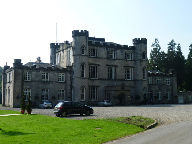
Bonnyrigg, United Kingdom
Bonnyrigg is a town of 18,320 people in Scotland, United Kingdom.
Why visit Bonnyrigg
Townapedia lists 16 museums and landmarks, 12 parks and trails, 29 places to eat, 6 places to stay and 1 attraction in and around town.
Highlights include Newbattle Viaduct, Mavisbank House, National Mining Museum Scotland and Broomieknowe Golf Course.
Weather in Bonnyrigg
Forecast from MET Norway (CC BY 4.0). Full forecast
About Bonnyrigg
Bonnyrigg is a town in Midlothian, Scotland, eight miles (13 kilometres) southeast of Edinburgh city centre, between the Rivers North and South Esk. The town had a population of 14,663 in the 2001 census, rising to 15,677 in the 2011 census, both figures being based on the 2010 definition of the locality, which, as well as Bonnyrigg and the adjacent settlement of Lasswade, includes Polton village, Poltonhall housing estate, and modern development at Hopefield. The estimated population as of 2018 was 18,120, the highest of any town in Midlothian. Along with Lasswade, Bonnyrigg is a twin town with Saint-Cyr-l'École, France.
From the Wikipedia article Bonnyrigg (this version), under CC BY-SA 4.0.
Photos of Bonnyrigg


Things to do1

Newbattle Viaduct
Bridge · 1.1 mi
Railway bridge in Midlothian, Scotland, UK
Museums and landmarks16


National Mining Museum Scotland
Museum · 1.7 mi
Mining museum in Midlothian, Scotland
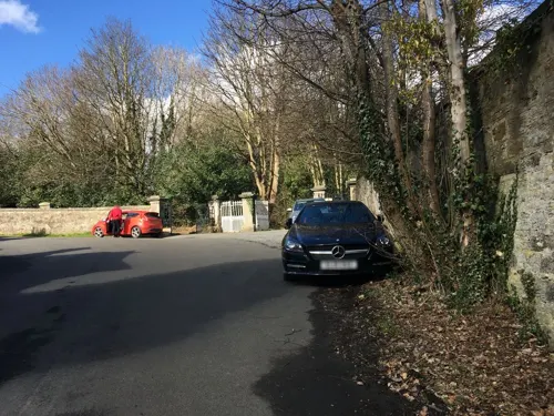

Elginhaugh
Monument and historic site · 1.6 mi
Archaeological site in Midlothian, Scotland, UK
4 more on the map.
Parks, trails and playgrounds12

King's Acre Golf Course
Golf course · 1.3 mi
18 hole Par 70 + 4 hole academy Par 12
Melville Mains, Lasswade

Roslin Glen Country Park
Park · 2.7 mi
Country park in Midlothian, Scotland, UK
Restaurants and cafes29
Cross Borders Brewing Co.
Brewery and winery · 1.1 mi
28/1 Hardengreen Lane
Fr 16:00-22:00; Sa 14:00-22:00



17 more on the map.
History
Early maps of the locality show various versions of the village name. It first appears as a small hamlet on William Roy's map of c. 1750 as Bonnebrig. From 1763, it is called Bannockrigg or Bannoc Rig. In 1817 the village is named Bonny Ridge, then Bonny Rigg in 1828, Bonnyrig in 1834, Bonny Rig in 1850 until, finally, the Ordnance Survey map of 1850-1852 standardises the name as Bonnyrigg.
In 1865, the villages of Bonnyrigg, Red Row, Polton Street, Hillhead and Broomieknowe combined to form the burgh of Bonnyrigg, and then, in 1881, the village of Lasswade and part of Broomieknowe combined to form the burgh of Lasswade. In 1929 the two burghs joined to form the burgh of Bonnyrigg & Lasswade. This burgh lasted for 45 years until it was abolished in 1974/75, when local government changes were introduced. Bonnyrigg was a mining village until the 1920s, while its Henry Widnell & Stewart carpet factory was demolished in 1994. Twentieth century expansions included the Hopefield, Poltonhall and Waverley neighbourhoods.
The town centre mostly dates from the 19th century, though buildings at the main crossroads were rebuilt in the 1960s. In 2006, Bonnyrigg town centre benefitted from £1.5M of environmental improvements. Natural stone paving replaced the existing concrete paving slabs in areas across the town centre and new street lighting and furniture were installed.
Read more of the history
Under the Midlothian Local Development Plan, the area's population is to rise considerably during the 2020s, with ongoing developments at Hopefield and Burnbrae south-west of the town centre augmented by another substantial project in the fields at Dalhousie Mains to the south-east. It is likely that the area's infrastructure will be unable to support the anticipated population increase.
From the History section of Bonnyrigg on Wikipedia, under CC BY-SA 4.0.
Notable people from Bonnyrigg
 Michael LeslieScottish snooker playerPhoto: Benutzer:Bill da Flute, CC BY-SA 3.0
- Jimmy RossScottish footballer (1895-?)
- Eric StevensonScottish footballer (1942-2017)
- Peter RamageScottish footballer (1908-1982)
- Ian Barrrugby union player
Born in Bonnyrigg, according to Wikidata (CC0). Each name links to its Wikipedia article.
Where to stay6
Churches and places of worship8
Lasswade and Rosewell Parish Church
Church · Church Of Scotland · 0.7 mi
Cockpen and Carrington Parish Church
Church · Church Of Scotland · 0.8 mi
Shopping5
Schools, colleges and libraries8
Healthcare2
Map of Bonnyrigg
87 places. The map loads OpenStreetMap tiles when you open it.
Getting there and nearby towns
Edinburgh Airport (EDI) is the nearest airport with scheduled flights listed in OpenStreetMap, 11 miles away.
- Dalkeith 2 mi northeast, about 3 min by car
- Musselburgh 5 mi northeast, about 8 min by car
- Edinburgh 6 mi northwest, about 10 min by car
- Penicuik 6 mi southwest, about 9 min by car
- Tranent 8 mi northeast, about 12 min by car
- Broxburn 15 mi west, about 24 min by car
- Livingston 16 mi west, about 26 min by car
- Kirkcaldy 17 mi north, about 27 min by car
- Rosyth 17 mi northwest, about 28 min by car
- Dunfermline 19 mi northwest, about 31 min by car
Drive times are estimates from straight-line distance, not routes.
Towns near Bonnyrigg


Keep exploring
Local news
Headlines from INDB.
Reviews, tips and questions
Loading what members have shared...
Sources and licences
- GeoNames (CC BY 4.0): population, coordinates, regions and time zone
- Mapillary (see each image): photos
- OpenStreetMap contributors (ODbL 1.0): places, airports, map data
- Wikidata (CC0 1.0): elevation, founding date, time zone, website, landmarks and historic places
- Wikimedia Commons (see each image): photos
- Wikipedia (CC BY-SA 4.0): overview and history text
Photo credits
- New Dundas Park, Bonnyrigg, John Lord from Edinburgh, Scotland, CC BY 2.0
- Bonnyrigg railway station 1853118 18093eda, Ben Brooksbank, CC BY-SA 2.0
- Lothianbridge viaduct01 2000-05-28, User:Klaus with K, CC BY-SA 3.0
- St. David's Roman Catholic Church, Dalkeith by Owen Proudfoot, Owen Proudfoot, CC BY-SA 2.0
- Cockpen and Carrington Church 345, RHaworth, CC BY 2.5
- Melville Castle, kim traynor, CC BY-SA 2.0
- Mavisbank House - principal elevation, Tom Parnell, CC BY-SA 4.0
- Melville Castle in 2014, Shani Evenstein (שני אבנשטיין), CC BY-SA 4.0
- Mavisbank House 02, Kognos, CC BY-SA 4.0
- National Mining Museum Scotland, gate, Drkirstyross, CC BY-SA 4.0
- Street-level photo, toho, CC BY-SA 4.0
- Street-level photo, southglos, CC BY-SA 4.0
- Street-level photo, lucagm, CC BY-SA 4.0
- Street-level photo, lucagm, CC BY-SA 4.0
- Street-level photo, annekaro, CC BY-SA 4.0
- Street-level photo, lucagm, CC BY-SA 4.0
- Street-level photo, southglos, CC BY-SA 4.0
- Street-level photo, ccbb7766, CC BY-SA 4.0
- Street-level photo, toho, CC BY-SA 4.0
- Street-level photo, toho, CC BY-SA 4.0
- Street-level photo, lucagm, CC BY-SA 4.0
- Street-level photo, lucagm, CC BY-SA 4.0
- Street-level photo, lucagm, CC BY-SA 4.0
- Street-level photo, lucagm, CC BY-SA 4.0
- Street-level photo, lucagm, CC BY-SA 4.0
- Street-level photo, lucagm, CC BY-SA 4.0
- Street-level photo, lucagm, CC BY-SA 4.0
- Street-level photo, lucagm, CC BY-SA 4.0
- Street-level photo, lucagm, CC BY-SA 4.0
- Street-level photo, lucagm, CC BY-SA 4.0
- Street-level photo, lucagm, CC BY-SA 4.0
Page built November 10, 2026. Spotted a mistake? Tell us or suggest a place.