


Dunfermline, United Kingdom
Dunfermline is a town of 54,990 people in Scotland, United Kingdom.
Why visit Dunfermline
Townapedia lists 36 museums and landmarks, 20 parks and trails, 146 places to eat, 24 places to stay and 11 attractions in and around town.
Highlights include Alhambra Theatre, Bridge, Halbeath Tramway, Inverkeithing, Fire Station Creative and Abbot House, Dunfermline.
Weather in Dunfermline
Forecast from MET Norway (CC BY 4.0). Full forecast
About Dunfermline
Dunfermline is a city, parish, and former royal burgh in Fife, Scotland, 3 miles (5 km) from the northern shore of the Firth of Forth. Dunfermline was the de facto capital of the Kingdom of Scotland between the 11th and 15th centuries.
From the Wikipedia article Dunfermline (this version), under CC BY-SA 4.0.
Travel tips from other travellers: Dunfermline on Wikivoyage (CC BY-SA 4.0).
Photos of Dunfermline


Things to do11

Alhambra Theatre
Cinema and theater
Theatre in Dunfermline, Scotland, formerly also used as a cinema and as a bingo hall

Bridge, Halbeath Tramway, Inverkeithing
Bridge · 3.6 mi
Bridge in Fife, Scotland, UK, carries a minor road across Keithing Burn and, previously, a tramway



Museums and landmarks36


Abbot House, Dunfermline
Museum
Historic house incorporating a heritage centre, in Dunfermline, Scotland

Andrew Carnegie Birthplace Memorial Museum
Museum
Museum in Fife, Scotland, UK


SS Orsova
Monument and historic site · 4.3 mi
Ocean liner of the Orient Line
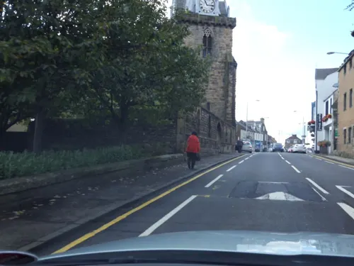
War Memorial, Church Street, Inverkeithing
Monument and historic site · 3.6 mi
War memorial in Inverkeithing, Fife, Scotland, UK


24 more on the map.
Parks, trails and playgrounds20

Pittencrieff Park
Park · 0.4 mi
Public park in Dunfermline, Fife, Scotland, UK

Ballast Bank Park
Park · 3.9 mi
Park in Inverkeithing, Fife, Scotland

KDM Group East End Park
Sports field and stadium · 0.7 mi
Halbeath Road, Dunfermline

Halkett Course
Golf course · 1.9 mi
Cairneyhill Road, Crossford

8 more on the map.
Restaurants and cafes146

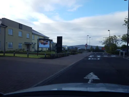
Wingstop Fife
Restaurant · Chicken · 2.5 mi
Unit 7A Fife Leisure Park
Su-Th 11:00-00:00; Fr-Sa 11:00-02:00
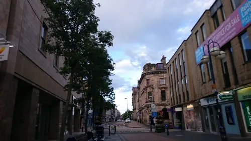
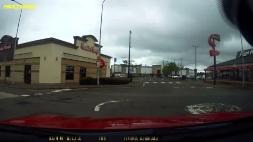

Starbucks
Cafe · Coffee Shop · 1.8 mi
Carnegie Avenue, Dunfermline
Mo-Fr 06:00-21:00; Sa 06:30-21:00; Su 07:00-20:00

Panas
Restaurant · Indian, Nepalese · 2.3 mi
170 Queensferry Road, Rosyth
Tu-Th 16:00-20:30; Fr-Sa 16:00-21:00; Su 15:00-20:00

Adamson Hotel
Bar and pub · 1.5 mi
One of the few original Coaching Inns left in Scotland
25, 27 Main Street, Crossford
Bob & Berts
Cafe · Coffee Shop
104 -106 High Street, Dunfermline
Mo-Sa 08:00-18:00; Su 09:00-18:00
Costa
Cafe · Coffee Shop
1 East Port
Mo-Fr 08:00-18:00; Sa 08:00-18:00; Su 09:00-17:00
134 more on the map.
History
There have been various interpretations of the name, "Dunfermline". The first element, "dun" translated from Gaelic, has been accepted as a (fortified) hill, and is assumed to be referring to the rocky outcrop at the site of Malcolm Canmore's Tower in Pittencrieff Glen (now Pittencrieff Park). The rest of the name is problematic. The second element, the "ferm" may have been an alternative name for the Tower Burn according to a medieval record published in 1455 which, together with the Lyne Burn to the south, suggests the site of a fortification between these two watercourses.
The first record of a settlement in the Dunfermline area was in the Neolithic period. This evidence includes finds of a stone axe, some flint arrowheads and a carved stone ball near the town. A cropmark which is understood to have been used as a possible mortuary enclosure has been found at Deanpark House, also near the town. By the time of the Bronze Age, the area was beginning to show some importance. Important finds included a bronze axe in Wellwood and a gold torc from the Parish Churchyard. Cist burials from the Bronze Age have also been discovered at both Crossford and Masterton, the latter of which contains a pair of armlets, a bronze dagger and a set necklace believed to have complemented a double burial.
Read more of the history
The first historic record for Dunfermline was made in the 11th century. According to the fourteenth-century chronicler, John of Fordun, Malcolm III married his second bride, the Anglo-Saxon princess Saint Margaret, at the church in Dunfermline between 1068 and 1070; the ceremony was performed by Fothad, the last Celtic bishop of St Andrews. Malcolm III established Dunfermline as a new seat for royal power in the mid-11th century and initiated changes that eventually made the township the de facto capital of Scotland for much of the period until the assassination of James I in 1437. Following her marriage to King Malcolm III, Queen Margaret encouraged her husband to convert the small culdee chapel into a church for Benedictine monks. The existing culdee church was no longer able to meet the demand for its growing congregation because of a large increase in the population of Dunfermline from the arrival of English nobility coming into Scotland. The founding of this new church of Dunfermline was inaugurated around 1072, but was not recorded in the town's records.
King David I of Scotland (reigned 1124–53) would later grant this church, dedicated to the Holy Trinity, to "unam mansuram in burgo meo de Dunfermlyn", which translates into "a house or dwelling place in my burgh of Dunfermline". The foundations of the church evolved into an Abbey in 1128, under the reign of their son, David I. Dunfermline Abbey would play a major role in the general romanisation of religion throughout the kingdom. At the peak of its power the abbey controlled four burghs, three courts of regality and a large portfolio of lands from Moray in the north down into Berwickshire. From the time of Alexander I (reign 1107–24), the Abbey would also become firmly established as a prosperous royal mausoleum of the Scottish Crown. A total of eighteen royals, including seven Kings, were buried here from Queen Margaret in 1093 to Robert Stewart, Duke of Albany in 1420. During the Wars of Scottish Independence, Robert The Bruce insisted as early as 1314 that he wanted to be buried in the royal mausoleum in Dunfermline. This was so he could maintain the legacy of previous Scottish kings interred here, referring to them as our ‘predecessors’. Robert The Bruce (reigned 1306–29) would ultimately become the last of the seven Scottish Kings to be given this honour in 1329, although his heart was taken to Melrose Abbey.
Dunfermline had become a burgh between 1124 and 1127, if not before this time. Dunfermline Palace was also connected to the abbey and the first known documentation of the Auld Alliance was signed there on 23 October 1295.
Although the second son of James VI of Scotland and Anne of Denmark, Prince Charles was born in Dunfermline Palace, Fife, on 19 November 1600, the Union of the Crowns ended the town's royal connections when James VI relocated the Scottish royal court to London in 1603. King Charles thus became the last monarch to be born in Scotland. The Reformation of 1560 had previously meant a loss of the Dunfermline's ecclesiastical importance. David Ferguson was the town's first reformed minister. On 25 May 1624, a fire engulfed around three-quarters of the medieval-renaissance burgh. Some of the surviving buildings of the fire were the palace, the abbey and the Abbot's House.
The decline in the fortunes of Dunfermline lasted until the introduction of a linen industry in the early 18th century. One reason for which the town became a centre for linen was there was enough water to power the mills and nearby ports along the Fife Coast. These ports also did trade with the Baltic and Low Countries. Another reason was through an act of industrial espionage in 1709 by a weaver known as James Blake who gained access to the workshops of a damask linen factory in Edinburgh by pretending to act like a simpleton in order to find out and memorise the formula. On his return to his home town in 1718, Blake established a damask linen industry in the town. The largest of these factories was St Leonard's Mill which was established by Erskine Beveridge in 1851. A warehouse and office block was later added around 1869. Other linen factories were built on land to both the north and south ends of the burgh. During the mid-19th century, power loom weaving started to replace linen damask. The latter did not survive, going into decline straight after the end of First World War. In 1909 the Royal Navy established Scotland's only Royal Naval Dockyard at nearby Rosyth.
From the History section of Dunfermline on Wikipedia, under CC BY-SA 4.0.
More about Dunfermline
Geography
Dunfermline is at 56°04′17″N 3°27′42″W on the coastal fringe of Fife. The medieval town rose from approximately 51 metres (167 ft) above sea level in the south, where Nethertown Broad Street can now be found; 69 to 67 metres (226 to 220 ft) west to east along what is now Priory Lane; to 90 to 101 metres (295 to 331 ft) up the High Street, from west to east; to 92 to 105 metres (302 to 344 ft) between Bruce Street and Queen Anne Street from south to north.
Temperatures in Dunfermline, much like the rest of Scotland, are relatively moderate given its northern latitude. Fife is a peninsula, between the Firth of Tay to the north, Firth of Forth to the south and the North Sea to the east. Summers are relatively cool and the warming of the water over the summer, results in warm winters. Average annual temperatures in Dunfermline range from a maximum of 18 °C (64 °F) to a minimum of 9 °C (48 °F).
The town is geologically separated from the area to the north by the Cleish Hills.
Economy
From about the fifteenth century coal and limestone had been extracted in the area around Dunfermline, at first on a very small and localised scale. As the Agricultural Revolution gathered pace the demand for lime (for improving land) increased the requirement for coal to burn it. Salt panning too required coal in large quantities, and the early outcrops near the Firth of Forth became exhausted, forcing the extraction to take place further inland. Many of the sites were within the present-day limits of Dunfermline.
The increasing distance of the pits from the Forth made transport of the minerals an issue, and Dunfermline was a pioneer in the construction of wooden waggonways for the purpose. By the eighteenth century a complex network had developed, and in time many of the lines were converted to railways: the Halbeath Railway, the Fordell Railway, the Elgin Railway and the Townhill Tramway being the most prominent. They generally ran from north to south, still conveying the mineral to the harbours at Charlestown, Limekilns, Inverkeithing and St David's. From 1848 more modern railways entered Dunfermline, at first on a west to east axis, intersecting the mineral lines. In time the latter were converted to make through running on to the main line network possible.
Arts and culture
Pittencrieff Park forms the western boundary of the town centre covering 31 hectares (76 acres). It was given to the people of Dunfermline in 1903 by Andrew Carnegie. The park is known locally as the Glen and was created from the estate of Pittencrieff and the lands of the house, owned by the Lairds of Pittencrieff. A £1.4 million project to regenerate, restore and re-establish the park began in 2009 and is ongoing. In December 2011 Pittencrieff Park was awarded £710,000 through the Heritage Lottery Fund's Parks for People programme for essential maintenance work. A previous award of £27,000 was made under this scheme in 2010. The work included the restoration of historic buildings and bridges; new lighting and the refurbishment of the greenhouse to create a classroom. A separate £1 million project finished in 2012, extending the Glen Pavilion to provide a new 120 seat cafe and linking corridor to the rear of the building.
The Bruce Festival is an annual attraction held in Pittencrieff Park every August. The festival which promotes Robert The Bruce's links to Dunfermline centres on a medieval village and is home to a food fayre, battle reenactments and displays of arts and crafts.
Education
Dunfermline has four secondary schools and fourteen primary schools. Other educational facilities include a private school and Calaiswood ASN School for children with learning difficulties and complex health needs. Dunfermline High School is the oldest secondary in the town, having originated in 1816 on what is now Queen Anne Street. The school which serves both the southern and western parts of the town as well as Rosyth and Kincardine has occupied a site on St Leonard's Street since 1939. A new £40 million Dunfermline High School opened in August 2012.
Further education is provided by Fife College. It was founded as Lauder Technical School in 1899 and funded by Andrew Carnegie who named it after his uncle, George Lauder who had been a campaigner for free technical education. A textile school, founded in 1910 and also funded by Carnegie later merged with the technical school in 1927. The school became known as a technical college in 1951 and the name was then shortened to Lauder College in the late 20th century before becoming Carnegie College in 2007. In 2013 Carnegie became part of Fife College. It is a partner of the Dunfermline Business Centre and provides courses catering to over 10,000 students annually.
From the Wikipedia article Dunfermline, under CC BY-SA 4.0.
Notable people from Dunfermline
 Andrew CarnegieScottish-American industrialist and philanthropist (1835–1919)Photo: Theodore C. Marceau, Public domain
 Charles I of EnglandKing of England, Scotland, and Ireland from 1625 to 1649 (1600-1649)Photo: Workshop of Anthony van Dyck, Public domain
 Iain BanksScottish writer (1954–2013)Photo: TimDuncan, CC BY-SA 3.0
 Alexander I of ScotlandKing of the Scots (1078-1124)Photo: Unknown author Unknown author, Public domain
 Ian AndersonScottish musician, leader of Jethro TullPhoto: Steve Knight from Halstead, United Kingdom, CC BY 2.0
 Scott BrownScottish association football player and manager (born June 1985)Photo: Alasdair Middleton from Rothesay,..., CC BY 2.0
 Dan McCaffertyBritish singer (1946–2022)Photo: twistyfoldy.net from Tain, Scotland, UK, CC BY-SA 2.0
 Caroline WeirScottish footballer (born 1995)Photo: Steffen Prößdorf, CC BY-SA 4.0
 Moira ShearerBritish ballerina and actress (1926–2006)Photo: Martin Feinstein, publicity director..., Public domain
- Matilda of ScotlandQueen consort of England
- Craig LeveinScottish association football player and manager
- Elizabeth de BurghIrish noblewoman and Queen consort of Scotland (c.1284–1327)
Born in Dunfermline, according to Wikidata (CC0). Each name links to its Wikipedia article.
Where to stay24
Churches and places of worship38
St Leonard's Parish Church
Church · Church Of Scotland · 0.4 mi
Brucefield Avenue, Dunfermline
Episcopal Church of St Peter, Hope Street, Inverkeithing
Church · 3.9 mi
St Leonard's Parish Church, Brucefield Avenue, Dunfermline
Church · 0.4 mi
Shopping32
Gas and EV charging3
Schools, colleges and libraries27
Dunfermline High School
School · 0.7 mi
St Leonard's Place, Dunfermline
Healthcare15
Queen Margaret Hospital
Hospital · 1.4 mi
Whitefield Road, Dunfermline
Map of Dunfermline
250 places. The map loads OpenStreetMap tiles when you open it.
Getting there and nearby towns
Edinburgh Airport (EDI) is the nearest airport with scheduled flights listed in OpenStreetMap, 9 miles away.
- Rosyth 3 mi south, about 4 min by car
- Linlithgow 9 mi southwest, about 14 min by car
- Grangemouth 11 mi west, about 18 min by car
- Livingston 12 mi south, about 19 min by car
- Kirkcaldy 12 mi east, about 19 min by car
- Edinburgh 13 mi southeast, about 21 min by car
- Falkirk 13 mi west, about 22 min by car
- Glenrothes 14 mi northeast, about 22 min by car
- Whitburn 17 mi southwest, about 27 min by car
- Musselburgh 18 mi southeast, about 29 min by car
Drive times are estimates from straight-line distance, not routes.
Towns near Dunfermline


Keep exploring
Local news
Headlines from INDB.
Reviews, tips and questions
Loading what members have shared...
Sources and licences
- GeoNames (CC BY 4.0): population, coordinates, regions and time zone
- Mapillary (see each image): photos
- OpenStreetMap contributors (ODbL 1.0): places, airports, map data
- Wikidata (CC0 1.0): elevation, founding date, time zone, website, landmarks and historic places
- Wikimedia Commons (see each image): photos
- Wikipedia (CC BY-SA 4.0): overview and history text
Photo credits
- East Port Bar, 5-7 East Port, Dunfermline, Victuallers, CC BY-SA 4.0
- Bank of Scotland, 1-3 East Port, Dunfermline, Victuallers, CC BY-SA 4.0
- Stagecoach buses in Dunfermline Bus Station 6 September 2006, Paul McIlroy, CC BY-SA 2.0
- Abbot House, Dunfermline Fife, Kim Traynor, CC BY-SA 3.0
- Birthplace of Andrew Carnegie, Dunfermline, Kilnburn ( talk ) 15:02, 7 February 2009 (UTC), Attribution
- Slwa b3293551 1, Unknown author Unknown author, Public domain
- Gardens in Pittencrieff Park, Dkardokas, CC BY-SA 3.0
- Section of Ballast Bank park playground, 2023, Harrybean07, CC0
- Carnegie Library, Dunfermline, Kilnburn ( talk ) 20:28, 25 February 2009 (UTC), Attribution
- (looking towards) Albraham Theatre, Dunfermline, Kilnburn ( talk ) 15:18, 4 April 2009 (UTC), Attribution
- St Leonard's Church, Dunfermline, Kilnburn ( talk ) 20:22, 3 April 2009 (UTC), Attribution
- Eastendpark, Ian Mitchell, CC BY-SA 2.0
- Dunfermline Palace south wall and Gatehouse, Chiswick Chap, CC BY-SA 3.0
- Steps to Malcolm's Tower, Dunfermline, Kim Traynor, CC BY-SA 3.0
- Fire Station, Carnegie Drive, Dunfermline, Tom Parnell, CC BY-SA 4.0
- Carnegie Hall3, Dunfermline, Kilnburn ( talk ) 16:22, 19 February 2009 (UTC), Attribution
- Dunfermline Abbey by John Slezer, John Slezer, Public domain
- Dunfermline Learning Campus Schools Opening (54211567982), Scottish Government, CC BY 2.0
- Boreland Road bridge arches over Keithing Burn and former Halbeath Waggon Way, Harrybean07, CC0
- St Peter in Chains, Inverkeithing, Harrybean07, CC0
- Stagecoach fife 64032, Calum Cape, CC BY 2.0
- LN23FHM Stagecoach fife, Calum Cape, CC BY 2.0
- LG23FHM Stagecoach East Scotland BYD D8UR E200EV, Calum Cape, CC BY 2.0
- Street-level photo, thx, CC BY-SA 4.0
- Street-level photo, hobgoblin, CC BY-SA 4.0
- Street-level photo, hobgoblin, CC BY-SA 4.0
- Street-level photo, Palemerk, CC BY-SA 4.0
- Street-level photo, hobgoblin, CC BY-SA 4.0
- Street-level photo, thx, CC BY-SA 4.0
- Street-level photo, thx, CC BY-SA 4.0
- Street-level photo, ccbb7766, CC BY-SA 4.0
- Street-level photo, hobgoblin, CC BY-SA 4.0
- Street-level photo, ccbb7766, CC BY-SA 4.0
- Street-level photo, thx, CC BY-SA 4.0
- Street-level photo, ccbb7766, CC BY-SA 4.0
- Street-level photo, hobgoblin, CC BY-SA 4.0
- Street-level photo, hobgoblin, CC BY-SA 4.0
- Street-level photo, ccbb7766, CC BY-SA 4.0
- Street-level photo, Palemerk, CC BY-SA 4.0
- Street-level photo, Palemerk, CC BY-SA 4.0
- Street-level photo, tallguy, CC BY-SA 4.0
- Street-level photo, smsm1, CC BY-SA 4.0
- Street-level photo, tallguy, CC BY-SA 4.0
- Street-level photo, hobgoblin, CC BY-SA 4.0
- Street-level photo, tallguy, CC BY-SA 4.0


Page built November 10, 2026. Spotted a mistake? Tell us or suggest a place.