


Why visit Bootle
Townapedia lists 2 museums and landmarks, 28 parks and trails, 77 places to eat, 2 places to stay and 5 attractions in and around town.
Highlights include Crosby Beach, Floral Pavilion Theatre, Bootle War Memorial and Canalside Park.
Weather in Bootle
Forecast from MET Norway (CC BY 4.0). Full forecast
About Bootle
Bootle (pronounced ) is a town in the Metropolitan Borough of Sefton, Merseyside, England, which had a population of 51,394 in 2011. It is part of the Liverpool City Region.
From the Wikipedia article Bootle (this version), under CC BY-SA 4.0.
Travel tips from other travellers: Bootle on Wikivoyage (CC BY-SA 4.0).
Photos of Bootle


Things to do5


Floral Pavilion Theatre
Cinema and theater · 2.0 mi
Theatre in New Brighton, England

New Brighton Lighthouse
Lighthouse · 1.9 mi
Grade II* listed lighthouse in New Brighton, Wirral, Merseyside, England, UK


Winter Gardens Theatre
Cinema and theater · 2.4 mi
Former cinema in New Brighton, Wallasey, Wirral, Merseyside, England
Museums and landmarks2

Bootle War Memorial
Monument and historic site · 1.9 mi
Grade II* listed war memorial in Bootle, Merseyside, England, UK

Parks, trails and playgrounds28


Stanley Park
Park · 3.3 mi
Park in Liverpool, Merseyside, England, UK

Vale Park
Park · 2.4 mi
Park in New Brighton, Merseyside, England, UK



16 more on the map.
Restaurants and cafes77
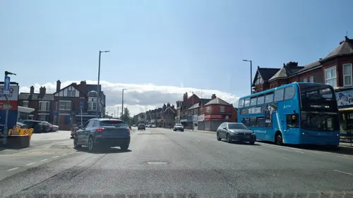
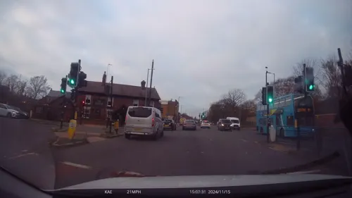
Mr Deli
Restaurant · Burger, Chicken, Sandwich, Japanese, Chinese, Sushi, Breakfast, Salad, Brunch · 0.7 mi
136 South Road, Waterloo
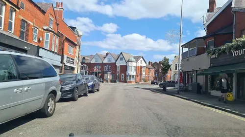
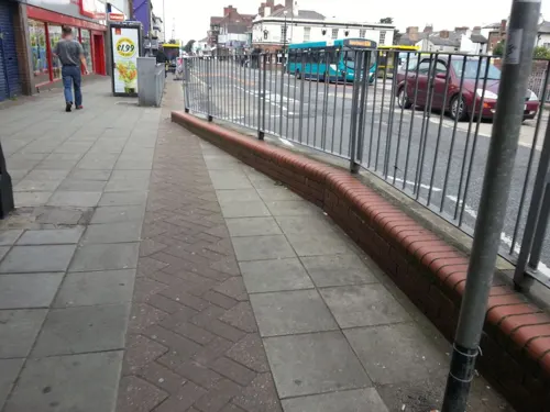
Another Coffee Place
Cafe · Breakfast, Coffee Shop, Sandwich · 0.7 mi
1A Lorne Road, Liverpool
Tu-Sa 08:00-14:00
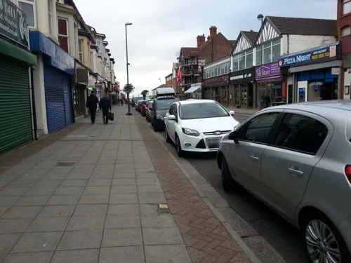
Valerie’s Coffee
Cafe · Coffee Shop, Breakfast, Toasted Sandwiches · 0.7 mi
52-54 South Road, Waterloo
Mo-Sa 08:00-17:00, Su 09:00-15:00



Trap & Hatch
Bar and pub · 0.7 mi
135 South Road, Waterloo
Mo 17:00-23:00, We-Th 16:00-23:00, Fr 15:00-23:00, Su 14:00-23:00
The Liver Hotel
Bar and pub · 0.7 mi
137 South Road, Liverpool
Mo-Su,PH 12:00-24:00
65 more on the map.
History
Etymologically, Bootle derives from the Anglo Saxon bold or botle meaning a dwelling.
It was recorded as Boltelai in the Domesday Book in 1086. By 1212 the spelling had been recorded as Botle. The spellings Botull, Bothull and Bothell are recorded in the 14th century. In the 18th century, it was known as Bootle cum Linacre.
Bootle was originally a small hamlet built near the 'sand hills' or dunes of the river estuary. In the early 19th century, it began to develop as a bathing resort, attracting wealthy people from Liverpool. Some remaining large villas which housed well-to-do commuters to Liverpool are located in the area known locally as 'Bootle Village', centred around the junction of Merton Road and Litherland Road.
Read more of the history
The Liverpool, Crosby and Southport Railway arrived in the 1840s and Bootle experienced rapid growth. By the end of the 19th century the docks had been constructed along the whole of the river front as far as Seaforth Sands to the north. The town became heavily industrialised. Fearful of annexation by Liverpool, Bootle was incorporated as a municipal borough in 1868 under the Municipal Corporations Act 1835, and in 1889 was granted the status of a county borough by the Local Government Act 1888, becoming independent from the administrative county of Lancashire. During this time period it was sometimes formally known as Bootle-cum-Linacre. Orrell was added to the borough in 1905. There are still large areas of Victorian terraced houses in Bootle, formerly occupied by dock workers. These are built in distinctive pressed red brick.
Bootle Town Hall and other municipal buildings were erected in the last quarter of the 19th century. The population of the town swelled during this period, boosted in large part by Irish immigration and the attraction of plentiful work on the docks. The wealth to pay for the splendour of the town hall and the gentrified 'Bootle Village' area was generated by these docks. The skilled workers lived in terraced houses in the east of the town, while the casual dock labourers lived in cramped, dwellings near the dockside. Stories about three streets in particular, Raleigh Street, Dundas Street and Lyons Street, caused great alarm. Lyons Street, the scene of the 'teapot murder', was renamed Beresford Street shortly before the First World War.
Bootle was the first borough to elect its own school board, following the passage of William Forster's Elementary Education Act 1870. In 1872 Dr R.J. Sprakeling was appointed the first Medical Officer of Health, and was instrumental in improving sanitary conditions in the town. The Metropole Theatre on Stanley Road played host to stars such as music hall singer Marie Lloyd. Tree lined streets surrounded magnificent open spaces, such as Derby Park, North Park and South Park. Roman Catholic and Anglican churches sprang up all over the town, and Welsh immigration brought with it Nonconformist chapels and the temperance movement. Local societies thrived, including sports teams, scouts and musical groups. The Bootle May Day carnival and the crowning of the May Queen were highlights of the social year. The town successfully fought against absorption by neighbouring Liverpool in 1903. It subsequently made good use of its Latin motto Respice, Aspice, Prospice ("look to the past, the present, the future").
The docks made Bootle a target for Nazi German Luftwaffe bombers during the Liverpool Blitz of the Second World War, with approximately 90% of the houses in the town damaged. Situated immediately adjoining the city of Liverpool, and the site of numerous docks, Bootle had the distinction of being the most heavily bombed borough in the UK, with 458 civilian deaths from enemy action recorded within the borough. Bootle played an important role in the Battle of the Atlantic.
Royal Navy's Captain Frederic John Walker, the famous U-boat hunter, would rest in the mayor's parlour of Bootle Town Hall and his ships, HMS Stork and HMS Starling, sailed out of Gladstone Dock Bootle. Memorabilia associated with Walker including the ships's bell from HMS Starling which was presented to Bootle County Borough Council on 21 October 1964 by Admiral Sir Nigel Henderson Commander-in-Chief, Plymouth. can be viewed in Bootle Town Hall.
After the Second World War large council housing estates were built inland from the town centre, including the area of Netherton, which was built on new town principles. The Liverpool Overhead Railway and Liverpool Corporation Tramways closure in the 1950s reduced Bootle's connection to Liverpool.
Bootle did share in the postwar boom. The centre of the town was redeveloped and the 'Bootle New Strand' shopping centre was opened in 1968. At the same time, new offices were built in the town centre. The town lost its access to the beach when neighbouring Seaforth Sands was redeveloped in the early 1970s, but the Seaforth Container Port brought new jobs into the area. The local authority, and other social landlords, saw to it that new housing was built and older stock renovated. Bootle did not go down the route of massive housing clearance, and many local communities remained intact.
The borough celebrated its centenary in 1968 and civic pride was much in evidence.
From the History section of Bootle on Wikipedia, under CC BY-SA 4.0.
More about Bootle
Geography
Bootle Docks was created as a part of the Mersey Docks and now promoted as Port of Liverpool, with the Liverpool and Wirral Docks, being located on both bank sides of the River Mersey. Bootle Docks are situated at the northern end, that is closer to the Irish Sea estuary.
Bootle, along with Southport, is one of the two main administrative headquarters for the Metropolitan Borough of Sefton. Among Bootle's neighbouring districts are Kirkdale to the south, Walton to the east, with Seaforth, Litherland and Netherton to the north. To the west it is bounded by the River Mersey. In the centre is a sizeable area of large office blocks, and the Leeds and Liverpool Canal.
The old civic centre of Bootle contains large Victorian buildings such as the town hall and the municipal baths. To the north lies the New Strand Shopping Centre, which gained notoriety after the abduction and murder of two-year-old James Bulger in 1993.
Education
The town has one further education college, Hugh Baird College, located on Balliol Road. The college delivers over 300 courses to more than 7,000 students with course levels from entry level to Level 3, A-levels, apprenticeships and university level courses and degrees.
In January 2014, a multimillion-pound facility called the L20 Building located on Stanley Road was opened. This houses a dedicated university centre with open-plan study areas for students studying university-level courses.
From the Wikipedia article Bootle, under CC BY-SA 4.0.
Notable people from Bootle
 Jamie CarragherEnglish associiation football player and sportcasterPhoto: Ludovic Péron, CC BY-SA 3.0
 Steve McManamanEnglish association football player (born 1972)Photo: Chensiyuan, CC BY-SA 4.0
 Alex GreenwoodEnglish association football player (born 1993)Photo: Katie Chan, CC BY-SA 4.0
 Roy EvansEnglish footballer and manager (born 1948)Photo: Jarvin, CC BY 3.0
 John C. WellsBritish phonetician and Esperanto teacherPhoto: Ziko, CC BY-SA 3.0
 Stephen WrightEnglish association football playerPhoto: Helen Bromley, CC BY 2.0
- Jose BaxterBritish footballer (born 1992)
- Alvin MartinEnglish footballer (born 1958)
- Allan WilliamsBritish talent manager (1930–2016)
- Elaine Feinsteinpoet, novelist, short-story writer, playwright, biographer and translator (1930-2019)
- Jack ParkinsonEnglish footballer (1883-1942)
- Derek AcorahEnglish television personality (1950-2020)
Born in Bootle, according to Wikidata (CC0). Each name links to its Wikipedia article.
Where to stay2
Churches and places of worship43
Shopping15
Gas and EV charging4
Schools, colleges and libraries28
Our Lady Queen of Peace Catholic Primary School
School · Roman Catholic · 1.2 mi
Ford Close, Liverpool
Our Lady Star of the Sea Catholic Primary School
School · Roman Catholic · 0.5 mi
Kepler Street, Liverpool
St Philip's Church of England Controlled Primary School
School · Anglican · 1.0 mi
Church Road, Liverpool
Healthcare9
Map of Bootle
213 places. The map loads OpenStreetMap tiles when you open it.
Getting there and nearby towns
Liverpool John Lennon Airport (LPL) is the nearest airport with scheduled flights listed in OpenStreetMap, 11 miles away.
- Litherland 1 mi east, about 1 min by car
- Wallasey 4 mi southwest, about 6 min by car
- Liverpool 4 mi south, about 7 min by car
- Fazakerley 4 mi east, about 6 min by car
- Birkenhead 5 mi south, about 8 min by car
- Maghull 5 mi northeast, about 7 min by car
- Kirkby 5 mi east, about 8 min by car
- West Derby 5 mi southeast, about 8 min by car
- Old Swan 6 mi southeast, about 9 min by car
- Knotty Ash 6 mi southeast, about 10 min by car
Drive times are estimates from straight-line distance, not routes.
Towns near Bootle


Keep exploring
Local news
Headlines from INDB.
Reviews, tips and questions
Loading what members have shared...
Sources and licences
- GeoNames (CC BY 4.0): population, coordinates, regions and time zone
- Mapillary (see each image): photos
- OpenStreetMap contributors (ODbL 1.0): places, airports, map data
- Wikidata (CC0 1.0): elevation, founding date, time zone, website, landmarks and historic places
- Wikimedia Commons (see each image): photos
- Wikipedia (CC BY-SA 4.0): overview and history text
Photo credits
- Bootle Town Hall 2020-2, Rodhullandemu, CC BY-SA 4.0
- Crosby Beach ship, Chris Howells (= Chowells ), CC BY-SA 3.0
- Floral Pavilion Theatre, Frombowen, CC BY-SA 4.0
- Perch Rock Lighthouse 2021, Rodhullandemu, CC BY-SA 4.0
- Bootle War Memorial 1, Rodhullandemu, CC BY-SA 4.0
- Canalside Park September 16 2010 (1), John Bradley, CC BY-SA 3.0
- Stanley Park Feb 11 2010 (10), John Bradley, CC BY 3.0
- Vale Park, Wallasey (33), Rept0n1x, CC BY-SA 3.0
- Warbreck Park 2, Rodhullandemu, CC BY-SA 4.0
- Church of St. Monica, Bootle 1, Rodhullandemu, CC BY-SA 4.0
- Crosby United Reformed Church 1, Rodhullandemu, CC BY-SA 4.0
- Manor Church Centre 2017-1, Rodhullandemu, CC BY-SA 4.0
- Old Christ Church, Waterloo 2, Rodhullandemu, CC BY-SA 4.0
- Our Lady Star of the Sea, Seaforth 1, Rodhullandemu, CC BY-SA 4.0
- Spellow Lane church 2018, Rodhullandemu, CC BY-SA 4.0
- St Anthony's, Scotland Road 2019-1a, Rodhullandemu, CC BY-SA 4.0
- St Benet's Chapel, Netherton 2, Rodhullandemu, CC BY-SA 4.0
- St George's Everton 2019-2, Rodhullandemu, CC BY-SA 4.0
- St Helen's Church, Sefton 2021, Rodhullandemu, CC BY-SA 4.0
- Entrance to Rimrose Valley at St Mary's Road, Rodhullandemu, CC BY-SA 4.0
- Plaza cinema, Waterloo, Rodhullandemu, CC BY-SA 4.0
- St Robert Bellarmine, Orrell 4, Rodhullandemu, CC BY-SA 4.0
- Princess Way, Seaforth from the west, Rodhullandemu, CC BY-SA 4.0
- Princess Way, Seaforth from Chatham Close, Rodhullandemu, CC BY-SA 4.0
- Newly exposed Victorian tiles in my sister's new house, Radarsmum67, CC BY 2.0
- View from the bench (OpenBenches 9214-2), Anonymous Unknown author, CC BY-SA 4.0
- Ewart Road Bridge, Seaforth 1, Rodhullandemu, CC BY-SA 4.0
- Ewart Road Bridge, Seaforth 2, Rodhullandemu, CC BY-SA 4.0
- Bowersdale Park 2, Rodhullandemu, CC BY-SA 4.0
- Street-level photo, mappo2, CC BY-SA 4.0
- Street-level photo, lamaar639, CC BY-SA 4.0
- Street-level photo, victuallers, CC BY-SA 4.0
- Street-level photo, lamaar639, CC BY-SA 4.0
- Street-level photo, mappo2, CC BY-SA 4.0
- Street-level photo, davidsong, CC BY-SA 4.0
- Street-level photo, davidsong, CC BY-SA 4.0
- Street-level photo, cyclestreets, CC BY-SA 4.0
- Street-level photo, cyclestreets, CC BY-SA 4.0
- Street-level photo, lamaar639, CC BY-SA 4.0
- Street-level photo, thingomy, CC BY-SA 4.0
- Street-level photo, thingomy, CC BY-SA 4.0
- Street-level photo, thingomy, CC BY-SA 4.0
- Street-level photo, ricorico, CC BY-SA 4.0
- Street-level photo, davidsong, CC BY-SA 4.0
- Street-level photo, davidsong, CC BY-SA 4.0
- Street-level photo, davidsong, CC BY-SA 4.0


Page built November 10, 2026. Spotted a mistake? Tell us or suggest a place.