


Why visit Maghull
Townapedia lists 1 museum or landmark, 8 parks and trails, 28 places to eat and 1 place to stay in and around town.
Highlights include Sefton War Memorial and Warbreck Park.
Weather in Maghull
Forecast from MET Norway (CC BY 4.0). Full forecast
About Maghull
Maghull is a town and civil parish in Sefton, Merseyside, England. The town is north of Liverpool and west of Kirkby. The town is also the location of Ashworth Hospital.
From the Wikipedia article Maghull (this version), under CC BY-SA 4.0.
Museums and landmarks1

Parks, trails and playgrounds8


Restaurants and cafes28

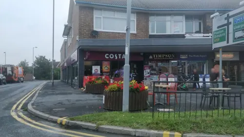
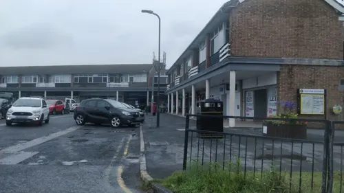
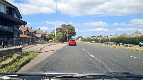



16 more on the map.
Where to stay1

Hidden Corner Camp Site
Campground · 0.7 mi
19 Millbank Lane, Sefton
History
The original settlement, consisting of fifty people and six square miles of agricultural settlement, was established prior to the Domesday Survey of 1086 where the town is recorded as Magele on a ridge of high ground, that can be most clearly seen at Red Lion Bridge towards the centre of the town and the Leeds and Liverpool Canal follows it on the plain and the A5147 on the brow. This ridge marks the edge of the flood plain of the River Alt, providing protection from flooding and access to this fertile pasture of the plain. A church is known to have existed in the area in 1100 although it has been rebuilt at least once and the chapel still stands, in the churchyard of the Victorian St Andrew's and is the oldest ecclesiastical building in Merseyside still in regular use for worship but in 1756 the mediaeval nave of Maghull Chapel was pulled down with a Roman Catholic dual-purpose school-chapel opening in 1890 near Massey's Barn.
Read more of the history
It is noted that in 1568 Maghull Moss was divided between Sir Richard Molyneux of Melling and Edward Hulme of Maghull. The boundary of Maghull was, in the north, Maghull Brook and to the south, Melling Brook; the west was marked by the River Alt. At the eastern edge, however, the boundary was ill-defined on the moorland and due to the value of turf from the moss as a vital fuel this caused regular disputes between both Maghull and Melling Manors. Maghull Manor House was built in 1638 and local tradition has it that Charles II slept there during a visit to the area but by 1780 a new manor house had been built near the site of the original and it still stands in the grounds of Maghull Homes with part of the original moat.
It is also recorded that by 1667 the population of Maghull had increased to 599 with 136 houses and 127 families and by 1770 initial work had begun on the Leeds and Liverpool Canal with the first sod being cut by the Honourable Charles Lewis Mordaunt. The actual spot lies in a rock cutting 400 metres to the east of Halsall Hill Bridge. Soon after, the Red Lion public house was built in Maghull to serve the canal trade. It became a café and general store in the 20th century and was demolished after the Second World War. Several other canalside pubs were built over the years; for example, near Hall Lane Bridge there was the Traveller's Rest (demolished 1936) and the Horse and Jockey in Melling. In 1774, the canal had reached Maghull and provided it with its second connection to Liverpool. The arrival of the canal created new industry in the area, notably quarrying of sandstone and clay extraction. It also bolstered the local hostelry trade.
Maghull's first school was founded in 1668 in a small cottage in School Lane with the headmaster being Humphries Webster, showing the town's emergence although County Rates from 1716 said of the town "Maghull doth always bear and pay a third less than either Down Holland or Lidyeat". This shows that Maghull was a developing community, but still not as rich as its neighbours Downholland and Lydiate. Economic development continued with the Molyneux family (Earls of Sefton) being significantly active in bringing about the Alt Drainage Act in 1779 which resulted in many acres of marshland along the river eventually becoming good agricultural land. This had led to the growth of the population to 534, with about half the employment being in trade rather than agriculture and a rise in 1815 to a population of 720 people with 71 families engaged in agriculture and 29 in trade, manufactures and handicrafts. There were 108 inhabited houses.
By the 1820s, horse racing was well established on land in Maghull. Old Racecourse Farm later became the site for the Meadows Hotel; and Old Racecourse Road, off Sefton Lane, commemorates the sport. Baines' Directory of Lancashire in 1825 provided the first list of specialist male occupations in Maghull – 1 blacksmith, 1 cooper, 1 tailor, 1 land surveyor and 1 wheelwright.
By 1840 the agriculture of the area had changed from animal to arable farming and the 1861 National Census the population stood at 1,222. Due to this increase in population the railway came to Maghull in 1849, with a station on the Liverpool, Ormskirk and Preston Railway as well as the construction of the town's first police station which was set up by Lancashire County Council in 1870 and the town got a second station in 1884, Sefton and Maghull, on the newly built Cheshire Lines Committee Southport & Cheshire Lines Extension Railway to Southport, the line was an extension of the North Liverpool Extension Line. A large section of embankment has been destroyed to make space for Switch Island. In 1933 Northway (A59 road) was built, initially as a tree-lined single carriageway but dualled in the early 1960s, which bisects Maghull, taking travellers from Liverpool to Ormskirk off 'Liverpool Road'. The arrival of Northway triggered an increased rate of expansion in Maghull.
From the History section of Maghull on Wikipedia, under CC BY-SA 4.0.
More about Maghull
Geography
Maghull is seven miles north-northeast of Liverpool city centre. To the northwest is Lydiate, to the east Melling, to the south Aintree and Netherton and to the west the Mersey Forest and Sefton village. Maghull is separated from the rest of the Greater Liverpool sprawl by a green belt which runs across the Switch Island motorway junction and through which flows the River Alt.
Education
Education in the town began with William Harper founding the Maghull School in Damfield Lane, the location of Maricourt Catholic High School, in 1815 under the terms of his will. In 1839, the National School, later St Andrew's Church of England School, was built and the earlier school, a small cottage, which still stands, became the headmaster's house. Money for the school, which cost £450 7s 0d (£450.35p), was raised by local subscription and the schoolmistress was paid £5 a year, and each scholar had to pay one penny (1d) a month towards the cost of a fire, and tuppence (2d) a month for pens and ink, if they were being taught to write but by 1873 a second storey was added to the school to accommodate the growing population. In 1957, the Sisters of Mercy created the Maricourt Catholic High School with all students initially taught in Quarry Brook House with an initial intake of only twelve girls. In 1982, Old Hall High School, formerly Maghull Grammar School, was merged with Ormonde Drive High School to form Maghull High School, concentrating on the Ormonde Drive site.
From the Wikipedia article Maghull, under CC BY-SA 4.0.
Notable people from Maghull
 John WarburtonBritish actor, 1903-1981Photo: Los Angeles Times, CC BY 4.0
 James GrahamEnglish rugby league footballerPhoto: https://www.flickr.com/photos/naparazzi/, CC BY-SA 2.0
 Mark BurgessBritish computer scientistPhoto: MarkBurgess, CC BY-SA 4.0
- Jimmy Ryanassociation football player
- Alun Leach-JonesUK artist (1937–2017)
- Mike WaywellEnglish rugby union footballer
Born in Maghull, according to Wikidata (CC0). Each name links to its Wikipedia article.
Churches and places of worship14
Church of the Holy Family Adjoining Service Wing of Ince Blundell Hall
Church · 3.1 mi
Shopping5
Gas and EV charging3
Schools, colleges and libraries13
St Thomas Church of England Primary School, Lydiate
School · Anglican · 0.7 mi
Kenyons Lane, Liverpool
Healthcare7
Map of Maghull
80 places. The map loads OpenStreetMap tiles when you open it.
Getting there and nearby towns
Liverpool John Lennon Airport (LPL) is the nearest airport with scheduled flights listed in OpenStreetMap, 13 miles away.
- Ormskirk 4 mi northeast, about 7 min by car
- West Derby 6 mi south, about 10 min by car
- Liverpool 7 mi south, about 12 min by car
- Birkenhead 9 mi south, about 15 min by car
- St Helens 10 mi southeast, about 16 min by car
- Rainhill 10 mi southeast, about 16 min by car
- Woolton 10 mi south, about 16 min by car
- Moreton 11 mi southwest, about 17 min by car
- Wigan 13 mi east, about 20 min by car
- Speke 13 mi south, about 21 min by car
Drive times are estimates from straight-line distance, not routes.
Towns near Maghull


Keep exploring
Local news
Headlines from INDB.
Reviews, tips and questions
Loading what members have shared...
Sources and licences
- GeoNames (CC BY 4.0): population, coordinates, regions and time zone
- Mapillary (see each image): photos
- OpenStreetMap contributors (ODbL 1.0): places, airports, map data
- Wikidata (CC0 1.0): elevation, founding date, time zone, website, landmarks and historic places
- Wikimedia Commons (see each image): photos
- Wikipedia (CC BY-SA 4.0): overview and history text
Photo credits
- Maghull Square, John Bradley, CC BY-SA 3.0
- Warbreck Park 2, Rodhullandemu, CC BY-SA 4.0
- St Benet's Chapel, Netherton 2, Rodhullandemu, CC BY-SA 4.0
- Lydiate Abbey 1a, Stonerat, CC BY-SA 3.0
- St Michael's Parish Church, Aughton, Small-town hero, Public domain
- St Helen's Church, Sefton 2021, Rodhullandemu, CC BY-SA 4.0
- Sefton Village War Memorial, Merseyside 1, Rodhullandemu, CC BY-SA 4.0
- The Punchbowl, Sefton Village, Rodhullandemu, CC BY-SA 4.0
- Street-level photo, mappo2, CC BY-SA 4.0
- Street-level photo, mappo2, CC BY-SA 4.0
- Street-level photo, mappo2, CC BY-SA 4.0
- Street-level photo, mappo2, CC BY-SA 4.0
- Street-level photo, davidsong, CC BY-SA 4.0
- Street-level photo, davidsong, CC BY-SA 4.0
- Street-level photo, davidsong, CC BY-SA 4.0
- Street-level photo, mappo2, CC BY-SA 4.0
- Street-level photo, davidsong, CC BY-SA 4.0
- Street-level photo, mappo2, CC BY-SA 4.0
Page built November 10, 2026. Spotted a mistake? Tell us or suggest a place.