


Knotty Ash, United Kingdom
Knotty Ash is a town of 14,355 people in England, United Kingdom.
Why visit Knotty Ash
Townapedia lists 14 museums and landmarks, 38 parks and trails, 123 places to eat, 4 places to stay and 5 attractions in and around town.
Highlights include Everyman Theatre, Liverpool Empire Theatre, 20 Forthlin Road and 59 Rodney Street, Liverpool.
Weather in Knotty Ash
Forecast from MET Norway (CC BY 4.0). Full forecast
About Knotty Ash
Knotty Ash is an area of Liverpool, Merseyside, England, and a Liverpool City Council Ward, historically in Lancashire. The population at the 2001 Census was 13,200, increasing to 13,312 at the 2011 Census. Knotty Ash is well known as the home of comedian Sir Ken Dodd, who often mentioned it in his act.
From the Wikipedia article Knotty Ash (this version), under CC BY-SA 4.0.
Photos of Knotty Ash


Things to do5

Everyman Theatre
Cinema and theater · 3.1 mi
Theatre and building in Liverpool, Merseyside, England

Liverpool Empire Theatre
Cinema and theater · 3.4 mi
Theatre in Liverpool, Merseyside, England, UK

Liverpool Olympia
Cinema and theater · 2.5 mi
Theatre in Liverpool, Merseyside, England, UK

Unity Theatre
Cinema and theater · 3.3 mi
Theatre in Liverpool, Merseyside, England

New Shakespeare Theatre, Liverpool
Cinema and theater · 3.3 mi
Theatre in the UK
Museums and landmarks14

20 Forthlin Road
Museum · 3.2 mi
House in which Paul McCartney had lived for several years

59 Rodney Street, Liverpool
Museum · 3.4 mi
Historic house museum in Liverpool

Croxteth Hall
Museum · 1.8 mi
Country house in Croxteth, Liverpool, England, UK

Falkner Square War Memorial
Monument and historic site · 3.0 mi
War memorial in the UK

Garstang Museum of Archaeology
Museum · 3.0 mi
University museum in Liverpool, UK

Mendips, Menlove Avenue
Museum · 2.8 mi
Childhood home of John Lennon in Liverpool, Merseyside, England, UK


Victoria Gallery & Museum
Museum · 3.0 mi
Art gallery and museum in Liverpool, UK

Wavertree Lock-up
Monument and historic site · 1.4 mi
Funded by local residents, the lock-up was constructed in 1796 as a drunk tank to hold intoxicated persons overnight. Prior to its...
Childwall Road, Liverpool


Monk's Well
Monument and historic site · 1.4 mi
Grade II listed holy well
2 more on the map.
Parks, trails and playgrounds38


Allerton Tower Park
Park · 3.3 mi
Public park on what was a country estate

Belle Vale Park
Park · 2.7 mi
Small family park in the Belle Vale area of Liverpool


Everton Park
Park · 3.1 mi
Park in the Everton area of Liverpool, England


Newsham Park
Park · 1.8 mi
Park in Liverpool, Merseyside, England, UK


Princes Park
Park · 3.2 mi
Grade II* listed municipal park in Liverpool, Merseyside, England, UK

26 more on the map.
Restaurants and cafes123
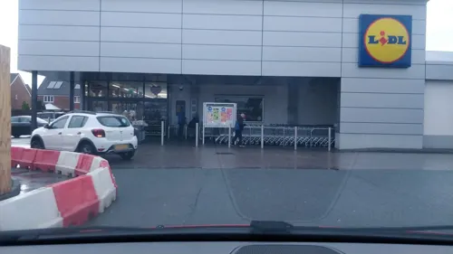
JUMBO
Restaurant · Chinese, Thai · 1.3 mi
Princess Drive, Liverpool
Mo-Su 16:00-23:00
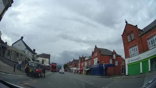

Espositos
Cafe · Ice Cream, Sandwich, Coffee Shop, Cake · 1.2 mi
Roby Road, Liverpool
Mo-Su 09:00-17:00


Frankie & Benny's
Diner · American · 1.2 mi
2 Montrose Way, Liverpool
Mo-Fr 12:00-22:00; Sa-Su 09:00-22:00


Sefton Arms
Bar and pub · 1.2 mi
1 Mill Lane, Liverpool
Mo-Th 10:30-23:00; Fr 10:30-24:00; Sa 09:00-24:00; Su 09:00-23:00
The Breakfast Lounge
Cafe · Breakfast, Sandwich · 0.6 mi
117 Broad Green Road, Liverpool
Mo-Sa 09:00-15:00
Costa
Cafe · Coffee Shop · 0.7 mi
598 Prescot Road, Liverpool
Mo-Sa 07:30-19:00, Su 08:00-19:00
111 more on the map.
Notable people from Knotty Ash
 Ken DoddEnglish comedian, singer-songwriter and actor (1927–2018)Photo: Virgil Lucky, CC BY-SA 4.0
- Alexandra PiggBritish actress (born 1962)
Born in Knotty Ash, according to Wikidata (CC0). Each name links to its Wikipedia article.
Where to stay4
Churches and places of worship81
St Luke's, West Derby & St Jude's, Stockbridge Village Church & Community Centre
Church · Anglican · 1.3 mi
Princess Drive, Liverpool
The Church of Christ the King and Our Lady
Church · Roman Catholic · 1.1 mi
78 Queens Drive, Liverpool
Shopping23
Gas and EV charging4
Schools, colleges and libraries51
Our Lady of Good Help Catholic Primary School
School · Roman Catholic · 1.4 mi
South Drive, Liverpool
Runnymede St Edward's Catholic Primary School
School · Roman Catholic · 0.8 mi
North Drive, Liverpool
St Cecilia's Catholic Infant & Nursery School
School · Roman Catholic · 1.5 mi
Snaefell Avenue, Liverpool
St Mary's Church of England Primary School, West Derby
School · Anglican · 1.3 mi
Meadow Lane, Liverpool
St Paul's and St Timothy's Catholic Infant School
School · Roman Catholic · 1.0 mi
South Parkside Drive, Liverpool
Healthcare29
Map of Knotty Ash
250 places. The map loads OpenStreetMap tiles when you open it.
Getting there and nearby towns
Liverpool John Lennon Airport (LPL) is the nearest airport with scheduled flights listed in OpenStreetMap, 6 miles away.
- West Derby 1 mi northwest, about 2 min by car
- Childwall 1 mi south, about 2 min by car
- Liverpool 3 mi west, about 5 min by car
- Woolton 3 mi south, about 5 min by car
- Fazakerley 3 mi northwest, about 5 min by car
- Dingle 4 mi southwest, about 6 min by car
- Whiston 4 mi east, about 7 min by car
- Birkenhead 5 mi west, about 8 min by car
- Halewood 5 mi southeast, about 8 min by car
- Litherland 6 mi northwest, about 9 min by car
Drive times are estimates from straight-line distance, not routes.
Towns near Knotty Ash


Keep exploring
Local news
Headlines from INDB.
Reviews, tips and questions
Loading what members have shared...
Sources and licences
- GeoNames (CC BY 4.0): population, coordinates, regions and time zone
- Mapillary (see each image): photos
- OpenStreetMap contributors (ODbL 1.0): places, airports, map data
- Wikidata (CC0 1.0): elevation, founding date, time zone, website, landmarks and historic places
- Wikimedia Commons (see each image): photos
- Wikipedia (CC BY-SA 4.0): overview and history text
Photo credits
- Knotty Ash, Frombowen, CC BY-SA 4.0
- Everyman Theatre, Liverpool 2018, Rodhullandemu, CC BY-SA 4.0
- Empire Theatre, Liverpool 2018, Rodhullandemu, CC BY-SA 4.0
- Liverpool Olympia 2018, Rodhullandemu, CC BY-SA 4.0
- Entrance of Unity Theatre, Liverpool, Rodhullandemu, CC BY-SA 4.0
- Paulhousenationaltrust, Havaska at English Wikipedia, CC BY-SA 3.0
- 59 Rodney Street, Liverpool 2020, Rodhullandemu, CC BY-SA 4.0
- Entrance to Garstang Museum, University of Liverpool, Rept0n1x, CC BY-SA 2.0
- Mendips 202001, Rodhullandemu, CC BY-SA 4.0
- Sudley House Liverpool, Man vyi, Public domain
- Victoria Gallery and Museum University of Liverpool, XeresNelro, CC BY-SA 4.0
- Lodge of Allerton Towers 2019, Rodhullandemu, CC BY-SA 4.0
- Belle Vale Park, Liverpool (1), Rept0n1x, CC BY-SA 3.0
- Calderstones House, Sue Adair, CC BY-SA 2.0
- Everton Park, Vanbasten 23, CC BY-SA 3.0
- Grants Gardens, July 07, 2012 (9), John Bradley, CC BY-SA 3.0
- Newsham Park 006, John Bradley, CC BY-SA 3.0
- Sunken parterre in Norris Green Park, Rodhullandemu, CC BY-SA 4.0
- StJohnTheBaptist, S Parish, CC BY-SA 2.0
- All Saints, Childwall from the south, Rodhullandemu, CC BY-SA 4.0
- Christ Church, Kensington 2019, Rodhullandemu, CC BY-SA 4.0
- Christ Church, Linnet Lane, Liverpool (6), Rept0n1x, CC BY-SA 3.0
- All Hallows, Allerton 1, Rodhullandemu, CC BY-SA 3.0
- St Andrew's Church, Rodney Street 2019-1, Rodhullandemu, CC BY-SA 4.0
- St Bridget's Church, Wavertree, Sue Adair, CC BY-SA 2.0
- Alder Hey from Springfield Park, Rodhullandemu, CC BY-SA 4.0
- Wavertree lockup 1, Rodhullandemu, CC BY-SA 4.0
- Our Lady of Good Help Catholic Primary School, Frombowen, CC BY-SA 4.0
- St Luke's Church (99204), Frombowen, CC BY-SA 4.0
- Trinity Church, Page Moss (1), Rept0n1x, CC BY-SA 3.0
- Christ the King church, Childwall 1, Rodhullandemu, CC BY-SA 4.0
- Church of Christ the King and Our Lady, Queens Drive, Childwall, Liverpool (April 2024) (3), User:Hassocks5489, CC0
- St. Edward's College, Liverpool (6), Rept0n1x, CC BY-SA 3.0
- Black Merchant Seamens Memorial 2019, Rodhullandemu, CC BY-SA 4.0
- Alder Hey Hospital under construction, Paul Harrop, CC BY-SA 2.0
- Agelastica alni 188509416, Stephen James McWilliam, CC0
- Alliaria petiolata 188508622, Stephen James McWilliam, CC0
- Radio Broadgreen, Frombowen, CC BY-SA 4.0
- Oak House, Frombowen, CC BY-SA 4.0
- Golovinomyces sordidus 131338419, Stephen James McWilliam, CC0
- Farm Lodge To Croxteth Hall, Frombowen, CC BY-SA 4.0
- Casbah Coffee Club 2024 07, The Midnite Wolf, CC0
- Court Hey Park, Frombowen, CC BY-SA 4.0
- Substation in Prince's Park, Liverpool, Rodhullandemu, CC BY-SA 3.0
- Street-level photo, davidsong, CC BY-SA 4.0
- Street-level photo, davidsong, CC BY-SA 4.0
- Street-level photo, davidsong, CC BY-SA 4.0
- Street-level photo, davidsong, CC BY-SA 4.0
- Street-level photo, davidsong, CC BY-SA 4.0
- Street-level photo, davidsong, CC BY-SA 4.0
- Street-level photo, mappo2, CC BY-SA 4.0
- Street-level photo, panieravide, CC BY-SA 4.0


Page built November 10, 2026. Spotted a mistake? Tell us or suggest a place.