


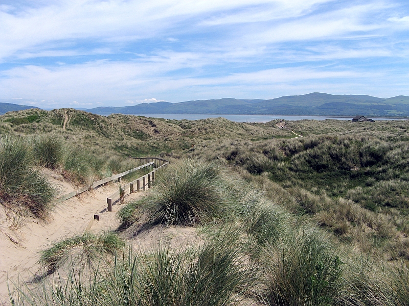
Why visit Borth
Townapedia lists 1 museum or landmark, 5 parks and trails, 7 places to eat, 7 places to stay and 6 attractions in and around town.
Highlights include Borth Animalarium, Wallog, Borth Wild Animal Kingdom and Dyfi National Nature Reserve.
Weather in Borth
Forecast from MET Norway (CC BY 4.0). Full forecast
About Borth
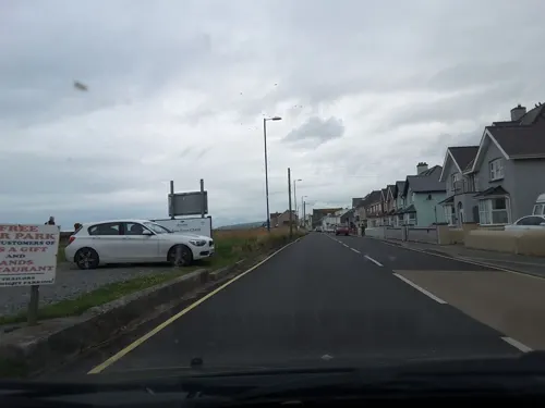
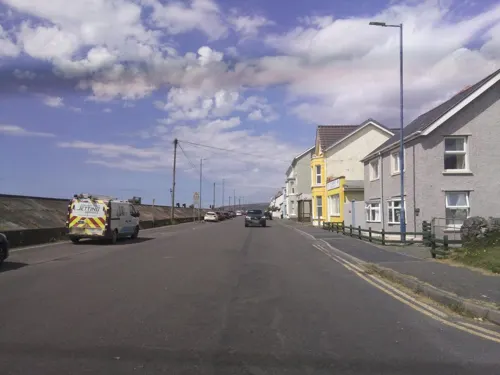
Borth (Welsh: Y Borth) is a village, seaside resort and community in Ceredigion, Mid Wales; it is located 7 miles (11 km) north of Aberystwyth, on the Ceredigion Coast Path. The community includes the settlement of Ynyslas and the population was 1,399 in 2011. Borth's sandy beach has helped to promote it as a seaside resort.
From the Wikipedia article Borth (this version), under CC BY-SA 4.0.
Travel tips from other travellers: Borth on Wikivoyage (CC BY-SA 4.0).
Photos of Borth

Things to do6



Museums and landmarks1

Parks, trails and playgrounds5


Restaurants and cafes7




History
There is an ancient submerged forest visible at low tide along the beach, where stumps of oak, pine, birch, willow and hazel (preserved by the acid anaerobic conditions in the peat) can be seen. Radiocarbon dating suggests the trees date from about 1500 BCE. This submerged forest also ties in with the legend of Cantre'r Gwaelod. The stumps were exposed for a time by Storm Hannah in 2019.
Cors Fochno, a raised peat mire, part of the Dyfi Biosphere, is the only UNESCO Biosphere reserve in Wales. It is located next to the village, together with the Dyfi National Nature Reserve and visitors' centre at Ynyslas. The village is crossed by a long-distance footpath, the Dyfi Valley Way.
In the past Upper Borth, then known simply as Borth, was in the township of Cyfoeth y Brenin, and nearby Morfa Borth being part of the township of Henllys. It is Morfa Borth which is now known as Borth today.
On 4 April 1876, the entire Uppingham School in Rutland, England, consisting of 300 boys, 30 masters and their families, moved to Borth for a period of 14 months, taking over the disused Cambrian Hotel and a large number of boarding houses, to avoid a typhoid epidemic.
The village war memorial, above a cliff south of the beach, was struck by lightning on 21 March 1983 and had to be rebuilt.
Read more of the history
In 2011, work commenced on the first phase of a £12-million coastal protection scheme along the Borth to Ynyslas coastline, which was finished in 2015. The work was funded by the Welsh Assembly and the EU. An unexpected consequence of the coastal defence work was to reveal the remains of the petrified forest.
In 2018, Borth was subjected to media attention after the escape of a wild lynx from its local zoo.
In 2019, the village hosted a community street production called Borth Begins.
From the History section of Borth on Wikipedia, under CC BY-SA 4.0.
Notable people from Borth
- Michael Olivercardiologist
Born in Borth, according to Wikidata (CC0). Each name links to its Wikipedia article.
Where to stay7
Churches and places of worship1
Shopping1
Schools, colleges and libraries1
Map of Borth
29 places. The map loads OpenStreetMap tiles when you open it.
Getting there and nearby towns
RAF Valley - Anglesey Airport (VLY) is the nearest airport with scheduled flights listed in OpenStreetMap, 56 miles away.
- Bow Street 3 mi south, about 5 min by car
- Aberystwyth 5 mi south, about 8 min by car
- Llanilar 9 mi south, about 15 min by car
- Machynlleth 11 mi northeast, about 17 min by car
- Dolgellau 19 mi north, about 30 min by car
- Tregaron 19 mi south, about 31 min by car
- Llanidloes 22 mi east, about 35 min by car
- Lampeter 26 mi south, about 42 min by car
- Harlech 26 mi north, about 41 min by car
- Rhayader 26 mi southeast, about 42 min by car
Drive times are estimates from straight-line distance, not routes.
Towns near Borth


Keep exploring
Local news
Headlines from INDB.
Reviews, tips and questions
Loading what members have shared...
Sources and licences
- GeoNames (CC BY 4.0): population, coordinates, regions and time zone
- Mapillary (see each image): photos
- OpenStreetMap contributors (ODbL 1.0): places, airports, map data
- Wikidata (CC0 1.0): elevation, founding date, time zone, website, landmarks and historic places
- Wikimedia Commons (see each image): photos
- Wikipedia (CC BY-SA 4.0): overview and history text
Photo credits
- Borth - 2008-03-01, Voice of Clam, Public domain
- G-CHOP Bell 47G at Borth 21 07 80, kitmasterbloke, CC BY 2.0
- Angorfa, Borth, Ellievking1, CC BY-SA 4.0
- Borth, United Kingdom (Unsplash), James Padolsey padolsey, CC0
- Borth - panoramio (62), Tanya Dedyukhina, CC BY 3.0
- Ynyslas Sand Dunes 1, Badgernet, CC BY-SA 3.0
- The Animalarium - panoramio, Steve Sea, CC BY 3.0
- The Friendship Inn, PKwicipics, CC BY-SA 3.0
- The Railway Inn, PKwicipics, CC BY-SA 3.0
- Sunset - panoramio - Tanya Dedyukhina, Tanya Dedyukhina, CC BY 3.0
- Street-level photo, southglos, CC BY-SA 4.0
- Street-level photo, southglos, CC BY-SA 4.0
- Street-level photo, southglos, CC BY-SA 4.0
- Street-level photo, southglos, CC BY-SA 4.0
- Street-level photo, southglos, CC BY-SA 4.0
- Street-level photo, davidgr, CC BY-SA 4.0
- Street-level photo, southglos, CC BY-SA 4.0
- Street-level photo, southglos, CC BY-SA 4.0
Page built November 10, 2026. Spotted a mistake? Tell us or suggest a place.