


Why visit Tregaron
Townapedia lists 2 museums and landmarks, 2 parks and trails, 10 places to eat and 1 place to stay in and around town.
Highlights include Henry Richard Memorial and Bremia.
Weather in Tregaron
Forecast from MET Norway (CC BY 4.0). Full forecast
About Tregaron
Tregaron (Welsh: [treˈɡaːrɔn] "town of St Caron") is an ancient market town in Ceredigion, Wales. It is sited astride the River Brenig, a tributary of the River Teifi, and is 11 miles (18 km) north-east of Lampeter. According to the 2011 Census, the population of the ward of Tregaron was 1,213 and 67% of the population could speak Welsh; Tregaron is a community covering 33 square miles (85 km2); two-thirds of the population were born in Wales. The community contains the hamlet Tynreithyn.
From the Wikipedia article Tregaron (this version), under CC BY-SA 4.0.
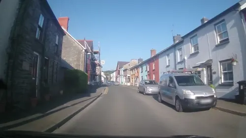
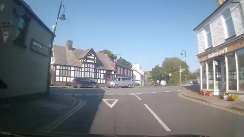
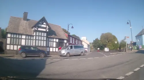
Photos of Tregaron

Museums and landmarks2


Bremia
Monument and historic site · 3.0 mi
Archaeological site in Ceredigion, Wales, UK
Parks, trails and playgrounds2

Restaurants and cafes10





Where to stay1

History
Tregaron received its royal charter as a town in 1292. It owes its origin and growth to its central location in the upper Teifi Valley. It was the market town for the scattered agricultural communities in the broad, fertile countryside to the south and the rich landowners with extensive holdings in the uplands to the east, the home of many sheep and few people. To the north was Cors Caron which was a fertile land when drained, and to the west a hilly region with self-sufficient farmers on smallholdings of a few acres. These people all converged on Tregaron for the weekly market and the annual fair, Ffair Garon, where the sale of poultry, pigs, cattle and horses took place. The charter for the yearly fair was granted by Edward I in the 13th century. Sheep fairs were held in May and June and two hiring fairs took place in November. A large number of taverns and inns in the town catered for the influx of country folk to these events.
Read more of the history
In the middle of the 18th century, Matthew Evans kept an inn in the town. He had two sons and a daughter who were celebrated robbers and collectively known as Plant Mat ('Matthew's children' in English). They lived for several years in a cave near Devils Bridge which still bears their name. They terrorized the district and would give to their friends a glove to act as a passport and identify them to their brethren. It was difficult to apprehend the trio because of the narrowness of the entrance to the cave which made it impossible to storm. After several years of success, they committed a murder and, eventually being taken, were sentenced to death and executed.
Tregaron was a main gathering place for the drovers who, before the advent of rail transport, herded large numbers of cattle, sheep and even geese hundreds of miles to the markets of southeast England. Many Tregaron men were drovers and accumulated considerable wealth in the process. They acted as news carriers and unofficial postmen and some were adept at avoiding tollgates.
The Tregaron area had a number of water-driven woollen mills and was a centre for the manufacture of hosiery. Woollen socks were knitted at home by men, women and children and sold at the market, often to dealers who resold them in the industrial valleys of South Wales.
From the History section of Tregaron on Wikipedia, under CC BY-SA 4.0.
More about Tregaron
Arts and culture
The church is dedicated to St Caron. He was a man of lowly origins but "his courage and generous deportment obtained him the sovereignty in Wales: he made war against the Romans, reigned seven years and was buried in Tregarron". He is almost certainly the same person as Carausius (Roman name) who took power in Britain in 286 and was assassinated in 293 by Allectus (also see Carausian Revolt). According to Geoffrey of Monmouth in the translation from Welsh "there was a young man of the name of Caron, of a British family, but of low degree, who... went to Rome, and solicited the Senate to grant him permission and aid to protect the sea coasts of Britain... [He] proposed to the Britons that they should make him king... Allectus with three legions... overpowered him..." An early Christian stone slab bearing the name Carausius and the Chi Rho symbol is preserved in Penmachno. The church has a tower and stands on a rocky eminence. It consists of a simple nave and chancel.
Other notable buildings in the town include the 13th-century Talbot Hotel, which supposedly has an elephant buried in its grounds. The remote chapel Soar y mynydd is close to Tregaron. In March, 1977, a cottage near Tregaron was one target of an Operation Julie police raid in which vast quantities of the drug LSD were seized.
Education
The Tregaron district has a 'through-age' school (ages 3 to 16 years), Ysgol Henry Richard, administered by Ceredigion County Council.
From the Wikipedia article Tregaron, under CC BY-SA 4.0.
Notable people from Tregaron
 Henry RichardBritish politician (1812-1888)Photo: William Williams, Public domain
 Wynne Melville JonesWelsh artistPhoto: Stefanik, CC BY-SA 4.0
 Twm Siôn CatiWelsh poet and genealogist, later a figure in Welsh folklorePhoto: Eirian Evans, CC BY-SA 2.0
- Nia CaronWelsh actress
- Annie DaviesWelsh radio and television producer
- David DaviesWelsh Conservative politician, born 1870
- Sir David NicholasBritish broadcast journalist and ITN Editor and Chairman (1930–2022)
- William EvansBritish cardiologist, born 1895 (1895–1988)
Born in Tregaron, according to Wikidata (CC0). Each name links to its Wikipedia article.
Churches and places of worship2
Shopping5
Schools, colleges and libraries1
Healthcare2
Map of Tregaron
25 places. The map loads OpenStreetMap tiles when you open it.
Getting there and nearby towns
Swansea Airport (SWS) is the nearest airport with scheduled flights listed in OpenStreetMap, 43 miles away.
- Aberystwyth 15 mi northwest, about 24 min by car
- Ammanford 30 mi south, about 48 min by car
- Carmarthen 30 mi southwest, about 48 min by car
- Ystalyfera 32 mi south, about 51 min by car
- Newtown 34 mi northeast, about 54 min by car
- Clydach 37 mi south, about 1 h by car
- Llanelli 38 mi south, about 1 h by car
- Gorseinon 38 mi south, about 1 h by car
- Neath 39 mi south, about 1 h by car
- Swansea 41 mi south, about 1 h by car
Drive times are estimates from straight-line distance, not routes.
Towns near Tregaron


Keep exploring
Local news
Headlines from INDB.
Reviews, tips and questions
Loading what members have shared...
Sources and licences
- GeoNames (CC BY 4.0): population, coordinates, regions and time zone
- Mapillary (see each image): photos
- OpenStreetMap contributors (ODbL 1.0): places, airports, map data
- Wikidata (CC0 1.0): elevation, founding date, time zone, website, landmarks and historic places
- Wikimedia Commons (see each image): photos
- Wikipedia (CC BY-SA 4.0): overview and history text
Photo credits
- St David's Church, Llanddewi Brefi J01, Jason.nlw, CC BY-SA 4.0
- Church of Saint Caron, PKwicipics, CC BY-SA 3.0
- Statue of Henry Richard, Tregaron 2017 C, Llywelyn2000, CC BY-SA 4.0
- Talbot Hotel (Y Talbot), PKwicipics, CC BY-SA 3.0
- Y Llew Coch, PKwicipics, CC BY-SA 3.0
- Henry Richard Esq MP, William Williams, Public domain
- Optare Solo in Ceredigion, Wales (28938150980), Jeremy Segrott from Cardiff, Wales, UK, CC BY 2.0
- Cacennau Gwen, Rhydian Wilson, CC BY-SA 4.0
- Street-level photo, trigpoint, CC BY-SA 4.0
- Street-level photo, trigpoint, CC BY-SA 4.0
- Street-level photo, trigpoint, CC BY-SA 4.0
- Street-level photo, trigpoint, CC BY-SA 4.0
- Street-level photo, trigpoint, CC BY-SA 4.0
Page built November 10, 2026. Spotted a mistake? Tell us or suggest a place.