


Aberystwyth, United Kingdom
Aberystwyth is a town of 18,749 people in Wales, United Kingdom, founded in 1109.
Why visit Aberystwyth
Townapedia lists 11 museums and landmarks, 23 parks and trails, 89 places to eat, 24 places to stay and 13 attractions in and around town.
Highlights include Commodore Cinema, Aberystwyth Arts Centre, Aberystwyth Castle and Ceredigion Museum.
Weather in Aberystwyth
Forecast from MET Norway (CC BY 4.0). Full forecast
About Aberystwyth
Aberystwyth (; Welsh: [abɛˈrəstʊɨθ] ) is a university and seaside town and a community in Ceredigion, Wales. It is the largest town in Ceredigion and 16 miles (26 km) from Aberaeron, the county's other administrative centre. In 2021, the population of the town was 14,640.
From the Wikipedia article Aberystwyth (this version), under CC BY-SA 4.0.
Travel tips from other travellers: Aberystwyth on Wikivoyage (CC BY-SA 4.0).
Photos of Aberystwyth

Things to do13


Aberystwyth Arts Centre
Cinema and theater · 0.8 mi
Arts centre of the University of Wales in Aberystwyth, Wales

King's Hall
Cinema and theater
Former theatre and entertainment complex in Aberystwyth, Wales






1 more on the map.
Museums and landmarks11


Ceredigion Museum
Museum
Local museum in Aberystwyth, Wales, United Kingdom


Aberystwyth War Memorial
Monument and historic site · 0.4 mi
By Mario Rutelli, unveiled 1923



Aberystwyth University Ceramics Collection
Museum · 0.8 mi
Ceramics collection in Ceredigion, Wales

Parks, trails and playgrounds23



Tan-y-Bwlch, Aberystwyth
Park · 1.5 mi
Nature reserve near Aberystwyth, Wales




11 more on the map.
Restaurants and cafes89
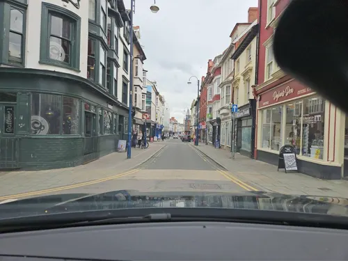
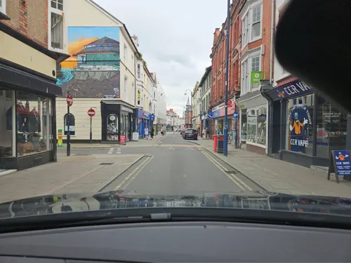
Mama Fay's
Restaurant · Caribbean
2a Ffordd Portland / Portland Road, Aberystwyth
Tu-Sa 10:00-22:00; Su 12:00-16:00
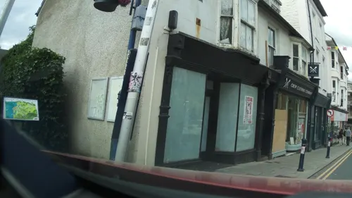
Penguin Pizza
Restaurant · Pizza
8 Heol y Wig / Pier Street, Aberystwyth
Mo-Sa 08:00-24:00; Su 16:00-24:00

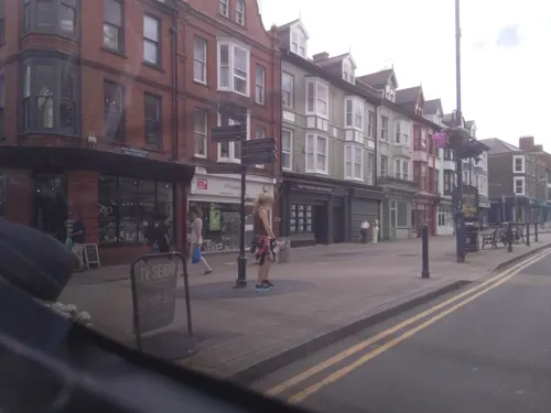


Baba Yummy Cafe
Cafe · Ukrainian
40 Bridge Street, Aberystwyth
We-Sa 11:00-21:00; Su 11:00-20:00
Khop Chai Deu
Restaurant · Thai
36 North Parade
Mo,Su off; Tu-Fr 17:00-21:00; Sa 13:00-21:00
77 more on the map.
History
There is evidence that during the Mesolithic Age the area of Tan-y-Bwlch at the foot of Pen Dinas (Penparcau) was used as a flint knapping floor for hunter-gatherers making weapons from flint that was deposited as the ice retreated.
The remains of a Celtic fortress on Pen Dinas (or more correctly 'Dinas Maelor'), a hill in Penparcau overlooking Aberystwyth, indicates that the site was inhabited before 700 BC. On a hill south of the present town, across the River Ystwyth, are the remains of a medieval ringfort believed to be the castle from which Princess Nest was abducted. This rare survival is now on private land and can only be accessed by arrangement.
The recorded history of Aberystwyth may be said to date from the building of a fortress in 1109 by Gilbert Fitz Richard (grandfather of Richard de Clare, known as Strongbow, the Cambro-Norman lord notable for his leading role in the Norman invasion of Ireland). Gilbert Fitz Richard was granted lands and the lordship of Cardigan by Henry I, including Cardigan Castle. The fortress built in Aberystwyth was located about a mile and a half south of today's town, on a hill over the south bank of the Ystwyth River, thus giving the settlement of Aberystwyth its name. The location is now known as Tan-Y-Castell.
Read more of the history
Aberystwyth was usually under the control of the princes of Deheubarth, but its position close to the border with Gwynedd and Powys left it vulnerable to attacks from the leaders of those polities. The town was attacked by Gwenwynwyn ab Owain in 1197, an assault in which Maelgwn ap Rhys was captured. Llywelyn the Great attacked and seized the town in late 1208, building a castle there before withdrawing.
Edward I replaced Strongbow's castle in 1277, after its destruction by the Welsh. His castle was, however, built in a different location, at the current Castle Hill, the high point of the town.
Between the years 1404 and 1408 Aberystwyth Castle was in the hands of Owain Glyndŵr but finally surrendered to Henry, Prince of Wales, the future King Henry V, on 23 September 1408. Shortly after this, the town was incorporated under the title of Ville de Lampadarn (the ancient name of the place being Llanbadarn Gaerog or the fortified Llanbadarn, to distinguish it from Llanbadarn Fawr, the village one mile (1.6 km) inland. It is thus styled in a Royal charter granted by Henry VIII but, by Elizabeth I's time, the town was invariably named Aberystwyth in all documents.
From 1639 to 1642, silver coins were minted at Aberystwyth Castle on behalf of the Royal Mint, using silver from local mines. £10,500 in currency was produced, equivalent to 2.5 million silver pennies.
In 1649, Parliamentarian troops razed the castle, although portions of three towers still exist. In 1988, an excavation within the castle area revealed a complete male skeleton, deliberately buried. Though skeletons rarely survive in Wales' acidic soil, this skeleton was probably preserved by the addition of lime from the collapsed building. Affectionately known as "Charlie" and now housed in the Ceredigion Museum in the town, he probably dates from the English Civil War period, and is likely to have died during the Parliamentarian siege. His image is featured in one of nine mosaics created to adorn the castle's walls.
The development of Aberystwyth's Port contributed to the town's economic development during the late 18th and early 19th centuries. Port improvements were carried out in both 1780 and 1836, with a new Customs House constructed in 1828. Rural industries and craftsmen were also an important part of life in this country town. The local trade directory for 1830 shows that there were in Aberystwyth:
Twenty boot makers, eight bakers, two corn millers, eleven carpenters and joiners, one cooper, seven tailors, two dressmakers, two straw hat makers, two hat makers, three curriers, four saddlers, two tinsmiths, six maltsters, two skinners, four tanners, eight stonemasons, one brewer, four lime burners, three shipwrights, three wheelwrights, five cabinet makers, one nail maker, one rope maker and one sail maker.
The Cambrian Railways line from Machynlleth reached Aberystwyth in 1864, closely followed by rail links to Carmarthen, which resulted in the construction of the town's impressive station. The Cambrian Line opened on Good Friday 1869, the same day that the new 292 metres (958 ft) Royal Pier, designed by Eugenius Birch, opened, attracting 7,000 visitors.
The railway's arrival gave rise to something of a Victorian tourist boom, with Aberystwyth becoming a significant holiday destination for working and middle-class families from South Wales in particular. The town was once even billed as the "Biarritz of Wales". During this time, a number of hotels and fine townhouses were built including the Queens Hotel, later renamed Swyddfa'r Sir (County Office) when used as offices by the town council, and most recently used as the external scenes of the police station in the television show Hinterland. One of the largest of these hotels, "The Castle Hotel", was never completed as a hotel but, following bankruptcy, was sold cheaply to the Welsh National University Committee, a group of people dedicated to the creation of a Welsh University. The University College of Wales (later to become Aberystwyth University) was founded in 1872 in this building.
Aberystwyth was a contributory parliamentary borough until the Third Reform Act, which merged its representation into that of the county in 1885.
From the History section of Aberystwyth on Wikipedia, under CC BY-SA 4.0.
More about Aberystwyth
Geography
Penglais Nature Park (Welsh: Parc Natur Penglais) is a woodland overlooking the town. The park was created in 1995 from a disused quarry and surrounding woodland that had formerly been part of the Richardes family estate. In spring, a carpet of bluebells bloom, in common with the many other bluebell woods.
The park covers 27 acres (11 ha). It was the first nature reserve to open in Ceredigion and is the only UNESCO Man and Biosphere urban reserve in Wales.
Aberystwyth experiences an oceanic climate (Köppen climate classification Cfb) similar to almost all of the United Kingdom. This is particularly pronounced due to its west coast location facing the Irish Sea. Air undergoes little land moderation and so temperatures closely reflect the sea temperature when winds are coming from the predominant onshore (westerly) direction. The nearest Met Office weather station is Gogerddan, 3 miles (4.8 km) to the north-east,and at a similar elevation.
The absolute maximum temperature is 35.8 °C (96.4 °F), set during July 2022. Typically, the warmest day will average 28.0 °C (82.4 °F) and 5.6 days will achieve at least 25.1 °C (77.2 °F).
The absolute minimum temperature is −12.4 °C (9.7 °F), set in December 1981. Typically 38.8 days will register an air frost.
Economy
The all-organic dairy unit of Rachel's Organic is based in Glan yr Afon and is the largest private sector employer in Aberystwyth.
The Cambrian News newspaper came to Aberystwyth from Bala in 1870, after it was purchased by Sir John Gibson. Printed in Oswestry, in May 1880 the paper integrated operations in a former Malthouse in Mill Street. Owned by the Read family from 1926, printing was contracted out in 1993 enabling the move of editorial staff to the current open-plan offices on Llanbadarn Fawr Science Park. On the death of Henry Read, the paper was purchased in 1999 by Sir Ray Tindle, whose company owns more than 200 weekly newspapers in Britain. Now printed in tabloid format, Cambrian News is the second-largest weekly-print circulation newspaper in Wales, with 24,000 copies in six regional editorial versions, read by 60,000 weekly readers. The circulation area of mid, west and north Wales covers 3,000 square miles (7,800 km2).
Arts and culture
The first public library in Aberystwyth was opened in Compton House, Pier Street, on 13 October 1874. In 1882, the library was moved to the Assembly Rooms which were leased to the council for 21 years. The lease expired in 1903 and the library returned to Pier Street, this time to the Old Banking Library at the corner with Eastgate Street, although this was short lived. A Carnegie library was built in Aberystwyth in 1905, with a grant of £3,000. Located in Corporation Street, it was designed by the architect Walter Payton of Birmingham, who was one of 48 who entered the competition to design the building. It was formally opened on 20 April 1906 by Mrs Vaughan Davies, wife of the local MP. The town library moved to Aberystwyth Town Hall, now named after Canolfan Alun R. Edwards, following the building's refurbishment in 2012.
The National Library of Wales is the national legal deposit library of Wales. Established in 1907, it is a Welsh Government sponsored body. According to Cyril Evans, the library's centenary events co-ordinator, "The library is considered to be one of the world's greatest libraries, and its international reputation is certainly something that all Welsh men and women are intensely...proud of". Welsh is the main medium of communication within the organisation; it aims to deliver all public services in Welsh and English.
Education
Two comprehensive schools serve the town and a wider rural area:
Ysgol Gyfun Gymunedol Penweddig, which uses Welsh as the primary language of tuition
Ysgol Penglais School teaches in English, with Welsh as a subject.
There are currently three primary schools within the town limits: Plascrug, Saint Padarns (Roman Catholic) and Ysgol Gymraeg. Ysgol Gymraeg was the first designated Welsh medium school in Wales, originally established as a private school in 1939 by Sir Ifan ab Owen Edwards as Ysgol Gymraeg yr Urdd.
Aberystwyth University's (Welsh: Prifysgol Aberystwyth) predecessor, University College Wales, was founded in 1872 and renamed the University of Wales, Aberystwyth in the mid-1990s. Prior to the college's establishment, Wales had very limited academic-degree capability through St David's College, Lampeter, founded in 1822; it is now the University of Wales, Trinity Saint David.
From the Wikipedia article Aberystwyth, under CC BY-SA 4.0.
Notable people from Aberystwyth
 Roger ReesBritish actor (1944–2015)Photo: Princeton Public Library from..., Public domain
 Tom CullenBritish actorPhoto: Drexl cullen, CC BY-SA 4.0
 Stephen WilliamsBritish cyclist and Olympian (born 1996)Photo: Martino Photos, CC BY-SA 2.0
 John Ainsworth-DavisBritish athlete (1895-1976)Photo: Agence de presse Meurisse, Public domain
 Steve JonesWelsh geneticist & biologist (1944-)Photo: Michal Maňas, CC BY 3.0
 Stephen JonesWelsh rugby union footballer and coachPhoto: Stefano Delfrate, CC BY-SA 2.0
 Kay SwinburneBritish politician (born 1967)Photo: Foto-AG Gymnasium Melle, CC BY-SA 3.0
 Andrew JohnWelsh ArchbishopPhoto: Alfred Cannan, CC0
 Owen EdwardsWelsh broadcaster (1933–2010)Photo: Geoff Charles, CC BY-SA 4.0
 Prano Bailey-BondBritish directorPhoto: Mark Chapman, CC BY-SA 4.0
- Sharon MaguireBritish television director (born 1960)
- Aneirin Hughessinger and actor
Born in Aberystwyth, according to Wikidata (CC0). Each name links to its Wikipedia article.
Where to stay24
Churches and places of worship18
The Church of Jesus Christ of Latter-day Saints
Church · Latter-Day Saints · 0.9 mi
Cefn Llan, Aberystwyth
Shopping25
Gas and EV charging7
Schools, colleges and libraries12
St. Padarn's Catholic Primary School
School · Roman Catholic · 0.4 mi
Llanbadarn Road, Aberystwyth
Healthcare4
Map of Aberystwyth
226 places. The map loads OpenStreetMap tiles when you open it.
Getting there and nearby towns
Haverfordwest Airport (HAW) is the nearest airport with scheduled flights listed in OpenStreetMap, 55 miles away.
- Newtown 34 mi east, about 54 min by car
- Carmarthen 40 mi south, about 1 h by car
- Ammanford 43 mi south, about 1 h 15 min by car
- Ystalyfera 47 mi south, about 1 h 15 min by car
- Llanelli 51 mi south, about 1 h 15 min by car
- Clydach 51 mi south, about 1 h 15 min by car
- Gorseinon 52 mi south, about 1 h 30 min by car
- Neath 53 mi south, about 1 h 30 min by car
- Swansea 55 mi south, about 1 h 30 min by car
- Merthyr Tydfil 55 mi southeast, about 1 h 30 min by car
Drive times are estimates from straight-line distance, not routes.
Towns near Aberystwyth


Keep exploring
Local news
Headlines from INDB.
Reviews, tips and questions
Loading what members have shared...
Sources and licences
- GeoNames (CC BY 4.0): population, coordinates, regions and time zone
- Mapillary (see each image): photos
- OpenStreetMap contributors (ODbL 1.0): places, airports, map data
- Wikidata (CC0 1.0): elevation, founding date, time zone, website, landmarks and historic places
- Wikimedia Commons (see each image): photos
- Wikipedia (CC BY-SA 4.0): overview and history text
Photo credits
- Arfordir Aberystwyth, Ceredigion - Aberystwyth SAC Special Areas of Conservation, West Wales Marine 01, Llywelyn2000, CC BY-SA 4.0
- AberystwythUniversityStudio, Vertigogen, CC BY-SA 2.0
- Neuadd y Brenin Baravin, Stefanik, CC BY-SA 4.0
- Arfordir Aberystwyth, Ceredigion - Aberystwyth SAC Special Areas of Conservation, West Wales Marine 43, Llywelyn2000, CC BY-SA 4.0
- No 9 At Devil's Bridge, John Lucas, CC BY-SA 2.0
- Aberystwyth - panoramio (20), Tanya Dedyukhina, CC BY 3.0
- EglwysSantPadarn LlanbadarnFawr, Pricey, CC BY 3.0
- Queen's Road English Methodist Church (1), GeraintTudur2, CC BY-SA 3.0
- National Library of Wales, Ian Capper, CC BY-SA 2.0
- Aberystwyth Old University Building, Eos12, Public domain
- Pen Dinas, Aberywstwyth, Ceredigion, Cymru (Wales); bryngaer (hillfort) June 2023 09, Llywelyn2000, CC BY-SA 4.0
- Aberystwyth Wales UK 1985, Manfred Heyde, CC BY-SA 3.0
- Ysgol Gyfun Gymunedol Penweddig, Simon Cobb, CC0
- Yr Ysgol Gymraeg, PKwicipics, CC BY-SA 3.0
- Ysgol Gymunedol Plascrug, PKwicipics, CC BY-SA 3.0
- Ysgol Llwyn Yr Eos, PKwicipics, CC BY-SA 3.0
- Cofeb Rhyfel Aberystwyth War Memorial, Ceredigion, Cymru (Wales) - Gradd II 06, Llywelyn2000, CC BY-SA 4.0
- Capel Bethel, Aberystwyth, Reading Tom from Reading, UK, CC BY 2.0
- Seion, capel yr Annibynwyr, Aberystwyth, GeraintTudur2, CC BY-SA 3.0
- Eglwys y Santes Fair, Aberystwyth, Ian Capper, CC BY-SA 2.0
- Sinema'r Commodore, Aberystwyth, Stefanik, CC BY-SA 4.0
- Hugh Owen Library, Simon Cobb, CC0
- Physical Sciences Library, PKwicipics, CC BY-SA 3.0
- Capel y Morfa, Aberystywth adeilad (Mai 2018), Stefanik, CC BY-SA 4.0
- Bottle & Barrel, Probinaries, CC BY-SA 3.0
- Aberystwyth University, School of Art Museum & Gallery, PKwicipics, CC BY-SA 3.0
- English Presbyterian Church, PKwicipics, CC BY-SA 3.0
- Elim Pentecostal Church (1), Simon Cobb, CC0
- Aberystwyth Beach - panoramio, Keith Ruffles, CC BY 3.0
- Memorial plaque to Annie Hughes-Griffiths, Rupertmaesglas, CC BY-SA 4.0
- Pen Dinas, Spacequack, CC0
- Ceredigion Museum (28121083292), Reading Tom from Reading, UK, CC BY 2.0
- Wellington Monument, Pendinas, Jason.nlw, CC BY-SA 4.0
- Clarach beach, Dyfi Biosphere, Ellievking1, CC BY-SA 4.0
- Street-level photo, toho, CC BY-SA 4.0
- Street-level photo, toho, CC BY-SA 4.0
- Street-level photo, southglos, CC BY-SA 4.0
- Street-level photo, southglos, CC BY-SA 4.0
- Street-level photo, southglos, CC BY-SA 4.0
- Street-level photo, southglos, CC BY-SA 4.0
- Street-level photo, jopparn, CC BY-SA 4.0
- Street-level photo, jopparn, CC BY-SA 4.0
- Street-level photo, laye, CC BY-SA 4.0
- Street-level photo, toho, CC BY-SA 4.0
- Street-level photo, toho, CC BY-SA 4.0
- Street-level photo, southglos, CC BY-SA 4.0
- Street-level photo, toho, CC BY-SA 4.0
- Street-level photo, jopparn, CC BY-SA 4.0
- Street-level photo, southglos, CC BY-SA 4.0
- Street-level photo, southglos, CC BY-SA 4.0
- Street-level photo, jopparn, CC BY-SA 4.0
- Street-level photo, laye, CC BY-SA 4.0
- Street-level photo, southglos, CC BY-SA 4.0
- Street-level photo, southglos, CC BY-SA 4.0


Page built November 10, 2026. Spotted a mistake? Tell us or suggest a place.