


Machynlleth, United Kingdom
Machynlleth is a town of 2,235 people in Wales, United Kingdom.
Why visit Machynlleth
Townapedia lists 12 museums and landmarks, 2 parks and trails, 14 places to eat, 3 places to stay and 3 attractions in and around town.
Highlights include Dyfi Bridge, Foel-Goch, MOMA Wales and Celtica.
Weather in Machynlleth
Forecast from MET Norway (CC BY 4.0). Full forecast
About Machynlleth
Machynlleth (Welsh: [maˈχənɬɛθ] ) is a market town, community and electoral ward in Powys, Wales, and within the historic boundaries of Montgomeryshire. It is in the Dyfi Valley at the intersection of the A487 and the A489 roads. It has a population of 2,098 (2024 mid-year estimate). At the 2001 Census it had a population of 2,147, rising to 2,235 in 2011 and falling slightly to 2,163 in 2021.
From the Wikipedia article Machynlleth (this version), under CC BY-SA 4.0.
Travel tips from other travellers: Machynlleth on Wikivoyage (CC BY-SA 4.0).
Photos of Machynlleth

Things to do3


Museums and landmarks12


Centre for Alternative Technology
Museum · 2.3 mi
Eco-centre in Powys, mid-Wales, UK, demonstrating and teaching sustainable development

Owain Glyndŵr's Parliament House
Museum
The old site of the 15th c. Parliament of Wales; now a Grade I Listed Building in Machynlleth, Powys, Wales



Parks, trails and playgrounds2

Restaurants and cafes14

Blasau Delicatessen
Cafe · Cake, Sandwich, Coffee Shop
13 Heol Pen'Rallt
Tu-Fr 10:00-14:00; Sa 10:00-14:00,15:00-21:00; Su,Mo off

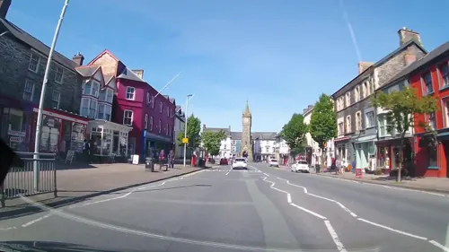
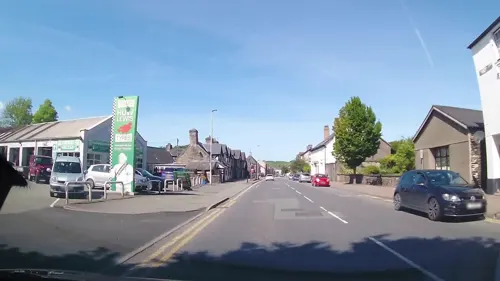
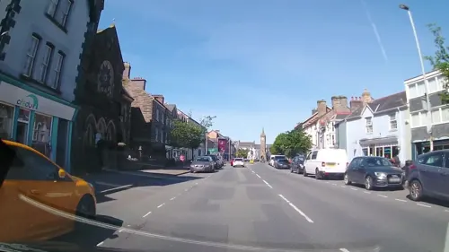
2 more on the map.
History
There is a long history of human activity in the Machynlleth area. In the late 1990s, radiocarbon dating showed that copper was being mined in the Early Bronze Age (c. 2,750 years ago), within 1 mile (1.6 km) of the town centre.
The Romans settled in the area; they built a fort at Cefn Caer, near Pennal, 2.5 miles (4 km) west of Machynlleth, and are reputed to have had two look-out posts above the town at Bryn-y-gog and Wylfa, and another fort, called Maglona, at Machynlleth. One of the earliest written references to Machynlleth is the Royal charter granted in 1291 by Edward I to Owen de la Pole, Lord of Powys. This gave him the right to hold "a market at Machynlleth every Wednesday for ever and two fairs every year". The Wednesday market is still a busy and popular day in Machynlleth 700 years later.
The Royal House, which stands on the corner of the Garsiwn, is another of the mediaeval houses that can still be seen today. According to local tradition, Dafydd Gam, a Welsh ally of the English kings, was imprisoned here from 1404 to 1412 for attempting to assassinate Owain Glyndŵr. After his release by Glyndŵr, ransomed Gam fought alongside Henry V at the Battle of Agincourt and is named amongst the dead in Shakespeare's Henry V. The name Royal House undoubtedly refers to the tradition that Charles I stayed at the house in 1643.
Read more of the history
The weekly market and biannual fair thrived, and in 1613 drew complaints from other towns whose trading in cloth was being severely affected. A document dated 1632 shows that animals for sale came from all over Merionethshire, Montgomeryshire, Cardiganshire, Carmarthenshire and Denbighshire, and prospective buyers came from Flintshire, Radnorshire, Brecknockshire, Herefordshire and Shropshire, in addition to the above.
The Dyfi Bridge (Welsh: Pont ar Ddyfi) was first mentioned in 1533, by Geoffrey Hughes, who left £6 13s 4d (ten marks) towards the making of the bridge.
Rowland Pugh was the Lord of Meirionedd, and lived at Mathafarn about two miles east of Machynlleth. Pugh supported the Royalist side in the English Civil War. On 2 November 1644, Sir Thomas Myddleton of Chirk Castle was marching on Machynlleth with a force of the Parliamentarian army, when he was ambushed by a force organised by Pugh. In retaliation for the attack, Myddleton burned down Mathafarn on 29 November 1644, along with a number of houses in Machynlleth.
Laura Ashley's first shop was opened in Machynlleth (at 35 Maengwyn Street) in 1961.
The disappearance of April Jones in October 2012 received a large amount of coverage in the UK media.
In 1846 Mary Cornelia, the daughter of a local landowner Sir John Edwards married Viscount Seaham, the second son of the third Marquess of Londonderry and they set up home at Plas Machynlleth. Seaham became Earl Vane on the death of his father and the fifth Marquess on the death of his half-brother.
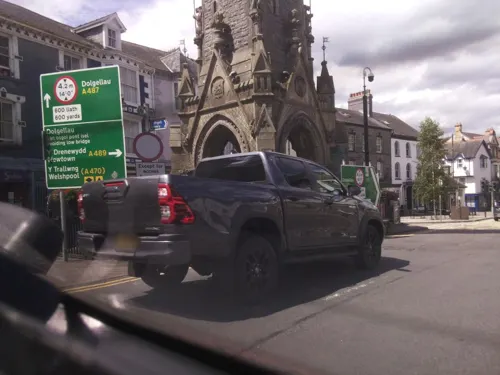
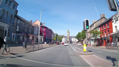
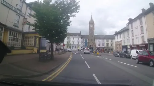
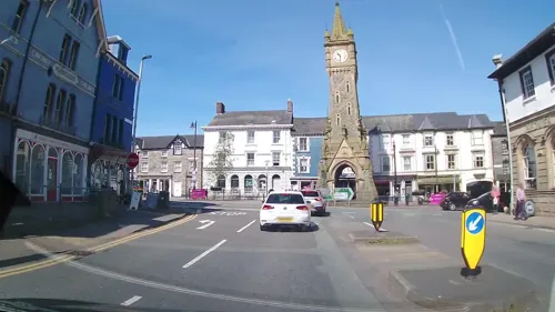
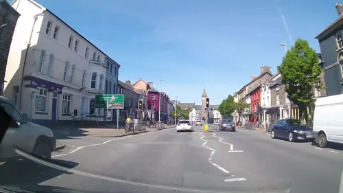
To celebrate the 21st birthday of the Seahams’ eldest son, Viscount Castlereagh, the townspeople paid for the clock tower which stands at the town's main road intersection. Erected on the site of the old town hall, it stands at 23.7m tall and has become the symbol of the town. The foundation stone was laid on 15 July 1874 amid great festivities. The clock tower, designed by Henry Kennedy of Bangor and now a Grade II listed monument, cost £800; the townspeople raised £1,000, of which the remainder was spent planting trees along nearby streets. Meanwhile, a new town hall was erected on the east side of Penrallt Street in 1872; after becoming unsafe, it was demolished in 1968.
Another son, Lord Herbert Vane-Tempest, was the last member of the family to live at the Plas and was killed in the Abermule train collision on the Cambrian Railways, of which he was a director.
The house was given to the townspeople in December 1948 under the stewardship of the then Machynlleth Urban District Council.
Although many sources state that the foundation stone was laid in 1874, the clock tower’s own dedicatory plaque records that it was erected to commemorate the coming of age of Charles Stewart Vane‑Tempest, Viscount Castlereagh, on 15 July 1873. Local historical accounts and community records note that the public subscription that funded the tower also provided for street planting, and that the town celebrated its centenary in July 1973 on the basis of the 1873 date. The clock was constructed by Edward Edwards and his brother John Edwards, local builders whose families continued to live in Machynlleth and its surrounding area.
Various local government re-organisations saw responsibility for the Plas pass first to Montgomeryshire District Council, who in 1995 converted it into the Celtica visitor centre. Celtica interpreted the history and culture of the Celts with a walk-through audio-visual exhibition housed in a purpose-built addition to the house. The £3 million attraction was part-funded by the European Union. The centre had a high-profile in the Welsh media, with opera singer Bryn Terfel officially opening the attraction in October 1995.
Powys County Council took over Celtica and the house when it was formed as a unitary authority in 1997. The centre was successful in attracting tourists, school groups and conferences for a number of years; however initial predictions of visitor numbers proved to be too ambitious, and the council was unwilling to prolong its subsidy. With little scope for alternative investment, Celtica closed in March 2006, and the house stood empty while Powys County Council sought to relinquish responsibility for it in line with their policy of selling many of their publicly owned buildings.
From the History section of Machynlleth on Wikipedia, under CC BY-SA 4.0.
More about Machynlleth
Arts and culture
Tourism is the primary employment sector with a range of activity based attractions (for example several mountain biking trails) as well as the visitor centre at the Centre for Alternative Technology. Agriculture continues to play a significant part in the make-up of the town and surrounding area.
The town has a market on Wednesdays which includes traditional Welsh, Spanish and French food stalls.
In March 2026 Machynlleth submitted a bid to be named as the first UK Town of Culture.
In May 2026 Led Zeppelin frontman Robert Plant backed Machynlleth's bid to become the UK Town of Culture.
The town has hosted the Machynlleth Comedy Festival annually since May 2010, featuring comedians such as Jon Richardson, Pappy's, Josie Long, Stewart Lee and Richard Herring. The festival dominates the town for a weekend, with events running over three days in nine venues.
Machynlleth lies on Glyndŵr's Way and the Dyfi Valley Way, two long-distance footpaths.
From the Wikipedia article Machynlleth, under CC BY-SA 4.0.
Notable people from Machynlleth
 Edward M. LewisWelsh - American academic and baseball playerPhoto: Original photographer unknown, Public domain
 John JonesBritish antiquarianPhoto: Thomas Williams Hunt, Public domain
- Gareth GlynBritish composer and broadcaster
- David DaviesWelsh clergyman, born 1741/2
- Peter ReesFootballer (born 1932)
- John Evansminer and political figure in British Columbia
- Emrys JamesWelsh actor (1928-1989)
- Philip BaxterBritish chemical engineer (1905-1989)
- Sid ThomasBritish association football player (born 1919)
- Lewis Meredithpreacher and writer
- David Emrys LewisWelsh poet and journalist
Born in Machynlleth, according to Wikidata (CC0). Each name links to its Wikipedia article.
Where to stay3
Churches and places of worship4
Shopping8
Gas and EV charging2
Schools, colleges and libraries3
Healthcare2
Map of Machynlleth
53 places. The map loads OpenStreetMap tiles when you open it.
Getting there and nearby towns
RAF Valley - Anglesey Airport (VLY) is the nearest airport with scheduled flights listed in OpenStreetMap, 53 miles away.
- Aberystwyth 15 mi southwest, about 25 min by car
- Newtown 24 mi east, about 38 min by car
- Rhayader 25 mi southeast, about 40 min by car
- Penrhyndeudraeth 25 mi north, about 41 min by car
- Porthmadog 26 mi northwest, about 42 min by car
- Tregaron 26 mi south, about 42 min by car
- Welshpool 30 mi east, about 48 min by car
- Pwllheli 31 mi northwest, about 50 min by car
- Pant 35 mi northeast, about 57 min by car
- Oswestry 38 mi northeast, about 1 h by car
Drive times are estimates from straight-line distance, not routes.
Towns near Machynlleth


Keep exploring
Local news
Headlines from INDB.
Reviews, tips and questions
Loading what members have shared...
Sources and licences
- GeoNames (CC BY 4.0): population, coordinates, regions and time zone
- Mapillary (see each image): photos
- OpenStreetMap contributors (ODbL 1.0): places, airports, map data
- Wikidata (CC0 1.0): elevation, founding date, time zone, website, landmarks and historic places
- Wikimedia Commons (see each image): photos
- Wikipedia (CC BY-SA 4.0): overview and history text
Photo credits
- Machynlleth - panoramio (4), Tanya Dedyukhina, CC BY 3.0
- Machynlleth Community, Peter Glyn, CC BY-SA 3.0
- Machynlleth - panoramio (2), Tanya Dedyukhina, CC BY 3.0
- Machynlleth Town Clock, Gerald England, CC BY-SA 2.0
- Former Smithy to Plas Machynlleth, Heol Pentrehedyn, Peter Glyn, CC BY-SA 3.0
- Y Llew Gwyn Machynlleth, Llywelyn2000, CC BY-SA 3.0
- Machynlleth - panoramio (1), Tanya Dedyukhina, CC BY 3.0
- Prince Owain Glyndwr's 15c Parliament house at Machynlleth, Powys, Wales - Senedd-dy Owain Glyn Dŵr, Machynlleth 23, Llywelyn2000, CC BY-SA 4.0
- Eglwys Pennal (crop), Steven Penton, CC BY 2.0
- The Tannery, MOMA, Machynlleth 05, Tyssil, CC BY-SA 4.0
- Eglwys Sant Pedr Church of St Peter's, Machynlleth, Powys, Wales 01, Llywelyn2000, CC BY-SA 4.0
- War Memorial,Heol Penrallt, Peter Glyn, CC0
- White Lion, Machynlleth, Peter_Glyn, CC0
- Machynlleth library, JuliaC2006, CC BY 4.0
- Skinners Arms, Peter Glyn, CC0
- Celticahhgv, Hogyncymru, CC BY-SA 4.0
- No.12 Heol Pentrehedyn (Bodlondeb), Peter_Glyn, CC0
- Centre for Alternative Technology (28723902941), Tom Parnell from Scottish Borders, Scotland, CC BY-SA 2.0
- Maen Llwyd, Machynlleth standing stone, Celuici, CC BY-SA 4.0
- Roman Steps, Machynlleth, Celuici, CC BY-SA 4.0
- Street-level photo, southglos, CC BY-SA 4.0
- Street-level photo, trigpoint, CC BY-SA 4.0
- Street-level photo, trigpoint, CC BY-SA 4.0
- Street-level photo, msevilla00, CC BY-SA 4.0
- Street-level photo, trigpoint, CC BY-SA 4.0
- Street-level photo, trigpoint, CC BY-SA 4.0
- Street-level photo, trigpoint, CC BY-SA 4.0
- Street-level photo, msevilla00, CC BY-SA 4.0
- Street-level photo, trigpoint, CC BY-SA 4.0
- Street-level photo, southglos, CC BY-SA 4.0
- Street-level photo, southglos, CC BY-SA 4.0
- Street-level photo, trigpoint, CC BY-SA 4.0
- Street-level photo, trigpoint, CC BY-SA 4.0
- Street-level photo, trigpoint, CC BY-SA 4.0
- Street-level photo, trigpoint, CC BY-SA 4.0
- Street-level photo, southglos, CC BY-SA 4.0
- Street-level photo, trigpoint, CC BY-SA 4.0
- Street-level photo, southglos, CC BY-SA 4.0
- Street-level photo, trigpoint, CC BY-SA 4.0
- Street-level photo, trigpoint, CC BY-SA 4.0
- Street-level photo, trigpoint, CC BY-SA 4.0


Page built November 10, 2026. Spotted a mistake? Tell us or suggest a place.