


Bovington Camp, United Kingdom
Bovington Camp is a town of 2,586 people in England, United Kingdom, founded in 1899.
Why visit Bovington Camp
Townapedia lists 13 museums and landmarks, 1 park or trail, 14 places to eat, 4 places to stay and 3 attractions in and around town.
Highlights include Monkey World, The Tank Museum, Clouds Hill and Tadnoll and Winfrith Heath.
Weather in Bovington Camp
Forecast from MET Norway (CC BY 4.0). Full forecast
About Bovington Camp
Bovington Camp () is a British Army military base in Dorset, South West England. Together with Lulworth Camp it forms part of Bovington Garrison.
From the Wikipedia article Bovington Camp (this version), under CC BY-SA 4.0.
Photos of Bovington Camp


Things to do3

Monkey World
Zoo and aquarium · 0.8 mi
Animal Welfare Organization
Mo-Su 10:00-17:00; Jul-Aug Mo-Su 10:00-18:00; Dec 25 closed

Museums and landmarks13


Clouds Hill
Museum · 1.5 mi
Home of Lawrence of Arabia located in Dorset, England.



Bindon Abbey
Monument and historic site · 1.7 mi
Monastery in Wool, Dorset, England, UK
1 more on the map.
Parks, trails and playgrounds1
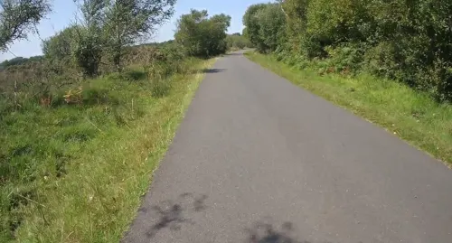
Tadnoll and Winfrith Heath
Park · 2.4 mi
Nature reserve in Dorset, UK
Restaurants and cafes14
Seven Stars (Freehouse)
Bar and pub · Regional, Sandwich, Steak House, Ice Cream, Fish And Chips, Barbecue, Burger, Traditional, Italian, Asian · 1.2 mi
East Burton Road, Wareham
Mo-Fr 10:30-15:00 (Food served 12:00-14:00), 17:45-23:00 (Food...
The Jurassic Coast Cafe
Cafe · Coffee Shop, Cakes, Ice Cream, Pizza, Indian, Fish And Chips, Cake, Burger, Breakfast, Lunch, Fish & Chips, Lunchboxes, Coffee, Tea · 1.2 mi
East Burton Road, Wareham
The Tamiya Café
Cafe · Burger, Pizza, Coffee Shop, Sandwich, Ice Cream · 0.4 mi
11:00-16:00

The Black Bear
Bar and pub · Regional, Chicken, Burger, Steak House, Sandwich, Italian, Coffee Shop, Seafood · 1.4 mi
High Street, Wareham
Mo-Th 10:30-23:00 (Food served 12:00-14:30, 18:00-21:00), Fri-Sa...

The Tank Museum Restaurant
Cafe · Regional, Sandwich, Ice Cream, Fish And Chips · 0.4 mi
10:00-16:30 (Food served 11:30-15:00)
2 more on the map.
History
The camps at Bovington and Lulworth were originally established in 1899 as an infantry training area and ranges. In 1916, they became training camps for the Heavy Branch of the Machine Gun Corps which relocated from Norfolk. The Heavy Branch was responsible for the operation of the tank in the British Army. In 1917 the Heavy Branch split from the Machine Gun Corps to become the Tank Corps, with the Depot and Central Schools being based at Bovington.
In 1937 the Central Schools became the Armoured Fighting Vehicles School, with driving and maintenance training at Bovington and gunnery at Lulworth. The School became known as the Royal Armoured Corps Centre in 1947, now renamed The Armour Centre.
From the History section of Bovington Camp on Wikipedia, under CC BY-SA 4.0.
Where to stay4
Churches and places of worship5
Kingdom Hall of Jehovah's Witnesses
Church · Jehovahs Witness · 1.5 mi
High Street, Wareham
Shopping2
Gas and EV charging2
Schools, colleges and libraries5
Healthcare2
Map of Bovington Camp
51 places. The map loads OpenStreetMap tiles when you open it.
Getting there and nearby towns
Bournemouth Airport (BOH) is the nearest airport with scheduled flights listed in OpenStreetMap, 18 miles away.
- Wool 1 mi southeast, about 2 min by car
- Bere Regis 4 mi north, about 6 min by car
- Puddletown 6 mi northwest, about 10 min by car
- Lytchett Matravers 8 mi northeast, about 13 min by car
- Dorchester 9 mi west, about 14 min by car
- Arne 9 mi east, about 14 min by car
- Corfe Castle 9 mi southeast, about 14 min by car
- Charminster 10 mi west, about 16 min by car
- Poole 11 mi east, about 18 min by car
- Weymouth 11 mi southwest, about 18 min by car
Drive times are estimates from straight-line distance, not routes.
Towns near Bovington Camp


Keep exploring
Local news
Headlines from INDB.
Reviews, tips and questions
Loading what members have shared...
Sources and licences
- GeoNames (CC BY 4.0): population, coordinates, regions and time zone
- Mapillary (see each image): photos
- OpenStreetMap contributors (ODbL 1.0): places, airports, map data
- Wikidata (CC0 1.0): elevation, founding date, time zone, website, landmarks and historic places
- Wikimedia Commons (see each image): photos
- Wikipedia (CC BY-SA 4.0): overview and history text
Photo credits
- CloudsHill1, LordHarris at English Wikipedia, CC BY 2.5
- Bovingtonpano, Hohum, CC BY-SA 3.0
- Royal Tank Regiment Memorial 2017 Bovington, Morio, CC BY-SA 4.0
- Exterior of The Tank Museum, Louise M Evans, CC BY-SA 4.0
- Big Willie (51406710589), DaveLevy, CC BY-SA 2.0
- A22 Churchill Mk.VI ‘T251952 D’ “Fording Height” (30337717787), Alan Wilson from Stilton, Peterborough, Cambs, UK, CC BY-SA 2.0
- A41 Centurion Mk13 ‘43 BA 71’ (30337719887), Alan Wilson from Stilton, Peterborough, Cambs, UK, CC BY-SA 2.0
- M60 A3 (7527999766), Simon Q from United Kingdom, CC BY 2.0
- Valentine (3665399437), Simon Q from United Kingdom, CC BY 2.0
- M3A1 Scout Car (4536521808), Simon Q from United Kingdom, CC BY 2.0
- British Challenger 1 (3666492274), Simon Q from United Kingdom, CC BY 2.0
- Armoured Car, Crossley Chevrolet (Indian Pattern) (4536126173), Simon Q from United Kingdom, CC BY 2.0
- Sd Kfz 251 8 Ausf C Armoured Ambulance (4536506652), Simon Q from United Kingdom, CC BY 2.0
- View of Tank floor (4536007261), Simon Q from United Kingdom, CC BY 2.0
- The Tank Story floor (4536217571), Simon Q from United Kingdom, CC BY 2.0
- Morris Mk II Light Reconnaissance Vehicle (7527966464), Simon Q from United Kingdom, CC BY 2.0
- Armortek 1 6 Scale Remote Control Tanks (7527812658), Simon Q from United Kingdom, CC BY 2.0
- Armortek Jagdpanther (3666362236), Simon Q from United Kingdom, CC BY 2.0
- Tank Gun Barrells (4535959335), Simon Q from United Kingdom, CC BY 2.0
- Contentious & Panzer 61 (4536037119), Simon Q from United Kingdom, CC BY 2.0
- View of Tank floor (4536005621), Simon Q from United Kingdom, CC BY 2.0
- US Sherman (3665610799), Simon Q from United Kingdom, CC BY 2.0
- US Sherman (3666207506), Simon Q from United Kingdom, CC BY 2.0
- WW2 Battle Reenactment (3665718107), Simon Q from United Kingdom, CC BY 2.0
- FV703 Car, Scout, Reconnaissance (4536739132), Simon Q from United Kingdom, CC BY 2.0
- Sherman M4A2 Tank Medium Duplex Drive (4536165329), Simon Q from United Kingdom, CC BY 2.0
- Spahpanzer Luchs (4536695980), Simon Q from United Kingdom, CC BY 2.0
- Char, SOMUA S 35 (4536499822), Simon Q from United Kingdom, CC BY 2.0
- Challenger 1 MBT Mark 3 (4536087077), Simon Q from United Kingdom, CC BY 2.0
- Matilda 1 (3665428019), Simon Q from United Kingdom, CC BY 2.0
- US M60 (3666460828), Simon Q from United Kingdom, CC BY 2.0
- Sd Kfz 182 Panzerkampfwagen VI Ausf B (Tiger 2) (4535852445), Simon Q from United Kingdom, CC BY 2.0
- Mark V (Male) (4536443898), Simon Q from United Kingdom, CC BY 2.0
- FV604A Armoured Command Vehicle 6x6 (4536845920), Simon Q from United Kingdom, CC BY 2.0
- M22 Locust (4535915157), Simon Q from United Kingdom, CC BY 2.0
- Sd Kfz 171 Panzerkampfwagen V Ausf G (Panther) (4536849746), Simon Q from United Kingdom, CC BY 2.0
- Tiger 131 (3665596607), Simon Q from United Kingdom, CC BY 2.0
- M26 Tank Heavy Pershing (T26E3) (4535897589), Simon Q from United Kingdom, CC BY 2.0
- Rusting Sherman hull (4536221963), Simon Q from United Kingdom, CC BY 2.0
- M60A1 (RISE) Main Battle Tank (4536054677), Simon Q from United Kingdom, CC BY 2.0
- Monkey World 2017, Xboxrocker84, CC BY-SA 4.0
- Challenger 1, The Tank Museum, Bovington. (11373760294), Roland Turner from Birmingham, Great Britain, CC BY-SA 2.0
- Centurion, The Tank Museum, Bovington. (11373703685), Roland Turner from Birmingham, Great Britain, CC BY-SA 2.0
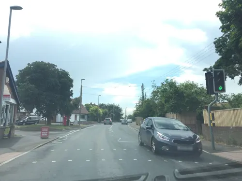
- Street-level photo, jpennycook, CC BY-SA 4.0
- Street-level photo, jpennycook, CC BY-SA 4.0
- Street-level photo, jpennycook, CC BY-SA 4.0
- Street-level photo, jpennycook, CC BY-SA 4.0
- Street-level photo, essexboy, CC BY-SA 4.0
- Street-level photo, essexboy, CC BY-SA 4.0
- Street-level photo, jpennycook, CC BY-SA 4.0
- Street-level photo, essexboy, CC BY-SA 4.0
- Street-level photo, essexboy, CC BY-SA 4.0
- Street-level photo, jpennycook, CC BY-SA 4.0
- Street-level photo, jpennycook, CC BY-SA 4.0
- Street-level photo, essexboy, CC BY-SA 4.0
- Street-level photo, essexboy, CC BY-SA 4.0
- Street-level photo, essexboy, CC BY-SA 4.0
- Street-level photo, jpennycook, CC BY-SA 4.0
- Street-level photo, jpennycook, CC BY-SA 4.0
- Street-level photo, essexboy, CC BY-SA 4.0
- Street-level photo, jpennycook, CC BY-SA 4.0


Page built November 10, 2026. Spotted a mistake? Tell us or suggest a place.