
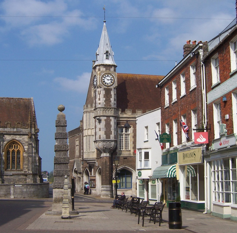




Dorchester, United Kingdom
Dorchester is a town of 16,879 people in England, United Kingdom.
Why visit Dorchester
Townapedia lists 35 museums and landmarks, 15 parks and trails, 82 places to eat, 6 places to stay and 4 attractions in and around town.
Highlights include Plaza Cinema, Max Gate, Roman Town House and Borough Gardens.
Weather in Dorchester
Forecast from MET Norway (CC BY 4.0). Full forecast
About Dorchester
Dorchester (UK: DOR-chist-ər, also DOR-chest-ər) is the county town of Dorset, England. It is situated between Poole and Bridport on the A35 trunk route. A historic market town, Dorchester is on the banks of the River Frome to the south of the Dorset Downs and north of the South Dorset Ridgeway that separates the area from Weymouth, 7 miles (11 km) to the south. Dorchester civil parish, which includes the experimental community of Poundbury and the suburb of Fordington, had a population of 21,358 in 2021.
From the Wikipedia article Dorchester, Dorset (this version), under CC BY-SA 4.0.
Travel tips from other travellers: Dorchester on Wikivoyage (CC BY-SA 4.0).
Things to do4



Museums and landmarks35

Max Gate
Monument and historic site · 0.8 mi
Grade I historic house in Dorchester, Dorset, England, UK
Alington Avenue, Dorchester
Apr 05-Sep 30 Mo,We,Su 14:00-17:00


Mount Pleasant henge
Monument and historic site · 1.1 mi
Neolithic henge monument in Dorset, England, UK

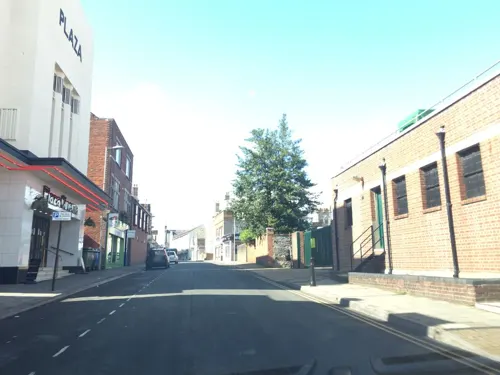
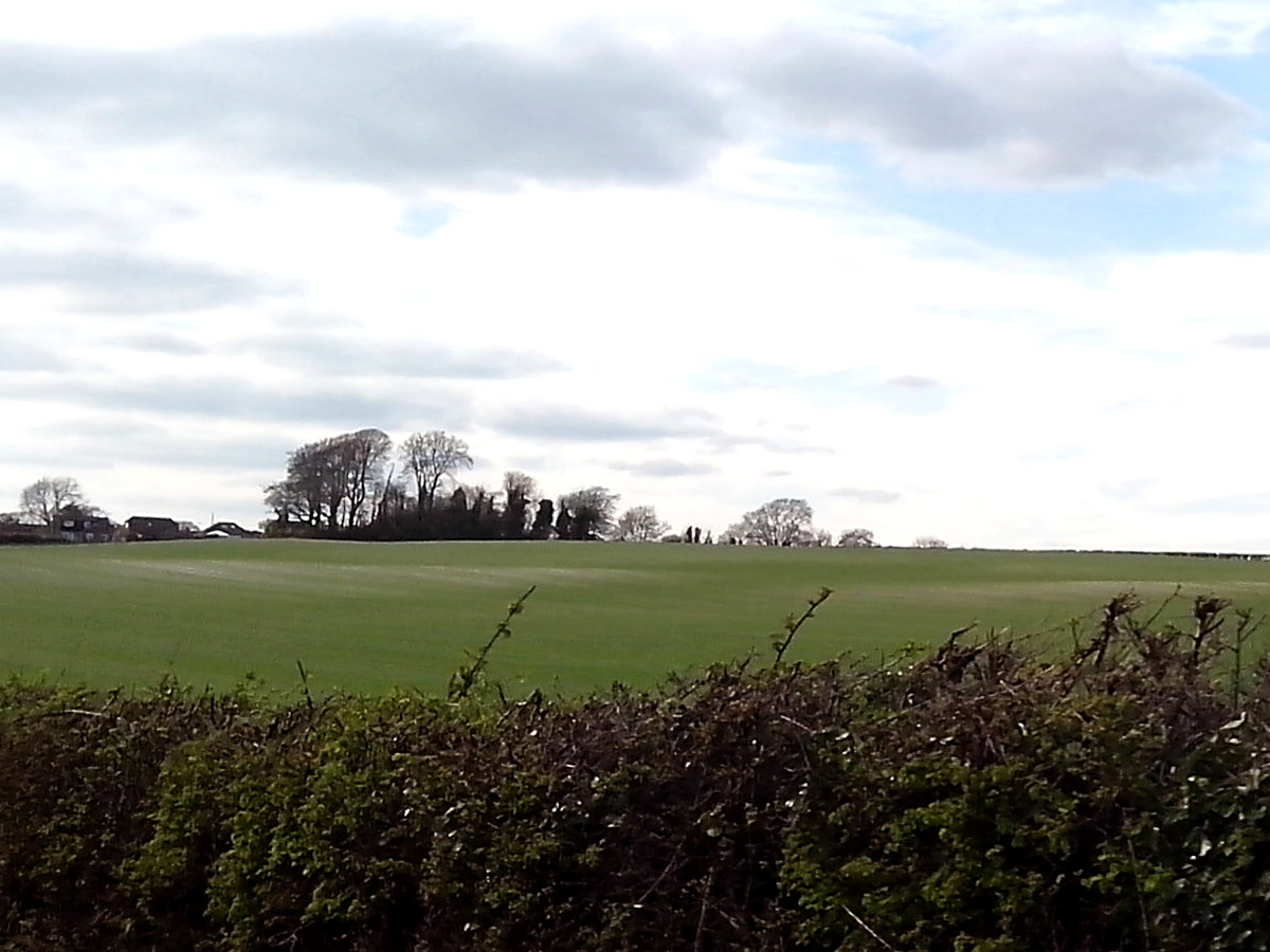
Dorchester Roman walls
Monument and historic site
Site of Roman walls in Dorchester, Dorset England
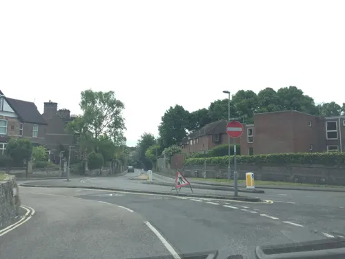
Dorset Martyrs Memorial
Monument and historic site
Sculpture by Elisabeth Frink

Dorset Museum & Art Gallery
Museum
Museum in Dorchester, Dorset, United Kingdom

Wolfeton House
Monument and historic site · 1.3 mi
Wolfeton House, stately home/historic house
Wolfeton, Dorchester

23 more on the map.
Parks, trails and playgrounds15

Borough Gardens
Park · 0.4 mi
Park in Dorchester, Dorset, England, UK




3 more on the map.
Restaurants and cafes82


Finca
Cafe · Coffee Shop · 1.5 mi
24 Buttermarket
Mo-Sa 08:00-17:00; Su 10:00-15:00


70 more on the map.
History
Dorchester's roots stem back to prehistoric times. The earliest settlements were about 2 miles (3.2 km) southwest of the modern town centre in the vicinity of Maiden Castle, a large Iron Age hill fort that was one of the most powerful settlements in pre-Roman Britain. Different tribes lived there from 4000 BC. The Durotriges were likely to have been there when the Romans arrived in Britain in 43 AD.
The Romans defeated the local tribes by 70 AD and established a garrison that became the town the Romans named Durnovaria, a Brythonic name incorporating durn, "fist", loosely interpreted as 'place with fist-sized pebbles'. It appears to have taken part of its name from the local Durotriges tribe who inhabited the area.
Durnovaria was recorded in the 4th-century Antonine Itinerary and became a market centre for the surrounding countryside, an important road junction and staging post, and subsequently one of the twin capitals of the Celtic Durotriges tribe.
The remains of the Roman walls that surrounded the town can still be seen. The majority have been replaced by pathways that form a square inside modern Dorchester known as The Walks. A small segment of the original wall remains near the Top 'o Town roundabout.
Read more of the history
Other Roman remains include part of the town walls and the foundations of a town house near County Hall. Modern building works within the walls have unearthed Roman finds; in 1936 a cache of 22,000 3rd-century Roman coins was discovered in South Street.
Other Roman finds include silver and copper coins known as Dorn pennies, a gold ring, a bronze figure of the Roman god Mercury and large areas of tessellated pavement.
The Dorset Museum contains many Roman artefacts. The Romans built an aqueduct to supply the town with water. It was rediscovered in 1900 as the remains of a channel cut into the chalk and contouring round the hills. The source is believed to be the River Frome at Notton, about 12 miles (19 km) upstream from Dorchester. Near the town centre is Maumbury Rings, an ancient British henge earthwork converted by the Romans for use as an amphitheatre, and to the north west is Poundbury Hill, another pre-Roman fortification.
Little evidence exists to suggest continued occupation after the withdrawal of the Roman administration from Britain. The name Durnovaria survived into Old Welsh as Caer Durnac and later as Durngueir, recorded by Asser in the 9th century.
The area remained in British hands until the mid-7th century and there was continuity of use of the Roman cemetery at nearby Poundbury. Dorchester has been suggested as the centre of a sub-kingdom of Dumnonia or other regional power base.
The first recorded raid of the Viking era took place at Isle of Portland near Dorchester around 790. According to a chronicler, Beaduheard, the king's reeve in Dorchester, assembled a few men and sped to meet them thinking that they were merchants from another country. When he arrived at their location, he admonished them and instructed that they should be brought to the royal town. The Vikings then slaughtered him and his men.
By 864, the area around Durnovaria was dominated by the Saxons who referred to themselves as Dorsaetas, 'People of the Dor' – Durnovaria. The original local name would have been Dorn-gweir giving the Old English Dornwary. The town became known as Dornwaraceaster or Dornwaracester, combining the original name Dor/Dorn from the Latin and Celtic languages with cester, an Old English word for a Roman station. This name evolved over time to Dorncester/Dornceaster and Dorchester.
At the time of the Norman Conquest in 1066, Dorchester was not a place of great significance; the Normans did build a castle but it has not survived. A priory was also founded, in 1364, though this also has since disappeared. In the later medieval period the town prospered; it became a thriving commercial and political centre for south Dorset, with a textile trading and manufacturing industry which continued until the 17th century. In the time of Edward III (1312–1377), the town was governed by bailiffs and burgesses, with the number of burgesses increasing to fifteen by the reign of James I (1566–1625).
The town is populous, tho' not large, the streets broad, but the buildings old, and low; however, there is good company and a good deal of it; and a man that coveted a retreat in this world might as agreeably spend his time, and as well in Dorchester, as in any town I know in England.
In the 17th and 18th centuries Dorchester suffered several serious fires: in 1613, caused by a tallow chandler's cauldron getting too hot and setting alight; in 1622, started by a maltster; in 1725, begun in a brewhouse; and in 1775, caused by a soap boiler. The 1613 fire was the most devastating, resulting in the destruction of 300 houses and two churches (All Saints and Holy Trinity).
Only a few of the town's early buildings have survived to the present day, including Judge Jeffreys' lodgings and a Tudor almshouse. Among the replacement Georgian buildings are many, such as the Shire Hall, which are built in Portland stone. The municipal buildings, which incorporate the former corn exchange and the former town hall, were erected in 1848 on the site of an earlier town hall, which was built in 1791 and had a marketplace underneath.
From the History section of Dorchester, Dorset on Wikipedia, under CC BY-SA 4.0.
More about Dorchester
Geography
Dorchester town centre is sited about 55 to 80 metres (180 to 262 ft) above sea-level on gently sloping ground beside the south bank of the River Frome. Measured directly, it is about 7 miles (11 km) north of Weymouth, 18 miles (29 km) SSE of Yeovil in Somerset, and 20 miles (32 km) west of Poole. The town's built-up area extends south, west and southeast of the town centre; to the north and northeast growth is restricted by the floodplain and watermeadows of the river.
The land immediately south and west of the town is part of the Dorset National Landscape area. It is traversed by the South Dorset Ridgeway, part of the South West Coast Path. There are over five hundred ancient monuments along the chalk hills that form the ridgeway, including barrows, stone circles and hillforts; many archaeological finds from the area are on view at the Dorset Museum in Dorchester.
Economy
In 2012 there were 17,500 people working in Dorchester, 51% of whom were working full-time. 57% of jobs were in public administration, education and health, 18% were in professional and market services (including finance and ICT), 17% were in distribution, accommodation and food, 4% were in production and 2% in construction. The unemployment rate in July 2014 was 0.9% of residents aged 16–64.
Dorchester has six industrial estates: The Grove Trading Estate (7.1 ha or 18 acres), Poundbury Trading Estate (5 ha or 12 acres), Marabout Barracks (2 ha or 4.9 acres), Great Western Centre (1.4 ha or 3.5 acres), Railway Triangle (1.4 ha or 3.5 acres) and Casterbridge Industrial Estate (1.1 ha or 2.7 acres). The estates mostly house light industrial units, wholesalers and the service sector. Significant employers for residents in the town include AEA Technology, BAeSEMA Ltd, Dorset County Council, Dorset County Hospital NHS Foundation Trust, Goulds Ltd, Henry Ling Ltd, Kingston Maurward College, Tesco, and Winterbourne Hospital.
Arts and culture
Novelist and poet Thomas Hardy based the fictional town of Casterbridge on Dorchester, and his novel The Mayor of Casterbridge is set there. Hardy's childhood home is to the east of the town, and his town house, Max Gate, is owned by the National Trust and open to the public. Hardy is buried in Westminster Abbey, but his heart was removed and buried in Stinsford.
William Barnes, the West Country dialect poet, was Rector of Winterborne Came, a hamlet near Dorchester, for 24 years until his death in 1886, and ran a school in the town. There is a statue of Hardy and one of Barnes in the town centre; Barnes outside St. Peter's Church, and Hardy's beside the Top o' Town crossroads.
John Cowper Powys's novel Maiden Castle (1936) is set in Dorchester and Powys intended it to be "a Rival of the Mayor of Casterbridge. Powys had lived in Dorchester as a child, between May 1880 and Christmas 1885, when his father was a curate there. Then, after returning from America in June 1934, he had lived at 38 High East Street, Dorchester, from October 1934 until July 1935, when he moved to Wales. The building is commemorated with a plaque erected by the Dorchester Heritage Committee, but giving the date of his residence as 1936.
Education
Dorchester has thirteen first schools, three middle schools: St Osmund's Church of England Middle School, St Mary's Church of England Middle School, Puddletown and Dorchester Middle School and an upper school; The Thomas Hardye School which was founded in 1569 and endowed by Thomas Hardye, a merchant in 1579. A free school "one of the most striking achievements of puritan Dorchester" operated here in the 1600s. The Thomas Hardye School was expanded and reopened in 1888 and in February 2023 it had 2,103 pupils enrolled. The author Thomas Hardy, a distant relative, was a school governor here from 1909 until shortly before his death. The nineteen schools in the Dorchester area form the Dorchester Area Schools Partnership (DASP). There is also a private school, Sunninghill Prep School.
Kingston Maurward College is a land-based studies college on the outskirts of the town. It offers full-time and part-time courses, apprenticeships and university-level courses in a wide range of subjects including agriculture, horticulture, conservation, construction, countryside and wildlife management.
The town's hospital is Dorset County Hospital on Williams Avenue. It offers a twenty-four-hour accident and emergency treatment with services being provided by Dorset County Hospital NHS Foundation Trust.
From the Wikipedia article Dorchester, Dorset, under CC BY-SA 4.0.
Notable people from Dorchester
 Thomas HardyEnglish novelist and poet (1840–1928)Photo: Bain News Service, publisher, Public domain
 Maurice EvansEnglish actor (1901-1989)Photo: NBC Television, Public domain
 Tom RobertsAustralian artist (1856-1931)Photo: State Library of New South Wales..., No restrictions
 Peter WilsonBritish sport shooter (born 1986)Photo: &DC, CC BY 2.0
 Sir Frederick Treves, 1st BaronetBritish surgeon and writer (1853-1923)Photo: Unknown author, Public domain
 Paul HillierBritish singer and director (born 1949)Photo: mawster, CC BY-SA 2.0
 Fran BagenalBritish astrophysics professorPhoto: en:NASA, Public domain
 Luke EvansBritish politician and Conservative MPPhoto: ©House of Commons / photography by..., CC BY 3.0
- Aaron CookTaekwondo athlete for Great Britain, the Isle of Man, and Moldova
- Edgar AmphlettEnglish fencer (1867–1931)
- Nikki HamblinNew Zealand middle-distance runner
- Sam HoskinsEnglish association football player
Born in Dorchester, according to Wikidata (CC0). Each name links to its Wikipedia article.
Where to stay6
Churches and places of worship23
Shopping20
Gas and EV charging3
Schools, colleges and libraries11
St Mary's Catholic First School, Dorchester
School · Roman Catholic · 0.6 mi
Lucetta Lane, Dorchester
Healthcare10
Map of Dorchester
209 places. The map loads OpenStreetMap tiles when you open it.
Getting there and nearby towns
Royal Naval Air Station Yeovilton (YEO) is the nearest airport with scheduled flights listed in OpenStreetMap, 22 miles away.
- Poole 20 mi east, about 32 min by car
- Wimborne Minster 20 mi east, about 33 min by car
- Swanage 22 mi east, about 36 min by car
- Bournemouth 24 mi east, about 39 min by car
- Verwood 27 mi northeast, about 43 min by car
- Ringwood 30 mi east, about 48 min by car
- Street 31 mi northwest, about 50 min by car
- Shepton Mallet 33 mi north, about 53 min by car
- New Milton 34 mi east, about 54 min by car
- Honiton 34 mi west, about 54 min by car
Drive times are estimates from straight-line distance, not routes.
Towns near Dorchester


Keep exploring
Local news
Headlines from INDB.
Reviews, tips and questions
Loading what members have shared...
Sources and licences
- GeoNames (CC BY 4.0): population, coordinates, regions and time zone
- Mapillary (see each image): photos
- OpenStreetMap contributors (ODbL 1.0): places, airports, map data
- Wikidata (CC0 1.0): elevation, founding date, time zone, website, landmarks and historic places
- Wikimedia Commons (see each image): photos
- Wikipedia (CC BY-SA 4.0): overview and history text
Photo credits
- Town Pump and Corn Exchange - Dorchester, Alex Liivet a derivate work by MrPanyGoff, CC BY 2.0
- Max Gate Dorchester, Pierre Terre, CC BY-SA 2.0
- The Keep Military Museum, Dorchester, Dorset-16Sept2009, Jim Linwood, CC BY 2.0
- Mount Pleasant Henge - April 2015, Pasicles, CC0
- Borough Gardens from south, Dorchester, England, Photochrom Print Collection, Public domain
- St.Michael's Church, Stinsford, Martinevans123, Public domain
- Tower of St. Mary's, Charminster, Poliphilo, CC0
- St Peter's Church, Dorchester - Dorset., Jim, CC BY 2.0
- Parish Church of St Peter - Winterborne Came, Ronald Searle, CC BY-SA 2.0
- DorsetCountyMuseum, Cmyk at English Wikipedia, Public domain
- All Saints Church - High Street East, Dorchester, Elliott Brown, CC BY 2.0
- Kingston Maurward College, Chase me ladies, I'm the Cavalry, CC BY-SA 4.0
- Roman Town House, Dorchester, hugh llewelyn, CC BY-SA 2.0
- The Thomas Hardye School, Rorynewbery, CC BY-SA 3.0
- The Royal Oak Pub (Wetherspoons), Dorchester, Dorset, Jim Linwood, CC BY 2.0
- The Plaza Cinema, Dorchester, Dorset, Jim Linwood, CC BY 2.0
- Terracotta Warriors Museum and Dorset Teddy Bear Museum - High Street Fordington, Dorchester - Kingdom Hall (7190935952), Elliott Brown from Birmingham, United Kingdom, CC BY 2.0
- Dorchester Town FC (14301479511), grassrootsgroundswell, CC BY 2.0
- Street-level photo, essexboy, CC BY-SA 4.0
- Street-level photo, southglos, CC BY-SA 4.0
- Street-level photo, essexboy, CC BY-SA 4.0
- Street-level photo, southglos, CC BY-SA 4.0
- Street-level photo, essexboy, CC BY-SA 4.0
- Street-level photo, essexboy, CC BY-SA 4.0
- Street-level photo, essexboy, CC BY-SA 4.0
- Street-level photo, essexboy, CC BY-SA 4.0
- Street-level photo, southglos, CC BY-SA 4.0
- Street-level photo, noid, CC BY-SA 4.0
- Street-level photo, southglos, CC BY-SA 4.0
- Street-level photo, noid, CC BY-SA 4.0
- Street-level photo, WaggyDog, CC BY-SA 4.0
- Street-level photo, essexboy, CC BY-SA 4.0
- Street-level photo, noid, CC BY-SA 4.0
- Street-level photo, southglos, CC BY-SA 4.0
- Street-level photo, southglos, CC BY-SA 4.0
- Street-level photo, southglos, CC BY-SA 4.0
- Street-level photo, essexboy, CC BY-SA 4.0
- Street-level photo, southglos, CC BY-SA 4.0
- Street-level photo, noid, CC BY-SA 4.0
- Street-level photo, essexboy, CC BY-SA 4.0


Page built November 10, 2026. Spotted a mistake? Tell us or suggest a place.