


Weymouth, United Kingdom
Weymouth is a town of 53,416 people in England, United Kingdom.
Why visit Weymouth
Townapedia lists 34 museums and landmarks, 26 parks and trails, 223 places to eat, 89 places to stay and 14 attractions in and around town.
Highlights include Pavilion Theatre, The Warehouse Theatre, Nothe Fort and Weymouth Museum.
Weather in Weymouth
Forecast from MET Norway (CC BY 4.0). Full forecast
About Weymouth
Weymouth is a seaside town and civil parish in the Dorset district, in the ceremonial county of Dorset, England. Situated on a sheltered bay at the mouth of the River Wey, 7 miles (11 km) south of the county town of Dorchester, Weymouth had a population of 53,416 in 2021. It is the third-largest settlement in Dorset after Bournemouth and Poole.
From the Wikipedia article Weymouth, Dorset (this version), under CC BY-SA 4.0.
Travel tips from other travellers: Weymouth on Wikivoyage (CC BY-SA 4.0).
Photos of Weymouth


Things to do14


The Warehouse Theatre
Cinema and theater · 0.7 mi
Theatre in Weymouth, Dorset, England, UK

Alexandra Gardens Theatre
Cinema and theater · 0.6 mi
Theatre in Weymouth, England


Chesil Beach
Beach · 2.6 mi
Shingle beach in Dorset, southern England
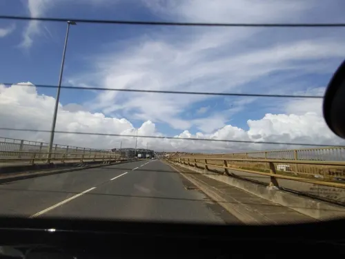

Jurassic Skyline
Monument and historic site · 0.6 mi
Observation tower in Dorset, England

Portland Breakwater Lighthouse
Lighthouse · 2.7 mi
Lighthouse on the Isle of Portland, Dorset, England

Town Bridge
Bridge · 0.5 mi
Road bridge in Weymouth, Dorset, England, UK

Weymouth Pavilion
Cinema and theater · 0.6 mi
Theatre in Weymouth, Dorset, England (1960-)

2 more on the map.
Museums and landmarks34


HMS Delight
Monument and historic site · 3.1 mi
1932 D-class destroyer

HMS Hood
Monument and historic site · 3.6 mi
1891 Royal Sovereign-class pre-dreadnought battleship

Jordan Hill Roman Temple Remains
Monument and historic site · 2.1 mi

Portland Castle
Museum · 3.2 mi
Grade I listed Device Fort in Dorset, England, UK

Ridgeway Hill Viking burial pit
Monument and historic site · 3.9 mi
Mass grave
Romano-Celtic temple and associated remains at Jordan Hill
Monument and historic site · 2.1 mi
Archaeological site in Overcombe, United Kingdom

Chesil Beach cannon
Monument and historic site · 3.3 mi
Shipwreck off Chesil Beach, Dorset, England, UK
Earl of Abergavenny
Monument and historic site · 2.4 mi
1796 British East India Company ship
HMS Foylebank
Monument and historic site · 3.1 mi
1930 cargo ship converted to anti-aircraft role
22 more on the map.
Parks, trails and playgrounds26


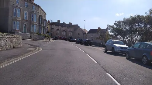
Victoria Gardens, Portland
Park · 3.7 mi
Park on the Isle of Portland, Dorset, England






14 more on the map.
Restaurants and cafes223




The Fat Badger
Restaurant · Pizza, Fish, Breakfast, Lunch · 1.8 mi
90 Camp Road, Weymouth
Mo-Su 10:00-22:00

Balti House
Restaurant · Indian
24-25 Commercial Road, Weymouth
Mo-Su 12:00-02:00,17:30-23:30
211 more on the map.
History
The modern town of Weymouth originated as the two settlements of Weymouth and Melcombe Regis, on opposite sides of Weymouth Harbour in Dorset. The older of the two, on the south side, was referred to as Weymouth as early as the 10th century, as part of the parish of Wyke Regis, and by 1252 had become a chartered borough and established seaport, trading in imported wine. Melcombe Regis, on the north side, was first noted in the 11th century. It developed separately from the mid 12th century onwards and in 1310 was a licensed wool port. However, French raiders found the port so accessible that in 1433 the staple was transferred to Poole. Melcombe Regis is thought to be the first port at which the Black Death came into England in June or July 1348, possibly aboard either a spice ship or an army ship from Calais, where fighting was taking place in the Hundred Years' War.
Read more of the history
In their early history, the two towns were rivals for trade and industry, and many arguments broke out over use of the harbour. In 1571, Queen Elizabeth I became so tired of the petitioning that she united the two towns in an Act of Parliament, to form a double borough of Weymouth and Melcombe Regis. Both towns have become known as Weymouth, despite Melcombe Regis being the main centre. The villages of Upwey, Broadwey, Preston, Wyke Regis, Chickerell, Southill, Radipole and Littlemoor have since become part of the built-up area.
Henry VIII had two Device Forts built to protect the south Dorset coast from invasion in the 1530s: Sandsfoot Castle in Wyke Regis and Portland Castle in Castletown. Coastal erosion forced the abandonment of Sandsfoot as early as 1665 and parts have since fallen into the sea. In 1635, around 100 emigrants from the town crossed the Atlantic Ocean on board the ship Charity and settled in Weymouth, Massachusetts. More townspeople emigrated to the Americas to bolster the population of Weymouth, Nova Scotia and Salem, Massachusetts, then called Naumking.
During the English Civil War, control of Weymouth changed a number of times and the town was much damaged as a result. When conflict first broke out in 1642, Weymouth was peacefully occupied by Parliamentarians, but it was captured in August the following year by 2,000 Royalist cavalry and held until June 1644, when it was retaken. Around 250 people were killed in the local Crabchurch Conspiracy when sympathetic residents let Royalist soldiers into the town in February 1645. It was recaptured later that month and remained in Parliamentarian hands for the remainder of the war, despite enduring a protracted siege.
The resort is among the first modern tourist destinations, after one of King George III's brothers, the Duke of Gloucester, built a country house named Gloucester Lodge there; the Duke spent the winter of 1780 at the house. George III made Weymouth his summer holiday residence on fourteen occasions between 1789 and 1805, even venturing into the sea in a bathing machine.
In celebration of the king's patronage, in 1810, a painted statue was placed on the seafront. Known simply as the King's Statue, it was extensively renovated in 2007–08. A second tribute to George III, completed two years earlier in 1808, is the mounted white horse at Osmington. Designed by local architect James Hamilton, and cut into the chalk hillside by soldiers under his direction, the figure measures 280 ft (85 m) long by 323 ft (98 m) high.
During the French Revolutionary and Napoleonic Wars, Weymouth started to gain some military importance: in 1795, the Red Barracks were constructed for cavalry troops stationed at Nothe. They were badly damaged in 1798 by a fire and work started on new buildings and a parade ground at Radipole. These premises could house 953 officers and men together with 986 horses. The Red Barracks were rebuilt in 1801 and given over to infantry.
Militarisation of the town continued through the Victorian era, with work starting on Portland Harbour in 1849. Built specifically to accommodate the new steam navy, the project was completed in 1872. Between 1860 and 1872, Nothe Fort was constructed at the entrance of Weymouth Harbour, overlooking the new harbour at Portland.
Weymouth's popularity, both as a trading port and as a holiday destination, also grew in this period and the arrival of the railway in 1857 boosted both industries. The Royal National Lifeboat Institution stationed a lifeboat at Weymouth for the first time on 26 January 1869. A boathouse was built with a slipway by the harbour and is still in use, although the lifeboat is now moored at a pontoon. In 1887, to mark the 50th year of Queen Victoria's reign, a multi-coloured Jubilee Clock was erected on the esplanade.
During World War I, about 120,000 Australian and New Zealand Army Corps personnel convalesced in Weymouth after being injured at Gallipoli or other theatres of the war; the existing army camps and mild climate made it an ideal location. Most of the soldiers were repatriated in 1919; some stayed and married local women.
Weymouth's military importance made it a target for German bombing during World War II. The air raids destroyed 1,200 civilian dwellings and killed 76 civilians, and the High Street was so badly damaged that much of it had to be demolished after the war. In September 1942 the first full-scale testing of the bouncing bomb was carried out west of the town, on the lagoon behind Chesil Bank. Tens of thousands of Allied troops departed Weymouth and Portland for D-Day, bound for Omaha in Normandy. By the time the conflict in Europe had ended, 517,816 troops and 144,903 vehicles had been through the ports.
From the History section of Weymouth, Dorset on Wikipedia, under CC BY-SA 4.0.
More about Weymouth
Geography
Weymouth is built on weak sand and clay rock which in most places along the Dorset coast, except for narrow bands at Lulworth Cove, Swanage and Durdle Door, has been eroded and transported away. This weak rock has been protected at Weymouth by Chesil Beach and the strong limestone Isle of Portland that lies offshore, 3 km (2 mi) south of Wyke Regis. The island affects the tides of the area, producing a double low tide in Weymouth Bay and Portland Harbour. The maximum tidal range is small, at around 2 m (7 ft).
There are two lakes in the borough, both designated Nature Reserves by the Royal Society for the Protection of Birds (RSPB)–Radipole Lake in the town centre, and Lodmoor between the town centre and Preston. Radipole Lake, the largest nature reserve, and mouth of the River Wey before it flows into Weymouth Harbour, are important habitats for fish and migratory birds, and over 200 species of plants. Radipole is an important tourist attraction; it and Weymouth Beach are situated very close to the town centre. There are 11 Sites of Special Scientific Interest in the borough, which cover an area of 1,979 acres (801 ha), and there are 37 other Nature Conservation Designations.
Economy
Tourism is important to the local economy, employing 17% of the local workforce. In 2019, over two million day trips and 469,600 longer stays, brought £209,560,000 of visitors money into the Weymouth and Portland area. Weymouth's coast and beaches, lakes, museums, aquarium, and two shopping centres are the main attractions for visitors. The visitor accommodation consists of hotels on the seafront, guest houses around the town centre, and caravan and camping sites just out of town, including three sites owned by Haven and British Holidays: Littlesea, Seaview and Weymouth Bay.
In 2019 there were 2,160 business units in the Weymouth and Portland area, employing 18,000 local residents. The largest sector was Wholesale, Retail and Repair at 17.66% of all local businesses. Construction and Accommodation and food services were the next two largest sectors with a 13.66% share each. Most businesses, 83.1%, had less than nine employees while only 0.5% were large, employing over 250 staff. Two of the area's largest employers are the aerospace parts manufacturer, FGP systems, and the retail clothing firm, New Look.
Arts and culture
There are over two hundred events held throughout the year in the borough, including firework festivals, dragon boat racing, beach volleyball, Weymouth Beach Motocross, and the annual carnival in mid-August. Weymouth is the only port in the world to have hosted the start of The Tall Ships' Races three times—in 1983, 1987 and 1994; the 1994 race attracting 300,000 spectators.
The Pavilion Theatre was built in 1960 on a peninsula of reclaimed land between the harbour and the esplanade, after the Ritz Theatre was destroyed by fire in 1954. The Pavilion was owned and operated by Weymouth and Portland Borough Council, providing a venue for local community groups and schools, and hosting seasonal 'end-of-the-pier' entertainment and year-round shows and events. A failed proposal to regenerate the area in 2006, led the council to announce the demolition of the theatre and on 31 May 2013, it closed but following a formal tender process, the theatre was leased to a local businessman and reopened on 13 July 2013. Weymouth Pavilion is now operated by Weymouth Pavilion CIC as a not-for-profit organisation.
Education
Weymouth has 14 primary schools and three secondary schools. All three secondary schools—All Saints Church of England Academy in Wyke Regis; Budmouth Academy in Chickerell; and Wey Valley Academy in Broadwey—converted to academies following poor Ofsted reports. Wey Valley was added to the Government's Failing Schools list in 2007 when only 27% of the students achieved 5 A*to C passes. After consistently failing to improve, the school closed on 1 May 2019. It reopened on 1 June 2019. In 2018, All Saints' had 830 students on roll, Budmouth had 1548 and Wey Valley 863.
In 2019, 35% of students at All Saints', 36% of students at Budmouth and 21% of students at Wey Valley, attained five or more A*to C GCSEs including English and mathematics; below the national average of 43%. From 2016, schools in England have been measured on their pupils progress rather than GCSE results with greater emphasis placed on advancement in English and mathematics. Progress 8 scores, for all three schools, were below average, in 2019.
From the Wikipedia article Weymouth, Dorset, under CC BY-SA 4.0.
Notable people from Weymouth
 Thomas Love PeacockEnglish novelist, poet, and official of the East India Company (1785–1866)Photo: Henry Wallis, Public domain
 Alan CarrBritish comedian and television personalityPhoto: JaceMerlyn, CC BY-SA 4.0
 Jack Simpsonassociation football player (born 1997)Photo: Timmy96, CC0
 Mary HoneyballBritish politician (born 1952)Photo: Foto-AG Gymnasium Melle, CC BY-SA 3.0
 Francis MarindinEnglish footballer, and British Army officer (1838-1900)Photo: Fradelle & Young, Regent Street, London, Public domain
 Andy ParsonsBritish comedian and writerPhoto: glastocabaret, CC BY 2.0
- Henry MoseleyEnglish physicist
- Paul GrahamEnglish-American programmer, venture capitalist, and essayist
- Verney Lovett Camerontraveller from England (1844–1894)
- Richard van der Riet WoolleyBritish astronomer royal (1906–1986)
- Lesley LangleyBritish model, actress, and beauty queen
- John SturrockEnglish rower
Born in Weymouth, according to Wikidata (CC0). Each name links to its Wikipedia article.
Where to stay89
Churches and places of worship59
Wyke Regis Methodist Church
Church · Methodist · 1.5 mi
Portland Road, Wyke Regis
Shopping41
Gas and EV charging5
Schools, colleges and libraries23
St Augustine's Catholic Primary School, Weymouth
School · Roman Catholic · 0.9 mi
Hardy Avenue, Weymouth
Healthcare15
Map of Weymouth
250 places. The map loads OpenStreetMap tiles when you open it.
Getting there and nearby towns
Royal Naval Air Station Yeovilton (YEO) is the nearest airport with scheduled flights listed in OpenStreetMap, 29 miles away.
- Dorchester 7 mi north, about 12 min by car
- Bridport 15 mi northwest, about 25 min by car
- Blandford Forum 21 mi northeast, about 34 min by car
- Poole 22 mi east, about 35 min by car
- Swanage 22 mi east, about 36 min by car
- Broadstone 23 mi northeast, about 36 min by car
- Yeovil 24 mi north, about 38 min by car
- Wimborne Minster 24 mi northeast, about 38 min by car
- Bournemouth 26 mi east, about 43 min by car
- Ferndown 28 mi northeast, about 45 min by car
Drive times are estimates from straight-line distance, not routes.
Towns near Weymouth


Keep exploring
Local news
Headlines from INDB.
Reviews, tips and questions
Loading what members have shared...
Sources and licences
- GeoNames (CC BY 4.0): population, coordinates, regions and time zone
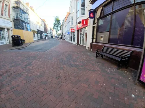
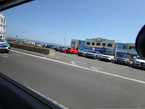
- Mapillary (see each image): photos
- OpenStreetMap contributors (ODbL 1.0): places, airports, map data
- Wikidata (CC0 1.0): elevation, founding date, time zone, website, landmarks and historic places
- Wikimedia Commons (see each image): photos
- Wikipedia (CC BY-SA 4.0): overview and history text
Photo credits
- Weymouth harbour, Dorset, England, ITookSomePhotos, CC BY-SA 4.0
- Carduelis carduelis -RSBP Radipole Lake, Weymouth, Dorset, England-8, Ian Kirk, CC BY 2.0
- 2006 Piaggio Porter in Swannery Car Park, Weymouth, UK (rear) (34207547971), Andrew Bone from Weymouth, England, CC BY 2.0
- 2006 Piaggio Porter in Swannery Car Park, Weymouth, UK (front) (33496774444), Andrew Bone from Weymouth, England, CC BY 2.0
- Warehouse, Weymouth 1, Richard Symonds, CC BY-SA 4.0
- Weymouth (2023-07-25) 119, Simon Cobb, CC0
- Chesil Beach, Isle of Portland, Dorset-9457, Raimond Spekking, CC BY-SA 4.0
- Weymouth Sea Life Tower, Dorset, England-3Sept2012, Jim Linwood, CC BY 2.0
- Lighthouse on the breakwater, Portland Harbour, Nicholas Mutton, CC BY-SA 2.0
- Weymouth Town Bridge (23559366455), Andrew Bone from Weymouth, England, CC BY 2.0
- Weymouth beach in July 2011, Edward Betts, CC BY-SA 3.0
- Brewers Quay Weymouth, Steve Daniels, CC BY-SA 2.0
- HMS Delight, Royal Navy official photographer, Public domain
- HMS Hood (Royal Sovereign-class battleship of 1890s), not stated, Public domain
- Portland castle closeup, Mark.murphy at English Wikipedia, CC BY-SA 3.0
- Isle of Portland Tout Quarry Landscape, Ajsmith141, CC BY 3.0
- Weymouth Baptist Chapel, Bank Building, Dorset, Sarah Smith, CC BY-SA 2.0
- Saint John's Church, Weymouth, Jim, CC BY 2.0
- Church of St Laurence 3, Chase me ladies, I'm the Cavalry, CC BY-SA 3.0
- Weymouth - The Weymouth Pavilion, Chris Talbot, CC BY-SA 2.0
- JordanHillRomanTempleC, MortimerCat, CC BY-SA 3.0
- Claude Monet Nymphéas Seerosen 1915 Neue Pinakothek Munich München, Schlaier, Public domain
- Tudor House Museum, Weymouth, Dorset, Ajsmith141, CC BY-SA 3.0
- Belvedere Inn, Weymouth, Richard Symonds, CC BY 3.0
- Weymouth Peace Garden, Jpbowen, CC BY-SA 4.0
- Weymouth (2023-07-25) 001, Simon Cobb, CC0
- Jordan Hill Roman Temple 2013-09-05, August Schwerdfeger, CC BY 4.0
- Weymouthcollege, BennH, CC BY-SA 4.0
- Weymouth Pavilion July 2016, Chrisjmcole, CC BY-SA 4.0
- Gardens 012rgb, Funkyjim, CC BY-SA 3.0
- Ridgeway Hill from Povington Hill 2, Bermicourt, CC BY-SA 3.0
- Tudor House, Weymouth, Dorset, Ashley Smith, CC BY-SA 4.0
- The cliff-top site of Sandsfoot Castle, Stefan Czapski, CC BY-SA 2.0
- Quay (5927381575), Rafaela Ely, CC BY 2.0
- Skulking beside the riverbank (10779180193), Ian Kirk from Broadstone, Dorset, UK, CC BY 2.0
- A little charmer! (8419216337), Ian Kirk from Broadstone, Dorset, UK, CC BY 2.0
- Dunnock at RSPB Radipole (8376124633), Ian Kirk from Broadstone, Dorset, UK, CC BY 2.0
- Vanessa atalanta (10779032654), Ian Kirk from Broadstone, Dorset, UK, CC BY 2.0
- A bright little robin! (8420315404), Ian Kirk from Broadstone, Dorset, UK, CC BY 2.0
- Casting a sinister shadow! (10778948906), Ian Kirk from Broadstone, Dorset, UK, CC BY 2.0
- View of Weymouth from Nothe Fort, Vsfx, CC BY-SA 3.0
- Nothe Gardens 01, Richard Symonds, CC BY 3.0
- Fantasy Island Fun Park (30828801533), Andrew Bone from Weymouth, England, CC BY 2.0
- Street-level photo, WaggyDog, CC BY-SA 4.0
- Street-level photo, WaggyDog, CC BY-SA 4.0
- Street-level photo, noid, CC BY-SA 4.0
- Street-level photo, WaggyDog, CC BY-SA 4.0
- Street-level photo, WaggyDog, CC BY-SA 4.0
- Street-level photo, WaggyDog, CC BY-SA 4.0
- Street-level photo, WaggyDog, CC BY-SA 4.0
- Street-level photo, WaggyDog, CC BY-SA 4.0
- Street-level photo, WaggyDog, CC BY-SA 4.0
- Street-level photo, WaggyDog, CC BY-SA 4.0
- Street-level photo, WaggyDog, CC BY-SA 4.0
- Street-level photo, WaggyDog, CC BY-SA 4.0
- Street-level photo, noid, CC BY-SA 4.0
- Street-level photo, noid, CC BY-SA 4.0


Page built November 10, 2026. Spotted a mistake? Tell us or suggest a place.