


Bracknell, United Kingdom
Bracknell is a town of 76,103 people in England, United Kingdom.
Why visit Bracknell
Townapedia lists 6 museums and landmarks, 48 parks and trails, 76 places to eat, 10 places to stay and 7 attractions in and around town.
Highlights include South Hill Park, Cineworld, South Hill Park Arts Centre and Jock's Copse.
Weather in Bracknell
Forecast from MET Norway (CC BY 4.0). Full forecast
About Bracknell
Bracknell () is a town and civil parish in Berkshire, England, the westernmost area within the Greater London Urban Area and the administrative centre of the borough of Bracknell Forest. It lies 11 miles (18 km) to the east of Reading, 9 miles (14 km) south of Maidenhead, 10 miles (16 km) southwest of Windsor and 25 miles (40 km) west of central London. Bracknell is the third largest town in Berkshire.
From the Wikipedia article Bracknell (this version), under CC BY-SA 4.0.
Travel tips from other travellers: Bracknell on Wikivoyage (CC BY-SA 4.0).
Photos of Bracknell


Things to do7

South Hill Park
Cinema and theater · 1.4 mi
Arts centre, theatre and cinema in a former mansion in Bracknell, England


Museums and landmarks6

House of the Dursley Family
Monument and historic site · 1.3 mi
Privet Drive no. 4
12 Picket Post Close, Bracknell
Parks, trails and playgrounds48

Jock's Copse
Park · 1.1 mi
Nature reserve in Binfield, Berkshire, England, UK

Temple Copse
Park · 1.3 mi
Nature reserve in Binfield, Berkshire, England, UK

Arlington Square
Park · 0.4 mi
Business park in Bracknell, Berkshire, England, UK
Tinkers Copse
Park · 1.2 mi
Nature reserve in Binfield, Berkshire, England, UK



36 more on the map.
Restaurants and cafes76
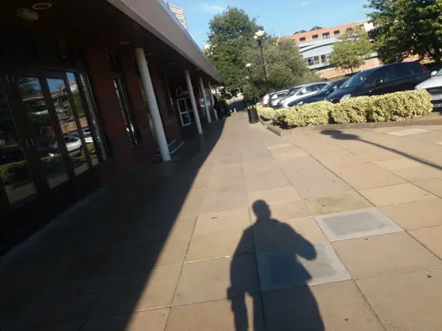
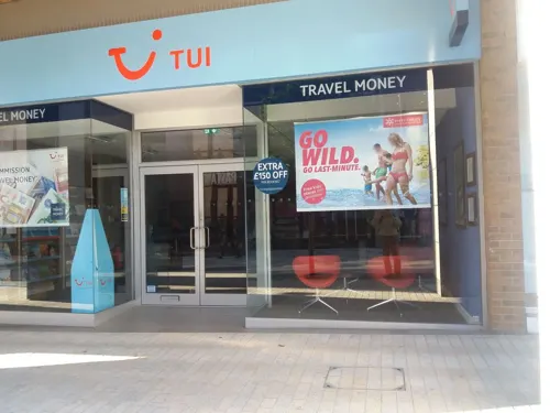
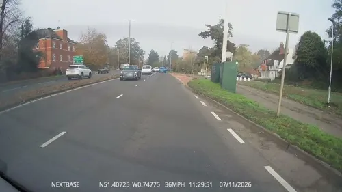


64 more on the map.
History
The name Bracknell is first recorded in a Winkfield Boundary Charter of AD 942 as both Braccan heal and Braccan heale. This was previously thought to mean "a nook of land belonging to a man called Bracca", from the Old English Braccan (genitive singular of a personal name) + heal, healh (a corner, nook or secret place), although recent academic evidence suggests it means simply "a hidden place where bracken grows." Bracknell was subsequently named on maps as Brakenhale (a name that still survives as the name of one of its schools), Brakehal and Brackenhal. The town today covers all of the old village of Easthampstead (though not all of the old parish) and the hamlet of Ramslade.
Evidence of human existence in Bracknell dates back to the end of the last ice age (c. 10,000BC), with abundant flint tools found in nearby Amen Corner. There is a Bronze Age round barrow at Bill Hill. Easthampstead Park was a favoured royal hunting lodge in Windsor Forest and Catherine of Aragon was banished there until her divorce was finalised. It was later the home of the Trumbulls who were patrons of Alexander Pope from Binfield.
To the north-east of the town, in the suburb of Quelm Park, is the Quelm Stone, a standing stone, and to the south-west, just over the border in Crowthorne, is Caesar's Camp, an Iron Age hill fort.
Read more of the history
One of the oldest buildings in the town is the Old Manor public house, a 17th-century brick manor house featuring a number of priest holes. Other surviving old pubs are the Red Lion and the Bull, both timber-framed and dating from before the 18th century.
The oldest place of worship in the town is the parish church of St Michael and St Mary Magdalene's Church, Easthampstead. There has been a church there since Saxon times, although the present building dates from the mid 19th century, except for the lower portions of the Tudor tower. Holy Trinity Church near the town centre was built in 1851.
Bracknell was designated a new town on 17 June 1949, in the aftermath of the Second World War. The site was originally a small market town in the civil parish of Warfield in the Easthampstead Rural District. Very little of the original Bracknell is left. The location was preferred to White Waltham, which was also considered, because the Bracknell site avoided encroaching on good quality agricultural land. It had the additional advantage of being on a railway line.
The new town was planned for 25,000 people; it was intended to occupy over 1,000 hectares (2,500 acres) of land in and around 'Old Bracknell', in the area now occupied by Priestwood, Easthampstead, Bullbrook and Harmans Water. The existing town centre and industrial areas were to be retained with new industry brought in to provide jobs. The town has since expanded far beyond its intended size into farmland to the south.
The New Town was planned on the neighbourhood principle, with a series of neighbourhoods each with a population of around 10,000 with (no more than around five minutes walk away) a church, a small parade of shops, a primary school, small business space, a community centre and a pub. The plans included pedestrianisation, the construction of a ring road around the town centre, and segregation of industrial areas from residential areas.
A feature of some of the estates is that streets only have names, not odonyms – in Birch Hill, Crown Wood, Great Hollands and others there is no Road, Avenue, Street, just 'Frobisher', 'Jameston', 'Juniper', 'Jevington'. The residential streets are, however, named in alphabetical order in Great Hollands and Wildridings, with As to Ds, such as Donnybrook, in Hanworth, Js, such as 'Jameston', 'Juniper' and 'Jevington' in Birch Hill.
Bracknell Development Corporation commissioned a history of the New Town, published in 1981, entitled Bracknell: The making of our New Town, by Henry and Judith Parris.
From the History section of Bracknell on Wikipedia, under CC BY-SA 4.0.
More about Bracknell
Geography
The town covers areas previously in the parishes of Easthampstead, Warfield, Binfield and Winkfield. The town's centre lies just north of the railway station with completely pedestrianised and much undercover shopping around Princess Square, Charles Square and the Broadway. There are 'out-of-town' shops, a multiscreen cinema and ten pin bowling complex at the Peel Centre. Just to the west are the Western and Southern industrial estates, either side of the railway line. There are many residential suburbs (see settlement table below) of varying dates, the oldest being Priestwood and, of course, Easthampstead village.
The former RAF Staff College buildings in Harmans Water, now closed, was part of the Joint Services Command and Staff College. From 2008, the site was redeveloped for housing by Wimpey, with an estimated 730 houses. The south-western corner of the town remains rural around Easthampstead Park and the wooded Yew Tree Corner. A newer housing development called Jennett's Park was built (from 2007) at Peacock Farm and on part of what was historically the grounds of Easthampstead Park. There are large ponds at Farley Wood and the Easthampstead Mill Pond between Great Hollands and Wildridings, and two lakes at South Hill Park. The Bull Brook emerges above ground just within the bounds of the suburb of Bullbrook.
Arts and culture
In the south of the town is South Hill Park, a mansion dating from 1760, although much rebuilt, that now houses a large arts centre. The Wilde Theatre was opened in 1984, named after Oscar Wilde who created the character 'Lady Bracknell' in his play The Importance of Being Earnest, which was also the inaugural production at the theatre in April of that year. South Hill Park has been home to a number of major music festivals over the years:
1970s – 1980s Bracknell Folk Festival ("The Handsome Mouldiwarp Festival")
1980s – 1990s – Bracknell Music Festival / South Hill Park Festival
2000s – 2013 – Big Day Out festival, a free, annual World Music and acoustic/folk festival
Bracknell does have an active music scene, with choirs such as Bracknell Choral Society, bands such as the Supertonics Big Band, and the Berkshire Music Trust, a music education charity.
Bracknell has been used in the filming of many TV shows and films, such as Harry Potter and the Philosopher's Stone (Martins Heron) and Time Bandits (Birch Hill). Bracknell is given the name 'Laxton' in the TV detective series Pie in the Sky and Waterside Park was used for the exterior of the police HQ in the same series. Bracknell has also featured in the 1991 Roger Daltrey film Buddy's Song.
Education
The area has various schools including St Joseph's Catholic Primary School, The Brakenhale School, Garth Hill College, King's Academy Easthampstead Park and Ranelagh Church of England School. Bracknell and Wokingham College of further education is also based in the area.
The Silwood Park campus of Imperial College London is five miles (eight kilometres) east of Bracknell town centre. The University of Reading is 8 mi (13 km) northwest, and Royal Holloway College is 8 mi (13 km) east.
From the Wikipedia article Bracknell, under CC BY-SA 4.0.
Notable people from Bracknell
 Hugh WelchmanBritish film producerPhoto: Georges Biard, CC BY-SA 3.0
 Jack StaceyEnglish association football player (born 1996)Photo: AFC Bournemouth, CC BY 3.0
 Jake CooperEnglish association football player, born 1995Photo: Timmy96, CC0
 Ella BruccoleriBritish actressPhoto: JaceMerlyn, CC BY-SA 4.0
 Danny CullipEnglish footballer (born 1976)Photo: Struway, Public domain
 Lucy Hollandwriter and former booksellerPhoto: ArthurTheGardener, CC0
- Millie BradyBritish actress
- Edward B. EastwickBritish orientalist, diplomat and MP (1814-1883)
- Kees SimsNew Zealand association football player
- Mark PhiloEnglish footballer (1984-2006)
- Nick CrittendenEnglish footballer (born 1978)
- Robert ParisEnglish footballer (born 1978)
Born in Bracknell, according to Wikidata (CC0). Each name links to its Wikipedia article.
Where to stay10
Churches and places of worship17
St Michael and St Mary Magdalene's Church, Easthampstead
Church · 0.9 mi
The Church of Jesus Christ of Latter-day Saints
Church · Latter Day Saints · 1.3 mi
Ringmead, Bracknell
Shopping19
Gas and EV charging11
Schools, colleges and libraries22
St Joseph's Catholic Primary School, Bracknell
School · Roman Catholic · 0.4 mi
Gipsy Lane, Bracknell
St Michael's Easthampstead Church of England Voluntary Aided Primary School
School · Anglican · 0.8 mi
Crowthorne Road, Bracknell
Healthcare8
Bullbrook Pharmacy
Clinic and pharmacy · 0.7 mi
3 Bullbrook Row, Lily Hill Row, Bracknell
Map of Bracknell
224 places. The map loads OpenStreetMap tiles when you open it.
Getting there and nearby towns
Blackbushe Airport (BBS) is the nearest airport with scheduled flights listed in OpenStreetMap, 7 miles away.
- Ascot 3 mi east, about 5 min by car
- Crowthorne 3 mi southwest, about 6 min by car
- Wokingham 4 mi west, about 6 min by car
- Sunninghill 4 mi east, about 7 min by car
- Sandhurst 5 mi south, about 8 min by car
- Camberley 5 mi south, about 9 min by car
- Yateley 6 mi southwest, about 10 min by car
- Frimley 7 mi south, about 11 min by car
- Lower Earley 7 mi west, about 12 min by car
- Maidenhead 8 mi north, about 12 min by car
Drive times are estimates from straight-line distance, not routes.
Towns near Bracknell


Keep exploring
Local news
Headlines from INDB.
Reviews, tips and questions
Loading what members have shared...
Sources and licences
- GeoNames (CC BY 4.0): population, coordinates, regions and time zone
- Mapillary (see each image): photos
- OpenStreetMap contributors (ODbL 1.0): places, airports, map data
- Wikidata (CC0 1.0): elevation, founding date, time zone, website, landmarks and historic places
- Wikimedia Commons (see each image): photos
- Wikipedia (CC BY-SA 4.0): overview and history text
Photo credits
- 458010+458027 Depart Bracknell, TheJRB, CC BY-SA 2.0
- 458027 Departs Bracknell, TheJRB, CC BY-SA 2.0
- Time Square, Bracknell, Richard Kelly, CC BY-SA 4.0
- Bracknell train station 1871979 09dcd561, Ben Brooksbank, CC BY-SA 2.0
- Time Square, Market Street, Bracknell, Richard Kelly, CC BY-SA 4.0
- South Hill Park, rear view, Garrick Hywel Darts, CC BY-SA 4.0
- St Michaels Easthampstead Front, Tim Sneller, Public domain
- Jock's Copse (1), Dudley Miles, CC BY-SA 4.0
- Temple Copse (5), Dudley Miles, CC BY-SA 4.0
- Lexicon Bracknell, Gareth Slaughter, Public domain
- Beeline N212 WRD (15169533882), KK70088, CC BY-SA 2.0
- Beeline TPE 164S (14983443999), KK70088, CC BY-SA 2.0
- Beeline F176 LBL (15178557571), KK70088, CC BY-SA 2.0
- Beeline K802 CAN (15169533042), KK70088, CC BY-SA 2.0
- Beeline G647 YVS (15169532902), KK70088, CC BY-SA 2.0
- Berks Bucks Bus Co E472 CGM (14983444129), KK70088, CC BY-SA 2.0
- Beeline M812 PGM (14983443989), KK70088, CC BY-SA 2.0
- Beeline F174 LBL (15178557591), KK70088, CC BY-SA 2.0
- Street-level photo, darbymark, CC BY-SA 4.0
- Street-level photo, jpennycook, CC BY-SA 4.0
- Street-level photo, darbymark, CC BY-SA 4.0
- Street-level photo, jpennycook, CC BY-SA 4.0
- Street-level photo, tonys999, CC BY-SA 4.0
- Street-level photo, tonys999, CC BY-SA 4.0
- Street-level photo, tonys999, CC BY-SA 4.0
- Street-level photo, jpennycook, CC BY-SA 4.0
- Street-level photo, OrangeHurst97, CC BY-SA 4.0
- Street-level photo, tonys999, CC BY-SA 4.0
- Street-level photo, darbymark, CC BY-SA 4.0
- Street-level photo, geoengtechel, CC BY-SA 4.0
- Street-level photo, tonys999, CC BY-SA 4.0
- Street-level photo, tonys999, CC BY-SA 4.0
- Street-level photo, tonys999, CC BY-SA 4.0
- Street-level photo, OrangeHurst97, CC BY-SA 4.0
- Street-level photo, OrangeHurst97, CC BY-SA 4.0
- Street-level photo, jpennycook, CC BY-SA 4.0
- Street-level photo, jpennycook, CC BY-SA 4.0
- Street-level photo, jpennycook, CC BY-SA 4.0
- Street-level photo, jpennycook, CC BY-SA 4.0


Page built November 10, 2026. Spotted a mistake? Tell us or suggest a place.