



Giffnock, United Kingdom
Giffnock is a town of 12,070 people in Scotland, United Kingdom.
Why visit Giffnock
Townapedia lists 17 museums and landmarks, 42 parks and trails, 67 places to eat, 2 places to stay and 4 attractions in and around town.
Highlights include Holmwood House, Burrell Collection, Linn Park and Bellahouston Park.
Weather in Giffnock
Forecast from MET Norway (CC BY 4.0). Full forecast
About Giffnock
Giffnock (; Scots: Giffnock; Scottish Gaelic: Giofnag, pronounced [ˈkʲifnak]) is a town and the administrative centre of East Renfrewshire in the Central Lowlands of Scotland.
From the Wikipedia article Giffnock (this version), under CC BY-SA 4.0.
Photos of Giffnock


Things to do4

Aidans Brae Viewpoint
Scenic view · 1.2 mi
Viewing point across the outer Clyde Valley

Museums and landmarks17

Holmwood House
Museum · 1.4 mi
Classical elegance and architectural tricks distinguish Alexander Greek Thomson's finest domestic creation
61-63 Netherlee Road, Glasgow

Burrell Collection
Museum · 1.9 mi
Art museum in Glasgow, Scotland, United Kingdom

Pollok House
Museum · 1.9 mi
Category A listed building in Glasgow, Scotland, UK

Scotland Street School Museum
Museum · 3.3 mi
Museum in Glasgow, Scotland, United Kingdom

Scottish Football Museum
Museum · 2.3 mi
Museum in Glasgow, Scotland, United Kingdom

Tramway
Museum · 2.8 mi
Contemporary visual and performing arts venue located in the Scottish city of Glasgow

Crookston Castle
Monument and historic site · 3.2 mi
Ringwork castle in Glasgow City, Scotland, UK

The Open Museum
Museum · 2.8 mi
Community museum in Glasgow, Scotland, UK
5 more on the map.
Parks, trails and playgrounds42


Overtoun Park
Park · 3.4 mi
Park in Rutherglen, near Glasgow, Scotland


Rouken Glen
Park · 1.0 mi
Park in Giffnock, East Renfrewshire, Scotland, UK



Dams to Darnley Country Park
Park · 2.6 mi
Country park to the south-west of Glasgow, Scotland, UK
Overlee Playing Fields
Park · 1.5 mi
Public park in East Renfrewshire, Scotland, UK
30 more on the map.
Restaurants and cafes67
The Dapper Mongoose
Restaurant · Small Plates, Modern · 1.5 mi
248 Kilmarnock Road, Glasgow
Tu-Fr 10:00-00:00
A. Pastry Shop
Bakery · 1.5 mi
63 Clarkston Road, Glasgow
Fr 11:00-16:00; Sa 10:00-16:00; Su 10:00-15:00


MJs Brasserie
Restaurant · Regional · 0.8 mi
65 Seres Road, Glasgow
Mo-Th 09:00-17:00; Fr,Sa 09:00-22:00; Su 10:00-17:00
55 more on the map.
History
The Scottish Gaelic name for Giffnock is Giofnag and is of partially Brythonic and Gaelic origin. 'Cefn' (i.e. 'Giff') comes from the Brythonic meaning 'ridge' and the Gaelic cnoc (i.e. 'nock') meaning "hill". In Gaelic, oc or og is a diminutive, and thus when added to cefn gives Giffnock the meaning of "Little Ridge".
The first written mention of Giffnock came in 1530, when James V presented Rockend (Ruken) Mill and the surrounding lands to Hugh Montgomerie, 1st Earl of Eglinton.
The settlement of Giffnock first appeared as Gisnock, in an atlas created by Dutch cartographer Joan Blaeu in 1654, the first atlas of Scotland. Giffnock was primarily a scattered farming community until the late 1780s, when Archibald Montgomerie, 11th Earl of Eglinton was forced to partition the land into a number of small properties for sale to raise finances.
In 1835, the first sandstone quarry in Giffnock opened. Before long, the town became known for this industry, and at its peak, there were four quarries in Giffnock, three surface quarries and one underground quarry, which together employed over 1,000 men. The quarries produced two types of sandstone: "liver rock" and "moor rock". "Liver rock" was particularly popular with masons thanks to its lack of stratification, which made the stone easy to work with.
Read more of the history
In 1854 Giffnock and Orchard Quarries were taken over by the former foreman and clerk, De Hort Baird and William Stevenson. They formed the firm Baird & Stevenson, which became a major force in Scottish quarrying; they later owned Locharbriggs Quarry in Dumfriesshire, thus supplying Glasgow with both blond Giffnock and red Dumfries sandstone. By 1866 the Busby Railway was built, allowing them to transport the stone by rail. Originally, a lower level line was laid from Giffnock railway station into the Orchard Quarry to facilitate the extraction of the stone.
Sandstone from the Giffnock quarries was primarily used within the nearby city of Glasgow and can be found in older parts of the University of Glasgow and the interior of Kelvingrove Art Gallery. A small amount of trade was done with Belfast, and some of the finer "liver rock" was even transported as far as America and South Africa to build both buildings and monuments.
Quarrying in Giffnock continued until 1912 when, due to flooding and the high cost of extracting stone, work ceased. Numerous ventures tried to revitalise the quarries for other purposes, including the cultivation of mushrooms in the tunnels. As the pits began to fill with water, it became an issue that needed to be resolved. In the early 1930s, William Bearmore & Co began tipping slag from the production of steel into the Giffnock quarries. The slag tipping continued until 1969, when Derek Crouch Limited began scrap metal extraction, which lasted until the late 1970s. Today the ground is a wasteland.
Coal mining was also carried out in Giffnock, between 1850 and 1926. The coal produced was of a very poor quality and was of little value to householders. The main use of Giffnock coal was with commercial and industrial customers such as Busby Gas Works.
The opening of Giffnock railway station in 1866 allowed business people to build sandstone villas and commute daily to the city. At the time, it was much more desirable to live in Giffnock than to live in the smog-polluted city. By the early 1890s, residential Giffnock began to grow around the railway station and Eastwood Toll, and by 1892 gas was introduced to the area. Gas street lamps were erected by Busby and District Gas Company in 1893; however, these were supported by a voluntary subscription that many households refused to pay, leaving many areas unlit. It was not until October 1896, when Eastwood Parish Council took over street lighting, that the area was consistently lit at night.
In 1903, two more railway stations were built on the edge of Giffnock, at Williamwood and Whitecraigs. These stations lay on the Lanarkshire and Ayrshire Railway, originally built to provide a through route from the Lanarkshire coalfields to ports such as Ardrossan on the Ayrshire coast.
The growth of Giffnock was furthered in 1905 by the arrival of the first Glasgow Corporation Tramways tram in the town. The addition of this tram link and the nearby Whitecraigs railway station helped the popularity of Giffnock as a weekend destination and lead to the opening of Rouken Glen park in 1906 by Archibald Corbett (later Lord Rowallan), the M.P. for Tradeston. The Giffnock tramline was one of Glasgow Corporation Tramways's most profitable routes; up to 15,000 travelled to Giffnock on a Sunday to visit Rouken Glen.
During the great housing boom of the late 1930s, Giffnock began to grow rapidly. Between 1930 and 1940, as many as 3,000 dwellings were constructed, and the population rose dramatically, from 1,425 to 3,471 in 1939 and 9,144 in 1951.
On 7 May 1941, during the Greenock Blitz of World War II, the Nazi German Luftwaffe dropped a group of bombs over Giffnock, but only two houses were destroyed.
On 10 May 1941, Rudolf Hess, a prominent Nazi politician and deputy to Adolf Hitler parachuted out of his Messerschmitt Bf 110D near Waterfoot. Hess had flown solo to Scotland in an attempt to negotiate peace with the United Kingdom. He was detained by the Home Guard in the battalion headquarters in the Giffnock Scout hall, where he was questioned by Major Donald, the Assistant Group Officer of the Glasgow Royal Observer Corps before being transferred to Maryhill Barracks in Glasgow the following day. The wreckage of Hess's aircraft was salvaged by 63 Maintenance Unit (MU) between 11 and 16 May 1941. Part of the aeroplane is now in London's Imperial War Museum.
From the History section of Giffnock on Wikipedia, under CC BY-SA 4.0.
More about Giffnock
Geography
At 55°48′9″N 4°17′43″W (55.803°, −4.30°) Giffnock is situated in Scotland's Central Lowlands. The town lies 3.7 miles (6.0 km) east of Barrhead, 5.3 miles (8.5 km) northwest of East Kilbride and 4.3 miles (6.9 km) south-southwest of Glasgow.
The territory of Giffnock is contiguous with Glasgow and forms part of Greater Glasgow, the United Kingdom's fifth largest conurbation.
Giffnock is situated on the plateau that encircles Glasgow. It is at edge of the area that defines the basin that Glasgow has developed within.
The underlay is composed mainly of sedimentary rocks and freestone from the Strathclyde and Clackmannan groups of early to mid Carboniferous age (354 to 316 million years).
The relatively soft and easily eroded rocks have resulted in the landform in the area being mostly flat with gentle undulations.
The area of Giffnock is typically around 45 metres (148 ft) to 50 metres (160 ft) above sea level, with the highest point in the area reaching 60 metres (200 ft).
Giffnock experiences a temperate maritime climate, like much of the British Isles, with relatively cool summers and mild winters. Regular but generally light precipitation occurs throughout the year.
Arts and culture
Until the end of the nineteenth century, Giffnock had no church buildings, and religious meetings took place in the waiting room of Giffnock Railway Station and, later, in the clubhouse at Eastwood Golf Course. Orchardhill Parish Church, designed by HE Clifford and completed in 1899, was the first church built within Giffnock. Now a category B listed building, the Church is built in a Gothic revival style of architecture and is built mainly of locally quarried stone.
Also located in Giffnock is Giffnock Synagogue, founded in 1938 and home to the largest Jewish religious congregation in Scotland.
In 1936 the Tudor Cinema was constructed in Giffnock by Alex Frutin. It opened in December as a "superb suburban cinema". The Tudor was an Art Deco style building and is considered Glasgow's first "entertainment complex", featuring a ballroom and restaurant as well as the 2,400-seat cinema.
Giffnock has numerous parks, including Rouken Glen, Huntly Park and Eastwood Park, where the East Renfrewshire Council offices are based. There remains some ancient woodland in Giffnock, which could be as old as 8,000 years.
Education
The first evidence of education in Giffnock is of a small private school that operated in the lodge house at the Redhurst Hotel. Due to the increased population, the first public school opened in 1902 in the Tower Rooms of Giffnock United Free Church, known now as the Orchardhill Parish Church.
Giffnock has a number of high schools, including St Ninian's High School, a co-educational Roman Catholic High School which was built in 1984 and is Scotland's top-performing state school. St Ninian's was the first state-funded school in Scotland to abandon the Standard Grade examination system in favour of the Higher Still system, using Access 3, Intermediate 1 and Intermediate 2 for pupils in third and fourth year, while maintaining Highers in fifth year and Advanced Highers in sixth year.
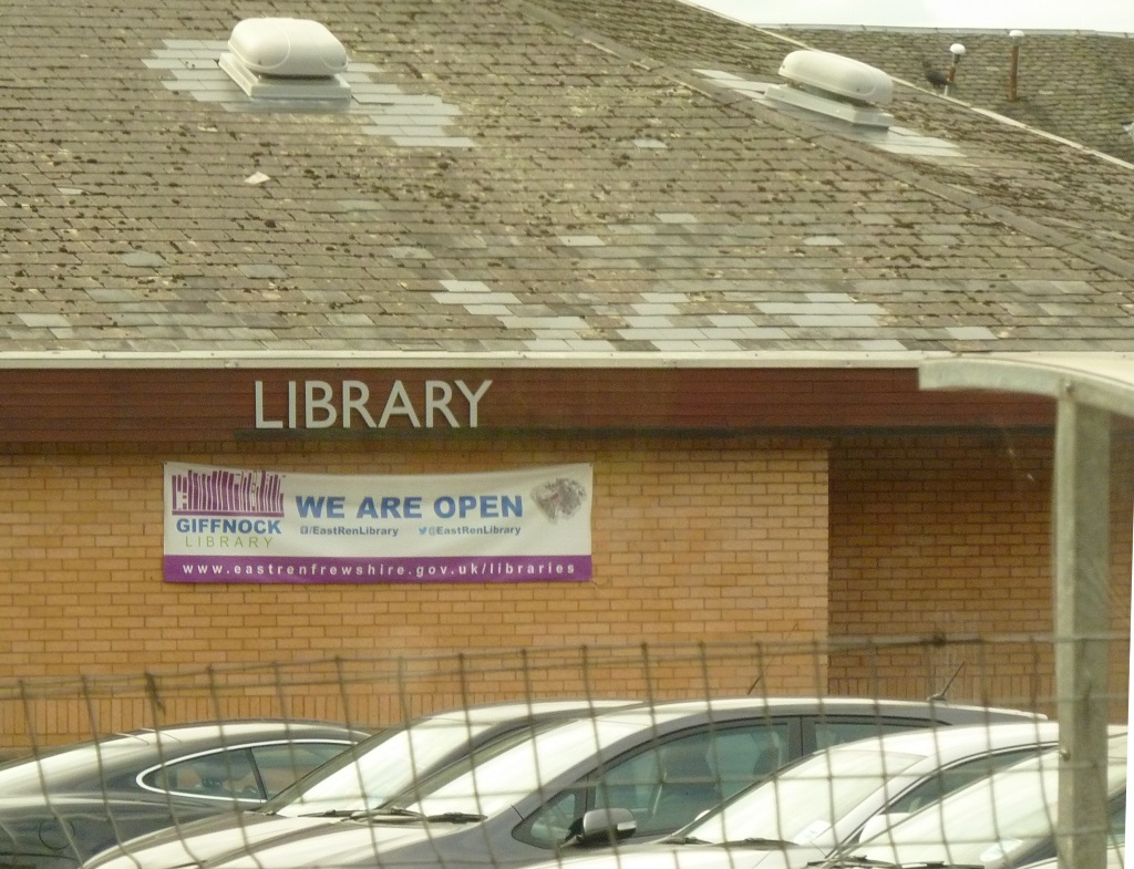
Furthermore, Giffnock has a library and two primary schools: Giffnock Primary School and Braidbar Primary school, non-denominational feeder primary schools for Woodfarm High School.
From the Wikipedia article Giffnock, under CC BY-SA 4.0.
Notable people from Giffnock
 David R. RossBritish historian and writerPhoto: McMarcoP, Public domain
- Gordon BrownPrime Minister of the United Kingdom from 2007 to 2010
- Calum GallagherScottish footballer (born 1994)
- Lewis SmithScottish professional footballer
- Daniel McGillivray BrownScottish organic chemist
- Hugh MorrisScottish footballer
Born in Giffnock, according to Wikidata (CC0). Each name links to its Wikipedia article.
Where to stay2
Churches and places of worship40
St Mary's Roman Catholic Church
Church · Roman Catholic · 1.5 mi
150 Shawhill Road, Glasgow
Williamwood Parish Church
Church · Protestant · 1.0 mi
4 Vardar Avenue, Clarkston
Caledonia Road United Presbyterian Church, 1 Caledonia Road, Glasgow
Church · 3.4 mi
Camphill Queen's Park Church, 20 Balvicar Drive, Glasgow
Church · 2.3 mi
Cathcart Old Parish Church and Hall, Carmunnock Road, Glasgow
Church · 1.9 mi
Cathcart South Church, 90-92 Clarkston Road, Glasgow
Church · 1.4 mi
Queen's Park West Church, 170 Queen's Drive, Glasgow
Church · 2.4 mi
Shopping17
Gas and EV charging8
Schools, colleges and libraries23
St Ninian's High School
School · Roman Catholic · 0.4 mi
Rouken Glen Road
Our Lady Of The Missions Primary School
School · Roman Catholic · 0.5 mi
49 Robslee Road, Thornliebank
Healthcare6
Map of Giffnock
226 places. The map loads OpenStreetMap tiles when you open it.
Getting there and nearby towns
Glasgow Airport (GLA) is the nearest airport with scheduled flights listed in OpenStreetMap, 7 miles away.
- Newton Mearns 3 mi southwest, about 4 min by car
- Rutherglen 4 mi northeast, about 6 min by car
- Glasgow 4 mi north, about 7 min by car
- Paisley 6 mi west, about 9 min by car
- Renfrew 6 mi northwest, about 10 min by car
- Johnstone 9 mi west, about 14 min by car
- Milngavie 10 mi north, about 15 min by car
- Hamilton 10 mi east, about 17 min by car
- Meikle Earnock 11 mi east, about 17 min by car
- Kirkintilloch 11 mi northeast, about 17 min by car
Drive times are estimates from straight-line distance, not routes.
Towns near Giffnock


Keep exploring
Local news
Headlines from INDB.
Reviews, tips and questions
Loading what members have shared...
Sources and licences
- GeoNames (CC BY 4.0): population, coordinates, regions and time zone
- Mapillary (see each image): photos
- OpenStreetMap contributors (ODbL 1.0): places, airports, map data
- Wikidata (CC0 1.0): elevation, founding date, time zone, website, landmarks and historic places
- Wikimedia Commons (see each image): photos
- Wikipedia (CC BY-SA 4.0): overview and history text
Photo credits
- Giffnock Library, WS212121, CC BY-SA 3.0
- Giffnock library (15009912679), JuliaC2006 from Rochester, UK, CC BY 2.0
- Giffnock Railway Station, East Renfrewshire, Wetchup, CC0
- Giffnock Railway Station, Wetchup, CC0
- Maverton Buildings 192-200 Fenwick Road Giffnock, WS212121, CC BY-SA 4.0
- Maverton Buildings 202-210 Fenwick Road Giffnock, WS212121, CC BY-SA 4.0
- 05508 The Park Church of Scotland, Giffnock 003, WeeHolly, CC BY-SA 4.0
- 05508 The Park Church of Scotland, Giffnock 013, WeeHolly, CC BY-SA 4.0
- 05508 The Park Church of Scotland, Giffnock 005, WeeHolly, CC BY-SA 4.0
- 05508 The Park Church of Scotland, Giffnock 004, WeeHolly, CC BY-SA 4.0
- 05508 The Park Church of Scotland, Giffnock 002, WeeHolly, CC BY-SA 4.0
- 05508 The Park Church of Scotland, Giffnock 014, WeeHolly, CC BY-SA 4.0
- 05508 The Park Church of Scotland, Giffnock 011, WeeHolly, CC BY-SA 4.0
- Wfm burrell collection, Unknown author, CC BY-SA 3.0
- Pollok House, Glasgow, LornaMCampbell, CC BY-SA 4.0
- Scotland Street School infants entrance DSCN8975, AlasdairW, CC BY-SA 4.0
- 25 Albert Drive, Tramway Theatre, Stinglehammer, CC BY-SA 4.0
- Linnpark fromcastle, Zeddy ( talk ), Public domain
- Ibroxhill House Portico, Rosser1954 Roger Griffith, Public domain
- Cathkinpark, Celticfcuk ( talk ), Public domain
- Wfm pollok country park, Unknown author, CC BY-SA 3.0
- Queen'sParkSnow, Raymond McCrae, CC BY 2.0
- Rouken Glen waterfall, May 2012, Thrissel, CC BY-SA 3.0
- Church Interior, Alanmathew1978, Public domain
- Caledonia Road Church, Glasgow, Scotland, Michal Klajban, CC BY-SA 4.0
- 20 Balvicar Drive, Camphill Queen's Park Church 01, Stinglehammer, CC BY-SA 4.0
- Govanhill Church Of Scotland, Glasgow, Scotland, Michal Klajban, CC BY-SA 4.0
- 11023 Pollokshields Church of Scotland, Pollokshields 001, WeeHolly, CC BY-SA 4.0
- 170 Queen's Drive, Queen's Park West Church 01, Stinglehammer, CC BY-SA 4.0
- Giffnock Synagogue East Renfrewshire, WS212121, CC BY-SA 4.0
- Holmwood, Zeddy at English Wikipedia, Public domain
- St Ninian's High School East Renfrewshire, WS212121, CC BY-SA 4.0
- Hillparkschool, school, CC BY-SA 4.0
- Couper Institute and Library September 2018, Little antipodes, CC BY-SA 4.0
- Detail of St Mary's & Holy Name Roman Catholic Church, Frayedattheedges, CC BY-SA 4.0
- Greenbank Garden2, Stevouk at English Wikipedia, Public domain
- St Ninians High School, Unknown author, CC BY-SA 3.0
- Hampden Park, Roger May, CC BY-SA 2.0
- Hillpark Secondary front of school, EELDW, CC BY-SA 4.0
- Giffnock Library, WS212121, CC BY-SA 3.0
- Overtoun Park Bandstand, Rutherglen 2016-02-28, User:BrainiacBlink, CC BY-SA 4.0
- Street-level photo, gmc, CC BY-SA 4.0
- Street-level photo, gmc, CC BY-SA 4.0
- Street-level photo, gmc, CC BY-SA 4.0
- Street-level photo, gmc, CC BY-SA 4.0
- Street-level photo, gmc, CC BY-SA 4.0
- Street-level photo, gmc, CC BY-SA 4.0
- Street-level photo, gmc, CC BY-SA 4.0
- Street-level photo, gmc, CC BY-SA 4.0
- Street-level photo, gmc, CC BY-SA 4.0
- Street-level photo, gmc, CC BY-SA 4.0
- Street-level photo, gmc, CC BY-SA 4.0
- Street-level photo, gmc, CC BY-SA 4.0
- Street-level photo, gmc, CC BY-SA 4.0
- Street-level photo, gmc, CC BY-SA 4.0
- Street-level photo, gmc, CC BY-SA 4.0
- Street-level photo, gmc, CC BY-SA 4.0
- Street-level photo, gmc, CC BY-SA 4.0
- Street-level photo, gmc, CC BY-SA 4.0
- Street-level photo, gmc, CC BY-SA 4.0
- Street-level photo, gmc, CC BY-SA 4.0
- Street-level photo, gmc, CC BY-SA 4.0


Page built November 10, 2026. Spotted a mistake? Tell us or suggest a place.