


Newton Mearns, United Kingdom
Newton Mearns is a town of 28,210 people in Scotland, United Kingdom.
Why visit Newton Mearns
Townapedia lists 10 museums and landmarks, 18 parks and trails, 18 places to eat and 2 places to stay in and around town.
Highlights include Mearns Castle, Greenbank Garden, Rouken Glen and Greenbank Gardens.
Weather in Newton Mearns
Forecast from MET Norway (CC BY 4.0). Full forecast
About Newton Mearns
Newton Mearns (Scottish Gaelic: Baile Ùr na Maoirne [ˈpalə ˈuːɾ nə ˈmɯːrˠɲə]) is a town and the largest settlement in East Renfrewshire, Scotland. It lies 7 miles (11 km) south-west of Glasgow City Centre on historically the main road to Ayrshire, 410 feet (125 m) above sea level. It has a population of approximately 26,993, stretching from Whitecraigs and Kirkhill in the north-east to Maidenhill in the south-east, to Westacres and Greenlaw in the west and Capelrig/Patterton in the north-west.
From the Wikipedia article Newton Mearns (this version), under CC BY-SA 4.0.
Photos of Newton Mearns


Museums and landmarks10

Mearns Castle
Monument and historic site · 1.0 mi
Waterfoot Road, Glasgow

Greenbank Garden
Museum · 1.5 mi
An urban oasis with woodland walks and beautiful plants in all seasons.

The Open Museum
Museum · 2.9 mi
Community museum in Glasgow, Scotland, UK

Parks, trails and playgrounds18

Rouken Glen
Park · 1.6 mi
Park in Giffnock, East Renfrewshire, Scotland, UK


Dams to Darnley Country Park
Park · 1.7 mi
Country park to the south-west of Glasgow, Scotland, UK
Overlee Playing Fields
Park · 2.7 mi
Public park in East Renfrewshire, Scotland, UK

6 more on the map.
Restaurants and cafes18
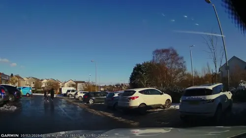
The Royal Indian Restaurant and takeaway
Restaurant · 0.6 mi
198 Harvie Avenue, Newton Mearns
Mo-Su 17:00-24:00
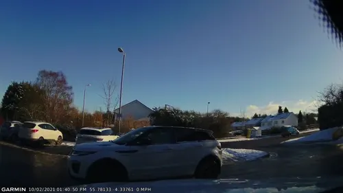
The Deli
Cafe · Glaswegian · 0.6 mi
196 Harvie Avenue, Newton Mearns
Mo-Fr 08:00-15:00


6 more on the map.
Where to stay2

History
The area surrounding Newton Mearns has been inhabited since prehistory, with the remains of an Iron Age hillfort visible on the nearby Duncarnock hill. Ownership of the region passed from Roland de Mearns, who was granted the land by Walter fitz Alan, to the Pollocks (whose name is perpetuated in the nearby Glasgow housing estate of Pollok), and then to the Maxwells of Caerlaverock around 1300. During the 15th century, the towerhouse of Mearns Castle was built. The town then passed to the Maxwells of Nether Pollok in 1648 and then the Stewarts of Blackhall in 1660. A new turnpike road from Eastwood Toll, now the main Ayr Road, was constructed in 1832. By the end of the 18th century quarrying had developed and more importantly numerous textile mills and finishing works became established availing themselves of the numerous rivers and lochs for water supply. The 1893 'Ordnance Gazetteer of Scotland' describes it as "pleasantly situated on a rising ground 410 feet [120 metres] above sea-level". It also reveals that it was a 'burgh of barony' which bestowed the right to hold a weekly market and two annual fairs. However, the Gazetteer also describes the village as being only a "single street on the Glasgow and Kilmarnock highroad".
Read more of the history
From the early 20th century, with the introduction of improved roads and railways to the area, it gradually became a growing commuter suburb of Glasgow. In the 1930s, between speculative and local authority housing ventures, a further 6,000 houses were added to the area and after a lull during the war years, in the 1950s, house building began again in earnest. Unfortunately, the old core village suffered neglect during and after World War II and was all but derelict by the 1960s. It was purchased and turned into a shopping centre which was later to become 'The Avenue at Mearns' in 1990.
Historical buildings in the area include the 15th century Mearns Castle, Greenbank House owned by the National Trust for Scotland (just inside neighbouring Clarkston) and the 1813 Mearns Kirk.
Glasgow University Archaeological Research Division (GUARD) undertook work on the Pollock Castle site, and history in 2000.
The castle appears to be noted by Pont's sixteenth-century map. The castle was demolished and rebuilt as a large stately house 1686 by Sir Robert Pollok. It was completely destroyed by fire in 1882 (after remaining empty for some while) and then rebuilt again shortly after in the Scottish Baronial style. It was finally abandoned in the 1940s and fell into ruin. Some of the ruins were dynamited in the 1970s and a large prefabricated house erected on the castle foundations. The prefabricated house was removed and the site cleared in the early 1990s, and the castle was again rebuilt in 2003, in the Scottish Adam style. Some of the original foundations and castle walls remain.
From the History section of Newton Mearns on Wikipedia, under CC BY-SA 4.0.
More about Newton Mearns
Economy
Newton Mearns is primarily a residential area, with most of its inhabitants travelling by car or public transport to Glasgow for employment and shopping. However, there are a number of small businesses in the area, as well as an indoor shopping centre.
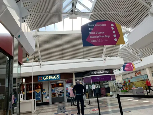
The Avenue Shopping Centre is the main large retail centre in Newton Mearns. It comprises a total of 44 stores, currently including two supermarkets, three banks, nine clothing stores, food shops, restaurants and a library. The line of the main shopping area in the Avenue runs the course of the old Mearns Main Street. There are also shopping units and restaurants at Broom on the Ayr Road, shopping units and restaurants at Broomburn on the Mearns Road, and shopping units and restaurants at Crookfur on Harvie Avenue. The newly constructed Greenlaw Village close to the M77 at Crookfur Road also has two supermarkets, a hotel, smaller shops and a number of restaurants.
The 120 homes in the Hugh Fraser Retirement Estate have been fitted with smart technology and sensors, giving residents control of heating, lighting and doorbells using Amazon Alexa, its first use in an assisted living setting for a Scottish retirement community.
Education
Mearns has nine primary schools and four high schools, including one Private school: The neighbouring town of Giffnock has the local Roman Catholic high school of St Ninians High School.
St Clare's Primary School and Calderwood Lodge Primary School (shared campus)
From the Wikipedia article Newton Mearns, under CC BY-SA 4.0.
Notable people from Newton Mearns
 Margaret Campbell, Duchess of ArgyllBritish socialite (1912-1993)Photo: Allan warren, CC BY-SA 4.0
- Donald McKinlayScottish footballer (1891-1959)
- Jackson CarlawLeader of the Scottish Conservative Party
- Jamie HamiltonScottish footballer
- Gavin JarvieScottish footballer (1879-1957)
- Allan Gilmour, Sr.Scottish lumber magnate; created operations in British North America
Born in Newton Mearns, according to Wikidata (CC0). Each name links to its Wikipedia article.
Churches and places of worship10
Broom Parish Church
Church · Church Of Scotland · 1.1 mi
1 Broom Road East, Newton Mearns
Shopping11
Gas and EV charging3
Schools, colleges and libraries12
Healthcare5
Map of Newton Mearns
89 places. The map loads OpenStreetMap tiles when you open it.
Getting there and nearby towns
Glasgow Airport (GLA) is the nearest airport with scheduled flights listed in OpenStreetMap, 8 miles away.
- Paisley 6 mi northwest, about 9 min by car
- Rutherglen 6 mi northeast, about 10 min by car
- Glasgow 7 mi northeast, about 11 min by car
- Renfrew 7 mi north, about 12 min by car
- Wishaw 16 mi east, about 26 min by car
- Port Glasgow 18 mi northwest, about 29 min by car
- Saltcoats 20 mi southwest, about 32 min by car
- Troon 20 mi southwest, about 33 min by car
- Prestwick 23 mi southwest, about 37 min by car
- Whitburn 26 mi east, about 42 min by car
Drive times are estimates from straight-line distance, not routes.
Towns near Newton Mearns


Keep exploring
Local news
Headlines from INDB.
Reviews, tips and questions
Loading what members have shared...
Sources and licences
- GeoNames (CC BY 4.0): population, coordinates, regions and time zone
- Mapillary (see each image): photos
- OpenStreetMap contributors (ODbL 1.0): places, airports, map data
- Wikidata (CC0 1.0): elevation, founding date, time zone, website, landmarks and historic places
- Wikimedia Commons (see each image): photos
- Wikipedia (CC BY-SA 4.0): overview and history text
Photo credits
- 03429 Newton Mearns Church of Scotland, Newton Mearns 006, WeeHolly, CC BY-SA 4.0
- 03429 Newton Mearns Church of Scotland, Newton Mearns 001, WeeHolly, CC BY-SA 4.0
- 03429 Newton Mearns Church of Scotland, Newton Mearns 014, WeeHolly, CC BY-SA 4.0
- 03429 Newton Mearns Church of Scotland, Newton Mearns 008, WeeHolly, CC BY-SA 4.0
- 03429 Newton Mearns Church of Scotland, Newton Mearns 013, WeeHolly, CC BY-SA 4.0
- 03429 Newton Mearns Church of Scotland, Newton Mearns 010, WeeHolly, CC BY-SA 4.0
- 03429 Newton Mearns Church of Scotland, Newton Mearns 005, WeeHolly, CC BY-SA 4.0
- 03429 Newton Mearns Church of Scotland, Newton Mearns 011, WeeHolly, CC BY-SA 4.0
- 03429 Newton Mearns Church of Scotland, Newton Mearns 007, WeeHolly, CC BY-SA 4.0
- 03429 Newton Mearns Church of Scotland, Newton Mearns 004, WeeHolly, CC BY-SA 4.0
- 03429 Newton Mearns Church of Scotland, Newton Mearns 002, WeeHolly, CC BY-SA 4.0
- 03429 Newton Mearns Church of Scotland, Newton Mearns 009, WeeHolly, CC BY-SA 4.0
- 03429 Newton Mearns Church of Scotland, Newton Mearns 003, WeeHolly, CC BY-SA 4.0
- 03429 Newton Mearns Church of Scotland, Newton Mearns 012, WeeHolly, CC BY-SA 4.0
- 02051 Glasgow Reform Jewish Synagogue, Newton Mearns 003, WeeHolly, CC BY-SA 4.0
- 02051 Glasgow Reform Jewish Synagogue, Newton Mearns 004, WeeHolly, CC BY-SA 4.0
- 02051 Glasgow Reform Jewish Synagogue, Newton Mearns 001, WeeHolly, CC BY-SA 4.0
- 02051 Glasgow Reform Jewish Synagogue, Newton Mearns 002, WeeHolly, CC BY-SA 4.0
- 07232 Former St Cadoc's Roman Catholic Church, Newton Mearns 001, WeeHolly, CC BY-SA 4.0
- Rouken Glen waterfall, May 2012, Thrissel, CC BY-SA 3.0
- Church Interior, Alanmathew1978, Public domain
- Mearns Castle, wrobison, CC BY-SA 2.0
- Greenbank Garden2, Stevouk at English Wikipedia, Public domain
- GreenbankGardensHouse2008, GeorgeRob ( talk ), Public domain
- Greenbank Garden, Clarkston 2, LornaMCampbell, CC BY-SA 4.0
- Street-level photo, gmc, CC BY-SA 4.0
- Street-level photo, gmc, CC BY-SA 4.0
- Street-level photo, gmc, CC BY-SA 4.0
- Street-level photo, gmc, CC BY-SA 4.0
- Street-level photo, gmc, CC BY-SA 4.0
- Street-level photo, gmc, CC BY-SA 4.0
- Street-level photo, gmc, CC BY-SA 4.0
- Street-level photo, gmc, CC BY-SA 4.0
- Street-level photo, gmc, CC BY-SA 4.0
- Street-level photo, gmc, CC BY-SA 4.0
- Street-level photo, gmc, CC BY-SA 4.0
- Street-level photo, gmc, CC BY-SA 4.0
- Street-level photo, gmc, CC BY-SA 4.0
- Street-level photo, gmc, CC BY-SA 4.0
- Street-level photo, gmc, CC BY-SA 4.0
- Street-level photo, gmc, CC BY-SA 4.0
- Street-level photo, gmc, CC BY-SA 4.0
- Street-level photo, gmc, CC BY-SA 4.0
- Street-level photo, gmc, CC BY-SA 4.0
- Street-level photo, gmc, CC BY-SA 4.0
- Street-level photo, gmc, CC BY-SA 4.0
- Street-level photo, gmc, CC BY-SA 4.0
- Street-level photo, gmc, CC BY-SA 4.0
- Street-level photo, gmc, CC BY-SA 4.0
- Street-level photo, gmc, CC BY-SA 4.0


Page built November 10, 2026. Spotted a mistake? Tell us or suggest a place.