


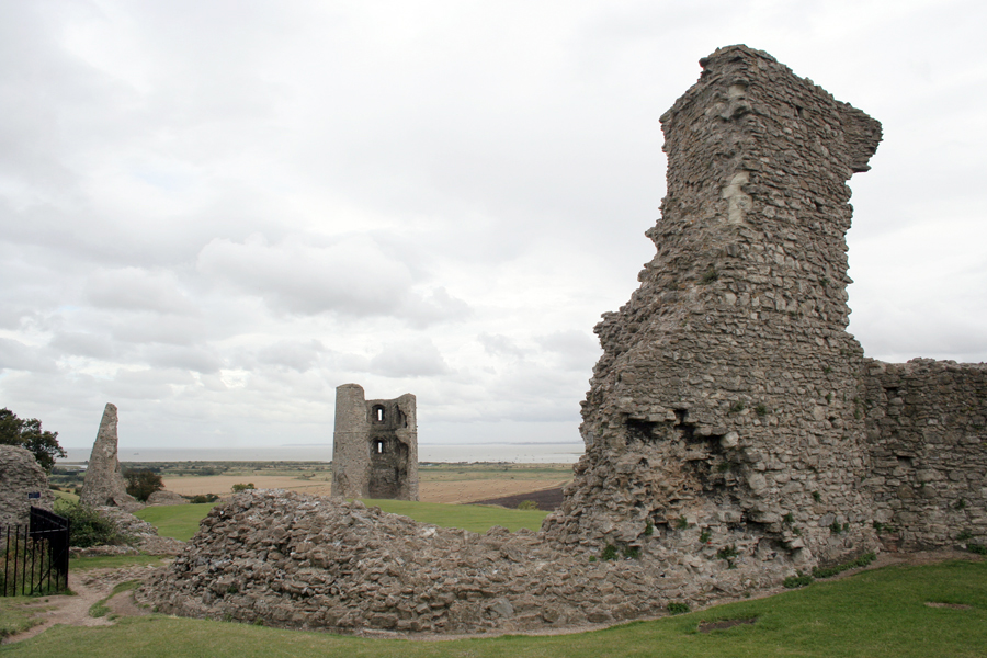


Canvey Island, United Kingdom
Canvey Island is a town of 38,170 people in England, United Kingdom.
Why visit Canvey Island
Townapedia lists 9 museums and landmarks, 29 parks and trails, 32 places to eat and 7 attractions in and around town.
Highlights include Movie Starr, Dutch Cottage Museum, Hadleigh Castle and Canvey Wick.
Weather in Canvey Island
Forecast from MET Norway (CC BY 4.0). Full forecast
About Canvey Island
Canvey Island is a town, civil parish and island in the Thames Estuary. It forms part of the Castle Point district of Essex, England. It is separated from the mainland of south Essex by a network of creeks, but is connected to the mainland by bridges. It has an area of 7.12 square miles (18.44 km2).
From the Wikipedia article Canvey Island (this version), under CC BY-SA 4.0.
Travel tips from other travellers: Canvey Island on Wikivoyage (CC BY-SA 4.0).
Things to do7



Museums and landmarks9




Parks, trails and playgrounds29


Little Haven Nature Reserve
Park · 3.6 mi
Essex Wildlife Trust Nature reserve




Great Wood and Dodd's Grove
Park · 3.1 mi
Essex Wildlife Trust Nature reserve
17 more on the map.
Restaurants and cafes32

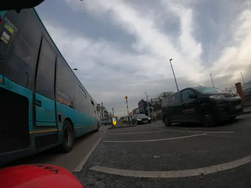
mall road
Restaurant · Indian · 2.5 mi
305-307 London Road, Benfleet
Mo off; Tu-Th 17:30-22:30; Fr-Sa 17:30-23:00; Su 17:30-22:00
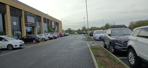
Costa Drive Thru
Cafe · Coffee Shop · 1.4 mi
Unit 6 Roscommon Way, Canvey Island
Mo-Sa 07:00-18:00; Su 08:00-17:00



New Mandarin Chinese Take Away
Restaurant · Chinese · 0.7 mi
358 Long Road, Canvey Island
20 more on the map.
History
Excavations on Canvey have unearthed a collection of early man-made objects comprising axes from the Neolithic era, a bracelet dating from the Bronze Age, and Iron Age pottery. However, the remains of Roman structures and objects suggests the first settlement of Canvey occurred between AD 50 and 250. The remains point to a community existing with a farmstead, a garrison, a burial ground, and the operation of a large salt-making industry (revealed by the existence of several red hills).
The discovery of a Roman road found to terminate 109 yards (100 m) across the creek in neighbouring Benfleet suggests a means may have existed to facilitate the salt's distribution to Chelmsford and Colchester, and the recovery of rich items of pottery and glassware of a variety only matched elsewhere by excavations of port facilities suggests the Romans may also have exploited Canvey's location in the Thames for shipping.
Read more of the history
In 1607 the Elizabethan antiquarian William Camden noted in his work Britannia (a topographical and historical survey of all of Great Britain and Ireland) that Canvey Island (which he called Island Convennon) was documented in the 2nd century by the Alexandrian geographer Ptolemy. In his work Geographia, Ptolemy mentions a headland in the mouth of the Thames to the east of the Trinovantes region called Counus Island. However, the difficulties faced in determining the location of land areas in Ptolemy's ancient work have led modern researchers to question the correlation between Ptolemy's island and contemporary Canvey. MacBean and Johnson, 18th-century historians, contend that Counus Island would have existed much further out to sea (or may even have been the Isle of Sheppey), so any similarity between the names is mere coincidence. Without any suitable island matching Ptolemy's Counus Island, 20th-century historians White and Yearsley posit the documented island to have been lost or reduced to an insignificant sandbank by subsidence and the constant effects of the sea.
The settlement and agricultural development of Essex by the Saxons from the 5th century saw the introduction of sheep farming, which would dominate the island's industry until the 20th century. After the Norman conquest the area of Canvey was recorded in the Domesday Book as a sheep-farming pasture under the control of nine parishes across south inland and coastal Essex; some of these parishes were on the adjacent mainland, but others were as far afield as Laindon and Prittlewell. Apart from the meat and wool produced from the sheep, the milk from the ewes was used for cheese-making. The abundance in later centuries would see the cheeses become a commodity taken for sale at the London markets, and at one stage exported via Calais to the continent.
The existence of several place names on modern Canvey using the wick suffix (denoting the sheds in which the cheese was made) shows the influence of the early Saxon culture. Historian Ian Yearsley states that the name of the island is derived from the Anglo-Saxon Caningaege, meaning "the Island of Cana's People". Developments in the English language yielded the more familiar form Caneveye found in manorial records of 1254. The period of transition from Old to Early Middle English often give rise to confusions of orthography, leading, in this instance, to such variant spellings as Canefe, Kaneweye, Kaneveye and Koneveye. By the 12th century, Essex and subsequently Canvey were in the possession of Henry de Essex who inherited the land from his grandfather, Swein, son of Robert fitz Wymarch. During the reign of Henry II (1154–1189) the land was confiscated from de Essex and redistributed among the King's favoured nobles.
During Edward II's reign (1307–1327) the land was under the possession of John de Apeton and the first attempts were made at managing the effects of the sea with rudimentary defences, but periodical flooding continued to blight the small population of mostly shepherds and their fat-tailed variety of sheep for a further 300 years. William Camden wrote of the island in 1607 that it was so low that it was often quite flooded, except the hills, upon which the sheep had a place of safe refuge. The uniform flatness of Canvey suggests that these hills are likely to be the red hills of the Roman saltmaking industry, or the early makeshift sea defences constructed by some of the landowners around their farms.
In 1622, Sir Henry Appleton (a descendant of John de Apeton) and Canvey's other landowners instigated a project to reclaim the land and wall the island from the Thames. The scheme was managed by an acquaintance of Appleton's – Joas Croppenburg, a Dutch haberdasher of Cheapside in London. An agreement reached in 1623 stipulated that in return for inning and recovering the island, the landowners would grant a third of the land as payment for the work.
The presence of the Dutch engineer Cornelius Vermuyden, a relation of Croppenburg's, in England at the time of the project on a commission to drain the Fens and involved in repairing the seawall at Dagenham, has led to speculation that Vermuyden oversaw the project, but proof appears to be vague; nevertheless, the work was completed by around 300 Dutch workers skilled in the construction of dykes and other sea defences. The engineers successfully reclaimed 3,600 acres (15 km2) by walling the island with local chalk, limestone and the heavy clay of the marshes, with the main length along the Thames faced with Kentish ragstone.
A broad drainage ditch was dug inland off the area facing the river while smaller inlets were filled in. Excess water would have collected in the broad ditch and then been discharged into the river by the means of seven sluices (later known as Commissioners Dykes). The completion of the work saw a considerable number of the Dutch engineers take land as payment for their work, and consequently settle on the island.
From the History section of Canvey Island on Wikipedia, under CC BY-SA 4.0.
More about Canvey Island
Geography
Canvey Island lies off the south coast of Essex 30 miles (48 km) east of London, and 15 miles (24 km) west of Southend-on-Sea. The island is separated from the mainland to the north and west by Benfleet, East Haven and Vange creeks, and faces the Thames Estuary to the east and south. Along with neighbouring Two Tree Island, Lower Horse and Upper Horse, Canvey is an alluvial island formed in the Holocene period from silt in the River Thames and material entering the estuary on the tides of the North Sea from the coast of Norfolk. An unsuccessful search for coal beneath the island in 1953 revealed that the alluvium rests upon layers of London Clay, Lower London Tertiaries, Chalk, Lower Greensand and Gault Clay, with the basement rocks at a depth of 1,300 feet (400 m) consisting of hard Old Red Sandstone of Devonian age.
The island is extremely flat, lying 10 feet (3 m) below mean high water level and consequently is at risk of flooding. Before reclamation, the surrounding area contained a number of islands separated by tidal creeks. Flood defences have been constructed since the Middle Ages, and the first sea wall to completely surround the island was built as part of the island's reclamation in 1622. The island suffered extensive flooding in 1731, 1736, 1791, 1881 and 1897, and substantial loss of life in the North Sea Flood of 1953.
Arts and culture
The island has only been populated since the 17th century when the Dutch including reputedly Cornelius Vermuyden made the marshlands habitable. There are local legends of a Dutchman carrying a sack wandering the northern parts of the island.
The story of 'The Black Man' and 'The White Lady' is believed to be a mythical tale conjured up by smugglers to stop people wandering onto the 'saltings' and finding their smuggled goods. It was said that 'The Black Man' offered a price for your soul, while the 'White Woman' would tempt you to dance with her. Men often spoke of trying to chase away the figures, only to watch them vanish before their eyes.
Many night fishermen have reported seeing a tall, burly Viking standing on the mudflats at The Point, on the far eastern side of the island. It is believed that he was left behind by his fleet and waited for his ship to return; only to drown in the rising tide.
According to an urban legend, a female farmhand at the now demolished Knightswick Farm watched a nun approach the farm from the fields one afternoon from the porch of the farmhouse. Puzzled as to why the nun had walked across the muddy fields, the girl left the porch and walked towards the nun intending to greet her. Allegedly the nun began to vanish into the ground as she walked.
Education
Canvey Island has two comprehensive schools: the Cornelius Vermuyden School and Castle View School. Both were rebuilt in 2012 as replacements for the island's three ageing comprehensives, and as a response to the island's decreasing numbers of 11- to 16-year-olds.
Cornelius Vermuyden occupies the same site as its predecessor near Waterside Farm, while Castle View School – within the town centre and centre of the island – has replaced Furtherwick Park School, having previously existed within the island's north/central Winter Gardens Ward, overlooked by Hadleigh Castle. Furtherwick Park School shut in 2010, remaining pupils were then moved to Castle View School to finish their education. This site is now the location of Canvey Skills Campus which was built in 2013 and provided vocational education for 14- to 19-year-olds, and adult learning and was run by PROCAT. However, after the merger of South Essex College and PROCAT, the centre was closed and was reopened by USP College in September 2021 as their XTEND digital campus and new home to its digital apprenticeship provider ITEC.
From the Wikipedia article Canvey Island, under CC BY-SA 4.0.
Notable people from Canvey Island
 Tim WhitnallEnglish actorPhoto: Timothy5555, CC BY-SA 3.0
- Wilko JohnsonEnglish musician (1947–2022)
- Billy KnottBritish footballer (born 1992)
- Frank SaulEnglish association football player (born 1943)
- Ty GoodenFootballer (born 1972)
- Gary HealeEnglish footballer (born 1958)
- Brett SolkhonEnglish association football player (born 1982)
- Kate Louise Jonesphysicist
- Dominic LyneBritish writer
- Claire KoberLabour Politician
- Sammy AlbonBritish YouTube personality, radio presenter and digital creator
- Niki AlbonBritish YouTube personality, radio presenter and digital creator
Born in Canvey Island, according to Wikidata (CC0). Each name links to its Wikipedia article.
Churches and places of worship16
Canvey Island Kingdom Hall Of Jehovah's Wittness
Church · Jehovahs Witness · 0.7 mi
Meppel Avenue
Shopping13
Gas and EV charging3
Schools, colleges and libraries19
St Joseph's Catholic Primary School and Nursery
School · Roman Catholic · 0.4 mi
Vaagen Road, Canvey Island
St Katherine's Church of England Primary School
School · Anglican · 0.5 mi
Hilton Road, Canvey Island
Healthcare3
Map of Canvey Island
131 places. The map loads OpenStreetMap tiles when you open it.
Getting there and nearby towns
London Southend Airport (SEN) is the nearest airport with scheduled flights listed in OpenStreetMap, 6 miles away.
- South Benfleet 2 mi northwest, about 4 min by car
- Hadleigh 2 mi northeast, about 4 min by car
- Pitsea 4 mi northwest, about 7 min by car
- Rayleigh 5 mi north, about 7 min by car
- Southend-on-Sea 6 mi east, about 9 min by car
- Basildon 6 mi northwest, about 10 min by car
- Stanford-le-Hope 6 mi west, about 10 min by car
- Wickford 7 mi north, about 11 min by car
- Rochford 7 mi northeast, about 11 min by car
- Gillingham 9 mi south, about 15 min by car
Drive times are estimates from straight-line distance, not routes.
Towns near Canvey Island


Keep exploring
Local news
Headlines from INDB.
Reviews, tips and questions
Loading what members have shared...
Sources and licences
- GeoNames (CC BY 4.0): population, coordinates, regions and time zone
- Mapillary (see each image): photos
- OpenStreetMap contributors (ODbL 1.0): places, airports, map data
- Wikidata (CC0 1.0): elevation, founding date, time zone, website, landmarks and historic places
- Wikimedia Commons (see each image): photos
- Wikipedia (CC BY-SA 4.0): overview and history text
Photo credits
- Canvey 060309 1, Terryjoyce, CC BY-SA 3.0
- Occidental jetty and reed beds at Canvey Wick, Oneblackline, CC BY-SA 3.0
- Belton Hills 6, Dudley Miles, CC BY-SA 4.0
- Hadleigh Castle curtain and east towers, Oneblackline, CC BY-SA 3.0
- Little Haven 3, Dudley Miles, CC BY-SA 4.0
- Pound Wood 2, Dudley Miles, CC BY-SA 4.0
- Tile Wood 11, Dudley Miles, CC BY-SA 4.0
- Belfairs Methodist Church cropped, David Howard, CC BY-SA 2.0
- StClementsChurch LeighOnSea, JohnArmagh, Public domain
- HadleighCastle, JohnArmagh, Public domain
- 1618 dutch cottage canvey island, Oneblackline, CC BY-SA 3.0
- Labworth Restaurant and Beach Bistro 2008, Oneblackline, CC BY 3.0
- Chalkwell Park Cricket Ground, Glyn Baker, CC BY-SA 2.0
- Street-level photo, kevinleake01, CC BY-SA 4.0
- Street-level photo, adam2, CC BY-SA 4.0
- Street-level photo, wasd42, CC BY-SA 4.0
- Street-level photo, adam2, CC BY-SA 4.0
- Street-level photo, adam2, CC BY-SA 4.0
- Street-level photo, adam2, CC BY-SA 4.0
- Street-level photo, kevinleake01, CC BY-SA 4.0
- Street-level photo, adam2, CC BY-SA 4.0
- Street-level photo, wasd42, CC BY-SA 4.0
- Street-level photo, wasd42, CC BY-SA 4.0
- Street-level photo, adam2, CC BY-SA 4.0
- Street-level photo, adam2, CC BY-SA 4.0
- Street-level photo, adam2, CC BY-SA 4.0
- Street-level photo, adam2, CC BY-SA 4.0
- Street-level photo, adam2, CC BY-SA 4.0
- Street-level photo, kevinleake01, CC BY-SA 4.0
- Street-level photo, adam2, CC BY-SA 4.0
- Street-level photo, kevinleake01, CC BY-SA 4.0


Page built November 10, 2026. Spotted a mistake? Tell us or suggest a place.