


Why visit Pitsea
Townapedia lists 1 museum or landmark, 19 parks and trails, 16 places to eat, 2 places to stay and 1 attraction in and around town.
Highlights include Wat Tyler Country Park and Canvey Wick.
Weather in Pitsea
Forecast from MET Norway (CC BY 4.0). Full forecast
About Pitsea
Pitsea is a suburban town forming the eastern part of Basildon in Essex, England. Historically a separate village and parish. Pitsea was a small village until the first half of the 20th century, when it experienced significant plotlands development. In 1949, it was included in the designated area of the new town of Basildon, which led to further residential and urban development.
From the Wikipedia article Pitsea (this version), under CC BY-SA 4.0.
Things to do1

Museums and landmarks1

Parks, trails and playgrounds19


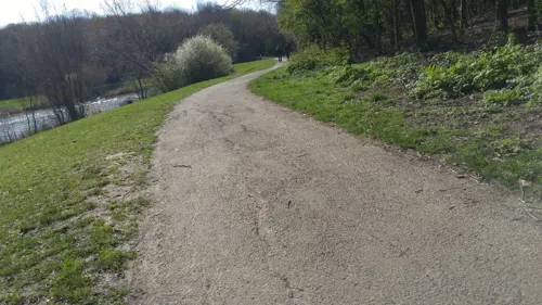

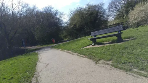


7 more on the map.
Restaurants and cafes16



4 more on the map.
History
The name Pitsea comes from ey, which in the Anglian dialect of Old English meant an island (in the sense of an area of dry land surrounded by marsh), coupled with the name of a person called Pic or Pit. The name therefore means Pic's island.
In the Domesday Book of 1086, Pitsea is listed as Piceseia in the Barstable Hundred of Essex. At that time it was owned by a woman called Wulfeva or Wulfgifu.
No church or priest is mentioned at Pitsea in the Domesday Book, but it subsequently became a parish. A church is known to have existed at Pitsea by the 12th century. The church, dedicated to St Michael, stood on a small hill called Pitsea Mount, which is likely the area of dry land referenced in Pitsea's name. The church was completely rebuilt in the early 16th century. It suffered with subsidence, and so the nave and chancel were rebuilt in 1871. The church was declared redundant in 1983 and fell into disrepair. The Victorian parts of the building were demolished in 1998, leaving just the 16th-century tower standing.
Read more of the history
In the 1840s, Pitsea was described as a village at the head of a creek, with the parish having a population of 304. It had two manor houses: Pitsea Hall to the west of the village, and Chalvedon to the north. Pitsea Hall dates back to the 16th century and was once owned by the Cromwell family. The building has now been renamed Cromwell Manor and serves as an events venue. The manor house of Great Chalvedon Hall also dates back to the 16th century. It now serves as a public house.
Pitsea railway station opened in 1855 on the London, Tilbury and Southend Railway. The original main line ran close to the Thames Estuary coast. In the 1880s the company built a shorter inland route, which left the old main line at Barking and rejoined it at Pitsea, which therefore became a junction station.
The area's heavy clay soil made for poor quality agricultural land. The late 19th century and early 20th century was a period of wider agricultural depression, and many farms in the area were sold for development as plotlands, especially in the 1920s and 1930s. People bought individual plots on which to build a house, but there was very little provision of infrastructure and many of the houses were of a poor quality.
Some facilities to serve Pitsea were built in the 1920s. A market started operating on Station Lane in 1925; it has since moved location a number of times. A number of other facilities were built at the instigation of Harold George Howard, a local landowner, farmer and businessman. He was responsible for the early development of much of Pitsea's nascent town centre on land to the north of the railway station in the late 1920s and early 1930s, including the Railway Hotel, a cinema, and parades of shops in a mock-Tudor style along The Broadway. The hotel and cinema have been demolished, but the shops remain. Howard was also responsible for laying out a park to the east of the town centre, where Pitsea's war memorial was erected in 1928. The park is now named Howard Park after him. By 1931, the parish of Pitsea had a population of 3,414.
The district and county councils were concerned by the poor quality of housing and infrastructure in the plotlands areas which had grown up around Pitsea and nearby Laindon. When the government was considering sites for new towns after the Second World War, the two councils petitioned for one such new town to be located around Pitsea and Laindon, partly as a way of securing funding to improve the area's infrastructure and housing. Basildon was formally designated as a new town in 1949, taking its name from a smaller village in between Laindon and Pitsea. There were about 8,700 existing homes in the designated area for the new town, of which 5,500 were deemed substandard.
A masterplan for the new town was published in 1951, which involved redeveloping most of the plotlands and replacing them with modern neighbourhoods. The neighbourhoods at the Pitsea end of the new town included Chalvedon, Eversley, Felmores (sometimes now called Northlands Park Neighbourhood), Pitsea Mount and the industrial area of Burnt Mills.
The Cinema Museum in London holds extensive home movies from the Jefree family of Pitsea in the 1950s.
Further major development of Pitsea did not take place until the 1960s, when the new town redevelopment of Basildon took shape. Pitsea market was moved from its original location in Station Lane in 1969 to Howards Field, to make way for the construction of South Mayne. The A13 flyover, completed in 1973, separates Pitsea Mount and the railway station from the rest of Pitsea. In 1976, Pitsea's expanded town centre was opened along Northlands Pavement (previously Northlands Drive), immediately north of the 1920s town centre. Sainsbury's was the anchor store, along with a new office block called Pembroke House; it was quickly followed by the new Pitsea swimming pool (demolished 2013). In 1978, Tesco opened what was at the time the largest supermarket in Europe, and would eventually become the first Tesco Extra store in 1997. Also, in 1978, Pitsea Market moved for a second time; it relocated behind the Railway Hotel and in front of the Sainsbury's supermarket (the second market place became a car park).
In 1981, the Pitsea Centre opened - a leisure centre and library opposite the former pool. A new leisure centre at Eversley opened in 1987. 1995 saw the opening of the Old Market Retail park on the second market place; part of this was destroyed by fire in 2006, to be rebuilt again in 2007. Sainsbury's supermarket moved outwards to Nethermayne, on the former sports ground of Carrera's cigarette factory.
From the History section of Pitsea on Wikipedia, under CC BY-SA 4.0.
More about Pitsea
Education
The Basildon Information and Technology Education Centre (ITEC) was formerly located in Burnt Mills Road. The centre provided both day and night courses in computer IT and design and technology for both school leavers and adults. It was once an infant and junior school for the local area called Nevendon Infant and Junior School, but due to other schools opening in the area, pupil numbers declined and the school eventually closed.
Essex County Council's Adult Community Learning service operated a satellite centre at Briscoe School in Felmores End until 2016, in addition to the main centre located at Ely House at Churchill Way in Fryerns.
From the Wikipedia article Pitsea, under CC BY-SA 4.0.
Where to stay2
Churches and places of worship15
Shopping4
Gas and EV charging2
Schools, colleges and libraries16
Healthcare3
Map of Pitsea
79 places. The map loads OpenStreetMap tiles when you open it.
Getting there and nearby towns
London Southend Airport (SEN) is the nearest airport with scheduled flights listed in OpenStreetMap, 8 miles away.
- Basildon 2 mi west, about 4 min by car
- Wickford 3 mi north, about 5 min by car
- Stanford-le-Hope 4 mi southwest, about 7 min by car
- Rayleigh 4 mi east, about 7 min by car
- Southend-on-Sea 9 mi east, about 15 min by car
- Rochford 9 mi east, about 14 min by car
- Tilbury 10 mi southwest, about 15 min by car
- South Ockendon 10 mi west, about 17 min by car
- Chelmsford 12 mi north, about 19 min by car
- Gillingham 12 mi south, about 20 min by car
Drive times are estimates from straight-line distance, not routes.
Towns near Pitsea


Keep exploring
Local news
Headlines from INDB.
Reviews, tips and questions
Loading what members have shared...
Sources and licences
- GeoNames (CC BY 4.0): population, coordinates, regions and time zone
- Mapillary (see each image): photos
- OpenStreetMap contributors (ODbL 1.0): places, airports, map data
- Wikidata (CC0 1.0): elevation, founding date, time zone, website, landmarks and historic places
- Wikimedia Commons (see each image): photos
- Wikipedia (CC BY-SA 4.0): overview and history text
Photo credits
- Church of St. Michael, Pitsea Mount, oneblackline, CC BY-SA 3.0
- Pitsea War Memorial Howard Park south, Piecesofuk, CC BY-SA 4.0
- Pitsea War Memorial Howard Park west, Piecesofuk, CC BY-SA 4.0
- Pitsea War Memorial Howard Park east, Piecesofuk, CC BY-SA 4.0
- Pitsea War Memorial Howard Park north, Piecesofuk, CC BY-SA 4.0
- Pitsea - Pitsea Memorial Statue - 20210708155019, MadeInBasildon, CC BY-SA 4.0
- Wat Tyler Country Park 10, Dudley Miles, CC BY-SA 4.0
- Occidental jetty and reed beds at Canvey Wick, Oneblackline, CC BY-SA 3.0
- Vange Hill 5, Dudley Miles, CC BY-SA 4.0
- Vange Church, John Salmon, CC BY-SA 2.0
- Street-level photo, adam2, CC BY-SA 4.0
- Street-level photo, IpswichEdits, CC BY-SA 4.0
- Street-level photo, wasd42, CC BY-SA 4.0
- Street-level photo, petermead, CC BY-SA 4.0
- Street-level photo, adam2, CC BY-SA 4.0
- Street-level photo, kevinleake01, CC BY-SA 4.0
- Street-level photo, wasd42, CC BY-SA 4.0
- Street-level photo, wasd42, CC BY-SA 4.0
- Street-level photo, petermead, CC BY-SA 4.0
- Street-level photo, kevinleake01, CC BY-SA 4.0
- Street-level photo, wasd42, CC BY-SA 4.0
- Street-level photo, danhancock, CC BY-SA 4.0

Page built November 10, 2026. Spotted a mistake? Tell us or suggest a place.