


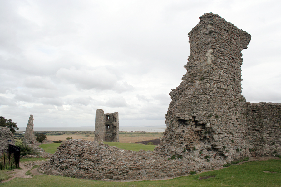

Rayleigh, United Kingdom
Rayleigh is a town of 32,380 people in England, United Kingdom.
Why visit Rayleigh
Townapedia lists 5 museums and landmarks, 21 parks and trails, 49 places to eat, 1 place to stay and 1 attraction in and around town.
Highlights include Rayleigh Town Museum, Rayleigh Mill, Tile Wood and Belton Hills.
Weather in Rayleigh
Forecast from MET Norway (CC BY 4.0). Full forecast
About Rayleigh
Rayleigh is a market town and civil parish in the Rochford District, Essex, England. It lies between Chelmsford and Southend-on-Sea, 32 miles (51 km) east of central London. At the 2021 census, the parish had a population of 32,248 and the built-up area had 32,380.
From the Wikipedia article Rayleigh, Essex (this version), under CC BY-SA 4.0.
Things to do1

Museums and landmarks5

Rayleigh Town Museum
Museum
Small local museum located in Rayleigh High Street

Parks, trails and playgrounds21


Little Haven Nature Reserve
Park · 1.0 mi
Essex Wildlife Trust Nature reserve

Marylands Nature Reserve
Park · 2.7 mi
Local Nature Reserve in Hockley, Essex, England



Great Wood and Dodd's Grove
Park · 2.0 mi
Essex Wildlife Trust Nature reserve
9 more on the map.
Restaurants and cafes49

The Paul Pry
Bar and pub
14 High Road
Mo-Th 11:00-23:00; Fr 11:00-24:00; Sa 10:00-24:00; Su 10:00-22:30


37 more on the map.
History
There has been a scattering of stray finds around the town from Prehistoric and Roman times, including some Roman roof and hypocaust tiles found within the fabric of Rayleigh Church. This suggests that there was a Roman habitation site within the area. However, there is little evidence of any density of population here during this period.
One significant archaeological find was in the early 2000s at the western edge of Rayleigh, at the site of the former Park School in Rawreth Lane. An early Saxon cemetery site was discovered here, with 144 cremation burials and evidence of just one high-status female inhumation burial.
By the end of the Saxon period, there was village here, as it is recorded in the Domesday Book of 1086 when it was held by Swein of Essex, the son of Robert FitzWimarc.
The most significant historic monument is the great medieval mound of Rayleigh Castle. This was an early Norman motte and bailey castle, of which only the motte and its surrounding embankments remain. Despite the loss of its timber superstructure and later stone buildings, its height and bulk mean that it still dominates the town centre.
A courthouse was erected in Rayleigh in 1338. This was apparently resented by the townspeople, who turned out in force to destroy it, with 20 ringleaders later arrested and tried.
Read more of the history
The forests around the town were royal hunting grounds. It is recorded that King Henry III hunted here in 1222 and three King Edwards also visited.
One of the oldest secular buildings is 91 High Street, which houses Rayleigh Town Museum upstairs. The Regal Room in the museum is dated circa 1350. It is suspected that some of Rayleigh's older brick built buildings may contain portions older than this.
Rayleigh Castle gradually fell into disuse and, in 1394, King Richard II gave permission for the townspeople of Rayleigh to use the foundations as a source of stone. By this time, the site was in royal ownership and used for pasture:
"...know all men of special grace who have the will to repair certain Chapel in the said town and to build a new a certain belfry we have granted them the foundations and to take away and use any stones found therein."
Records indicate that the church was rich in plate, vestments and stained glass, but these were disposed of:
"No church within the hundred was more splendidly adorned; none were so richly furnished with plate, vestments and other accessories for the celebration of the divine service; none were so rich in painted glass; none have been more mercilessly despoiled"
During Henry VIII's reign, deer were constantly taken from here to replenish the herds in Greenwich Park.
During the 1990s, many new housing estates appeared on formerly greenfield areas of the town, with the East of England region currently pushing for more homes to be built in the area. This has caused some controversy locally, with residents of Rayleigh feeling that the areas surrounding the town should be preserved with more care.
From the History section of Rayleigh, Essex on Wikipedia, under CC BY-SA 4.0.
More about Rayleigh
Education
Rayleigh has two secondary schools: The Sweyne Park School, formed by the amalgamation of the Sweyne and Park schools, and FitzWimarc School.
It also has seven primary schools: Down Hall, Edward Francis, Grove Wood, Our Lady of Ransom (Catholic), Rayleigh Primary and Wyburns. The seventh, Glebe Primary School with UHI, was created in September 2014 through the amalgamation
of Glebe Infant and Nursery School and Glebe Junior School. In addition, St Nicholas C of E Primary School, a long-established school for the adjoining village of Rawreth, moved in 2006 to a new building just on the Rayleigh side of the parish boundary.
There are also two cadet units: Rayleigh Detachment Essex ACF and 1476 (Rayleigh) Squadron RAFAC.
From the Wikipedia article Rayleigh, Essex, under CC BY-SA 4.0.
Notable people from Rayleigh
- Judith E. KingBritish zoologist (1926-2010)
Born in Rayleigh, according to Wikidata (CC0). Each name links to its Wikipedia article.
Where to stay1
Churches and places of worship13
Shopping5
Gas and EV charging4
Schools, colleges and libraries13
Our Lady of Ransom Catholic Primary School
School · Roman Catholic · 1.1 mi
Little Wheatley Chase, Rayleigh
Healthcare4
Map of Rayleigh
116 places. The map loads OpenStreetMap tiles when you open it.
Getting there and nearby towns
London Southend Airport (SEN) is the nearest airport with scheduled flights listed in OpenStreetMap, 4 miles away.
- Wickford 4 mi northwest, about 6 min by car
- Rochford 4 mi east, about 7 min by car
- Southend-on-Sea 6 mi southeast, about 9 min by car
- Basildon 6 mi west, about 10 min by car
- Stanford-le-Hope 9 mi southwest, about 14 min by car
- Chelmsford 12 mi northwest, about 19 min by car
- Sheerness 12 mi southeast, about 20 min by car
- Gillingham 14 mi south, about 22 min by car
- Tilbury 14 mi southwest, about 22 min by car
- Rochester 14 mi south, about 23 min by car
Drive times are estimates from straight-line distance, not routes.
Towns near Rayleigh


Keep exploring
Local news
Headlines from INDB.
Reviews, tips and questions
Loading what members have shared...
Sources and licences
- GeoNames (CC BY 4.0): population, coordinates, regions and time zone
- Mapillary (see each image): photos
- OpenStreetMap contributors (ODbL 1.0): places, airports, map data
- Wikidata (CC0 1.0): elevation, founding date, time zone, website, landmarks and historic places
- Wikimedia Commons (see each image): photos
- Wikipedia (CC BY-SA 4.0): overview and history text
Photo credits
- High st from church, Auntalys at English Wikipedia, CC BY-SA 3.0
- Rayleigh Town Museum 190916, Terryjoyce, CC BY-SA 4.0
- Tile Wood 11, Dudley Miles, CC BY-SA 4.0
- Belton Hills 6, Dudley Miles, CC BY-SA 4.0
- Hadleigh Castle curtain and east towers, Oneblackline, CC BY-SA 3.0
- Kendal Park 1, Dudley Miles, CC BY-SA 4.0
- Little Haven 3, Dudley Miles, CC BY-SA 4.0
- Marylands 8, Dudley Miles, CC BY-SA 4.0
- Belfairs Methodist Church cropped, David Howard, CC BY-SA 2.0
- Pound Wood 2, Dudley Miles, CC BY-SA 4.0
- Holy Trinity Church Rayleigh, Nick Bate, CC BY-SA 3.0
- Rayleigh Mount - panoramio, Luke Cops, CC BY 3.0
- Street-level photo, IpswichEdits, CC BY-SA 4.0
- Street-level photo, adam2, CC BY-SA 4.0
- Street-level photo, adam2, CC BY-SA 4.0
- Street-level photo, IpswichEdits, CC BY-SA 4.0


Page built November 10, 2026. Spotted a mistake? Tell us or suggest a place.