


Wickford, United Kingdom
Wickford is a town of 27,535 people in England, United Kingdom.
Why visit Wickford
Townapedia lists 2 museums and landmarks, 12 parks and trails, 5 places to eat and 1 place to stay in and around town.
Highlights include Barleylands Farm Museum, Crowsheath Wood and Hanningfield Reservoir.
Weather in Wickford
Forecast from MET Norway (CC BY 4.0). Full forecast
About Wickford
Wickford is a town and civil parish in the Borough of Basildon of Essex, England. It is located approximately 30 miles (48 km) east of London and 4 miles (6 km) north-east of Basildon. At the 2021 census, the parish had a population of 27,601 and the built-up area, as defined by the Office for National Statistics, was 27,535.
From the Wikipedia article Wickford (this version), under CC BY-SA 4.0.
Travel tips from other travellers: Wickford on Wikivoyage (CC BY-SA 4.0).
Photos of Wickford

Museums and landmarks2

Barleylands Farm Museum
Museum · 3.4 mi
Farm museum in Billericay, England

Parks, trails and playgrounds12




Restaurants and cafes5

North Wing Restaurant @ Downham Hall
Restaurant · British, Breakfast, Afternoon Tea · 1.5 mi
Castledon Road, Downham

Where to stay1

History
There is evidence that the area was inhabited in prehistoric times. The tribe of ancient Britons called the Trinovantes also lived in the area. There was a Roman military marching camp on the Beauchamps Farm site, which was succeeded by a Roman villa. This is now the site of Beauchamps High School.
The name Wickford is first attested in a Saxon charter of 995, where it appears as Wicford. The "-ford" indicates a crossing of the river Crouch, but there are a number of theories as to the meaning of the "Wick-" element; it may refer to wych elm, a dairy or other specialised farm, or sheep.
In the Domesday Book of 1086, there were nine estates or manors at the vill of Wicfort or Wincfort in the Barstable Hundred of Essex. The two main estates were the manor of Wickford Hall and the manor of Stilemans. Robert Wikeford or de Wickford (c.1320–90), Archbishop of Dublin, was born in the town and his family are thought to have been Lords of the Manor of Wickford Hall.
No priest or church is mentioned in any of the Wickford entries in the Domesday Book, but Wickford became a parish. Its parish church, dedicated to St Catherine, stands on high ground along Southend Road, to the east of the Crouch. The church was rebuilt in 1875–1876, replacing a medieval building on the same site.
Read more of the history
Before the 20th century, Wickford was an agricultural village. Its original core was centred around the church; the manor house of Wickford Hall formerly stood immediately to its east. Over time, the commercial centre of Wickford has migrated westwards towards the modern High Street on the western side of the river Crouch.
Wickford railway station opened to passengers in 1889 on the Shenfield–Southend line of the Great Eastern Railway; later that year, it became a junction station when the Crouch Valley line to Southminster was opened. The arrival of the railway encouraged the growth of the town.
During the Second World War, the edge of the town was hit by a German doodlebug and, on 6 December 1944, a V-2 rocket fell in Branksome Avenue, about 1 mile (1.6 km) west of the town centre. Around the town, in amongst the hedgerows and fields, there are numerous pillboxes which were constructed as a part of British anti-invasion preparations.
In 1958, Wickford town centre was hit by a flood that made the national news headlines. The most striking image of the flood was that of a double-decker bus, left stranded at Halls Corner overnight, partly submerged by the floodwater. A second flood, in 1960, meant that changes were made to the course of the river Crouch; this included running it in a concrete channel through the centre of the town.
There have been a number of proposals to regenerate the town centre in recent years. A town centre masterplan was adopted by Basildon Council in 2006, followed by a town centre regeneration strategy in 2013. Some of the proposals in these plans have been delivered and further plans for the regeneration of the town centre continue to be considered.
Wickford became the birthplace of Naturism in the United Kingdom; in 1924, the English Gymnosophist Society was formed and had its home in the town.
From the History section of Wickford on Wikipedia, under CC BY-SA 4.0.
More about Wickford
Geography
For the most part, Wickford is flat and lies 10 metres (33 ft) above sea level; the highest point is 74 metres (243 ft), on the outskirts of the town. The river Crouch flows through the town, from the west to the east; the river Wick flows into it from the south.
The Office for National Statistics defines a Wickford built-up area, which also covers Shotgate, forming its own parish separate from the town; it had a population of 27,535 at the 2021 census. Immediately adjoining it to the north is the Runwell built-up area, which is includes the parts of the Wickford parish north of the railway line and the river Crouch; its population was 8,085 in 2021.
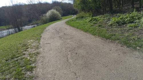
Wick Country Park comprises 50 acres (20 ha) of former agricultural land, with around 1+1⁄4 miles (2.0 km) of easy access trails around the site. The trails leads visitors past old hedgerows, the 5-acre (2.0 ha) lake, ponds, World War II pillboxes and recent woodland plantings; bridges and boardwalks allow the trails to continue over the North Benfleet brook.
From the Wikipedia article Wickford, under CC BY-SA 4.0.
Notable people from Wickford
 Chantelle HoughtonEnglish television personality and modelPhoto: See Li, CC BY 2.0
- Steve TilsonBritish footballer (born 1966)
- Ken MayesEnglish footballer (1910-1975)
- Harry PhillipsEnglish footballer, born 1997
- Betty MoysBritish law librarian and indexer
- Jack MayesEnglish footballer
Born in Wickford, according to Wikidata (CC0). Each name links to its Wikipedia article.
Churches and places of worship9
Shopping2
Gas and EV charging3
Schools, colleges and libraries10
Healthcare1
Map of Wickford
45 places. The map loads OpenStreetMap tiles when you open it.
Getting there and nearby towns
London Southend Airport (SEN) is the nearest airport with scheduled flights listed in OpenStreetMap, 8 miles away.
- Basildon 4 mi southwest, about 7 min by car
- Chelmsford 9 mi north, about 14 min by car
- Southend-on-Sea 10 mi southeast, about 16 min by car
- Witham 14 mi north, about 23 min by car
- Gillingham 15 mi south, about 25 min by car
- Dagenham 16 mi west, about 26 min by car
- Barking 20 mi west, about 32 min by car
- Bexley 20 mi southwest, about 32 min by car
- Ilford 20 mi west, about 32 min by car
- London 29 mi west, about 46 min by car
Drive times are estimates from straight-line distance, not routes.
Towns near Wickford


Keep exploring
Local news
Headlines from INDB.
Reviews, tips and questions
Loading what members have shared...
Sources and licences
- GeoNames (CC BY 4.0): population, coordinates, regions and time zone
- Mapillary (see each image): photos
- OpenStreetMap contributors (ODbL 1.0): places, airports, map data
- Wikidata (CC0 1.0): elevation, founding date, time zone, website, landmarks and historic places
- Wikimedia Commons (see each image): photos
- Wikipedia (CC BY-SA 4.0): overview and history text
Photo credits
- Abbotts Countrywide Wickford, Abbottscountrywide, CC BY-SA 4.0
- Crowsheath Wood 1, Dudley Miles, CC BY-SA 4.0
- Hanningfield Reservoir (1878006637), Michael Bridgen from London, United Kingdom, CC BY-SA 2.0
- St Catherine's Church, Wickford SS11 8EB, RobertP4591, CC BY-SA 4.0
- Long shot of the bench (OpenBenches 8012-1), ukmoose, CC BY-SA 4.0
- View from the bench (OpenBenches 8012-2), ukmoose, CC BY-SA 4.0
- Close-up of the inscription (OpenBenches 8012), ukmoose, CC BY-SA 4.0
- Street-level photo, adam2, CC BY-SA 4.0
- Street-level photo, IpswichEdits, CC BY-SA 4.0
- Street-level photo, petermead, CC BY-SA 4.0
- Street-level photo, IpswichEdits, CC BY-SA 4.0
- Street-level photo, IpswichEdits, CC BY-SA 4.0
- Street-level photo, IpswichEdits, CC BY-SA 4.0
Page built November 10, 2026. Spotted a mistake? Tell us or suggest a place.