


Gillingham, United Kingdom
Gillingham is a city of 101,187 people in England, United Kingdom.
Why visit Gillingham
Townapedia lists 89 museums and landmarks, 49 parks and trails, 272 places to eat, 10 places to stay and 7 attractions in and around town.
Highlights include Dickens World, Medway Viaducts, The Brook and Old Brook Pumping Station.
Weather in Gillingham
Forecast from MET Norway (CC BY 4.0). Full forecast
About Gillingham
Gillingham is a town in Kent, England, which forms a conurbation with neighbouring Chatham, Rochester, Strood and Rainham. It is the largest town in the borough of Medway and in 2022 had a population of 111,033.
From the Wikipedia article Gillingham, Kent (this version), under CC BY-SA 4.0.
Travel tips from other travellers: Gillingham on Wikivoyage (CC BY-SA 4.0).
Photos of Gillingham


Things to do7

Dickens World
Monument and historic site · 1.1 mi
Amusement park in England


Rochester Bridge
Bridge · 2.1 mi
Bridge in Rochester, Kent, England, UK


Museums and landmarks89


Old Brook Pumping Station
Monument and historic site · 1.0 mi
Solomons Road, Chatham
Jun-Sep Sa 11:00-15:00; Oct-May [1]Sa 11:00-15:00 || "groups by...
Former Town Hall and Medway Arts Centre
Monument and historic site · 1.0 mi
Theatre and former town hall in Chatham, Kent, England, UK
The Brook, Chatham

Royal Engineers Museum
Museum · 0.5 mi
Military museum in Gillingham, Kent, England, UK
Prince Arthur Road, Gillingham
Tu-Su 10:00-17:00; PH 10:00-17:00; Dec 24-Jan 04 off
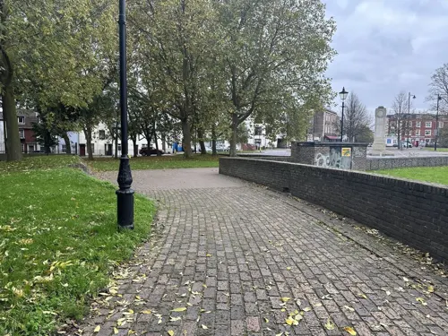


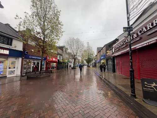
Gillingham Town Centre (High Street)
Monument and historic site
Gillingham High St is a main commercial thoroughfare in Gillingham, Kent. It features a mix of shops, cafes, and services, reflecting...
High Street, Gillingham

Headquarters Royal School For Militiary Engineering and Attached Basement Railings
Monument and historic site · 0.6 mi
The Headquarters Royal School for Military Engineering, designed by Sir Frederick Ommanney (1872-74), is an Italianate-style building...

Port Werburgh Concrete Barge
Monument and historic site · 1.5 mi
WWII era concrete fuel barge converted into breakwater
77 more on the map.
Parks, trails and playgrounds49


The Strand Lido and Leisure Park
Park · 0.8 mi
Strand Approach Road, Gillingham
24/7



Capstone Farm Country Park
Park · 2.1 mi
Former farmland now nature reserve and park, near Gillingham, Kent, United Kingdom

37 more on the map.
Restaurants and cafes272

The Thomas Waghorn
Bar and pub · British · 1.2 mi
14 Railway Street, Chatham
Mo-Th,Su 08:00-24:00; Fr-Sa 08:00-01:00

Boyce's Bakery
Bakery · Bakery
62 High Street, Gillingham
Mo-Fr 07:30-16:30; Sa 07:30-16:30; Su off
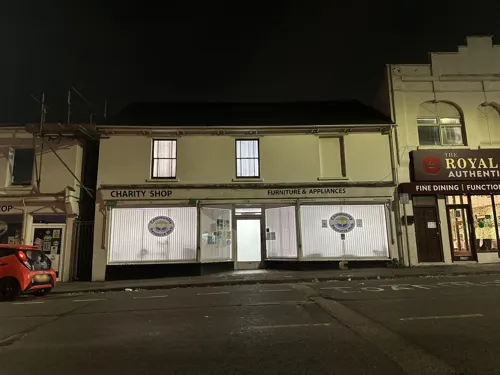
Plan Burrito
Restaurant · Mexican
Plan Burrito Gillingham is a Tex-Mex restaurant on the High Street, serving burritos, tacos, and nachos. It offers customizable meals...
146 High Street, Gillingham
06:00-22:30
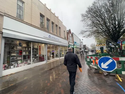
Mooboo
Cafe · Bubble Tea
Mooboo Gillingham, at 129 High Street, specializes in bubble tea with over 1,000 drink combinations. Previously Bobaiocca Bubble Tea, it...
129 High Street, Gillingham
Mo-Fr 09:00-18:00; Sa 09:00-17:00
Pizza Hut
Restaurant · Pizza · 1.1 mi
Leviathan Way, Chatham
Mo-Th 11:00-22:00, Fr-Sa 11:00-23:00, Su 12:00-22:00

Coffee Republic
Cafe · Coffee Shop · 1.1 mi
245a High Street, Chatham
Mo-Sa 07:30-18:00; Su 09:00-17:00
260 more on the map.
History
The name Gillingham is recorded in the Domesday Book of 1086. It is said to have been named after a warlord, Gyllingas—from the old English gyllan, meaning "to shout". He was a notable man in Kent history as he led his warriors into battle screaming and shouting. At the time of the Norman Conquest, Gillingham was given to the half-brother of William I of England, Odo, Bishop of Bayeux, who rebuilt the parish church at Gillingham and constructed an Archbishop's Palace on land bordered by Grange Road, the ruins of which could still be seen in the last century. At the time Gillingham itself was a small hamlet, built around the parish church and surrounded by large farm-holdings, of which St. Mark's Parish formed part, being part of Brittain Farm.
William Adams mentioned Gillingham in his writings, saying: "... two English miles from Rochester and one mile from Chatham, where the King's ships do lie". Adams was baptised at Gillingham Parish Church on 24 September 1564.
Read more of the history
The Strand was once owned by the Davenport family in 1635, the Davenport family included a Mayor of Gillingham, pie makers and key holders of Gillingham. The Davenport family had a road named after them in 1920. The Davenport estate was in Ashford, Kent. The estate comprised around 15000 acres and was called The Davenport Manor. The Davenports lost the estate in 1889. The Davenport family were among the investors in the Chatham Dockyard. In medieval times the part of Gillingham known as Grange was a "limb" (junior member) of the Cinque Ports and the maritime importance of the area continued until the late 1940s. Indeed, a large part of Chatham Dockyard lay within Gillingham, and when it was closed in 1984, two-thirds of the then modern-day dockyard lay within the boundaries of Gillingham. The dockyard was founded by Queen Elizabeth I on the site of the present gun wharf, the establishment being transferred to the present site about 1622. In 1667 a Dutch fleet sailed up the River Medway and, having landed at Queenborough on the Isle of Sheppey and laying siege to the fort at Sheerness, invaded Gillingham in what became known as the raid on the Medway. The Dutch eventually retreated, but the incident caused great humiliation to the Royal Navy.
The Seven Years' War began in 1756 and the government immediately gave orders for the defence of the dockyard; by 1758 the Chatham Lines of Defence were built. Over a mile long, they stretched across the neck of the dockyard peninsula, from Chatham Reach, south of the dockyard, across to Gillingham Reach on the opposite side. One of the redoubts on the Lines was at Amherst. The batteries faced away from the dockyard itself to forestall an attack from the landward side; the ships and shore-mounted guns on the river were considered sufficient to protect from that side. The lines of defence are now part of the Great Lines Heritage Park and also the Lower Lines Park (near MidKent College, Gillingham Campus).
War with France began again in 1778, and once more it was necessary to strengthen the defences. Fort Amherst was the first to be improved; it was followed by work beginning in 1800 to add others at Fort Pitt, Chatham, plus Fort Delce and Fort Clarence (both in Rochester); later in the 19th century others were added, including one at Fort Darland in Gillingham. This work, and the expansion of the dockyard, meant that more homes were needed for the workers. The position of the Lines meant that this building could only happen beyond, and so New Brompton came into being. The population rose to 9,000 people by 1851.
Gillingham was still only a small village; eventually it, too, was swallowed up, and the name of the whole settlement changed to Gillingham. In the 1891 census its population was 27,809, and in 1901, it was 42,530.
In 1919, after World War I, a naval war memorial in the shape of a white stone obelisk was set up on the Great Lines in Chatham. This monument, known as the Chatham Naval Memorial, commemorates members of the Royal Navy who died during the First and Second World Wars and have no known grave. Unveiled on 26 April 1924 by the Prince of Wales (the future King Edward VIII), the memorial originally listed 8,515 names of those lost in World War I. In 1952, an extension was added to commemorate the 10,098 sailors who died in World War II, bringing the total number of names to over 18,500. Designed by Sir Robert Lorimer, the memorial features a rostral obelisk intended as a mark for shipping, symbolizing the naval heritage of Chatham. It is one of three such monuments erected by the Commonwealth War Graves Commission, with similar structures in Portsmouth and Plymouth.
In 1924, a war memorial was unveiled at the junction of Mill Road and Brompton Road in Gillingham to commemorate the borough's fallen from World War I. Designed by sculptor F.W. Doyle-Jones, the Gillingham War Memorial is a stone obelisk featuring sculptural roundels and inscriptions. Later additions honored those lost in World War II and the Korean War. Originally located at the junction, the memorial was relocated in the early 1970s to its current position outside Medway Park Sports Centre. It was granted Grade II listed status in 2016 for its architectural and historic significance.
Gillingham has been the scene of two notable disasters: on 11 July 1929 a public demonstration by Gillingham Fire Brigade went wrong, resulting in 15 fatalities; and in the 1951 Gillingham bus disaster, 24 Royal Marine cadets aged 10 to 13 were killed in a road accident.
From the History section of Gillingham, Kent on Wikipedia, under CC BY-SA 4.0.
More about Gillingham
Geography
The town grew along the road from Brompton on the great lines (military barracks), to the railway station. As such it was a linear development. Close by was the road along the shore line, linking The Strand, and the tiny village of Gillingham Green. Later, communities developed along the top road – Watling Street – turnpike linking Chatham with Dover. All these communities merged into the town that is called today Gillingham.
Gillingham experiences an oceanic climate (Köppen climate classification Cfb) similar to almost all of the United Kingdom. Due to its southerly, sheltered, marine position near the European continent the climate is among the warmest in the whole of England.
Economy
The main source of employment was at Chatham Dockyard, two-thirds of which lay within the boundaries of Gillingham. When it ceased to be a naval base in 1984, there was significant unemployment. A World Heritage Site application has been made for the Dockyard and its defences. Since the 1980s, Gillingham has rebuilt its economic base and the Gillingham Business Park was set up 3 miles (4.8 km) from the town centre, to attract investments and diversify economic activity. The business park and ice rink were an early commission for Grimshaw Architects.
Gillingham has a marina called Gillingham Marina. Gillingham is an important retail centre serving a substantial part of Medway. The town has a large street market in the High Street on Saturdays and Mondays, and is the busiest in the whole of Medway.
Arts and culture
Gillingham Library & Community Hub is located in the High Street.
The town is home to Gillingham F.C., who play at Priestfield Stadium and were first elected to the Football League in 1920 as members of the new Football League Third Division (south). They were voted out of the league in 1938, only to be re-elected when the league expanded in 1950. They spent the next 50 years moving between the two lower divisions before finally reaching the second tier (then Division One) in the 1999–2000 season after beating Wigan Athletic in the Play-off Final at Wembley. They spent five years at this level before being relegated twice, and in 2013–22 played in League One (third tier), into which they were promoted after winning their first championship for fifty years in the 2012–13 season under manager Martin Allen. They were relegated to EFL League Two in 2022.
Education
The Gillingham Boys Grammar School, which was opened in 1923, later became The Howard School in 1975, when it merged with the Rainham Campus secondary school for boys. Other secondary schools include Rainham Mark Grammar School (formerly the Gillingham Technical School), Brompton Academy (formerly New Brompton College and before that Upbury Arts College, Upbury Manor), Rainham Girls School, Chatham Grammar School for Girls and the Robert Napier School.
There are also three primary schools in the small residential area called Twydall: Twydall Infant School, Twydall Junior School and St Thomas of Canterbury R.C. School. In Gillingham itself are St. Mary's, Barnsole Road, Woodlands, Saxonway Primary School, Byron, and Napier Community Primary Schools. In Wigmore, there is the Fairview Infants and Junior Schools and in Hempstead, the Hempstead Infant and Junior Schools.
Gillingham also hosts MidKent College, a Further Education College which introduced Higher Education courses in 2012 and Universities at Medway, a university campus complex comprising University of Kent, Canterbury Christ Church University and University of Greenwich on the former HMS Pembroke barracks buildings.
See List of schools in Medway for a full list of schools serving Gillingham and the Medway area.
From the Wikipedia article Gillingham, Kent, under CC BY-SA 4.0.
Notable people from Gillingham
 David HarveyBritish geographer and anthropologistPhoto: FLOK Society, CC BY 3.0
 William AdamsEnglish navigator who travelled to JapanPhoto: Editor = Dalton, W. / (Dalton, William)., Public domain
 Henry TizardBritish chemist (1885–1959)Photo: Bernard Hailstone, Public domain
 James McCuddenrecipient of the Victoria Cross (1895–1918)Photo: British Government, Public domain
 Luis BinksEnglish footballer (born 2001)Photo: MilesaMFC, CC0
 Antony JamesonBritish aerospace engineerPhoto: P. Birken, CC BY-SA 3.0
 Tirzah GarwoodBritish artist (1908-1951)Photo: Eric Ravilious, Public domain
- Lorna WingBritish autism researcher (1928–2014)
- Ted DitchburnEnglish footballer (1921-2005)
- Ron TauranacAustralian engineer and racing car designer
- Dee MurrayEnglish bassist (1946–1992)
- Matt LetleyBritish musician
Born in Gillingham, according to Wikidata (CC0). Each name links to its Wikipedia article.
Where to stay10
Churches and places of worship42
Our Lady of Gillingham Church
Church · 0.4 mi
2A Ingram Road, Gillingham
Shopping31
Gas and EV charging6
Schools, colleges and libraries41
Healthcare20
Map of Gillingham
250 places. The map loads OpenStreetMap tiles when you open it.
Getting there and nearby towns
Rochester Airport (RCS) is the nearest airport with scheduled flights listed in OpenStreetMap, 3 miles away.
- Maidstone 9 mi south, about 14 min by car
- Southend-on-Sea 13 mi northeast, about 20 min by car
- Ilford 24 mi northwest, about 38 min by car
- Walthamstow 28 mi northwest, about 45 min by car
- London 30 mi west, about 49 min by car
- Islington 30 mi west, about 48 min by car
- City of Westminster 30 mi west, about 49 min by car
- Tottenham 30 mi northwest, about 49 min by car
- Sutton 32 mi west, about 52 min by car
- Enfield Town 33 mi northwest, about 53 min by car
Drive times are estimates from straight-line distance, not routes.
Towns near Gillingham


Keep exploring
Local news
Headlines from INDB.
Reviews, tips and questions
Loading what members have shared...
Sources and licences
- GeoNames (CC BY 4.0): population, coordinates, regions and time zone
- Mapillary (see each image): photos
- OpenStreetMap contributors (ODbL 1.0): places, airports, map data
- Wikidata (CC0 1.0): elevation, founding date, time zone, website, landmarks and historic places
- Wikimedia Commons (see each image): photos
- Wikipedia (CC BY-SA 4.0): overview and history text
Photo credits
- Crown Street, Gillingham, Chris Whippet, CC BY-SA 2.0
- Crown Street, Gillingham (1), N Chadwick, CC BY-SA 2.0
- MedwayM2Bridge5567, Clem Rutter, Rochester Kent, CC BY-SA 3.0
- Rochester Bridge from Rochester Castle Gardens, Prioryman, CC BY-SA 4.0
- Royal-Engineers-Museum-01, Immanuel Giel, CC BY-SA 4.0
- ChathamAmherst6572, Clem Rutter, Rochester Kent, CC BY 2.5
- Aerial view of the Great Lines Heritage Park, Stephen Kennard, CC0
- Nashenden Down 3, Dudley Miles, CC BY-SA 4.0
- FrindsburyChurchGreenChatZoom, Clem Rutter, Rochester, Kent., CC BY 2.5
- Southern End of the Church of St Nicholas, Rochester (01), Ethan Doyle White, CC BY-SA 4.0
- The Brook Theatre (Chatham Town Hall) - June 2025, Sunolafjagtenben-hur, CC0
- Royal Engineers cypher Charles III, Gisbwoy, Public domain
- Entrance Brompton Academy, Gillingham 7566, ClemRutter, CC BY-SA 4.0
- Medway Maritime Hospital 01, Immanuel Giel, CC BY-SA 4.0
- RBSG HQ, St Andrews Square, Edinburgh, Thunderwing at English Wikipedia, CC BY-SA 3.0
- Medway UTC, DavidAnstiss, CC BY-SA 4.0
- Luton library (6817432741), JuliaC2006 from Rochester, UK, CC BY 2.0
- The Thomas Waghorn JD Wetherspoon pub in converted Edwardian post office building on Railway Street at night, Chatham, Kent, England, 16 October 2025, OathOn, CC BY 4.0
- Aerial view of The Brook (A231), facing Dock Road & Globe Lane direction, Stephen Kennard, CC0
- Aerial view of The Strand Lido & Leisure Park (2), Stephen Kennard, CC0
- Boyce’s Bakery, Gillingham (High Street) - 9th July, 2025, OathOn, CC0
- The Brook Theatre - Chatham, Medway, Kent, Sunolafjagtenben-hur, CC0
- Gillingham Asda 4350, Photograph by Clem Rutter, Rochester, Kent. ( www.clemrutter.net )., CC BY-SA 4.0
- Brompton-Academy, Immanuel Giel, CC BY-SA 4.0
- RE grad, Corps of Royal Engineers, CC BY-SA 4.0
- Aerial view of Medway Maritime Hospital, Stephen Kennard, CC0
- Aerial view of the Pentagon Shopping Centre complex in Chatham, Kent, Stephen Kennard, CC0
- 2013 Subaru BRZ, Hugh Llewelyn, CC BY-SA 2.0
- 2013 Subaru BRZ (2), Hugh Llewelyn, CC BY-SA 2.0
- Advertisement for The Wharf retirement apartments in Rochester Riverside displayed inside an Arriva bus, OathOn, CC BY-SA 4.0
- Chatham- Dickens World 0118, Clem Rutter, Rochester, Kent, CC BY 3.0
- Old Brook Pumping Station, Chatham (May 2025), Sunolafjagtenben-hur, CC0
- Hillyfields Community Park - June 2025, Sunolafjagtenben-hur, CC0
- Bridge leading from Lower Lines Park towards housing of Johnson Avenue, DavidAnstiss, CC BY-SA 4.0
- Riverside country park 4815, Photograph by Clem Rutter, Rochester, Kent. ( www.clemrutter.net )., CC BY-SA 4.0
- Street-level photo, mapper42, CC BY-SA 4.0
- Street-level photo, mapper42, CC BY-SA 4.0
- Street-level photo, mapper42, CC BY-SA 4.0
- Street-level photo, tallguy, CC BY-SA 4.0
- Street-level photo, mapper42, CC BY-SA 4.0
- Street-level photo, tallguy, CC BY-SA 4.0
- Street-level photo, mapper42, CC BY-SA 4.0
- Street-level photo, tallguy, CC BY-SA 4.0
- Street-level photo, tallguy, CC BY-SA 4.0
- Street-level photo, tallguy, CC BY-SA 4.0
- Street-level photo, mapper42, CC BY-SA 4.0
- Street-level photo, mapper42, CC BY-SA 4.0
- Street-level photo, tallguy, CC BY-SA 4.0
- Street-level photo, tallguy, CC BY-SA 4.0
- Street-level photo, mapper42, CC BY-SA 4.0
- Street-level photo, mapper42, CC BY-SA 4.0
- Street-level photo, mapper42, CC BY-SA 4.0
- Street-level photo, paulbiv, CC BY-SA 4.0
- Street-level photo, paulbiv, CC BY-SA 4.0
- Street-level photo, paulbiv, CC BY-SA 4.0
- Street-level photo, paulbiv, CC BY-SA 4.0
- Street-level photo, mapper42, CC BY-SA 4.0


Page built November 10, 2026. Spotted a mistake? Tell us or suggest a place.