


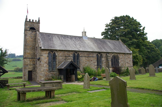


Why visit Chatburn
Townapedia lists 4 museums and landmarks, 1 park or trail, 9 places to eat and 5 attractions in and around town.
Highlights include Edisford Bridge, Sawley Abbey, Clitheroe Castle and Salthill Quarry.
Weather in Chatburn
Forecast from MET Norway (CC BY 4.0). Full forecast
About Chatburn
Chatburn is a village, civil parish and electoral ward in the Ribble Valley, East Lancashire, England. The population of the civil parish at the 2011 census was 1,102. Situated in a hollow between two ridges north-east of Clitheroe, just off the A59 road, relatively near Pendle Hill south-east of the village. Lanehead quarry is situated to the West at the termination of Chatburn Old Road.
From the Wikipedia article Chatburn (this version), under CC BY-SA 4.0.
Things to do5


Museums and landmarks4


Clitheroe Castle Museum
Museum · 2.2 mi
Museum in Lancashire, England, United Kingdom

Parks, trails and playgrounds1

Restaurants and cafes9



Downham Ice Cream Shop
Ice cream · 1.1 mi
Main Street, Clitheroe



History
The village itself can be dated back to Anglo-Saxon times; it takes its name (as does the lowest Avenue) from one of the most distinguished characters of that time, St Chad, and having a brook (or burn) hence the name. The village sits outside the Forest of Bowland and was never considered part of the ancient Lordship of Bowland.
A feature of the village is the spire of the parish church, which was erected around 1838. The steeple was struck by lightning in 1854, but was rebuilt in the same year. Over the years Chatburn has had several mills, one had a large brick chimney, the site is now houses on both sides of Ribble Lane. Early in the 15th century there was a watermill.
Chatburn railway station was closed in 1962 before the Beeching cuts.
Bold Venture lime works, gas works and quarry provided much employment for villagers for many years, now part of Lanehead quarry located across the railway from the Pendle trading estate, the former Pendle Hotel and the opposite side of the road to the old telephone exchange building. It was owned by Dixon Robinson from 1837, he also built the Pendle Hotel and Black Bull public houses. Dixon was a major landowner and also built about 20 houses in the village.
At Quarry farm, on the left of Ribble lane there were 3 limekilns, Big, Small & Farm. All 3 appear on the 1786 Yates map One was located on the very east end of Park Ave
Read more of the history
The village also features Chatburn Post Office which was bombed during the Second World War.
Chatburn Old road was the main Liverpool to Skipton road before the existing Chatburn to Clitheroe was cut in 1826/7. This then became the main A59 road, until the Clitheroe bypass & Downham road cutting was opened in about 1971.
Parts of the village and surroundings featured in the 1961 film Whistle Down the Wind starring Hayley Mills, Alan Barnes, Diane Holgate and children from Chatburn Primary School.
From the History section of Chatburn on Wikipedia, under CC BY-SA 4.0.
Notable people from Chatburn
- Joanna JacksonBritish equestrian
Born in Chatburn, according to Wikidata (CC0). Each name links to its Wikipedia article.
Churches and places of worship9
Gas and EV charging1
Schools, colleges and libraries5
Grindleton Church of England Voluntary Aided Primary School
School · Anglican · 1.0 mi
Sawley Road, Clitheroe
Healthcare1
Map of Chatburn
35 places. The map loads OpenStreetMap tiles when you open it.
Getting there and nearby towns
Warton Aerodrome (WRT) is the nearest airport with scheduled flights listed in OpenStreetMap, 24 miles away.
- Waddington 2 mi west, about 4 min by car
- Clitheroe 3 mi southwest, about 4 min by car
- Sabden 4 mi south, about 7 min by car
- Padiham 6 mi south, about 10 min by car
- Brierfield 7 mi southeast, about 11 min by car
- Barnoldswick 7 mi east, about 11 min by car
- Burnley 8 mi southeast, about 13 min by car
- Nelson 8 mi southeast, about 12 min by car
- Colne 8 mi east, about 13 min by car
- Great Harwood 8 mi south, about 12 min by car
Drive times are estimates from straight-line distance, not routes.
Towns near Chatburn


Keep exploring
Local news
Headlines from INDB.
Reviews, tips and questions
Loading what members have shared...
Sources and licences
- GeoNames (CC BY 4.0): population, coordinates, regions and time zone
- OpenStreetMap contributors (ODbL 1.0): places, airports, map data
- Wikidata (CC0 1.0): elevation, founding date, time zone, website, landmarks and historic places
- Wikimedia Commons (see each image): photos
- Wikipedia (CC BY-SA 4.0): overview and history text
Photo credits
- Sawley Abbey 2, Alexander P Kapp, CC BY-SA 2.0
- Clitheroe Castle, Lux01 at English Wikipedia, Public domain
- Clitheroe Castle Museum, Gpwitteveen, CC BY-SA 3.0
- St Ambrose's Church, Grindleton, Alexander P Kapp, CC BY-SA 2.0
- Downham Hall, Dave.Dunford, CC BY-SA 4.0
- Assheton arms, Tomw37, CC BY-SA 4.0
Page built November 10, 2026. Spotted a mistake? Tell us or suggest a place.