


Why visit Chobham
Townapedia lists 17 museums and landmarks, 31 parks and trails, 92 places to eat, 2 places to stay and 28 attractions in and around town.
Highlights include The New Victoria Theatre, Rhoda McGaw Theatre, The Lightbox and Muslim Burial Ground, Horsell Common.
Weather in Chobham
Forecast from MET Norway (CC BY 4.0). Full forecast
About Chobham
Chobham is a village and civil parish in the Borough of Surrey Heath in Surrey, England.
From the Wikipedia article Chobham (this version), under CC BY-SA 4.0.
Photos of Chobham


Things to do28

The New Victoria Theatre
Cinema and theater · 2.8 mi
The Ambassadors, Peacocks Centre, Woking
Mo-Su 10:00-23:00

New Victoria Theatre
Cinema and theater · 2.8 mi
Theatre in Woking, England



16 more on the map.
Museums and landmarks17

The Lightbox
Museum · 2.8 mi
The lightbox museum (free entry, some exhibitions have a charge, see website for details)
Chobham Road, Woking
Tu-Sa 10:00-17:00; Su 11:00-16:00; PH off

Muslim Burial Ground, Horsell Common
Monument and historic site · 3.1 mi
Former cemetery and current peace garden in Woking, Surrey, England, UK
Sunningdale Barrows
Monument and historic site · 3.0 mi
Barrows in Sunningdale, Berkshire, England, UK

5 more on the map.
Parks, trails and playgrounds31


Burner's Heath and Swallows Pond
Park · 4.4 mi
Nature reserve in Pirbright in Surrey, South East England

Silwood Park
Park · 4.4 mi
Rural campus of Imperial College London, United Kingdom

Milford Green and Coxhill Green
Park · 1.1 mi
Nature Reserves in Chobham, Surrey, British Columbia

Mizen's Railway
Sports field and stadium · 1.5 mi
Barrs Lane, Woking
summer: Su 14:00-17:00 || "special events"
19 more on the map.
Restaurants and cafes92


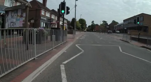
Beijing Restaurant
Restaurant · Chinese · 2.1 mi
95-99 High Street, Woking
Tu-Th 12:00-14:00,17:30-22:30; Fr,Sa 12:00-14:00,17:30-23:00; Su...
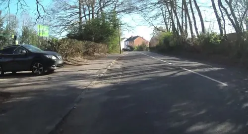
Fieldhouse Coffee
Cafe · Coffee Shop, Breakfast, Lunch, Cake, Speciality Coffee · 2.6 mi
12 Kennel Lane, Windlesham
Mo-Su 08:30-16:00
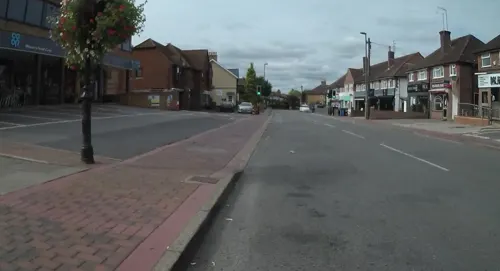
Masala Spice
Restaurant · Indian · 2.2 mi
96 High Street, Woking
Tu-Th,Su 17:00-22:00; Fr,Sa 17:00-23:00
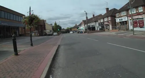
Bridge Barn
Bar and pub · British · 2.5 mi
Hotel guests only!
Bridge Barn Lane, Woking
80 more on the map.
History
Neolithic flints have been found and there are several round barrows on the heaths. Albury Bottom, also known as "The Bee Garden" a scheduled monument with evidence of "a roughly trapezoidal bank and ditched enclosure measuring approximately 100 x 100m, with a surviving second outer bank in some places" and the "Herestraet or Via Militaris" (an old Roman road extant in the post-Roman kingdom) of the Chertsey Abbey charters ran through Chobham parish. In 1772 Roman silver coins of Gratian and of the time of a Valentinian, and copper coins of a Theodosius, Honorius, and another Valentinian, a spear-head and a gold ring, were found near Chobham Park in the parish.
The village lay within the Godley hundred, a Saxon administrative area.
Chobham appears in the Domesday Book of 1086 as Cebeham held by Chertsey Abbey, as it was at the time of the conquest, with interests also acquired by the time of its survey, 1086, by two minor Norman figures, possibly bishops, Corbelin and Odin. Its Domesday assets were: 10 hides; 1 church, 1 chapel, 16 ploughs, 10 acres (4 ha) of meadow, woodland worth 130 hogs. It rendered £15 10s 0d per year. Chabbeham is the version written in Chertsey Charter, and Chabham was the version recorded in the 13th century Patent Rolls.
Read more of the history
St Lawrence Church is on the High Street. Its earliest parts date from about 1080 although there may have been an earlier church on the site. It is dedicated to St Lawrence, who was martyred in Rome in 258.
Until the 19th century almost entirely surrounded by Chobham Common, which was heathland of little agricultural value compared to its central fertile belt, the village was isolated. During mediaeval times, Chobham remained part of the Chertsey Abbey estates. As across the whole hundred which he dominated, the power of the Abbot of Chertsey was considerable.
When the railways were built in the 19th century, lines running east–west went north and south of the village, passing through the neighbouring and at the time smaller villages of Sunningdale and Woking. Thus Chobham remained largely undeveloped during the Industrial Revolution and 20th century, while Woking has grown into a large town on the South West Main Line. In the 19th century peat was cut from the soil all around the village, which provided a cheap and reliable fuel source for heat, smelting and cooking.
No property in the parish possessed as much land as a medieval manor would have had, since the dues of the whole parish before the English Reformation belonged to ecclesiastical landowners. However, some expansion in building and a modest amount of farming resulted from the presence of two lines of baronets: the Abdy baronets and Le Marchant baronets. The buildings and estate no longer survive.
John Cordrey, the last Abbot of Chertsey, surrendered the possessions of the Abbey to the crown in the reign of Henry VIII, and in July 1558, under Queen Mary I of England, the crown sold a parcel of land for £3,000 to Nicholas Heath, Archbishop of York and Lord Chancellor. The land was inclosed by a pale, whence it was called a park, and is marked as such in Norden and Speed's map of 1610. This grant was confirmed by Queen Elizabeth, but as Heath was later deprived for refusing the statutory oaths, the nominal ownership was conveyed to his brother William in 1564. The former archbishop continued, however, to reside when his nephew Thomas forfeited his new lands in 1588. Later they were restored, and in 1606 sold to Francis Leigh. The Cope, Hale and Henn families held the lands until 1681. The Martin and Crawley families held them until the time when Mr Revel, M.P. 1734–52, is said to have been the owner. In 1758, his daughter and heiress married Sir George Warren, and in 1777 their daughter married Thomas Bulkeley, 7th Viscount Bulkeley. The latter died in 1822, leaving the land to Sir Richard Williams-Bulkeley, 10th Baronet, after which now reduced in area, it was acquired by the Le Marchant baronets.
By 1911, Chobham House, which built in the 16th century as the home of minor local gentry, was only represented by a small farm-house. John Ardern held land in Chobham in 1331 and in 1540 this was held by John Danaster 'seized of the manor', baron of the Exchequer, his heiress daughter married a son of the wealthy Sir Edward Bray of Shere, a name later significant in local events and architecture.
The vicarage was built in 1811 by the Rev. Charles Jerram, vicar 1810–34. Jerram was a noted tutor whose pupils included Lord Teignmouth and Horace Mann.
A court roll of the time of Charles II mentions 'Stanners' and 'Pentecost' as tythings (presenting tythingmen). Pennypot Cottage, dating to the 17th century, situated on the long Pennypot Lane, is a Grade II listed building.
Brook Place, also known as Malt House, is a Grade II*-listed building is dated "W B[ray] 1656". It was built in the Artisan Mannerist style and was mentioned as fine architecture in the History of Surrey in 1809 by Manning and Bray. In 1648 this house's predecessor was the property of Edward Bray, a descendant of the Shiere family, who paid composition for his estate as a Royalist. It belonged to the manor of Aden (locally always pronounced Ardern) linked to Worplesdon but was not the manor house.
In 1911 Broadford (House) was the residence of Sir Charles George Walpole and Highams, formerly occupied by Lord Bagot was the estate of Mrs Leschallas.
Chobham became known for the development represented by its tank factory and testing ground, producing Chobham armour. The terrain was carved out of Chobham Common.
From the History section of Chobham on Wikipedia, under CC BY-SA 4.0.
More about Chobham
Geography
The village and hamlets are chiefly on the gravel and alluvium of the stream beds, but the rest of the pre-1968 drawn parish of 9,057 acres (3,665 ha) is on the Bagshot Sands ('Formation'), with extensive peat beds.
The Chobham Ridges rise to the west of West End to a long ridge which bounds Camberley, at 110–120 metres (360–390 ft), and Staple Hill to the north rises to 87 metres (285 ft).
The River Bourne and its northern tributary, the Hale, Mill Bourne or Windle Brook run through the village. These can flood small but well-developed parts of the village in extreme localised rainfall.
The rolling basin below reaches lowest elevations of between 30 metres (98 ft) in the centre of the west and 20 metres (66 ft) where the rivers join in the centre of the east. The rivers at the western point are less than 100 metres (330 ft) apart; to the east end of the parish where the parish adjoins the landscape of the McLaren Technology Centre the rivers are finally merged along that boundary.
Economy
1% of the population at the 2011 census (15 people) were employed in agriculture, forestry and fishing sector in 2011. The largest sectors of employment were Wholesale and Retail Trade; Repair of Motor Vehicles and Motor Cycles and Professional, Scientific and Technical Activities at 15% and 11% of the population respectively. Construction, manufacturing, education and health or social work, closely compete for 8% of the labour force.
From the Wikipedia article Chobham, under CC BY-SA 4.0.
Notable people from Chobham
 Peter GabrielBritish singer and musician (born 1950)Photo: Raph_PH, CC BY 2.0
 Simon PosfordBritish musicianPhoto: Digitalex, Public domain
 Charlotte JordanEnglish actressPhoto: Meena, CC BY-SA 4.0
 Merlin MinshallBritish spy (1906-1987)Photo: Thwm100, CC BY-SA 4.0
- John AddisonBritish composer (1920–1998)
- Martyn JerramRoyal Navy admiral (1858-1933)
- Wally Smithersgolfer (1904-1993)
Born in Chobham, according to Wikidata (CC0). Each name links to its Wikipedia article.
Where to stay2
Churches and places of worship32
Shopping9
Gas and EV charging6
Schools, colleges and libraries23
Healthcare10
Map of Chobham
250 places. The map loads OpenStreetMap tiles when you open it.
Getting there and nearby towns
Farnborough Airport (FAB) is the nearest airport with scheduled flights listed in OpenStreetMap, 9 miles away.
- Woking 3 mi southeast, about 5 min by car
- Ottershaw 4 mi east, about 6 min by car
- Sunninghill 4 mi northwest, about 7 min by car
- Mayford 4 mi south, about 6 min by car
- Chertsey 5 mi northeast, about 8 min by car
- Addlestone 5 mi east, about 8 min by car
- Ascot 5 mi northwest, about 8 min by car
- Deepcut 5 mi southwest, about 9 min by car
- Camberley 6 mi west, about 10 min by car
- Egham 6 mi north, about 10 min by car
Drive times are estimates from straight-line distance, not routes.
Towns near Chobham


Keep exploring
Local news
Headlines from INDB.
Reviews, tips and questions
Loading what members have shared...
Sources and licences
- GeoNames (CC BY 4.0): population, coordinates, regions and time zone
- Mapillary (see each image): photos
- OpenStreetMap contributors (ODbL 1.0): places, airports, map data
- Wikidata (CC0 1.0): elevation, founding date, time zone, website, landmarks and historic places
- Wikimedia Commons (see each image): photos
- Wikipedia (CC BY-SA 4.0): overview and history text
Photo credits
- Chobham1, SuzanneKn at en.wikipedia, Public domain
- The White Hart Inn, Chobham, Surrey - April 2025 - 01, Mertbiol, CC0
- Milestone and shelter, Bagshot Road, Chobham, Surrey - April 2025 - 01, Mertbiol, CC0
- Milestone and shelter, Bagshot Road, Chobham, Surrey - April 2025 - 02, Mertbiol, CC0
- Shelter at junction of Bagshot Road and High Street, Chobham, Surrey - April 2025 - 02, Mertbiol, CC0
- Shelter at junction of Bagshot Road and High Street, Chobham, Surrey - April 2025 - 01, Mertbiol, CC0
- The White Hart Inn, Chobham, Surrey - April 2025 - 02, Mertbiol, CC0
- The Lightbox (c) Ian Rudgewick Brown - cropped, The Lightbox, CC BY-SA 4.0
- Brookwood Lye 6, Dudley Miles, CC BY-SA 4.0
- Burner's Heath and Swallows Pond 4, Dudley Miles, CC BY-SA 4.0
- SilwoodParkSimonMortimer, Simon Mortimer, CC BY-SA 2.0
- Christ Church, Guildford Road, Ottershaw (NHLE Code 1260037) (June 2015) (2), User:Hassocks5489, CC0
- Woking-TownSquare, AlanFord at English Wikipedia, Public domain
- St Edward the Martyr Orthodox Church, Brookwood Cemetery, Brookwood (June 2015) (2), Hassocks5489, CC0
- St Mary of Bethany's Church, Mount Hermon Road, Woking (June 2015) (2), Hassocks5489, CC0
- Horsell Church1, Akoliasnikoff, CC BY-SA 4.0
- New Victoria Theatre, Woking, Murgatroyd49, CC BY-SA 4.0
- St Andrew SU9858 231, RHaworth, CC BY-SA 3.0
- Winston Churchill School, Woking, Surrey, Mertbiol, CC0
- The Cricketers, Horsell, Surrey, 1209b, CC BY-SA 4.0
- Horsell CofE Aided Junior School, Quilt Phase, CC BY-SA 3.0
- Holy Trinity Church, Chobham Road, Knaphill (June 2015) (5), Hassocks5489, CC0
- Rhoda McGaw Auditorium front 1975, Woking Borough Council, CC0
- Street-level photo, jpennycook, CC BY-SA 4.0
- Street-level photo, jpennycook, CC BY-SA 4.0
- Street-level photo, jpennycook, CC BY-SA 4.0
- Street-level photo, jpennycook, CC BY-SA 4.0
- Street-level photo, jpennycook, CC BY-SA 4.0
- Street-level photo, adam2, CC BY-SA 4.0
- Street-level photo, jpennycook, CC BY-SA 4.0
- Street-level photo, jpennycook, CC BY-SA 4.0
- Street-level photo, jpennycook, CC BY-SA 4.0
- Street-level photo, jpennycook, CC BY-SA 4.0
- Street-level photo, keithonearth, CC BY-SA 4.0
- Street-level photo, jpennycook, CC BY-SA 4.0
- Street-level photo, keithonearth, CC BY-SA 4.0
- Street-level photo, jpennycook, CC BY-SA 4.0
- Street-level photo, jjh, CC BY-SA 4.0
- Street-level photo, jjh, CC BY-SA 4.0
- Street-level photo, jjh, CC BY-SA 4.0
- Street-level photo, jpennycook, CC BY-SA 4.0
- Street-level photo, jpennycook, CC BY-SA 4.0
- Street-level photo, jpennycook, CC BY-SA 4.0
- Street-level photo, jpennycook, CC BY-SA 4.0
- Street-level photo, jpennycook, CC BY-SA 4.0
- Street-level photo, jpennycook, CC BY-SA 4.0
- Street-level photo, jpennycook, CC BY-SA 4.0


Page built November 10, 2026. Spotted a mistake? Tell us or suggest a place.