


Why visit Deepcut
Townapedia lists 6 museums and landmarks, 22 parks and trails, 22 places to eat, 4 places to stay and 9 attractions in and around town.
Highlights include Camberley Theatre, FAST Museum, Museum of Military Medicine and Frimley Lodge Park.
Weather in Deepcut
Forecast from MET Norway (CC BY 4.0). Full forecast
About Deepcut
Deepcut is a village in the borough of Surrey Heath in Surrey, England, approximately 28 mi (45 km) southwest of central London. The nearest towns are Camberley, Surrey (3 mi (4.8 km) to the north) and Farnborough, Hampshire (3 mi (4.8 km) to the west). Deepcut is named after the excavations required for the building of the Basingstoke Canal during the 1790s, although the village dates primarily from the early 20th century.
From the Wikipedia article Deepcut (this version), under CC BY-SA 4.0.
Things to do9

Camberley Theatre
Cinema and theater · 2.7 mi
400 seat Theatre in Surrey, England

Museums and landmarks6

FAST Museum
Museum · 2.4 mi
Aviation museum in Hampshire, England, United Kingdom

Museum of Military Medicine
Museum · 1.7 mi
Military museum in Mytchett, Surrey, United Kingdom

Parks, trails and playgrounds22


Burner's Heath and Swallows Pond
Park · 3.2 mi
Nature reserve in Pirbright in Surrey, South East England

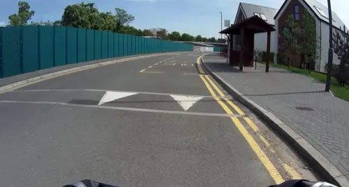

Lakeside Park
Park · 3.4 mi
Local nature reserve in Ash, Surrey, England, UK

10 more on the map.
Restaurants and cafes22
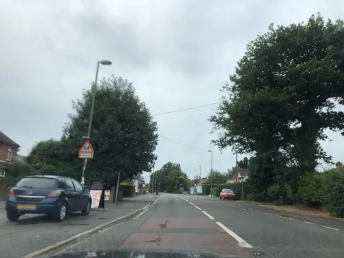
The Kings Head
Diner · American · 0.7 mi
Guildford Road, Frimley Green
Mo-Th 11:30-22:00; Fr-Su 09:00-22:00
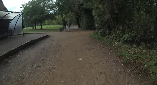

Kingfisher on the Quay
Restaurant · 1.3 mi
Coleford Bridge Road, Mychett
Mo-We,Su 11:30-22:00; Th-Sa 11:30-23:00

Prince of Wales
Bar and pub · 1.5 mi
186 Rectory Road, Farnborough
Mo-We 16:30-23:00; Th-Sa 12:00-23:00; Su 12:00-22:30

Canal Cafe
Cafe · 1.2 mi
Mychett Place Road
Tu-Fr 09:30-15:00; Sa,Su 09:00-16:00; Mo off
10 more on the map.
History
Paleolithic flints have been found in the drift gravels on the hills, and a few neolithic implements in old Frimley parish generically. On the crest on which the community sits, near the southern end of Chobham Ridges, is a very large round barrow called Round Butt; south of it Mainstone Hill probably preserves the name of the Standing Stone, which formed a boundary mark of Chobham in the 12th-century Chertsey charter. William Stukeley's Itinerarium Curiosum records a Roman urn and coins as found here.
Deepcut is so named as the Basingstoke Canal was constructed through the area in a deep cutting below ground level, in the 18th century. Deepcut was part of the parish of Ash until 1866, when Frimley gained its own civil and ecclesiastical parishes. Due to non-agricultural soil and undulating landscape leading to little transport infrastructure few people lived here. The parish provided the traditional community structures of church, particularly vestry, and the increasingly redundant rights and functions of manors. Frimley and Ash manors were among the major landholdings whose owners could acquire the common land covering almost the entire area in 1801 and 1826.
In 1537 the abbey granted Ash with its other lands to Henry VIII. Edward VI, however, shortly after his accession granted it to Winchester College, which held the adjoining lands to the south, Ash Manor, in 1911.
Read more of the history
Deepcut from 1894 was in the administrative area Frimley and Camberley Urban District until the establishment of Surrey Heath in 1974. Blackdown camp, which became the Deepcut barracks was established by the Royal Engineers in late 1903 to accommodate artillery and infantry, centred on Winchester House, renamed Blackdown House when it was bought from the Pain family of Frimley Green by the War Office for military use.
The Victoria County History (1911) provides an overview of all parts of the country and of Frimley only surrounding features of the parish gained a mention, including the prehistoric artefacts above:
[Frimley] contains 7,800 acres, and measures 4 miles from north to south, and 3 miles from east to west. The parish covers the western side of Chobham Ridges, and extends down into the valley of the Blackwater, which bounds the county. The soil is, therefore, Bagshot sand and alluvium, with patches of gravel and large beds of peat. In the latter conifers and rhododendrons flourish...The Heatherside Nurseries, where are some of the finest Wellingtonias in England, may be taken as the typical industry of the neighbourhood, which is otherwise a residential district, or occupied by those connected with Aldershot, the Staff College, which is in the parish, and Sandhurst which lies just outside it. A very great part of the parish was open land, heather-covered, before the Inclosure Act of 1801. Much of it is still uncultivated. The main road from London to Southampton crosses the northern part of the parish. It is substantially on the line of the Roman road. On the top of the hill, near the Golden Farmer Inn, named after a notorious highwayman, the road to Farnham branches south from it, and passes through Old Frimley village
From the History section of Deepcut on Wikipedia, under CC BY-SA 4.0.
More about Deepcut
Geography
In common with Camberley, the village is high on the long north–south crest of the Chobham Ridges. The crest stretches from the Berkshire border at Swinley Forest in the north, to the east of Mytchett in the south, at the southern end of the borough. As such the settled part of the village is at 90-115m AOD.
As a high watershed on mostly permeable soil, the crest drains mostly below ground into the Blackwater or the River Bourne, Addlestone, depending if land is sloped towards the east or the west of the village. The south of the community is bisected by the Basingstoke Canal which has a cycle and pedestrian route alongside (its towpath).
The soil here is naturally wet acid and sandy soil, producing heath vegetation such as coniferous trees, ericaceae and gorse which accounts for less than 2.5% of English soil.
Economy
Deepcut had a major training base of the British army employing 441 persons at the time of the 2011 census. Its trainee-level and logistics military community accounted for 31.4% of the engaged workforce.
The only other sectors of employment in 2001 with more than 100 workers were Wholesale and Retail Trade; Repair of Motor Vehicles and Motor Cycles and Human Health and Social Work and Activities.
From the Wikipedia article Deepcut, under CC BY-SA 4.0.
Where to stay4
Churches and places of worship10
Shopping1
Gas and EV charging3
Schools, colleges and libraries14
Healthcare2
Map of Deepcut
93 places. The map loads OpenStreetMap tiles when you open it.
Getting there and nearby towns
Farnborough Airport (FAB) is the nearest airport with scheduled flights listed in OpenStreetMap, 4 miles away.
- Frimley 2 mi northwest, about 3 min by car
- Farnborough 2 mi west, about 3 min by car
- Camberley 3 mi northwest, about 4 min by car
- Normandy 4 mi southeast, about 6 min by car
- Sandhurst 4 mi northwest, about 7 min by car
- Aldershot 5 mi southwest, about 7 min by car
- Wood Street Village 5 mi southeast, about 8 min by car
- Fairlands 5 mi southeast, about 8 min by car
- Fleet 6 mi west, about 9 min by car
- Crowthorne 6 mi northwest, about 9 min by car
Drive times are estimates from straight-line distance, not routes.
Towns near Deepcut


Keep exploring
Local news
Headlines from INDB.
Reviews, tips and questions
Loading what members have shared...
Sources and licences
- GeoNames (CC BY 4.0): population, coordinates, regions and time zone
- Mapillary (see each image): photos
- OpenStreetMap contributors (ODbL 1.0): places, airports, map data
- Wikidata (CC0 1.0): elevation, founding date, time zone, website, landmarks and historic places
- Wikimedia Commons (see each image): photos
- Wikipedia (CC BY-SA 4.0): overview and history text
Photo credits
- St Barbara's Garrison Church, Deepcut, Lewis Hulbert, CC BY-SA 3.0
- Camberley Theatre, Knoll Road, Camberley, Surrey, Mertbiol, CC0
- Noel Chavasse Memorial, Gaius Cornelius, CC BY-SA 3.0
- Burner's Heath and Swallows Pond 4, Dudley Miles, CC BY-SA 4.0
- Snaky Lane Community Wildlife Area 3, Dudley Miles, CC BY-SA 4.0
- Farnborough Abbey looking gothic, ThunderingTyphoons!, CC BY-SA 4.0
- Church of St Tarcisius, Camberley, Lewis Hulbert, CC BY-SA 4.0
- St Peter's Church, Frimley, Lewis Hulbert, CC BY-SA 3.0
- St Andrew's Church, Sturt Road, Frimley Green, Surrey 01, Mertbiol, CC0
- Frimley Church of England Junior School 1, Simon Burchell, CC BY-SA 4.0
- Drake Pavilion, Unknown author, Public domain
- ZJ496 at the FAST Museum (8631013999), Simon Boddy from Maidenhead, Uk, CC BY-SA 2.0
- Street-level photo, southglos, CC BY-SA 4.0
- Street-level photo, laye, CC BY-SA 4.0
- Street-level photo, jpennycook, CC BY-SA 4.0
- Street-level photo, jpennycook, CC BY-SA 4.0
- Street-level photo, jpennycook, CC BY-SA 4.0
- Street-level photo, jpennycook, CC BY-SA 4.0
- Street-level photo, jpennycook, CC BY-SA 4.0
- Street-level photo, jpennycook, CC BY-SA 4.0
- Street-level photo, jpennycook, CC BY-SA 4.0
- Street-level photo, laye, CC BY-SA 4.0
- Street-level photo, jpennycook, CC BY-SA 4.0
- Street-level photo, jpennycook, CC BY-SA 4.0
- Street-level photo, laye, CC BY-SA 4.0
- Street-level photo, laye, CC BY-SA 4.0
- Street-level photo, laye, CC BY-SA 4.0
- Street-level photo, jpennycook, CC BY-SA 4.0
- Street-level photo, laye, CC BY-SA 4.0


Page built November 10, 2026. Spotted a mistake? Tell us or suggest a place.