


Cinderford, United Kingdom
Cinderford is a town of 12,942 people in England, United Kingdom.
Why visit Cinderford
Townapedia lists 10 museums and landmarks, 12 parks and trails, 35 places to eat, 2 places to stay and 3 attractions in and around town.
Highlights include The Palace, Forest of Dean Sculpture Trail, Cinderford War Memorial and Foxes Bridge Bog.
Weather in Cinderford
Forecast from MET Norway (CC BY 4.0). Full forecast
About Cinderford
Cinderford is a town and civil parish on the eastern fringe of the Forest of Dean in Gloucestershire, England. The population was 8,777 at the 2021 Census.
From the Wikipedia article Cinderford (this version), under CC BY-SA 4.0.
Things to do3
The Palace
Cinema and theater
"15 minutes before first film of the day - Please check current schedule."

Museums and landmarks10
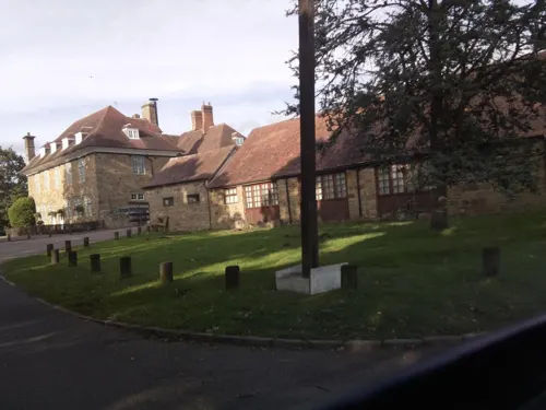

Dean Heritage Centre
Museum · 2.2 mi
Industrial heritage centre and museum in Gloucestershire, England, United Kingdom

Littledean Camp
Monument and historic site · 1.3 mi
Castle near Littledean, Gloucestershire, England, UK
Parks, trails and playgrounds12

Foxes Bridge Bog
Park · 1.9 mi
Nature reserve in Gloucestershire, England, UK

Ruspidge Recreational Ground
Park · 1.2 mi
Recreation area with playground for children and fitness equipment for adults. Also has a Multi Use Games Area (MUGA)
94 Ruspidge Road, Cinderford

Edgehills Bog
Park · 0.9 mi
Nature reserve in Gloucestershire, England

Restaurants and cafes35
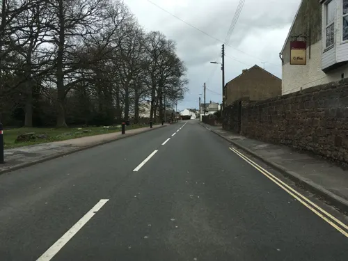
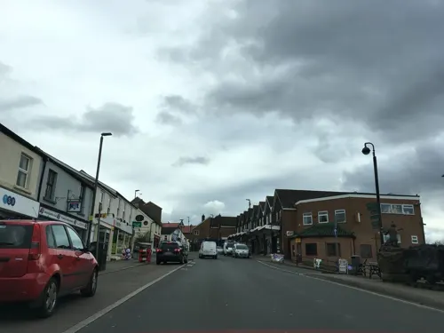

Sumz
Cafe · Coffee Shop · 0.8 mi
1 Broad Street
Mo,Su off; Tu-Fr 07:30-15:00; Sa 08:30-13:00


23 more on the map.
History
The name Cinderford, used for a crossing-point, is recorded as early as 1258. The name reflects the site of early ironmaking which created deposits of cinders (clinker), sometimes in large mounds.
Following the construction of Cinderford Ironworks in the late 1790s, and the opening of large mines nearby, the town was laid out on a fairly conventional urban plan. In 1841 there were two inns and at least ten beerhouses in and around Cinderford. A new church was consecrated at Cinderford in 1844 and dedicated to St. John the Evangelist. By 1843 Cinderford also had a Baptist church which became by far the largest Baptist meeting in the Forest of Dean. Methodists and Primitive Methodists also had chapels in the area, and there was even an iron building which became known as the Ark, which was registered in 1886 by a group called the Blue Ribbon Gospel Army.
Read more of the history
A coke-fired furnace was established in around 1797. It was situated 800 metres north of Cinderford bridge and used coke brought from Broadmoor, to the north, by a short canal. The furnace struggled to compete with iron furnaces elsewhere, and fell idle ten years later. It was revived in 1829 when new works on the old site were established by the Forest of Dean Iron Company, and in 1841 there were three furnaces producing 12,000 tons of iron a year and employing 100 men and boys. Only one furnace at the works was in blast in 1890 and the works closed in 1894.
By the 1840s Cinderford had a number of foundries and small engineering firms supplying the mining industry with machine parts, and it remained a centre for metal industries in the early 20th century.
For many years coal mining was the principal industry in the area. Lightmoor coal mine was being deepened in the late 1830s. Trafalgar colliery which was in production in 1860, was the only large mine in the coalfield run by freeminers in the later 19th century. Trafalgar closed in 1925. A deep mine, called Northern United, was begun north-west of Cinderford in 1933, but Lightmoor, with a workforce of 600 in 1934, was the main colliery in the Cinderford area until it closed in 1940. There were still many smaller collieries in the Forest of Dean, employing 84.5 per cent of the adult male population in the Cinderford area, until the industry declined in the 1960s.
Iron ore mines were also worked near the town in the 19th century until the closure of the Cinderford ironworks led to the abandonment of Buckshaft and other ore mines near the town in 1899.
On 26 April 1889, four Frenchmen and their two tame bears were making their way to Ruardean, having performed in Cinderford. They were attacked by a mob, enraged by claims that the bears had killed a child and injured a woman. The bears were killed and the Frenchmen badly beaten. It soon became clear that the bears had not attacked anyone. Police proceedings followed, and 13 colliers and labourers appeared before magistrates at Littledean a week later, charged with ill-treating and killing the bears, and assaulting the Frenchmen. All but two were found guilty on one or more charges, with another convicted a week later. A total of £85 (equivalent to £9,444 in 2025) was paid in fines. A subscription was also launched which generously compensated the Frenchmen. The question "Who killed the bears?" was used for many years as an insult, directed particularly towards the people of Ruardean, despite the fact that all those convicted were from Cinderford.Cinderford Town Trail has been created and researched by school pupils to celebrate the history of the town.
From the History section of Cinderford on Wikipedia, under CC BY-SA 4.0.
More about Cinderford
Education
Cinderford has three primary schools; Steam Mills Primary School, on Steam Mills Road, St. White's Primary School, on St. Whites Road, and Forest View Primary School based on Latimer Road. Forest View Primary School is an amalgamation of the Latimer Junior School and the Bilson Infants' School (formerly on Station Street).
Cinderford has a single, relatively small secondary school on Causeway Road, currently called The Forest High School but previously known as Heywood Community School. The school existed as Double View Secondary Modern School on a previous campus, on Woodville Road, but moved to the Causeway Road campus, in the early-mid-1970s. Until 1979 it was split between the two sites; in the mid-1980s it changed its name from Double View to Heywood Community School, and in 2012 it became an academy called Forest E-ACT Academy. The name changed again to Forest Academy in 2014 and to the current name in 2015.
Opened in 2018, Gloucestershire College is situated beside the Forest Vale Industrial Estate.
From the Wikipedia article Cinderford, under CC BY-SA 4.0.
Notable people from Cinderford
 John McAfeeBritish-American programmer and businessman (1945–2021)Photo: Gage Skidmore, CC BY-SA 3.0
- Jimmy YoungBritish singer and disc jockey (1921–2016)
- Gerald Daviescricketer
- Gerry GazzardEnglish footballer (1925-2006)
- Frederic Wattscricketer (1884-1968)
- Oliver BurghamEnglish-Welsh rugby league footballer
Born in Cinderford, according to Wikidata (CC0). Each name links to its Wikipedia article.
Where to stay2
Churches and places of worship8
Shopping4
Gas and EV charging3
Schools, colleges and libraries7
Healthcare3
Map of Cinderford
87 places. The map loads OpenStreetMap tiles when you open it.
Getting there and nearby towns
Gloucestershire Airport (GLO) is the nearest airport with scheduled flights listed in OpenStreetMap, 15 miles away.
- Ross on Wye 7 mi northwest, about 11 min by car
- Gloucester 11 mi east, about 18 min by car
- Dursley 12 mi southeast, about 19 min by car
- Thornbury 15 mi south, about 24 min by car
- Cheltenham 19 mi east, about 30 min by car
- Tewkesbury 19 mi northeast, about 30 min by car
- Yate 20 mi south, about 32 min by car
- Stoke Gifford 21 mi south, about 34 min by car
- Bristol 26 mi south, about 42 min by car
- Newport 27 mi southwest, about 43 min by car
Drive times are estimates from straight-line distance, not routes.
Towns near Cinderford


Keep exploring
Local news
Headlines from INDB.
Reviews, tips and questions
Loading what members have shared...
Sources and licences
- GeoNames (CC BY 4.0): population, coordinates, regions and time zone
- Mapillary (see each image): photos
- OpenStreetMap contributors (ODbL 1.0): places, airports, map data
- Wikidata (CC0 1.0): elevation, founding date, time zone, website, landmarks and historic places
- Wikimedia Commons (see each image): photos
- Wikipedia (CC BY-SA 4.0): overview and history text
Photo credits
- Marsh Violet 218519527972, Miika Silfverberg, CC BY-SA 2.0
- Old Severn ^ Wye Railway at Laymoor Quag - March 2013 - panoramio, Forester2009, CC BY-SA 3.0
- Street-level photo, southglos, CC BY-SA 4.0
- Street-level photo, cehwitham, CC BY-SA 4.0
- Street-level photo, southglos, CC BY-SA 4.0
- Street-level photo, southglos, CC BY-SA 4.0
- Street-level photo, southglos, CC BY-SA 4.0
- Street-level photo, southglos, CC BY-SA 4.0
- Street-level photo, southglos, CC BY-SA 4.0
- Street-level photo, southglos, CC BY-SA 4.0
- Street-level photo, southglos, CC BY-SA 4.0
- Street-level photo, southglos, CC BY-SA 4.0
- Street-level photo, southglos, CC BY-SA 4.0
- Street-level photo, southglos, CC BY-SA 4.0
- Street-level photo, southglos, CC BY-SA 4.0
- Street-level photo, southglos, CC BY-SA 4.0
- Street-level photo, cehwitham, CC BY-SA 4.0
- Street-level photo, southglos, CC BY-SA 4.0
- Street-level photo, southglos, CC BY-SA 4.0
- Street-level photo, southglos, CC BY-SA 4.0
- Street-level photo, southglos, CC BY-SA 4.0
- Street-level photo, southglos, CC BY-SA 4.0
- Street-level photo, southglos, CC BY-SA 4.0
- Street-level photo, southglos, CC BY-SA 4.0
- Street-level photo, southglos, CC BY-SA 4.0
- Street-level photo, southglos, CC BY-SA 4.0
- Street-level photo, southglos, CC BY-SA 4.0
- Street-level photo, southglos, CC BY-SA 4.0
Page built November 10, 2026. Spotted a mistake? Tell us or suggest a place.