


Why visit Dursley
Townapedia lists 13 museums and landmarks, 8 parks and trails, 31 places to eat, 1 place to stay and 7 attractions in and around town.
Highlights include Lister Hall, Nympsfield Long Barrow and Owlpen Manor.
Weather in Dursley
Forecast from MET Norway (CC BY 4.0). Full forecast
About Dursley
Dursley is a market town and civil parish in the Stroud District of Gloucestershire, England. It lies between the cities of Bristol and Gloucester. It is under the northeast flank of Stinchcombe Hill, and about 4 miles (6 km) southeast of the River Severn. The town is adjacent to the village of Cam.
From the Wikipedia article Dursley (this version), under CC BY-SA 4.0.
Photos of Dursley

Things to do7

Lister Hall
Cinema and theater
Theatre in Dursley, Gloucestershire, United Kingdom

Museums and landmarks13

Nympsfield Long Barrow
Monument and historic site · 3.0 mi
Long barrow in Frocester, Gloucestershire, England, UK

Owlpen Manor
Museum · 2.7 mi
Grade I listed historic house museum in Stroud District, United Kingdom

Tyndale Monument
Monument and historic site · 1.8 mi
Monument in North Nibley, Gloucestershire, England, UK




1 more on the map.
Parks, trails and playgrounds8




Restaurants and cafes31
The Froffy Coffee
Cafe · Coffee Shop, Breakfast · 1.4 mi
3 Noel Lee Way, Cam
Mo-Fr 08:30-16:30; Sa 08:30-16:00; Su 09:30-15:30; PH 09:30-15:30
The Hoptician
Bar and pub
4 Silver Street
Mo-Th 15:00-22:00; Fr-Sa 12:00-23:00; Su 12:00-21:00

Leaf & Ground - The Café
Cafe · 1.2 mi
Dursley Road, Dursley
Mo-Su 10:00-17:00; PH open; Dec 25-26 off


19 more on the map.
History
The name Dursley derives from the Old English deorsigeslēah meaning 'Deorsige's wood or clearing'.
Ancient historical sites in the vicinity give evidence of earlier occupation. Uley Bury is an Iron Age hill fort dating from around 300 BC. The area also has neolithic long barrows; one called "Hetty Pegler's Tump" can be entered. Roman remains exist at Frocester, West Hill near Uley, Woodchester and Calcot Manor.
Dursley once had a castle, built by Roger de Berkeley in 1153.
Dursley gained borough status in 1471 and lost it in 1886. From 1837 to 1851, it was the administrative centre of Dursley Registration District which recorded vital records of people living in the parishes of North Nibley, Coaley, Slimbridge, Stinchcombe, Uley, Dursley, Cam, Nympsfield, Kingswood, Wotton-under-Edge and Owlpen. From 1886 until 1974 it was the administrative centre of Dursley Rural District (RDC). In 1974 the RDC became part of Stroud District.
Read more of the history
The Grade I listed parish church of St. James the Great dates from the 13th century. The modern building is largely of 14th and 15th century construction and carries the Tudor coat of arms on the outside below the guttering, indicating that some of its construction was funded by the Tudor royals. The original church spire collapsed in January 1699 during a bell-ringing session, causing casualties. The current belltower, in an imposing Gothic survival style, was built by Thomas Sumsion of Colerne in 1708–09.
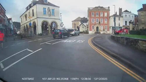
Dursley Town Hall, a structure complete with statue of Queen Anne and bell turret, dates from 1738, when the town's markets attracted farmers and traders from miles around. It is now maintained by the Dursley Town Council.
In 1856, a short branch line railway opened, called the "Dursley Donkey" by locals, linking Dursley and Cam to the Bristol–Gloucester main line at Coaley Junction. The branch line was closed in 1968 and Coaley Junction station was also closed at about this time. However, in 1994, a new station called Cam and Dursley was opened on the main line, 330 yards north of the site of Coaley Junction.
In the 19th and 20th centuries, Dursley was a large-scale manufacturing town; engines built here by the Lister engine company founded in 1867 were used around the world.
That company's successor, Lister Petter, was based in the town until 2014, though much of the original 92-acre (37 ha) factory site was acquired in 2000 by the South West Regional Development Agency and then in 2011 by Stroud District Council. It is now being developed as a large housing development with some industrial units. The Towers, a large gothic-style house, formerly part of the Lister Petter estate, still overlooks the town and has been converted into flats and a residential care home. The Lister Hall theatre is named after the company.
Other large factories based in the town included Mawdsley's, an electrical equipment manufacturer; Bymack's, an upholsterers; and the Bailey Newspaper Group, a newspaper printer, all of which have reduced or closed operations.
From the History section of Dursley on Wikipedia, under CC BY-SA 4.0.
Notable people from Dursley
 Walter Rice, 7th Baron DynevorBritish politician (1873-1956)Photo: William Edwards Miller, Public domain
- Dave Brutonprofessional footballer (born 1952)
- Dick KingBritish businessman (1811-1871)
- Edward FoxeBritish bishop
- Nicholas WapshottBritish journalist
- Henry WitchellEnglish cricketer (1906-1965)
- Reginald Hollowaycricketer (1904-1979)
- Don LlewellynNew Zealand scientist and university administrator (1919-2004)
- Harold FreemanEnglish rugby union player (1850-1916)
Born in Dursley, according to Wikidata (CC0). Each name links to its Wikipedia article.
Where to stay1
Churches and places of worship15
Shopping13
Gas and EV charging6
Schools, colleges and libraries8
Healthcare6
Map of Dursley
108 places. The map loads OpenStreetMap tiles when you open it.
Getting there and nearby towns
Cotswold Airport (GBA) is the nearest airport with scheduled flights listed in OpenStreetMap, 12 miles away.
- Thornbury 9 mi southwest, about 14 min by car
- Yate 10 mi south, about 16 min by car
- Gloucester 14 mi north, about 22 min by car
- Stoke Gifford 14 mi southwest, about 22 min by car
- Bristol 19 mi southwest, about 30 min by car
- Cheltenham 19 mi northeast, about 31 min by car
- Ross on Wye 19 mi northwest, about 30 min by car
- Keynsham 19 mi south, about 31 min by car
- Bath 21 mi south, about 34 min by car
- Portishead 23 mi southwest, about 36 min by car
Drive times are estimates from straight-line distance, not routes.
Towns near Dursley


Keep exploring
Local news
Headlines from INDB.
Reviews, tips and questions
Loading what members have shared...
Sources and licences
- GeoNames (CC BY 4.0): population, coordinates, regions and time zone
- Mapillary (see each image): photos
- OpenStreetMap contributors (ODbL 1.0): places, airports, map data
- Wikidata (CC0 1.0): elevation, founding date, time zone, website, landmarks and historic places
- Wikimedia Commons (see each image): photos
- Wikipedia (CC BY-SA 4.0): overview and history text
Photo credits
- Owlpen in 2007, Derek Harper, CC BY-SA 2.0
- Tyndall Monument from a distance, Poshjosh1999, CC BY-SA 4.0
- St MaryTheVirginChurchWootton-under-Edge, Lobsterthermidor at en.wikipedia, CC0
- Cam Congregational Church extension work 1995, Torchbearer-Ted, CC BY-SA 4.0
- St James the Great Dursley, Unknown author, Public domain
- Market housedursley, Jongleur100, Public domain
- Dursley Methodist Church, Castle Street, Dursley, Gloucestershire, Mertbiol, CC0
- Cam Congregational Church, Torchbearer-Ted, CC BY-SA 4.0
- Standing stones in Nympsfield Long Barrow, Ethan Doyle White, CC BY-SA 4.0
- 2020-10-01 — Dursley library, JuliaC2006, CC BY 2.0
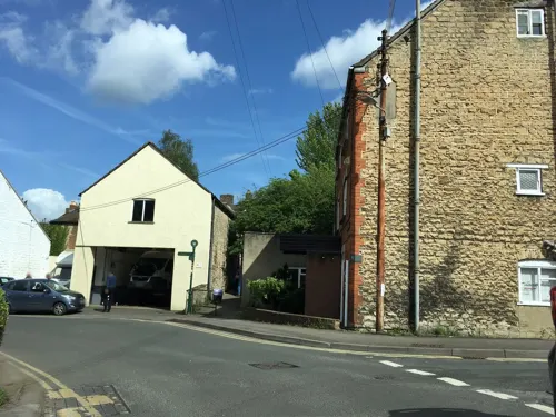
- Street-level photo, OrangeHurst97, CC BY-SA 4.0
- Street-level photo, OrangeHurst97, CC BY-SA 4.0
- Street-level photo, southglos, CC BY-SA 4.0
- Street-level photo, OrangeHurst97, CC BY-SA 4.0
- Street-level photo, OrangeHurst97, CC BY-SA 4.0
- Street-level photo, southglos, CC BY-SA 4.0
- Street-level photo, southglos, CC BY-SA 4.0
- Street-level photo, southglos, CC BY-SA 4.0
- Street-level photo, southglos, CC BY-SA 4.0
- Street-level photo, southglos, CC BY-SA 4.0
- Street-level photo, OrangeHurst97, CC BY-SA 4.0
- Street-level photo, OrangeHurst97, CC BY-SA 4.0
- Street-level photo, southglos, CC BY-SA 4.0
- Street-level photo, OrangeHurst97, CC BY-SA 4.0
- Street-level photo, southglos, CC BY-SA 4.0
- Street-level photo, OrangeHurst97, CC BY-SA 4.0
- Street-level photo, OrangeHurst97, CC BY-SA 4.0

Page built November 10, 2026. Spotted a mistake? Tell us or suggest a place.