


Why visit Yate
Townapedia lists 2 museums and landmarks, 26 parks and trails, 67 places to eat and 5 places to stay in and around town.
Highlights include Acton Court, Yate Heritage Centre and Chipping Sodbury Golf Club.
Weather in Yate
Forecast from MET Norway (CC BY 4.0). Full forecast
About Yate
Yate is a town and civil parish in South Gloucestershire, England. It lies just to the southwest of the Cotswold Hills and is 12 miles (19 kilometres) northeast of Bristol and 12 miles (19 kilometres) from Bath.
From the Wikipedia article Yate (this version), under CC BY-SA 4.0.
Travel tips from other travellers: Yate on Wikivoyage (CC BY-SA 4.0).
Photos of Yate


Museums and landmarks2

Acton Court
Museum · 2.3 mi
Grade I listed historic house museum in South Gloucestershire, England, UK
Parks, trails and playgrounds26





14 more on the map.
Restaurants and cafes67
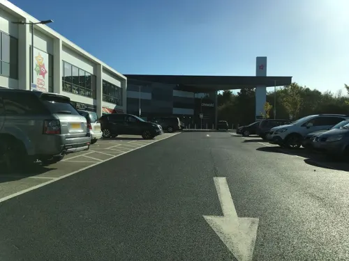



55 more on the map.
Where to stay5


Rounceval House Hotel
Motel and hotel · 0.9 mi
64 Rounceval Street, Chipping Sodbury

History
The first mention of Yate is the existence of a religious house in about AD 770; Yate is also mentioned in the Domesday Book of 1086. The name is derived from the Old English word giete or gete, meaning 'a gateway into a forest area'.
During the Anglo-Saxon period and well into medieval times, most of this part of south Gloucestershire was covered with forest. Through the centuries the land was cleared for farming.
The town's parish church, St Mary's, dates from Norman times. It was altered during the 15th century and was extensively restored in 1970. St Mary's Primary School, situated outside the churchyard walls, was built on the site of a former poorhouse.
It was the opening of the railway station in 1844, as part of Bristol and Gloucester Railway, that established Yate, with Station Road becoming the central thoroughfare. The cattle and produce markets were held around this road, and businesses were established there. Yate railway station was closed by the Beeching cuts in January 1965, but was reopened in May 1989; the Brunel-built engine shed is preserved nearby.
Read more of the history
Major growth in Yate started in the early 1920s with the construction of the Moorland Road estates behind Station Road, close to the Parnall aeroplane factory. In the 1950s the Ridge housing estate was developed. The area between these estates was still being mined for celestine and therefore could not be built on until the mineral had been extracted.
In the 1960s Yate was designated as a development area and the building boom began. The creation of a new town included a large retail shopping area, sports and leisure development together with public buildings.
In the 1960s the area around Stanshawes was exhausted of celestine and the housing boom started with the major construction taking place in the south. Much of this development was planned using the Radburn model, a design that created a vehicle-free environment by the use of green spaces and linking paths at the front of the houses. This model was used until the late 1980s and early 1990s, when the planners reverted to traditional street design methods for the development of the remainder of North Yate, Brimsham Park and the Newmans factory site.
When a secondary school was built in the late 1970s, it was supposed to be called Brinsham Green School, after Brinsham Lane at nearby Yate Rocks. Owing to a spelling error, however, it was in fact called Brimsham Green School. The town further expanded in the 1990s and 2000s with the construction of housing at North Yate. This housing estate continued to use the corrupted name of Brimsham. To locals the area is known as Brimsham Park.
During the Second World War, a railway transfer yard was constructed for the United States Army, probably as part of Operation Bolero to assist the buildup of troops and stores before D-Day. Two large storage sheds survived on the site until 2008.
At the end of the Second World War, the site was taken over by the Royal Navy and became known as the Sea Transport Stores Depot. It was occupied by the Highways Agency until the sheds were demolished for development.
Oxford Archaeology has been commissioned to undertake an investigation as to the military significance of this site. The opinion of Bristol Industrial Archaeological Society has also been sought.
From the History section of Yate on Wikipedia, under CC BY-SA 4.0.
More about Yate
Geography
Yate is located to the northeast of Bristol, which is 12 miles (19 kilometres) away by road. Yate is surrounded by countryside and is situated to the south-west of the Cotswolds. The A432 is the main road through Yate and runs through the centre of the town.
Economy
Before the Second World War, Yate had an aircraft manufacturing industry (Parnall) with a grass aerodrome. During the Second World War, Parnall specialised in making gun turrets. A number of people were killed in raids by the Luftwaffe on the factory in February and March 1941.
Following the war, the Parnall factory turned to the manufacture of domestic goods and was famous for its washing machines. In 1958 Parnall merged with Radiation Ltd to become known as Jackson, producing the Jackson range of cookers. Through mergers and acquisitions, Jacksons is now part of Indesit and the Jackson name is no longer used.
Newman's of Bristol had a large factory on Station Road, from 1932 until the 1980s, in its heyday in the 1960s, employing over 1,500 people.
Yate has had three natural products associated with it: limestone to the east, celestine or spar near the centre of the town and coal to the west.
From the Wikipedia article Yate, under CC BY-SA 4.0.
Notable people from Yate
 J. K. RowlingEnglish author (born 1965)Photo: Daniel Ogren, CC BY 2.0
 Luke HedgerBritish motorcycle racerPhoto: Richard Wiseman, CC BY-SA 2.0
- Richard ThompsonEnglish footballer (born 1969)
- Tony Grubbgolfer (1936-2017)
- Adrian MeyerEnglish footballer
Born in Yate, according to Wikidata (CC0). Each name links to its Wikipedia article.
Churches and places of worship13
Chipping Sodbury Baptist Church
Church · Baptist · 1.1 mi
High Street, Chipping Sodbury
The Church of Jesus Christ of Latter-day Saints
Church · Latter Day Saints · 0.5 mi
Shopping21
Gas and EV charging5
Schools, colleges and libraries18
St John's Mead Church of England Primary School
School · Anglican · 1.1 mi
Hounds Road, Chipping Sodbury
Healthcare6
Map of Yate
163 places. The map loads OpenStreetMap tiles when you open it.
Getting there and nearby towns
Bristol Airport (BRS) is the nearest airport with scheduled flights listed in OpenStreetMap, 17 miles away.
- Bristol 10 mi southwest, about 16 min by car
- Bath 12 mi south, about 19 min by car
- Yatton 20 mi southwest, about 33 min by car
- Gloucester 24 mi north, about 38 min by car
- Newport 25 mi west, about 40 min by car
- Swindon 27 mi east, about 44 min by car
- Cheltenham 29 mi northeast, about 46 min by car
- Cardiff 33 mi west, about 53 min by car
- Worcester 46 mi north, about 1 h 15 min by car
- Oxford 52 mi east, about 1 h 30 min by car
Drive times are estimates from straight-line distance, not routes.
Towns near Yate


Keep exploring
Local news
Headlines from INDB.
Reviews, tips and questions
Loading what members have shared...
Sources and licences
- GeoNames (CC BY 4.0): population, coordinates, regions and time zone
- Mapillary (see each image): photos
- OpenStreetMap contributors (ODbL 1.0): places, airports, map data
- Wikidata (CC0 1.0): elevation, founding date, time zone, website, landmarks and historic places
- Wikimedia Commons (see each image): photos
- Wikipedia (CC BY-SA 4.0): overview and history text
Photo credits
- Yate.church.view.arp, Unknown author, Public domain
- Yate Lifestyle Centre - Near Armadillo Youth Cafe, RichieLegend, CC BY-SA 4.0
- Acton Court (3001219432), Nick from Bristol, UK, CC BY 2.0
- Moda House, No 1 High Street, Chipping Sodbury, Gloucestershire 2014, Ray Bird, CC BY-SA 4.0
- Rounceval House, MartinPoulter, CC BY-SA 4.0
- SNC13938 (4922608255), Roland Turner from Birmingham, Great Britain, CC BY-SA 2.0
- SNC13936 (4922607661), Roland Turner from Birmingham, Great Britain, CC BY-SA 2.0
- SNC13937 (4923200952), Roland Turner from Birmingham, Great Britain, CC BY-SA 2.0
- Royal Marines, Helicopter Portable, Citroen 2CV (4919798686), Roland Turner from Birmingham, Great Britain, CC BY-SA 2.0
- Royal Marines, Helicopter Portable, Citroen 2CV (4919200171), Roland Turner from Birmingham, Great Britain, CC BY-SA 2.0
- Lilliput Park, Chipping Sodbury 02, MartinPoulter, CC BY-SA 4.0
- Street-level photo, southglos, CC BY-SA 4.0
- Street-level photo, southglos, CC BY-SA 4.0
- Street-level photo, southglos, CC BY-SA 4.0
- Street-level photo, southglos, CC BY-SA 4.0
- Street-level photo, southglos, CC BY-SA 4.0
- Street-level photo, southglos, CC BY-SA 4.0
- Street-level photo, southglos, CC BY-SA 4.0
- Street-level photo, southglos, CC BY-SA 4.0
- Street-level photo, southglos, CC BY-SA 4.0
- Street-level photo, southglos, CC BY-SA 4.0
- Street-level photo, southglos, CC BY-SA 4.0
- Street-level photo, southglos, CC BY-SA 4.0
- Street-level photo, southglos, CC BY-SA 4.0
- Street-level photo, southglos, CC BY-SA 4.0
- Street-level photo, southglos, CC BY-SA 4.0
- Street-level photo, southglos, CC BY-SA 4.0

Page built November 10, 2026. Spotted a mistake? Tell us or suggest a place.