


Thornbury, United Kingdom
Thornbury is a town of 11,687 people in England, United Kingdom.
Why visit Thornbury
Townapedia lists 8 museums and landmarks, 10 parks and trails, 36 places to eat, 2 places to stay and 2 attractions in and around town.
Highlights include Thornbury and District Museum and Thornbury Golf Centre.
Weather in Thornbury
Forecast from MET Norway (CC BY 4.0). Full forecast
About Thornbury
Thornbury is a market town and civil parish in the South Gloucestershire unitary authority area of England, about 12 miles (19 km) north of Bristol. It had a population of 12,063 at the 2011 census, rising to 14,496 in the 2021 census. Thornbury is a Britain in Bloom award-winning town, with its own competition: Thornbury in Bloom. The earliest documentary evidence of a village at "Thornbyrig" dates from the end of the 9th century.
From the Wikipedia article Thornbury, Gloucestershire (this version), under CC BY-SA 4.0.
Travel tips from other travellers: Thornbury on Wikivoyage (CC BY-SA 4.0).
Things to do2

Museums and landmarks8
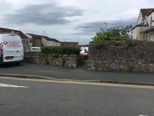


Bowl Barrow and Moot
Monument and historic site · 1.5 mi
The barrow survives as a circular flat-topped mound measuring approximately 25m in diameter and 1m high. It is later mentioned in...
Parks, trails and playgrounds10

Thornbury Golf Centre
Golf course · 1.0 mi
18 hole Par 71 Marlwood Course& 18 hole Par 54 Severn View Course
Bristol Road, Thornbury

Restaurants and cafes36
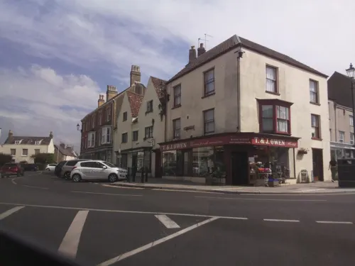
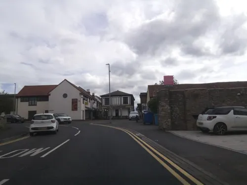

Ship Inn
Bar and pub · 1.2 mi
Coaching inn. C17 with later alterations and additions.
Fr,Sa 09:00-23:00; Mo-Th 11:00-23:00; Su 09:00-10:30


24 more on the map.
History
There is evidence of human activity in the Thornbury area in the Neolithic and Bronze Ages, but evidence of the Roman presence is confined to the Thornbury hoard of 11,460 Roman coins dating from 260 to 348 CE, found in 2004 during the digging of a fishpond. The name Thornbury derives from the Old English þornburh meaning 'thorn burh' (fortification). The earliest documentary evidence of a village at "Thornbyrig" dates from the end of the 9th century. Domesday Book noted a manor of "Turneberie" belonging to William the Conqueror's consort, Matilda of Flanders, with 104 residents, after which Turnberrie's community centre is named.
St Mary's Church, begun in the 12th century with later additions, is the oldest surviving building. The town charter was granted in 1252 by Richard de Clare, 6th Earl of Gloucester and lord of the manor of Thornbury. (The charter's 750th anniversary in 2002 was celebrated with a "750" flowerbed planted in Grovesend Road.) The town grew around the site of its cattle market. Thornbury lost its status as a borough in 19th-century local-government reforms, but in 1974 the parish council exercised its new right to designate itself a town council.
Read more of the history
The ancient parish covered an area extending to the River Severn, including the detached area of Rangeworthy until 1866, when this became a separate civil parish. In 1894 the western part of Thornbury was detached to form the civil parish of Oldbury-on-Severn and the eastern part to create that of Falfield.
Thornbury Township, Pennsylvania, founded in 1687, was named after Thornbury, Gloucestershire, by George Pearce, whose wife Ann came from there. In 1765 Dr John Fewster of Thornbury presented a paper to the Medical Society of London entitled "Cow Pox and its Ability to Prevent Smallpox". Fewster influenced his friend and colleague Edward Jenner, pioneer of vaccination.
Thornbury was once the terminus of a Midland Railway (later LMS) branch line from Yate on the Bristol to Gloucester main line, with intermediate stations at Iron Acton and Tytherington. It lost its passenger services in June 1944 but continued as a goods route, also serving quarries at Tytherington. The site of Thornbury railway station and the line have been redeveloped into a supermarket, a housing estate, a bypass road and a long footpath. Further relics can be seen at Tytherington Quarry to the east of the town. There are plans to reopen the line to Yate via Tytherington and Iron Acton and possibly restore services to Gloucester and Bristol.
Thornbury held a market in the high street and the market hall. This closed in the late 1990s and was partly replaced by a smaller one in a car park near the United Reformed Church. The older site has been redeveloped as a community centre called "Turnberrie's"; the older community centre, at the Chantry in Castle Street, remains in active use. The old market hall is now a restaurant.
Thornbury's coat of arms combines the arms of four families important to its history: the Attwells – Howard, Clare and Stafford. John Attwells bequeathed £499.99 for the establishment of a free school that merged with the grammar school in 1879. Their arms were later adopted as the badge for Marlwood School. The other three families held the manor at Thornbury over several centuries, with the Latin motto Decus Sabrinae Vallis (Jewel of the Severn Vale).
From the History section of Thornbury, Gloucestershire on Wikipedia, under CC BY-SA 4.0.
More about Thornbury
Geography
Thornbury lies in the lower Severn Valley in South Gloucestershire. The parish includes Morton, which is split into Upper and Lower Morton, as areas of farmland to the north-east of Thornbury. There is a large farm shop in Upper Morton, while Lower Morton has several cattle farms. Grovesend is a hamlet on the A38 on the south-east side of the parish. Grovesend Quarry is further east towards Tytherington, but outside the parish.
Arts and culture
The largest music and drama venues are the Armstrong Hall near the town centre, seating 350, and the adjacent Cossham Hall, seating 140. Both are under construction, due to reopen in April 2026. Performances also take place in churches, church halls and occasionally in the leisure centre. Some local amateur groups are:
Thornbury Musical Theatre Group (TMTG), performing at the Armstrong Hall, normally with a musical in October, a pantomime in the February school half-term, and a concert-style production in June. Rehearsals are held at Tytherington Village Hall.
North Avon Youth Theatre (NYTC) perform an annual show at the Armstrong Hall in April.
Octopus Thornbury, a drama group which produces a show in June each year, a charity show in October and a pantomime in January. rehearses and performs in Christ the King Church Hall.
Thornbury Area Music Trust (TAMT), a charitable music trust, runs music groups for those aged 4–18. On Saturday mornings the Thornbury Area Music Centre and Junior Music Centre meet at Marlwood School. They perform regularly at other local venues.
The South Cotswold Youth Orchestra (SCYO) is for musicians of Grade 5 standard and above. It performs at least one concert per term in the area.
Thornbury Choral Society (TCS) is a non-auditioned choir bringing concerts to the community.
Education
The Castle School is Thornbury's secondary school. The former Thornbury Grammar School buildings in Gloucester Road were previously used as its sixth-form centre but this moved to the main site in 2024. Thornbury Grammar School moved to new buildings in neighbouring Alveston in 1972, when it received its first comprehensive school intake and was renamed Marlwood School.
Gillingstool Primary School dates from 1862 and is known for its school bell. The school was rebuilt in a project that began in spring 2009. Its Victorian buildings are being retained, as is its mission as a special school.
St Mary's Church of England Primary School, founded in 1839, recently marked its 175th anniversary with events that included a Victorian Week, where children dressed up in period dress, and planted celebratory daffodils. Other schools include Crossways Infant and Junior schools, Christ the King Roman Catholic Primary School, Manorbrook Primary School, New Siblands Special School and the Sheiling School (an independent special school, part of the Camphill Movement). John Attwells's Free School existed in the 19th century. A plaque about it can be seen on a shop in St Mary's Shopping Centre.
From the Wikipedia article Thornbury, Gloucestershire, under CC BY-SA 4.0.
Notable people from Thornbury
 Algar HowardBritish officer of arms (1880–1970)Photo: artist Frank Brooks, Public domain
 Charles Harford LloydEnglish composer and organistPhoto: Unknown author Unknown author, Public domain
 W. N. HodgsonBritish writer (1893–1916)Photo: Credit line says "Langfier", most..., Public domain
- Michael FortescueBritish-born linguist
- Richard William George DennisBritish mycologist (1910-2003)
- Simon HodgkinsonEnglish rugby union footballer
- Tony Fordfootballer (born 1944)
- John RolphCanadian politician (1793–1870)
- Lawson Rollcricketer (born 1965)
- Norman GraceEnglish cricketer and Royal Navy officer (1894-1975)
- Arthur PenduckEnglish cricketer (1883-1924)
- Handel CosshamBritish politician (1824–1890)
Born in Thornbury, according to Wikidata (CC0). Each name links to its Wikipedia article.
Where to stay2
Thornbury Castle Hotel
Motel and hotel · 0.6 mi
Castle Street, Bristol
Churches and places of worship9
Shopping16
Gas and EV charging1
Schools, colleges and libraries13
Healthcare5
Map of Thornbury
102 places. The map loads OpenStreetMap tiles when you open it.
Getting there and nearby towns
Bristol Airport (BRS) is the nearest airport with scheduled flights listed in OpenStreetMap, 18 miles away.
- Yate 6 mi southeast, about 10 min by car
- Bristol 11 mi south, about 18 min by car
- Bath 18 mi southeast, about 28 min by car
- Yatton 20 mi southwest, about 32 min by car
- Newport 21 mi west, about 33 min by car
- Gloucester 21 mi northeast, about 34 min by car
- Royal Wootton Bassett 27 mi east, about 43 min by car
- Cheltenham 28 mi northeast, about 44 min by car
- Cardiff 30 mi west, about 48 min by car
- Swindon 32 mi east, about 51 min by car
Drive times are estimates from straight-line distance, not routes.
Towns near Thornbury


Keep exploring
Local news
Headlines from INDB.
Reviews, tips and questions
Loading what members have shared...
Sources and licences
- GeoNames (CC BY 4.0): population, coordinates, regions and time zone
- Mapillary (see each image): photos
- OpenStreetMap contributors (ODbL 1.0): places, airports, map data
- Wikidata (CC0 1.0): elevation, founding date, time zone, website
- Wikimedia Commons (see each image): photos
- Wikipedia (CC BY-SA 4.0): overview and history text
Photo credits
- Thornbury.high.street.pumparea.arp.750pix, Adrian Pingstone at en.wikipedia, Public domain
- MARLWOOD SCHOOL, South Gloucestershire, Peppermintleaf, CC0
- Castle school thornbury arp, Arpingstone, Public domain
- Thornbury Castle - 1, nick sarebi, CC BY 2.0
- Thornbury.saint.marys.church.arp.750pix, Arpingstone (Adrian Pingstone) at en.wikipedia, Public domain
- Thornbury.castle.west.front.arp.750pix, Arpingstone (Adrian Pingstone) at en.wikipedia, Public domain
- Street-level photo, southglos, CC BY-SA 4.0
- Street-level photo, southglos, CC BY-SA 4.0
- Street-level photo, southglos, CC BY-SA 4.0
- Street-level photo, southglos, CC BY-SA 4.0
- Street-level photo, southglos, CC BY-SA 4.0
- Street-level photo, southglos, CC BY-SA 4.0
- Street-level photo, southglos, CC BY-SA 4.0
- Street-level photo, southglos, CC BY-SA 4.0
- Street-level photo, southglos, CC BY-SA 4.0
- Street-level photo, southglos, CC BY-SA 4.0
- Street-level photo, southglos, CC BY-SA 4.0
Page built November 10, 2026. Spotted a mistake? Tell us or suggest a place.