


City of Westminster, United Kingdom
City of Westminster is a city of 247,614 people in England, United Kingdom.
Why visit City of Westminster
Townapedia lists 141 museums and landmarks, 62 parks and trails, 123 places to eat, 30 places to stay and 73 attractions in and around town.
Highlights include His Majesty's Theatre, Picturehouse Central, Imperial War Museum London and Apsley House.
Weather in City of Westminster
Forecast from MET Norway (CC BY 4.0). Full forecast
About City of Westminster
Westminster () is the main settlement of the City of Westminster in Central London, England. It extends from the River Thames to Oxford Street and has many famous landmarks, including the Palace of Westminster, Buckingham Palace, Westminster Abbey, Westminster Cathedral, Trafalgar Square and much of the West End cultural centre including the entertainment area of West End theatre.
From the Wikipedia article Westminster (this version), under CC BY-SA 4.0.
Things to do73


61 more on the map.
Museums and landmarks141

Imperial War Museum London
Museum · 1.2 mi
IWM London tells the story of those whose lives have been shaped by war from the First World War to the present day.
Lambeth Road, London
10:00-18:00; Dec 24-26 off

Apsley House
Museum · 0.8 mi
London townhouse of the Dukes of Wellington
149 Piccadilly, London
We-Su 11:00-17:00


Royal Academy of Arts
Museum · 0.8 mi
The Royal Academy of Arts is one of Britain's foremost cultural institutions and a major attraction located in the heart of Piccadilly....
Piccadilly, London

Banqueting House
Monument and historic site · 0.6 mi
Tu-Th, Sa-Su 10:00-17:00; Mo 10:00-13:00; Fr 10:00-16:00


Ronchini
Museum · 1.0 mi
21 Conduit Street, London
Mo "By Appointment"; Tu-Fr 10:00-18:00; Sa 11:00-18:00; Su off


The Cartoon Museum
Museum · 1.4 mi
63 Wells Street, London
Tu,We,Th,Fr,Sa 10:30-17:30; Su 12:00-16:00; Th[-1] 10:30-20:00

129 more on the map.
Parks, trails and playgrounds62


Victoria Embankment Gardens
Park · 1.0 mi
Victoria Embankment, London
Jan 01-Feb 15 08:30-16:30,Feb 16-Feb 29 08:30-17:30,Mar 01-Mar...


St Anne's Churchyard
Park · 1.0 mi
week 1-13 Mo-Su 10:00-16:00; week 14-43 10:00-18:00; week 44-52 10:00-16:00

50 more on the map.
Restaurants and cafes123

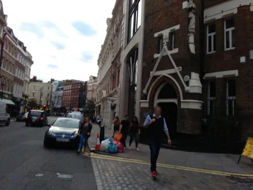

The Old Bank of England
Bar and pub · 1.5 mi
194 Fleet Street, London
Mo-We 11:30-22:00; Th-Fr 11:30-23:00; Sa 11:30-22:00; Su 12:00-20:00
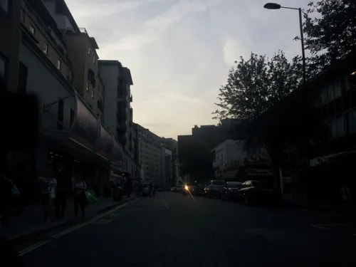

Green Man
Bar and pub · Fish And Chips · 1.2 mi
57 Berwick Street, London
Mo-We 11:00-23:30; Th-Sa 10:00-01:00; Su 10:00-22:30


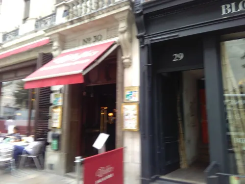

Macellaio
Restaurant · Steak House · 1.0 mi
39-45 Shaftesbury Avenue, London
Mo-Su 12:00-22:00; Th-Sa 12:00-23:00

Maze Grill
Restaurant · Steak, Sushi · 1.4 mi
79 Royal Hospital Road, London
Mo-Fr 12:00-24:00, Sa,Su 11:00-24:00


Galvin at Windows
Restaurant · French, Fine Dining · 0.8 mi
22 Park Lane, London
Mo-We 12:00-14:30,17:30-22:00; Th-Fr 12:00-14:30,17:30-22:30; Sa...
111 more on the map.
History
The former Thorney Island, the site of Westminster Abbey, formed the historic core of Westminster. The abbey became the traditional venue of the coronations of the kings and queens of England from that of Harold Godwinson (1066) onwards.
From about 1200 the Palace of Westminster, near the abbey, became the principal royal residence, a transition marked by the transfer of royal treasury and financial records to Westminster from Winchester. Later the palace housed the developing Parliament and England's law courts. Thus, London developed two focal points: the City of London (financial/economic) and Westminster (political and cultural).
The monarchs moved their principal residence to the Palace of Whitehall (1530–1698), then to St James's Palace in 1698, and eventually to Buckingham Palace and other palaces after 1762. The main law courts moved to the Royal Courts of Justice in the late-19th century.
The settlement grew up around the palace and abbey, as a service area for them. The parish church, St Margaret's Westminster served the wider community of the parish; the servants of the palace and abbey as well as the rural population and those associated with the high status homes developing on the road from the city. The area became larger and in the Georgian period became connected through urban ribbon development with the City along the Strand.
Read more of the history
Henry VIII's Reformation in the early 16th century abolished the abbey and established a cathedral – thus the parish ranked as a "City", although it was only a fraction of the size of the City of London and the Borough of Southwark at that time.
Indeed, the cathedral and diocesan status of the church lasted only from 1539 to 1556, but the "city" status remained for a mere parish within Middlesex. As such it is first known to have had two Members of Parliament in 1545 as a new Parliamentary Borough, centuries after the City of London and Southwark were enfranchised.
The growing Elizabethan city had a High Constable, Bailiff, Town Clerk, and a keeper of the ponds.
Charles Booth's poverty map showing Westminster in 1889 recorded the full range of income- and capital-brackets living in adjacent streets within the area; its central western area had become (by 1850) (the) Devil's Acre in the southern flood-channel ravine of the River Tyburn, yet Victoria Street and other small streets and squares had the highest colouring of social class in London: yellow/gold. Westminster has shed the abject poverty with the clearance of this slum and with drainage improvement, but there is a typical Central London property distinction within the area which is very acute, epitomised by grandiose 21st-century developments, architectural high-point listed buildings and nearby social housing (mostly non-council housing) buildings of the Peabody Trust founded by philanthropist George Peabody.
From the History section of Westminster on Wikipedia, under CC BY-SA 4.0.
More about City of Westminster
Geography
The City and Liberty of Westminster and other historical Westminster administrative units (except the broader modern City of Westminster, a London Borough created in 1965) extended from the River Thames to the old Roman road from the City to western England, which is now locally called Oxford Street.
Thorney Island lay between the arms of the former River Tyburn at its confluence with the Thames, while the western boundary with Chelsea was formed by the similarly lost River Westbourne. The line of the river still forms (with very slight revisions) the boundaries of the modern borough with the Royal Borough of Kensington and Chelsea.
Further north, away from the river mouth, Westminster included land on both sides of the Westbourne, notably Knightsbridge (including the parts of Hyde Park west of the Serpentine lake (originally formed by damming the river) and most of Kensington Gardens).
Westminster includes the sub-districts of Soho, St James, Mayfair, Covent Garden (shared with neighbouring Camden), Pimlico, Victoria, Belgravia and Knightsbridge (shared with neighbouring Kensington).
Economy
The area has a substantial residential population. By the 20th century Westminster saw rising numbers of residential apartments with wealthy inhabitants. Hotels, large Victorian homes and barracks exist near to Buckingham Palace. Westminster has a large number of pubs, bars and restaurants. As of October 2024, Westminster has 1,430 licensed restaurants employing 37,183 people, and 565 unlicensed restaurants employing 7,495 people, according to Office for National Statistics data; these are the highest figures among London boroughs.
Westminster hosts the High Commissions of many Commonwealth countries:
Within the area is Westminster School, a major public school which grew out of the abbey, and the University of Westminster, attended by over 20,000 students.
From the Wikipedia article Westminster, under CC BY-SA 4.0.
Notable people from City of Westminster
 Rachel WeiszBritish actress (born 1970)Photo: Harald Krichel, CC BY-SA 4.0
 Ben JonsonEnglish playwright, poet, and actor (1572-1637)Photo: George Vertue / After Gerard van Honthorst, Public domain
 Edward I of EnglandKing of England from 1272 to 1307Photo: Unknown author Unknown author, Public domain
 Tom HiddlestonBritish actor (born 1981)Photo: Kevin Payravi, CC BY-SA 4.0
 Edward V of Englandking of England in 1483 (1470-1483)Photo: Unknown author Unknown author, Public domain
 Henry PurcellEnglish composer (1659–1695)Photo: John Closterman, Public domain
 Daisy RidleyEnglish actress (born 1992)Photo: Our Movie Guide, CC BY 3.0
 William JonesAnglo-Welsh philologist and scholar of ancient India (1746–1794)Photo: Joshua Reynolds, Public domain
 Emily RatajkowskiAmerican model and actressPhoto: Yann Tosseyn, CC BY-SA 3.0
 George GrenvillePrime Minister of Great Britain (1712-1770)Photo: William Hoare, Public domain
 Charlie CoxBritish actor (born 1982)Photo: JaceMerlyn, CC BY-SA 4.0
- Oswald MosleyBritish aristocrat and fascist politician (1896–1980)
Born in City of Westminster, according to Wikidata (CC0). Each name links to its Wikipedia article.
Where to stay30
Churches and places of worship64
Shopping60
Gas and EV charging19
Schools, colleges and libraries32
Archbishop Sumner Church of England Primary School
School · Anglican · 1.2 mi
Reedworth Street, London
Burdett-Coutts and Townshend Foundation C of E Primary School
School · Anglican
Rochester Street, London
Healthcare28
Map of City of Westminster
250 places. The map loads OpenStreetMap tiles when you open it.
Getting there and nearby towns
London City Airport (LCY) is the nearest airport with scheduled flights listed in OpenStreetMap, 8 miles away.
- London 1 mi northeast, about 1 min by car
- Kennington 1 mi southeast, about 2 min by car
- Holborn 2 mi northeast, about 2 min by car
- City of London 2 mi northeast, about 3 min by car
- Clerkenwell 2 mi northeast, about 3 min by car
- King's Cross 2 mi north, about 4 min by car
- Walthamstow 8 mi northeast, about 13 min by car
- Watford 16 mi northwest, about 25 min by car
- Woking 22 mi southwest, about 35 min by car
- Worthing 48 mi south, about 1 h 15 min by car
Drive times are estimates from straight-line distance, not routes.
Towns near City of Westminster


Keep exploring
Local news
Headlines from INDB.
Reviews, tips and questions
Loading what members have shared...
Sources and licences
- GeoNames (CC BY 4.0): population, coordinates, regions and time zone
- Mapillary (see each image): photos
- OpenStreetMap contributors (ODbL 1.0): places, airports, map data
- Wikidata (CC0 1.0): elevation, founding date, time zone, website, landmarks and historic places
- Wikimedia Commons (see each image): photos
- Wikipedia (CC BY-SA 4.0): overview and history text
Photo credits
- Westminster from the dome on Methodist Central Hall, Colin, CC BY-SA 4.0
- Westminster Cathedral London, 4th May 2024 - 53708806889, Frank Kovalchek, CC BY 2.0
- Westminster-Abbey, Σπάρτακος, CC BY-SA 3.0
- Buckingham Palace, London - April 2009, Diliff, CC BY-SA 3.0
- Tate Britain, Millbank - panoramio (1), Carlos Cunha, CC BY-SA 3.0
- Burlington House, Photograph by Mike Peel ( www.mikepeel.net )., CC BY-SA 4.0
- HarrodsDay, User:Mikegr, CC BY-SA 3.0
- 2008 Haymarket Theatre, Kbthompson at English Wikipedia, CC BY-SA 3.0
- Clarence house, ChrisO, CC BY-SA 3.0
- Somerset House, Strand, Stephen Richards, CC BY-SA 2.0
- Imperial War Museum. London, UK, Ввласенко, CC BY-SA 3.0
- Langham london, The Langham, London, CC BY-SA 3.0
- Battersea Power Station, London-22May2010, Aurelien Guichard from London, United Kingdom, CC BY-SA 2.0
- Grosvenor Square nord, CVB, CC BY-SA 4.0
- Chelsea physic garden, flickr user flickr-rickr, CC BY-SA 2.0
- St.thomas.hospital.arp.750pix, Photographer and original uploader was Adrian Pingstone at en.wikipedia, Public domain
- His Majesty’s Theatre London August 2023, AirshipJungleman29, CC BY-SA 4.0
- Waldorf Hotel 2, No machine-readable author provided. Edward assumed (based on copyright claims)., Public domain
- Temple Church, Temple, London EC4, John Salmon, CC BY-SA 2.0
- The Ritz (6902790412), Tony Hisgett from Birmingham, UK, CC BY 2.0
- London Transport Museum (42206944281), Wei-Te Wong from Taipei City, Taiwan, Republic of China, CC BY-SA 2.0
- Aldwych Theatre 3, No machine-readable author provided. Edward assumed (based on copyright claims)., Public domain
- Lambeth, London, UK - panoramio (124), joinai, CC BY 3.0
- Liberty of London, habitatgirl, CC BY 2.0
- LyricLondon, KF, Public domain
- London Aquarium.001 - London, Fernando Losada Rodríguez, CC BY-SA 4.0
- Palace Theatre - London, Matt May uploaded and derivative work: MrPanyGoff, CC BY 2.0
- Apollo Theatre, February 2022, Magic Goes Wrong, Richard Nevell, CC BY-SA 4.0
- Benjamin Franklin House, 36 Craven Street, London, Ridiculopathy, CC0
- Duchess Theatre 1, User:Edward, Public domain
- Holy Trinity Sloane Street Church Exterior - Diliff, Diliff, CC BY-SA 3.0
- Church of the Immaculate Conception, Farm Street entrance, AndyScott, CC BY-SA 4.0
- Knightsbridge School building, Dukes Education, CC BY-SA 4.0
- Frontage of L'Escargot Restaurant Soho London - 2024, 40Dover, CC BY 4.0
- Park Lane Hotel, Piccadilly - DSC04267, Rept0n1x, CC BY-SA 3.0
- Quo Vadis, Soho, W1 (2588280146), Ewan Munro from London, UK, CC BY-SA 2.0
- Simpson 40418, gillfoto, CC BY-SA 4.0
- St. Luke's Church, Chelsea 84, Simon Burchell, CC BY-SA 4.0
- 68 Cadogan Square 07, Edwardx, CC BY-SA 3.0
- Victoria Embankment Gardens, Alexrk2, CC BY-SA 3.0
- Lima, Fitzrovia, W1, Ewan Munro, CC BY-SA 2.0
- RonchiniGalleryExteriorJacobHashimoto, Jessicagrover, CC BY-SA 3.0
- Church of Notre Dame De France-London, Yair Haklai, CC BY-SA 4.0
- Cafe Monico, Shaftesbury Avenue (2), Philafrenzy, CC BY-SA 4.0
- John Bell & Croyden Skincare, Cheryl Goddard, CC BY-SA 4.0
- Cleaver Square (8669104680), Reading Tom from Reading, UK, CC BY 2.0
- House on Cockspur Street London, Ricardalovesmonuments, CC BY-SA 4.0
- 1192681 II THE OLD BANK OF ENGLAND London 20250615 0001, Tilman2007, CC BY-SA 4.0
- 1 Colville Place, Fitzrovia, August 2023, No Swan So Fine, CC BY-SA 4.0
- Green Man, Soho, W1 (2534865794), Ewan Munro from London, UK, CC BY-SA 2.0
- Monmouth Coffee Company, Monmouth Street, Covent Garden 03, Edward Hands, CC BY-SA 4.0
- Durning Library, October 2014 08, Edwardx, CC BY-SA 4.0
- Victoria Library (5081895158), JuliaC2006 from Rochester, UK, CC BY 2.0
- Newport Street Gallery, London, https://www.flickr.com/photos/r4vi/ R4vi, CC BY-SA 2.0
- Picturehouse Central, Piccadilly Circus, W1 (18234385723), Ewan Munro from London, UK, CC BY-SA 2.0
- Tate South Lambeth library (21755715568), Libraries Taskforce, CC BY 2.0
- Maze Grill (5166455218), Kim, CC BY-SA 2.0
- Holy Trinity C of E Primary School, Sedding Street, ZeevoX, CC BY-SA 4.0
- Old Paradise Gardens, Robert-brook, CC0
- Foyles, Charing Cross Road (April 2015) (cropped), Chris Sampson, CC BY 2.0
- Altea Gallery, St George Street, Mayfair, January 2016, Basher Eyre, CC BY-SA 2.0
- Lyceum Theatre 1, The Lud, Public domain
- Grosvenor Chapel 2020, GrindtXX, CC BY-SA 4.0
- Covent Garden, Corpus Christi Catholic Church, chancel, AndyScott, CC BY-SA 4.0
- Grosvenor Place, London, Philafrenzy, CC BY-SA 4.0
- The Gielgud Theatre (5152149396), Tony Hisgett from Birmingham, UK, CC BY 2.0
- Novello Theatre - Aldwych, London - Crazy For You (6447453625), Elliott Brown from Birmingham, United Kingdom, CC BY 2.0
- The Water Seller of Seville title QS:P1476,en:"The Water Seller of Seville " label QS:Len,"The Water Seller of Seville " label QS:Les,"El aguador de Sevilla" label QS:Lfr,"Le Porteur d'eau de..., Diego Velázquez, Public domain
- Banqueting House 01, The wub, CC BY-SA 3.0
- The Cartoon Museum interior 2025-11-20, Matt Brown, CC BY 4.0
- Archbishop's Park 3, Mx. Granger, CC0
- Vauxhall Park model village, Matt Brown, CC BY 2.0
- Pedlars Park Sept 2024, Byron.R.Green, CC BY 4.0
- St Anne's churchyard fence, Wardour Street, London, Mark Ahsmann, CC BY-SA 3.0
- Street-level photo, ris, CC BY-SA 4.0
- Street-level photo, tommorris, CC BY-SA 4.0
- Street-level photo, ris, CC BY-SA 4.0
- Street-level photo, paulbiv, CC BY-SA 4.0
- Street-level photo, laye, CC BY-SA 4.0
- Street-level photo, ris, CC BY-SA 4.0
- Street-level photo, erias, CC BY-SA 4.0
- Street-level photo, tommorris, CC BY-SA 4.0
- Street-level photo, pbb, CC BY-SA 4.0
- Street-level photo, erias, CC BY-SA 4.0
- Street-level photo, paulbiv, CC BY-SA 4.0
- Street-level photo, ris, CC BY-SA 4.0
- Street-level photo, gness, CC BY-SA 4.0
- Street-level photo, erias, CC BY-SA 4.0
- Street-level photo, cyclestreets, CC BY-SA 4.0
- Street-level photo, asturksever, CC BY-SA 4.0
- Street-level photo, tommorris, CC BY-SA 4.0
- Street-level photo, erias, CC BY-SA 4.0
- Street-level photo, richlv, CC BY-SA 4.0
- Street-level photo, tommorris, CC BY-SA 4.0
- Street-level photo, laye, CC BY-SA 4.0
- Street-level photo, paulbiv, CC BY-SA 4.0
- Street-level photo, jamesb3947, CC BY-SA 4.0
- Street-level photo, erias, CC BY-SA 4.0
- Street-level photo, chuck, CC BY-SA 4.0


Page built November 10, 2026. Spotted a mistake? Tell us or suggest a place.