


Clacton-on-Sea, United Kingdom
Clacton-on-Sea is a town of 50,548 people in England, United Kingdom.
Why visit Clacton-on-Sea
Townapedia lists 37 museums and landmarks, 67 parks and trails, 215 places to eat, 44 places to stay and 6 attractions in and around town.
Highlights include Century Cinema, West Cliff Theatre, Martello Tower C and Martello Tower D.
Weather in Clacton-on-Sea
Forecast from MET Norway (CC BY 4.0). Full forecast
About Clacton-on-Sea
Clacton-on-Sea, often simply called Clacton, is a coastal town in Essex, England. It lies on the Tendring Peninsula and is the largest settlement in the Tendring District, with a population of 53,200 in 2021. The town is situated around 77 miles (124 km) north-east of London, 16 miles (26 km) south-east of Colchester and 16 miles (26 km) south of Harwich. The area was historically in the parish of Great Clacton.
From the Wikipedia article Clacton-on-Sea (this version), under CC BY-SA 4.0.
Travel tips from other travellers: Clacton-on-Sea on Wikivoyage (CC BY-SA 4.0).
Photos of Clacton-on-Sea

Things to do6

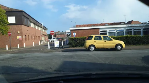
West Cliff Theatre
Cinema and theater · 0.4 mi
Theatre in Clacton-on-Sea, England
Tower Road, Clacton-on-Sea


Museums and landmarks37




25 more on the map.
Parks, trails and playgrounds67


Colne Point nature reserve
Park · 4.5 mi
Essex Wildlife Trust nature reserve in the United Kingdom
Weeleyhall Wood
Park · 4.0 mi
Site of Special Scientific Interest in Essex, England




55 more on the map.
Restaurants and cafes215
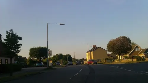
The Robin Hood
Bar and pub · 1.3 mi
211 London Road, Clacton-on-Sea
Mo-We 12:00-22:00; Th-Sa 12:00-23:00; Su 12:00-22:00
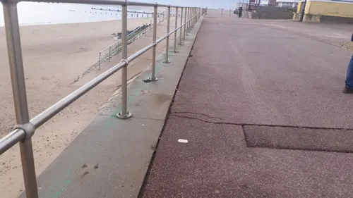
Greensward Cafe
Cafe · Fish And Chips, Breakfast, Ice Cream, Coffee Shop · 0.7 mi
Marine Parade West, Clacton-on-Sea
Mo-Su 09:00-15:30
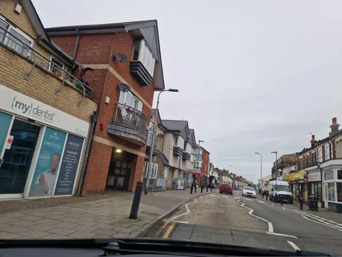
Kitchen & Lounge
Restaurant · Nigerian · 0.4 mi
126 Old Road, Clacton-on-Sea
Mo-Sa 17:00-23:00; Su 12:00-23:00

Golden Curry
Restaurant · Indian
110 Pier Avenue, Clacton-on-Sea
Su-Th 12:00-14:00,18:00-23:30; Fr,Sa 12:00-14:00,18:00-00:00

Regency Cottage
Restaurant · Indian
41 Rosemary Road, Clacton-on-Sea
Mo-Su 12:00-14:30,18:00-23:30; Fr,Sa 12:00-14:30,18:00-24:00

Sun Tong
Restaurant · Peking, Cantonese, Szechuan · 0.4 mi
79-81 Old Road, Clacton-on-Sea
Mo-Su 17:00-23:30; Th-Sa 12:00-14:00,17:00-23:30
Thai Vintage
Restaurant · Thai · 1.0 mi
1-3 St Johns Road, Great Clacton
Mo-Sa 17:30-23:00; Su 13:00-22:00
The Saffron
Restaurant · Indian · 1.1 mi
51 Ravensdale, Clacton-on-Sea
Su-Th 17:30-23:00; Fr,Sa 17:30-23:30
203 more on the map.
History
Deposits at Clacton have provided important evidence for the Lower Palaeolithic occupation of Britain by Homo heidelbergensis during the Hoxnian Interglacial, around 424–375,000 years ago, including stone tools of the titular Clactonian industry. At this time Britain had a temperate deciduous forest environment and climate similar to today. The "Clacton Spear", a wooden (yew) spear found in these deposits around Clacton in 1911 is the world's oldest known wooden spear.
The Domesday Book of 1086 records the village as Clachintuna.
Clacton was repeatedly surveyed by the Army in the Napoleonic Wars as a possible invasion beach-head for Napoleon and his Dutch allies. There was a large army and militia camp where Holland-on-Sea now stands. In 1810, five Martello Towers were built to guard the beaches between Colne Point to the south and what is now Holland-on-Sea to the north of the town.
Read more of the history
In 1865, railway engineer and land developer Peter Bruff, the steamboat owner William Jackson, and a group of businessmen bought an area of undeveloped farmland adjoining low gravelly cliffs and a firm sand-and-shingle beach lying to the south-east of Great Clacton village, with the intention of establishing a new resort. One of the first facilities they built for the new resort was the pier, which opened in 1871, allowing visitors to travel by ship; the railway would not reach Clacton until 1882. The town of Clacton-on-Sea was laid out rather haphazardly over the next few years; though it has a central 'grand' avenue (originally Electric Parade, now Pier Avenue) the street plan incorporates many previously rural lanes and tracks, such as Wash Lane. Plots and streets were sold off piecemeal to developers and speculators. In 1882, the Great Eastern Railway already serving the well-established resort of Walton-on-the-Naze along the coast, opened a branch line to Clacton from a junction on the existing railway at Thorpe-le-Soken.
Clacton grew into the largest seaside resort between Southend-on-Sea and Great Yarmouth, with around 10,000 residents by 1914 and 20,000 by 1939. Due to its accessibility from the East End of London and the Essex suburbs, the town, like Southend, remained preferentially geared to catering for working-class and lower-middle-class holidaymakers.
For well over a century, Clacton Pier has been used as an RNLI lifeboat station.
Just before the Second World War, the building of Butlin's Holiday Camp boosted its economy; the Army took it over between then and 1945 for use as an internment, engineer, pioneer and light anti-aircraft artillery training camp.
Notable incidents occurred in Clacton-on-Sea during the Second World War. A Luftwaffe Heinkel He 111 bomber crashed into the town on 30 April 1940, demolishing several houses in the Vista Road area as one of the magnetic mines on board exploded on impact, killing the crew and two civilians; another mine was defused by experts from the Navy. In addition, the Wagstaff Corner area was bombed in May 1941, demolishing some well-known buildings. Finally, a V-2 rocket hit in front of the Tower Hotel, injuring dozens of troops inside though without bringing down the structure. Clacton lay beneath the route taken by many of the V-1 flying bombs and V-2 rockets aimed at London.
A big role in the town during the pre- and post-war period was played by the Kingsman family, which bought and developed the pier and ran a pleasure-steamer service from London. A summer sea excursion to Calais also ran until the early 1960s. Butlin's reopened the holiday camp after the war. This, along with the expansion of the nearby chalet town of Jaywick, originally a speculative private development of inter-war years, and increasingly capacious caravan sites, all swelled by the movement of retired Londoners into the area, altered the character of the town.
Throughout the 1960s, Clacton beach remained a popular summer excursion for residents of Essex and east London and in August was often crammed to capacity in the area around the Pier. The pirate radio ship MV Galaxy (originally known as USS Density), which broadcast Wonderful Radio London, was anchored offshore from 1964 until its forced closure in 1967.
With the advent of cheap flights to Mediterranean resorts in the 1970s, the holiday industry began to decline. Pier Ward, in the centre of the town, is one of the poorest in England; nearby Jaywick was cited as the poorest of all in 2025.
Since around 1970, several well-known local buildings have been demolished, including the palatial art deco Odeon Cinema , the Warwick Castle Pub; the Waverley Hotel; Barker House, a large home for the learning disabled and John Groom's Crippleage which housed orphaned handicapped girls from London. Cordy's, a well-known large seafront restaurant has recently been demolished. The site of Butlin's Holiday Camp was redeveloped as a housing estate. The once famously crowded bus station in Jackson Road has become a car park. The Ocean Revue Theatre, where Max Bygraves made one of his first appearances, has closed.
The town expanded substantially in the 1980s, 1990s and first decade of the 21st century, with new housing estates on the rural margins of town, and some brownfield developments. Many residents commute to work in Colchester, Witham, Chelmsford or London. Clacton was in the news when its town centre and seafront areas were struck by an F1/T2 tornado on 23 November 1981, as part of the record-breaking nationwide tornado outbreak on that day.
Gunfleet Sands Offshore Wind Farm, built in the early 2000s, is around 3 nautical miles (5.6 km) offshore, is visible from many places in the flat hinterland of the town.
As is common with many English seaside towns, unemployment has remained stubbornly high in Clacton. In 2023, the town was awarded a £20 million government levelling-up grant to improve the town centre.
From the History section of Clacton-on-Sea on Wikipedia, under CC BY-SA 4.0.
More about Clacton-on-Sea
Geography
Clacton-on-Sea is located between Jaywick and Holland-on-Sea along the coastline; the original village of Great Clacton, now a suburb, lies to the north. The local authority is Tendring District Council.
It is at the south-eastern end of the A133. The resort of Frinton-on-Sea is nearby to the north-east.
From the Wikipedia article Clacton-on-Sea, under CC BY-SA 4.0.
Notable people from Clacton-on-Sea
 Paul BanksInterpol BandPhoto: Henry W. Laurisch, CC BY-SA 4.0
- Jennifer WorthBritish nurse, author and musician (1935–2011)
- Ian WestlakeEnglish footballer (born 1983)
- Mike EverittEnglish footballer and manager (born 1941)
- Graham HurleyEnglish crime writer
- Christine Tullis Hunter DaviesProfessor of Physics, University of Glasgow
- Stephen D. Nashillustrator
- Adrian Browncricketer (born 1962)
- Steve WrightEnglish professional footballer born 1959
- Ellie ChallisAthlete
- Arnold Quickcricketer (1915-1990)
- Arthur Townsend (athlete)British long-distance runner (1883–1937)
Born in Clacton-on-Sea, according to Wikidata (CC0). Each name links to its Wikipedia article.
Where to stay44
Churches and places of worship26
Shopping30
Gas and EV charging3
Schools, colleges and libraries24
Great Clacton Church of England Junior School
School · Anglican · 1.3 mi
Craigfield Avenue, Clacton-on-Sea
Healthcare18
Holland Pharmacy
Clinic and pharmacy · 1.5 mi
77, 79, 81 Frinton Road, Clacton-on-Sea
Map of Clacton-on-Sea
250 places. The map loads OpenStreetMap tiles when you open it.
Getting there and nearby towns
London Southend Airport (SEN) is the nearest airport with scheduled flights listed in OpenStreetMap, 25 miles away.
- Frinton-on-Sea 5 mi northeast, about 8 min by car
- Walton-on-the-Naze 6 mi northeast, about 10 min by car
- Harwich 12 mi northeast, about 19 min by car
- Colchester 13 mi northwest, about 21 min by car
- Felixstowe 15 mi northeast, about 24 min by car
- Ipswich 19 mi north, about 30 min by car
- Kesgrave 19 mi north, about 31 min by car
- Maldon 21 mi west, about 34 min by car
- Witham 22 mi west, about 35 min by car
- Southend-on-Sea 26 mi southwest, about 41 min by car
Drive times are estimates from straight-line distance, not routes.
Towns near Clacton-on-Sea


Keep exploring
Local news
Headlines from INDB.
Reviews, tips and questions
Loading what members have shared...
Sources and licences
- GeoNames (CC BY 4.0): population, coordinates, regions and time zone
- Mapillary (see each image): photos
- OpenStreetMap contributors (ODbL 1.0): places, airports, map data
- Wikidata (CC0 1.0): elevation, founding date, time zone, website, landmarks and historic places
- Wikimedia Commons (see each image): photos
- Wikipedia (CC BY-SA 4.0): overview and history text
Photo credits
- Clacton-on-Sea, Sannse at English Wikipedia, CC BY-SA 3.0
- Westleigh House, Clacton-On-Sea, Essex, UK, PeterEssexHeritage, CC0
- Pickers Ditch Meadow 5, Dudley Miles, CC BY-SA 4.0
- JMT pre-restored 008, Martello Tower Caravan Park, CC BY 2.5
- The Parish Church of St James Tower Road Clacton-on-Sea Essex England UK from SE, PeterSouthEast99, CC BY-SA 4.0
- SSPeter&Paul'sChurch StOsyth, JohnArmagh, Public domain
- Clacton Golf Course, Stevekraken, CC BY-SA 4.0
- Martello Tower E Hastings Avenue Clacton-on-Sea Essex England UK, PeterSouthEast99, CC BY-SA 4.0
- Century Cinema 129 Pier Avenue Clacton-on-Sea Essex England UK, PeterSouthEast99, CC BY-SA 4.0
- Moon and Starfish pub, Clacton, Rwendland, CC BY-SA 4.0
- The Martello - panoramio, Steve Sea, CC BY 3.0
- Street-level photo, petermead, CC BY-SA 4.0
- Street-level photo, edloach, CC BY-SA 4.0
- Street-level photo, edloach, CC BY-SA 4.0
- Street-level photo, edloach, CC BY-SA 4.0
- Street-level photo, edloach, CC BY-SA 4.0
- Street-level photo, edloach, CC BY-SA 4.0
- Street-level photo, edloach, CC BY-SA 4.0
- Street-level photo, edloach, CC BY-SA 4.0
- Street-level photo, edloach, CC BY-SA 4.0
- Street-level photo, edloach, CC BY-SA 4.0
- Street-level photo, edloach, CC BY-SA 4.0
- Street-level photo, edloach, CC BY-SA 4.0
- Street-level photo, petermead, CC BY-SA 4.0
- Street-level photo, edloach, CC BY-SA 4.0
- Street-level photo, edloach, CC BY-SA 4.0
- Street-level photo, petermead, CC BY-SA 4.0
- Street-level photo, edloach, CC BY-SA 4.0
- Street-level photo, edloach, CC BY-SA 4.0
- Street-level photo, petermead, CC BY-SA 4.0
- Street-level photo, edloach, CC BY-SA 4.0
- Street-level photo, edloach, CC BY-SA 4.0
- Street-level photo, edloach, CC BY-SA 4.0
- Street-level photo, edloach, CC BY-SA 4.0
- Street-level photo, edloach, CC BY-SA 4.0
Page built November 10, 2026. Spotted a mistake? Tell us or suggest a place.