


Why visit Maldon
Townapedia lists 13 museums and landmarks, 20 parks and trails, 81 places to eat, 5 places to stay and 2 attractions in and around town.
Highlights include The Moot Hall, Combined Military Services Museum, Maldon Wick and Promenade Park.
Weather in Maldon
Forecast from MET Norway (CC BY 4.0). Full forecast
About Maldon
Maldon (, locally ) is a town and civil parish on the Blackwater Estuary in Essex, England. It is the seat of the Maldon District and starting point of the Chelmer and Blackwater Navigation. It is known for Maldon Sea Salt which is produced in the area. At the 2021 census, the parish had a population of 14,938, and the Maldon built-up area as defined by the Office for National Statistics, which extends beyond the parish boundary to also take in Heybridge to the north, had a population of 23,380.
From the Wikipedia article Maldon (this version), under CC BY-SA 4.0.
Travel tips from other travellers: Maldon on Wikivoyage (CC BY-SA 4.0).
Photos of Maldon


Things to do2


Museums and landmarks13


Combined Military Services Museum
Museum · 0.4 mi
Military museum in Maldon, Essex, England, United Kingdom
Station Road, Maldon
Mo-Tu off; We-Su 10:30-17:00

Museum of Power
Museum · 1.6 mi
Industrial museum in Langford, Essex, United Kingdom
1 more on the map.
Parks, trails and playgrounds20
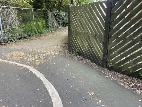


Northey Island
Park · 2.0 mi
Island in the estuary of the River Blackwater, Essex


8 more on the map.
Restaurants and cafes81
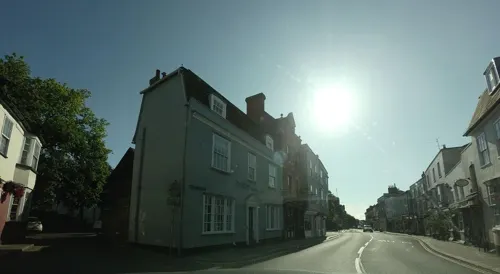
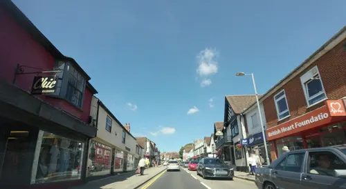
El Guaca
Restaurant · Mexican
122, 124 High Street, Maldon
Mo-Su 12:00-22:30; Fr,Sa 12:00-24:00


Bengal Tiger
Restaurant · Indian · 0.8 mi
4 The Square, Maldon
Mo off; Tu-Th 17:30-22:00; Fr-Sa 17:30-22:00; Su 12:30-22:00

The Balti Bhujon
Restaurant · Indian · 0.5 mi
24 Mill Road, Maldon
Mo, We-Th 17:30-22:30; Fr-Sa 17:30-23:00; Su 17:00-10:30
The Steam Pump Tea Room
Cafe · Breakfast, Cake, Coffee Shop, Sandwich, Tea · 1.4 mi
Hatfield Road
We-Su 09:30-15:00
IZUMI
Restaurant · Chinese · 1.0 mi
Mo-Fr 12:00-14:30,17:30-22:30; Sa 12:00-15:00,17:00-22:30; Su 12:00-22:30
69 more on the map.
History
The place-name Maldon is first attested in 913 in the Anglo-Saxon Chronicle, where it appears as Maeldun. Maldon's name comes from mǣl, meaning 'monument or cross', and dūn meaning 'hill', so translates as 'monument hill'. East Saxons settled the area in the 5th century and the area to the south is still known as the Dengie Peninsula after the Dæningas. It became a significant Saxon port with a hythe or quayside and artisan quarters. Recent scholarship has linked it to Haegelisdun, the site of the death of Edmund the Martyr at the hands of the Great Heathen Army.
Evidence of imported pottery from this period has been found in archaeological digs. From 958 there was a royal mint issuing coins for the late Anglo-Saxon and early Norman kings.
Read more of the history
It was one of the only two towns in Essex (Colchester was the other), and King Edward the Elder is thought to have lived here while combating the Danish settlers who had overrun North Essex and parts of East Anglia. A Viking raid was beaten off in 924, but in another raid in 991 the defenders were defeated in the Battle of Maldon and the Vikings received tribute but apparently did not attempt to sack the town. It became the subject of the celebrated Old English poem "The Battle of Maldon". The battle is commemorated by a window in St Mary's Church and by a statue at the end of the Maldon Promenade Walk (facing the battle site of Northey Island and the Causeway) of the slain Saxon warrior Byrhtnoth.
According to the Domesday Book of 1086, there were 54 households and an estimated 180 townsmen in 1086. The town still had the mint and supplied a warhorse and warship for the king's service in return for its privileges of self-government. The town was awarded a charter by Henry II in 1171, stating the rights of the town as well as defining its borders and detailing its duty to provide a ship for the monarch "when necessary". The town's All Saints' Church, unique in England in having a triangular tower, dates from around this period. While the precise building date is unknown, the church existed by 1180, the date of the foundation of nearby Beeleigh Abbey. A Charter of Richard I of December 1189 confirms "certain grants to Beeleigh Abbey, including the Church of Blessed Peter in Maldon and the Church of All Saints' in the same town". St Mary's Church, on the Hythe Quay has a grade I listed Norman nave from 1130, though evidence exists of an earlier church on the site from at least a hundred years before. The hotel and public house now called The Blue Boar Hotel dates back to the latter half of the 14th century, having been built by the de Veres family headed by the Earl of Oxford and used as an occasional residence supplementary to their main seat, Hedingham Castle. Meanwhile, Maldon Moot Hall dates back to around 1420.
Maldon’s municipal administration of the River Blackwater estuary is defined by a series of historical civic charters and regulatory adaptations. While some early 20th-century municipal publications reference a traditional timeline originating from a charter of 7 October 1155, modern archival consensus identifies the earliest surviving royal grant as the Pembroke Charter, issued by King Henry II on 7 October 1171.
The 1171 text defines the borough's landward boundaries and establishes its custom duties and ship-service obligations, but contains no explicit provisions regarding exclusive fishery rights or riverbed ownership. Following the restrictions established under the Magna Carta in 1215 regarding the creation of private tidal fisheries, subsequent royal grants modified the borough's role; the 1555 Charter of Philip and Mary formally established the office of Water Bailiff to oversee local maritime policing, conservation enforcement, and Admiralty court jurisdictions rather than transferring proprietary freehold title of the watercourse. Following the suspension of the corporation's active functions between 1768 and 1810, the New Charter of 1810 re-established the borough’s civic framework, confirming its traditional regulatory and policing powers over specified sectors of the river highway.
There were strong urban traditions, with two members elected to the Commons and three guilds which hosted lavish religious plays until they were suppressed by Puritans in 1576. Then, until 1630, professional actors were invited to perform plays, which were also stopped by Puritans. From 1570 to about 1800 a rival tradition of inviting prominent clergy to visit the town also existed. In 1629 a series of grain riots took place, led by the wife of a local butcher.
In the 17th century Thomas Plume started the Plume Library to house over 8,000 books and pamphlets printed between 1487 and his death in 1704; the collection has been added to at various times since 1704. The Plume Library is to be found at St Peter's Church. Only the original tower survives, the rest of the building having been rebuilt by Thomas Plume to house his library (on the first floor) and what was Maldon Grammar School (on the ground floor). The ground floor is now the Maeldune Heritage Centre.
In the church of All Saints is a memorial window to George Washington, whose great-great grandfather, Lawrence Washington, is buried here. Unveiled by an American diplomat on 5 July 1928, the window displays Saint Nicholas with the Mayflower, Saint George and Saint Joan of Arc in the centre. At the top are the arms of the Washington family, and the arms of the USA, England, Scotland and Wales. At the bottom are depictions of George Washington, the landing of the Mayflower, the signing of the Declaration of Independence and the Statue of Liberty.
Also in Maldon are Maldon Baptist Church in Butt Lane, Maldon Methodist Church in the High Street, and Maldon United Reformed Church on Market Hill. Maldon Mosque is in Church Street.
From the History section of Maldon on Wikipedia, under CC BY-SA 4.0.
More about Maldon
Geography
Maldon is on the tidal River Chelmer by the Blackwater Estuary. It is on the A414 10 miles (16 km) east of Chelmsford and 49 miles (79 km) north-east of Charing Cross, London, via the A13 road.
Essex is a county built on London Clay, overlain with pockets of gravel deposited by riparian action; the lowest land is made up of river alluvium and salt marsh. At Maldon, the railway cutting (now a road cutting) provided a reference section for geologists. There are three landslips on the north-facing river cliff of the Blackwater at Maldon. The middle slip is called the West Maldon Landslip, which was caused by repeated rotational slips of the bedrock London Clay, which is trying to reach a stable angle.
Hythe Quay at the confluence of the Chelmer and Blackwater, which flanks the northern edge of the town, was an important port. Both Hythe Quay and Cooks Yard are home to a large number of Thames barges, sailing vessels which attract many visitors.
The River Blackwater, that was diverted into the Chelmer and Blackwater Navigation, re-emerges into the Blackwater Estuary, through locks at the Heybridge Basin, the stream bed passes down Heybridge Creek. Here it delineates the border between Maldon Town and Heybridge Parish Council.
Arts and culture
The town holds the charitable Maldon mud race where competitors race across the Blackwater estuary at low tide, along the bank and back through the water. The race generated over £55,000 for charities in 2014. Maldon also hosts the international Maldon Festival, which takes place each year in late June and July.
The town holds an annual "Taxi Day" which sees mentally and physically disabled children from London driven to Maldon in London Black Cabs for a fun day of activities and a meal. The event dates back to 1952 when a London cab driver visited the Elizabeth Fry Special School (formerly Grange Road Special School) in Plaistow. He wanted to do something special for the young patients he saw there. He wrote to every one of Essex's seaside towns to arrange an outing and the only town that was willing to help was Maldon; thus, Taxi Day has remained a tradition ever since.
Maldon is twinned with the Dutch town of Cuijk. The charter between the two towns was signed in 1970 to cement the relationship.
Maldon and the surrounding area are the setting for a series of books by the prolific author Samuel L. Bensusan. Bensusan's stories recall a lost way of life among the towns and villages in the area, and along the local coastline and marshland. In Bensusan's books, Maldon is called Market Waldron.
From the Wikipedia article Maldon, under CC BY-SA 4.0.
Notable people from Maldon
 John William StruttEnglish physicist (1842–1919)Photo: Unknown author Unknown author, Public domain
 Sam RyderEnglish singer, songwriter and social media personality (born 1989)Photo: Harald Krichel, CC BY-SA 3.0
 Horatio GatesAmerican general in the American Revolutionary War (1727–1806)Photo: Gilbert Stuart, Public domain
 Alex DowsettBritish racing cyclistPhoto: Nicola, CC BY-SA 4.0
 Sarah ChampionBritish politicianPhoto: ©House of Commons / Laurie Noble, CC BY 3.0
 Toby WilkinsBritish film directorPhoto: numberstumper, CC BY-SA 2.0
 Richard KempBritish Army officerPhoto: Europecentral, Public domain
 Myra Sadd BrownSuffragette, women's rights activist and internationalistPhoto: Unknown author Unknown author, Public domain
 Virginia CrosbieBritish politicianPhoto: Roger Harris, CC BY 3.0
 Bea FitzgeraldEnglish novelistPhoto: The Novelry, CC BY 3.0
 John WhiteEnglish footballer, born 1986Photo: Mattythewhite, CC BY-SA 3.0
- John Rogers HerbertEnglish painter (1810-1890)
Born in Maldon, according to Wikidata (CC0). Each name links to its Wikipedia article.
Where to stay5
Churches and places of worship19
Shopping25
Gas and EV charging1
Schools, colleges and libraries13
All Saints Maldon Church of England Voluntary Controlled Primary School
School · Anglican
Highlands Drive, Maldon
Healthcare4
Map of Maldon
183 places. The map loads OpenStreetMap tiles when you open it.
Getting there and nearby towns
London Southend Airport (SEN) is the nearest airport with scheduled flights listed in OpenStreetMap, 11 miles away.
- Witham 5 mi north, about 8 min by car
- Chelmsford 9 mi west, about 14 min by car
- Rayleigh 10 mi south, about 17 min by car
- Rochford 10 mi south, about 17 min by car
- Wickford 11 mi southwest, about 17 min by car
- Southend-on-Sea 13 mi south, about 22 min by car
- Pitsea 14 mi southwest, about 22 min by car
- Basildon 15 mi southwest, about 23 min by car
- Colchester 15 mi northeast, about 24 min by car
- Stanford-le-Hope 18 mi southwest, about 28 min by car
Drive times are estimates from straight-line distance, not routes.
Towns near Maldon


Keep exploring
Local news
Headlines from INDB.
Reviews, tips and questions
Loading what members have shared...
Sources and licences
- GeoNames (CC BY 4.0): population, coordinates, regions and time zone
- Mapillary (see each image): photos
- OpenStreetMap contributors (ODbL 1.0): places, airports, map data
- Wikidata (CC0 1.0): elevation, founding date, time zone, website, landmarks and historic places
- Wikimedia Commons (see each image): photos
- Wikipedia (CC BY-SA 4.0): overview and history text
Photo credits
- Maldon 060309-2, Maldon_060309.jpg : Terryjoyce derivative work: oneblackline ( talk ), CC BY-SA 3.0
- Sailing barges, The Hythe, Maldon (16176450464), Rob Mitchell, CC0
- Maldon All Saints fr SW GeoUK 4278122, Colin Park, CC BY-SA 2.0
- St Mary's Church, Mundon 04, Alan Shearman, CC BY 2.0
- Beeleigh Abbey 1, Maria, CC BY-SA 3.0
- St Mary the Virgin 20140608 2, Helmut Seger, CC BY-SA 4.0
- BeeleighAbbey, JohnArmagh, Public domain
- Promenade Park Autumn Springs - panoramio - Lee Garton (1), Lee Garton, CC BY-SA 3.0
- Moot Hall (4932417593), Simon Harriyott from Uckfield, England, CC BY 2.0
- Moot Hall (4932418807), Simon Harriyott from Uckfield, England, CC BY 2.0
- Street-level photo, tallguy, CC BY-SA 4.0
- Street-level photo, edloach, CC BY-SA 4.0
- Street-level photo, stolenoxygen, CC BY-SA 4.0
- Street-level photo, tallguy, CC BY-SA 4.0
- Street-level photo, stolenoxygen, CC BY-SA 4.0
- Street-level photo, tallguy, CC BY-SA 4.0
- Street-level photo, edloach, CC BY-SA 4.0
- Street-level photo, edloach, CC BY-SA 4.0
- Street-level photo, edloach, CC BY-SA 4.0
- Street-level photo, tallguy, CC BY-SA 4.0
- Street-level photo, tallguy, CC BY-SA 4.0
Page built November 10, 2026. Spotted a mistake? Tell us or suggest a place.